Richardson Highway Alaska: Fairbanks to Valdez
This realistic Richardson Highway Alaska Driving Guide helps you plan your next drive on this scenic highway.
Richardson Highway is the oldest highway and a scenic route in Alaska. It runs for 368 miles (592 km). The highway connects Fairbanks and Valdez.
- Richardson Highway Alaska History
- Sights & Places of Interest
- Fairbanks
- North Pole
- Salcha River
- Birch Lake
- Tanana River
- Alaska Range
- Delta Junction
- Delta River
- Black Rapids Glacier
- Trans-Alaska Pipeline System
- Rainbow Mountain
- Wrangell-St. Elias National Park Visitor Center
- Worthington Glacier
- Thompson Pass
- Lowe River
- Keystone Canyon
- Rudleston Falls
- Bridal Veil Falls
- Horsetail Falls
- Valdez
- Getting to Richardson Highway Alaska
- Where to Stay
- Entrance Requirements & Passes
- Takeaways: Richardson Highway Alaska
This post includes affiliate links that will earn us commission if you make a purchase via these links.
Richardson Highway Alaska History
Fairbanks is the largest city in Interior Alaska. It is a distant second most populous city in the state after Anchorage. Valdez is a small town on the coast of Prince William Sound. It is an important oil port.
The gold rush and oil discovery contributed to the development of the Richardson Highway. The highway was first a trail in 1898. Then a telegraph line followed its route.
The road became car ready in 1920s. The highway carries a name of General Wilds P. Richardson. He was the head of the construction project.
Sights & Places of Interest
Alaska designated two sections of the highway as State Scenic Byways.
- North Segment is a 95-mi (152-km) stretch that connects Fairbanks with Paxson.
- South Segment is a 119-mi (192-km) stretch that connects Glennallen with Valdez.
The part between the two segments proceeds via plains. It lacks official designation.
This Richardson Highway Alaska Guide documents the notable stops along this great route.
Fairbanks
Fairbanks is the starting point for the Richardson Highway. Mountains surround the city from the all sides but south. But the city itself is on a plain. It has several rivers and creeks.
Fairbanks is not the most scenic city in Alaska. But it has places to stay, dine, and shop. It is best to fill up in Fairbanks. You should also buy snacks for the road there. The only other large grocery stores on the Richardson Highway are in Glennallen and Valdez.
North Pole
North Pole is a town near Fairbanks. It has the Santa Claus House. You can buy gifts and pastries at this shop. The house is very hard to miss. You will see a giant Santa statue from the highway.
Salcha River
Salcha River State Recreation Site is the next notable sight on the Richardson Highway. This site provides access to the Salcha River. This river is a tributary of the Tanana River, which, in turn, feeds the Yukon River.
The park has campsites and a cabin. You can launch a boat at this site if you have one. The site is also a good fishing spot during Salmon run in July. But it lacks viewpoints and marked trails.
Birch Lake
Birch Lake State Recreation Site is about 20 minutes south of the Salcha River. The lake is right next to the Richardson Highway. You can stop at the rest area and admire its beauty.
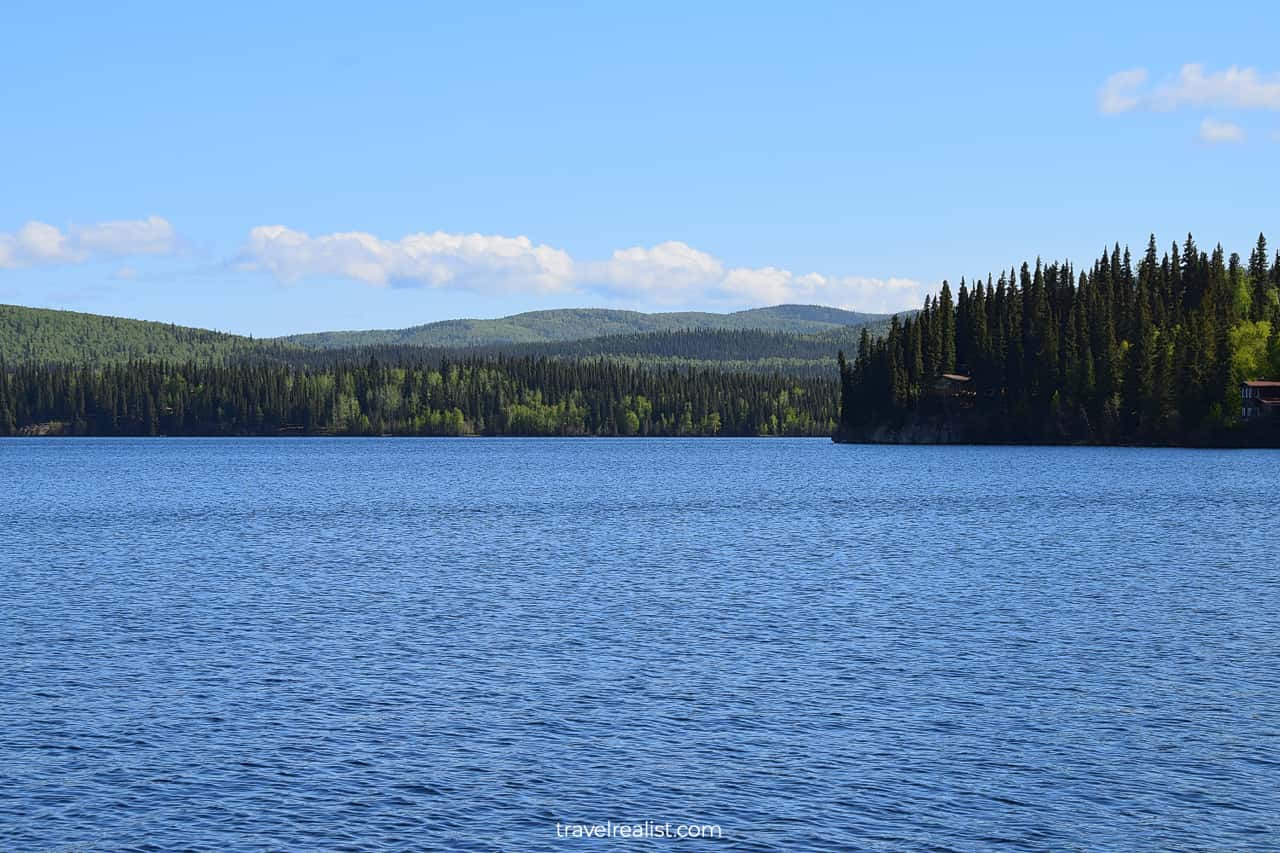
Birch Lake is a popular summer destination. The locals come to the Birch lake to fish, swim, and jet ski.
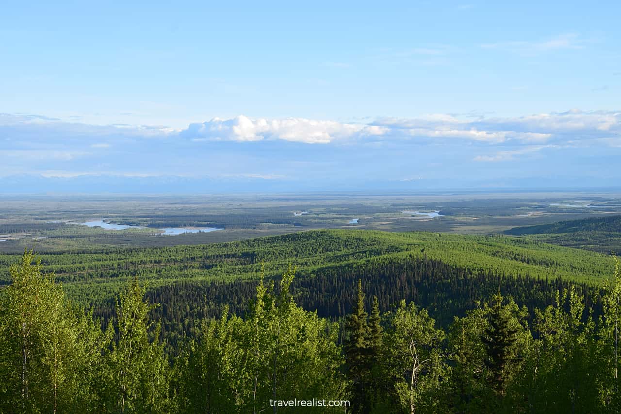
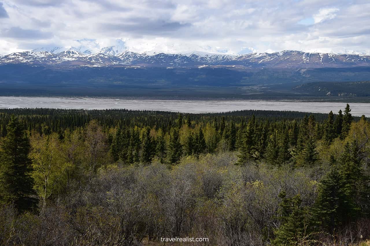
Tanana River
The Richardson Highway continues inland after Birch lake for a few miles. The highway then starts to follow the Tanana River closely.
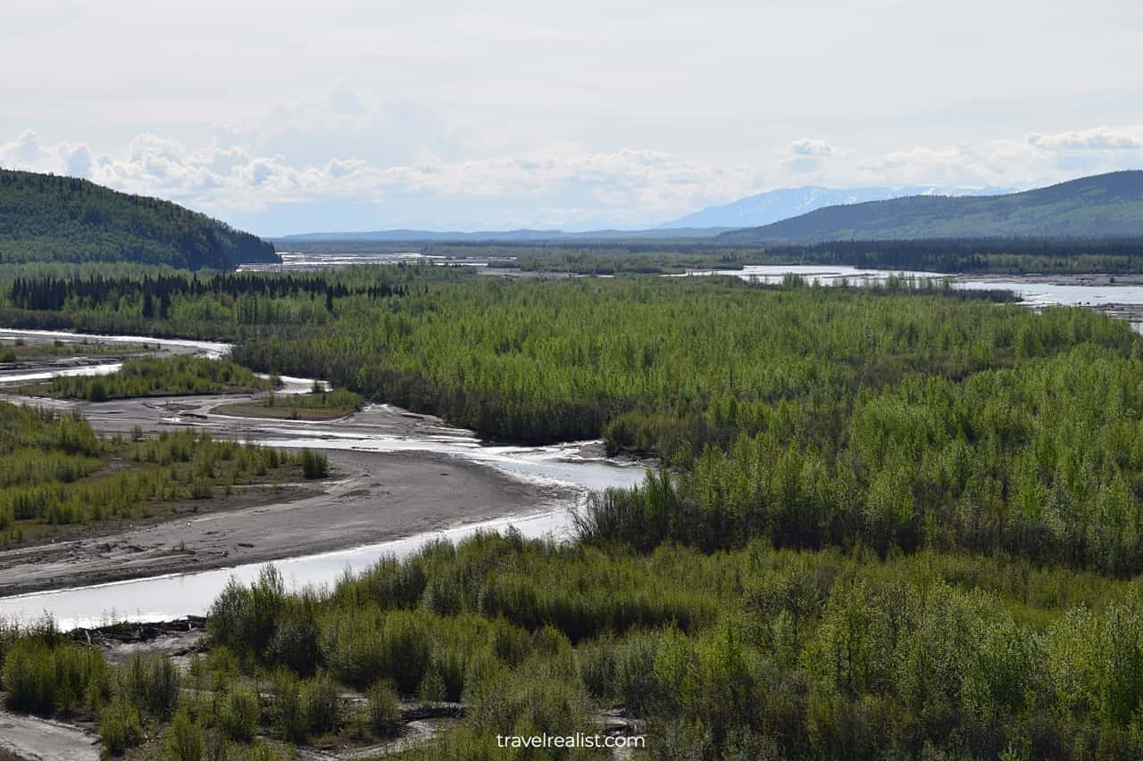
This stretch of the highway has several viewpoints. Some of them provide access to the river. The Tanana River flows in a typical way for rivers in Alaska. There are multiple streams that sometimes come together.
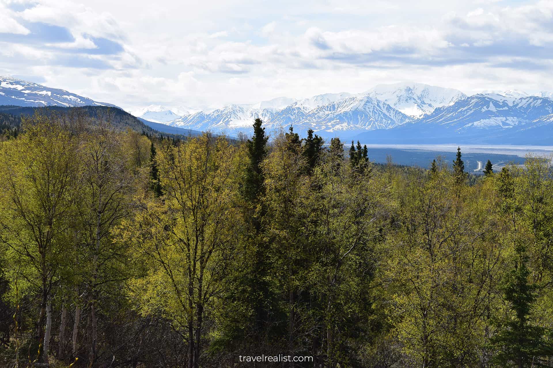
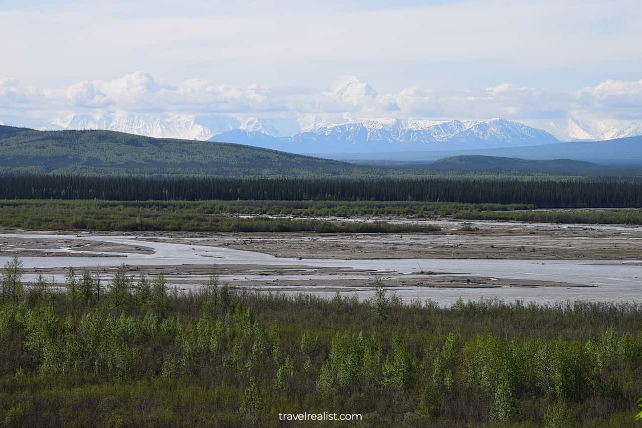
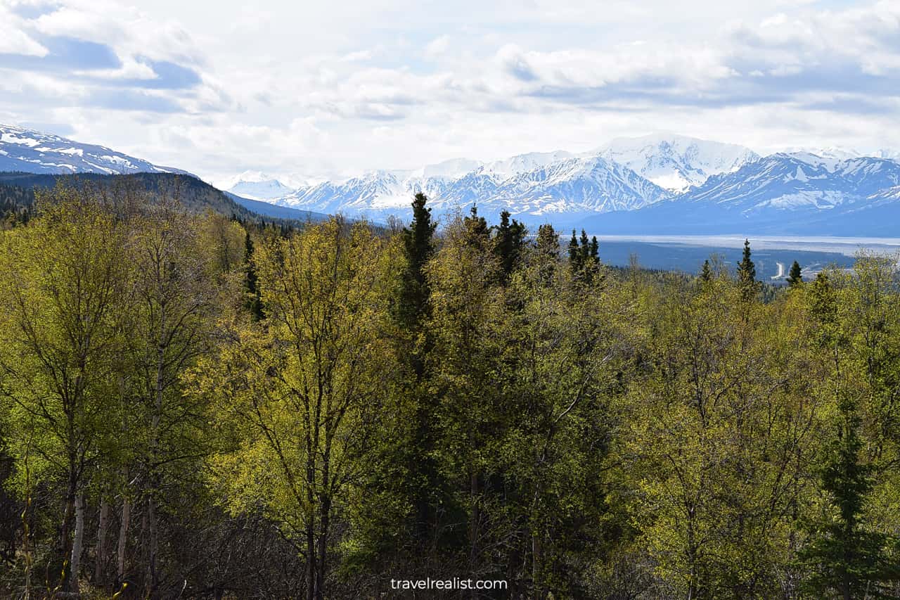
Alaska Range
The next overlook provides excellent views of the Alaska Range. This range separates Anchorage and Glennallen from Fairbanks and Denali. The Richardson Highway route would soon cross the range at Donnelly.
Delta Junction
The Richardson Highway turns south towards Glennallen in Delta Junction.
AK-2 highway it originally followed continues southeast to the border with Canada. It is the main road that connects Alaska with the mainland.
Delta Junction is a great stop to get a bite to eat and fill up gas. There are no other gas stations until Glennallen.
The Richardson Highway (now AK-4) gets closer to the Alaska Range after Delta Junction.
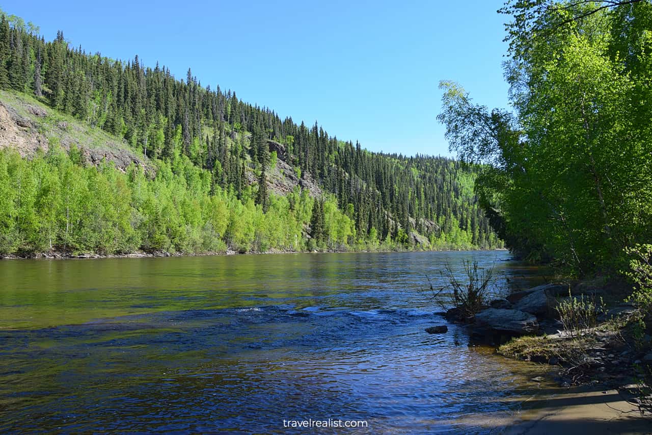
Delta River
This section of the highway follows the Delta River. As the river crosses the mountain range, it narrows. Difference in elevation created the river rapids.
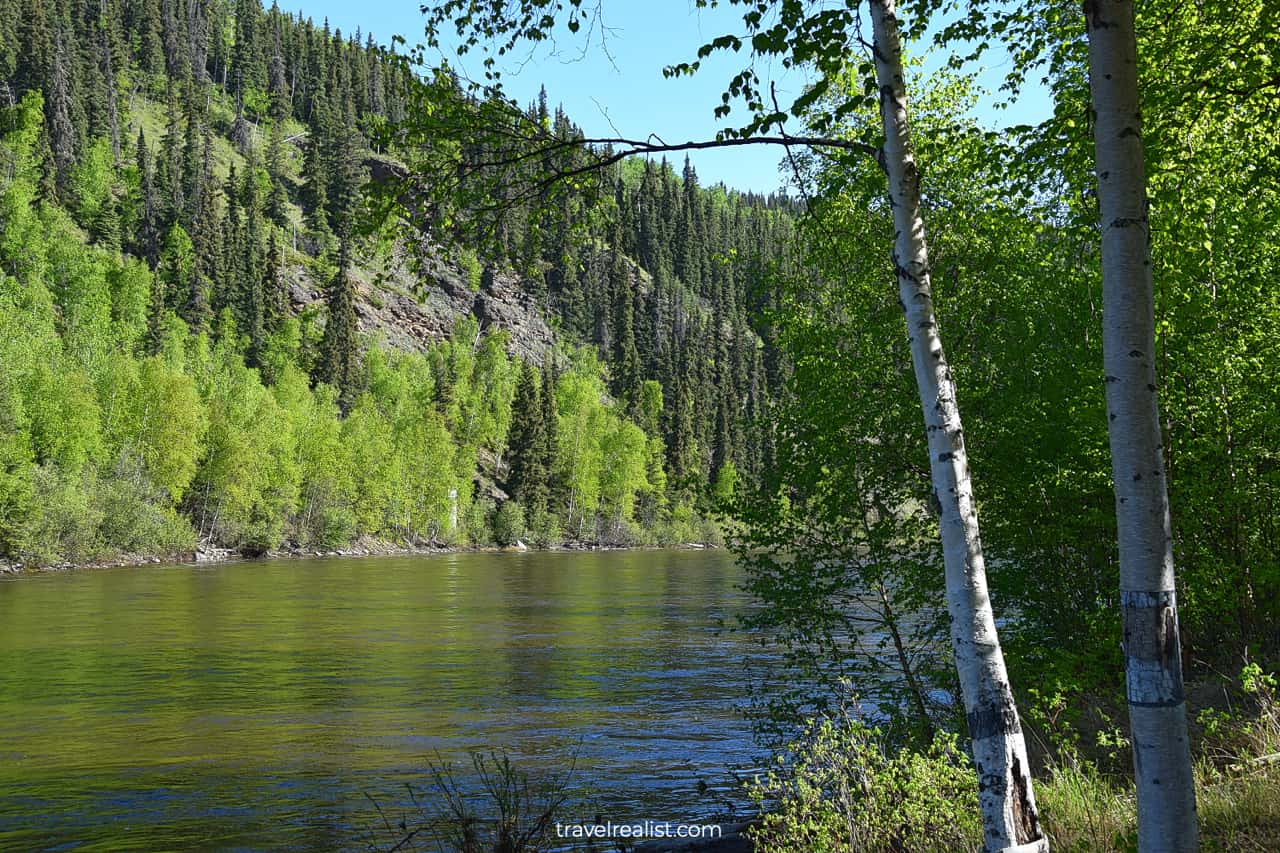
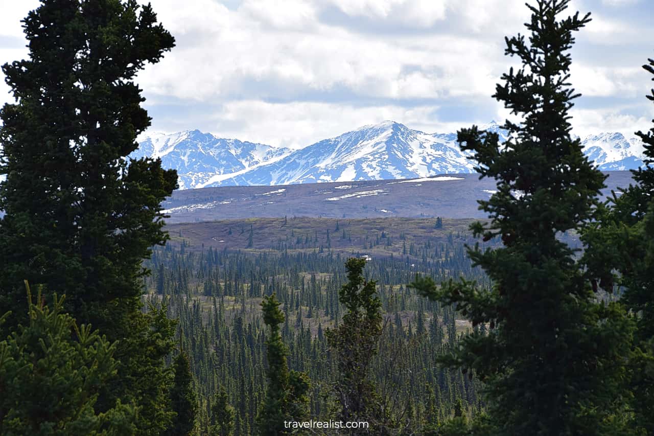
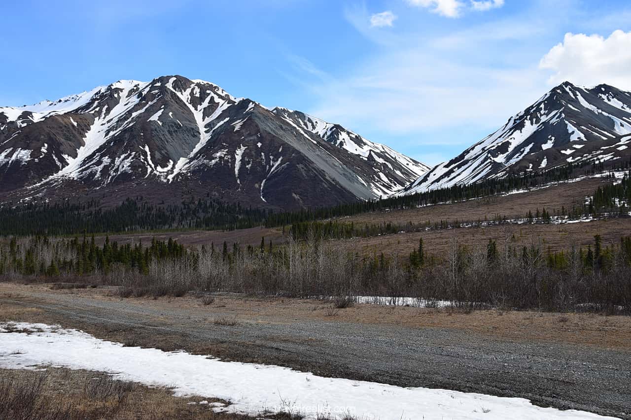
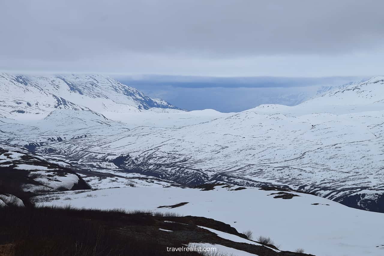
Black Rapids Glacier
The area around Black Rapids is very scenic. Many no-name viewpoints offer superb views of valleys, forests, and mountains.
Whenever the sun comes out, Alaskan landscape becomes even more scenic. It is hard to not stop at every viewpoint. The beauty of the surrounding landscape is just overwhelming.
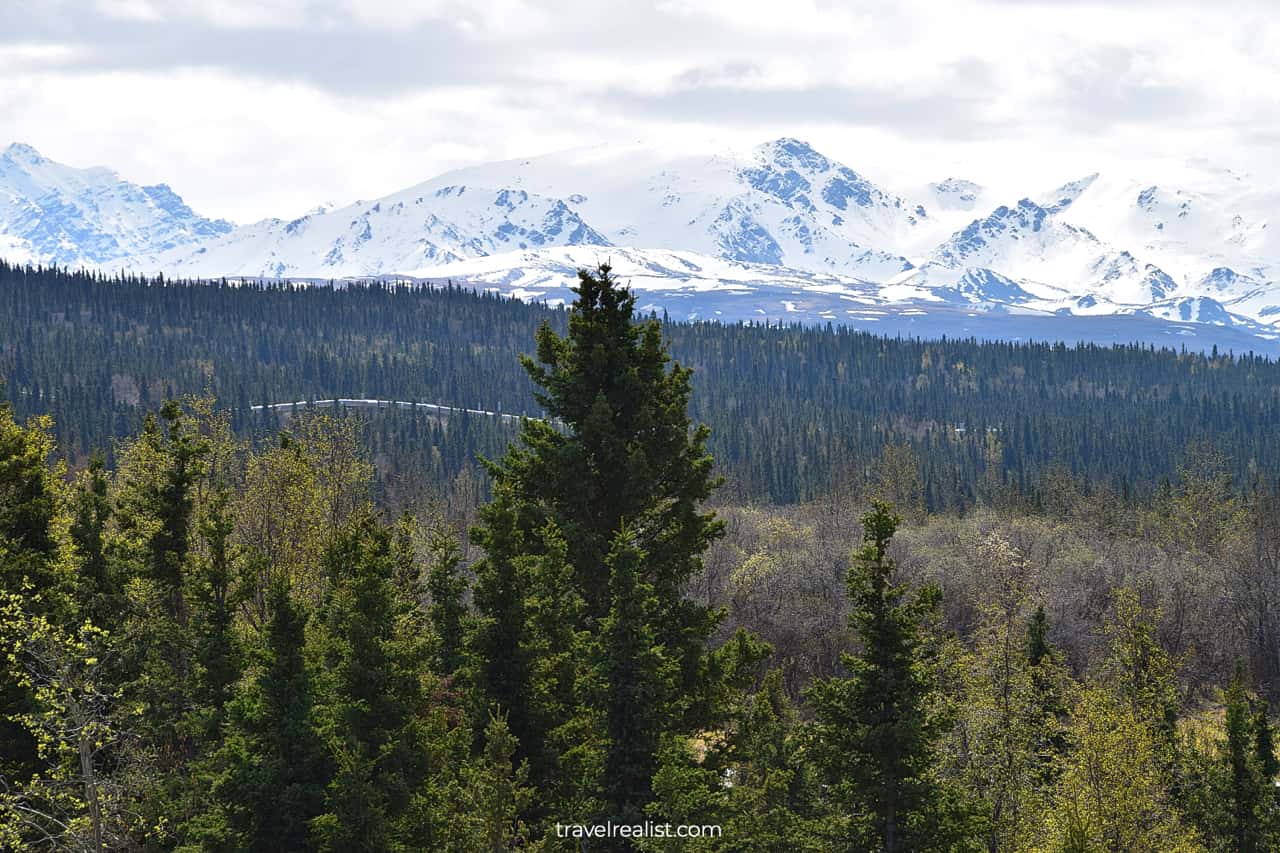
Trans-Alaska Pipeline System
The highway often runs in parallel to the Trans-Alaska Pipeline System. It is one of the longest systems in the world. The pipeline connects Prudhoe Bay with Valdez.
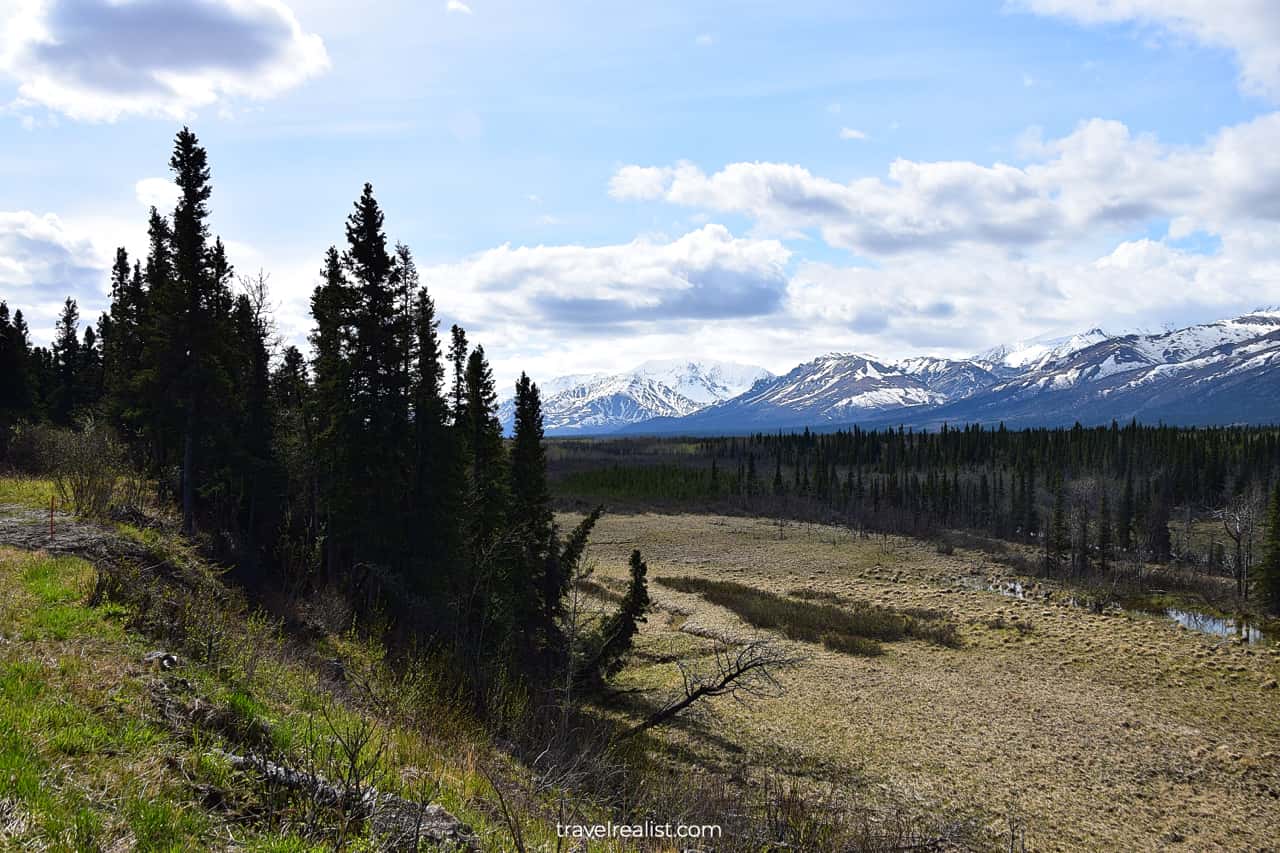
Rainbow Mountain
The Richardson Highway steadily gains elevation. The higher elevation areas might still have snow, even if you drive during the summer.
This area is home to the Rainbow Mountain. Layers of differently colored minerals gave this mountain its name.
Wrangell-St. Elias National Park Visitor Center
The highway continues for a while through slightly less scenic landscapes. The views start to improve once the road passed Glennallen.
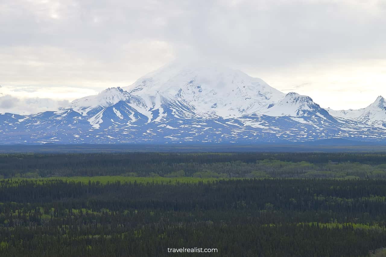
A viewpoint near Wrangell-St. Elias National Park Visitor Center provides great views of Mt. Drum.
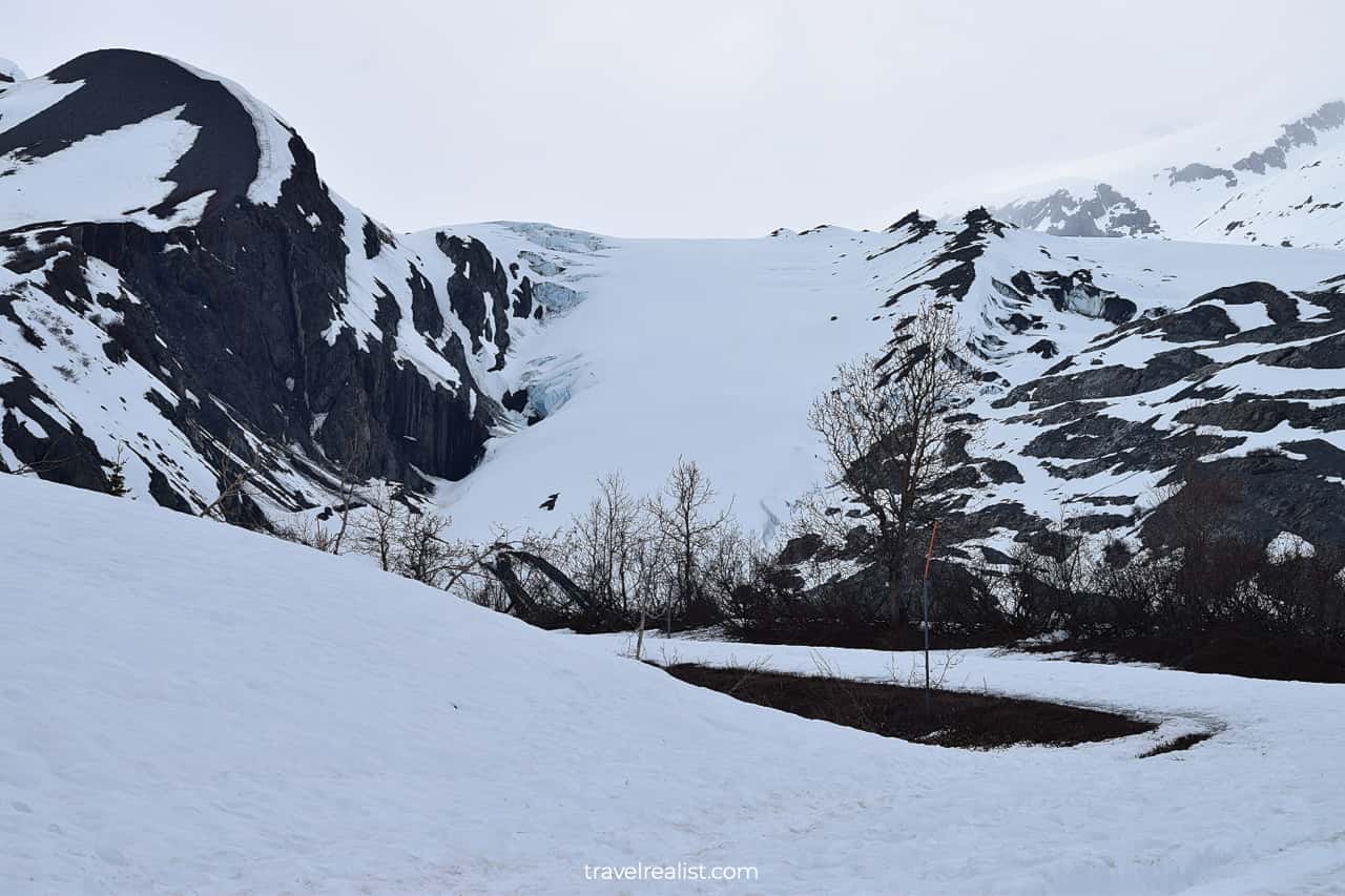
Worthington Glacier
Worthington Glacier State Area is another beautiful stop on the highway’s South Segment. It is best to visit the glacier in the middle of summer. Snow retreats and uncovers hiking trails to the glacier.
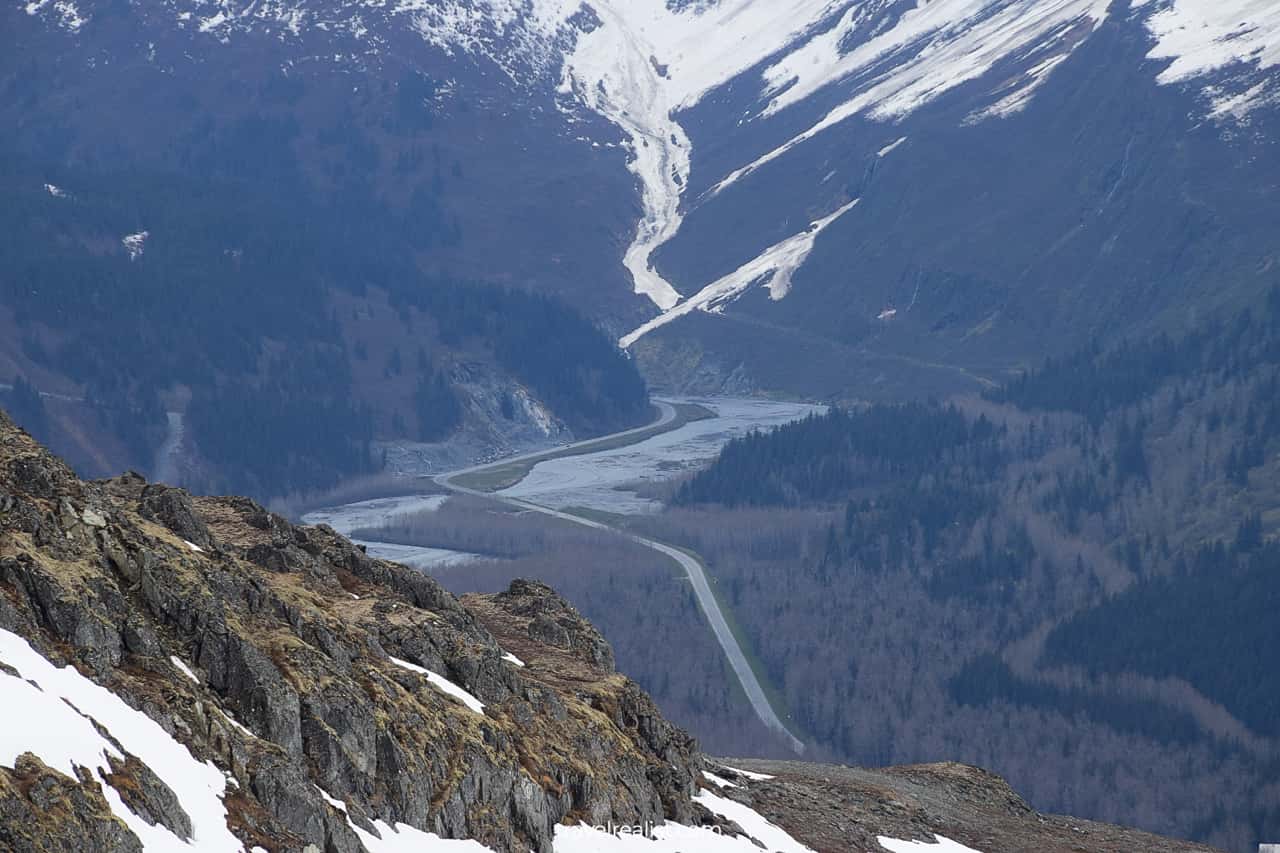
Thompson Pass
The site is very close to Thompson Pass. This mountain pass is the snowiest place in Alaska. It receives 500 inches (12.7 m) of snow per year.
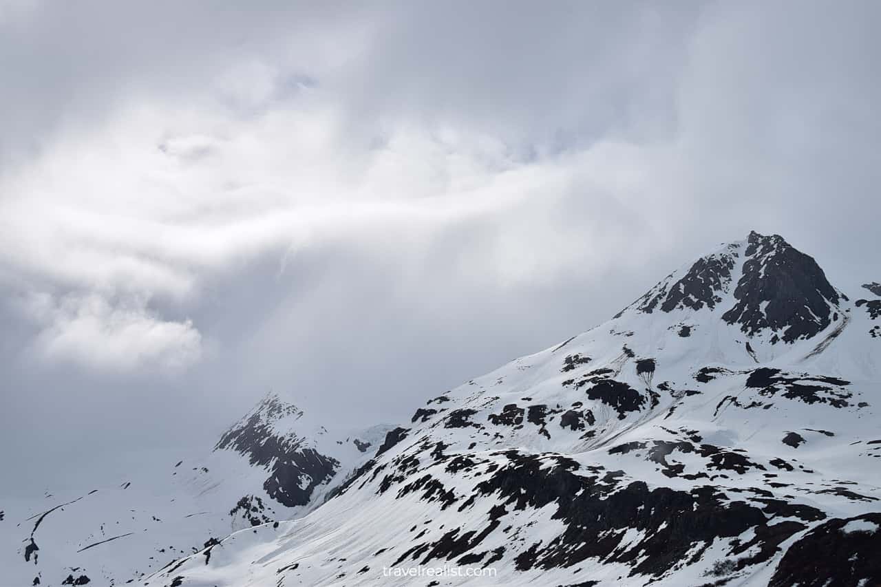
The weather at Thompson Pass is unpredictable. You might get lucky. In this case, you will have good visibility.
Or you could run into thick fog and snow. The season does not matter. It could snow at Thompson Pass even during late in spring or early summer.
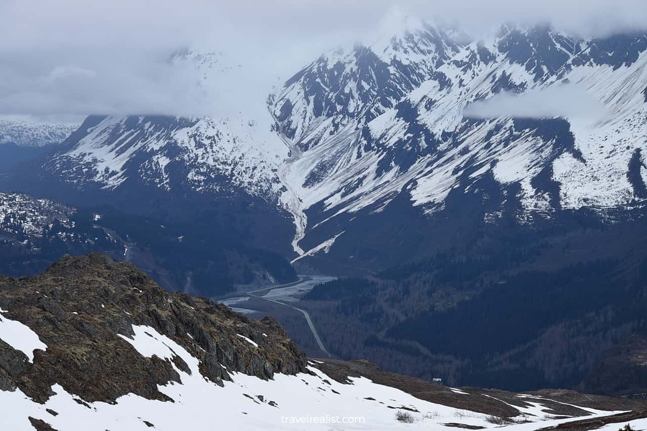
The Richardson Highway loses nearly 2,300 ft (700 m) from Thompson Pass to the Lowe River.
Lowe River
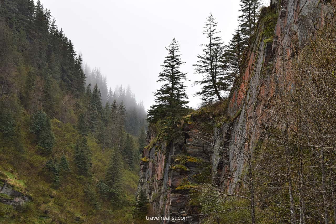
Once the highway reaches the river level, it enters Keystone Canyon. The canyon is a 3-mile (4.8-km) narrow gorge of the Lowe River. It is one of the most scenic parts of the entire highway.
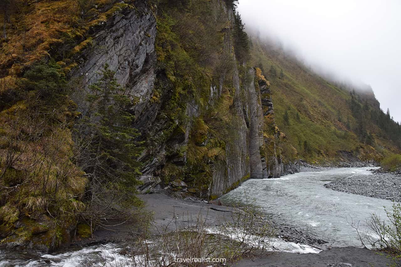
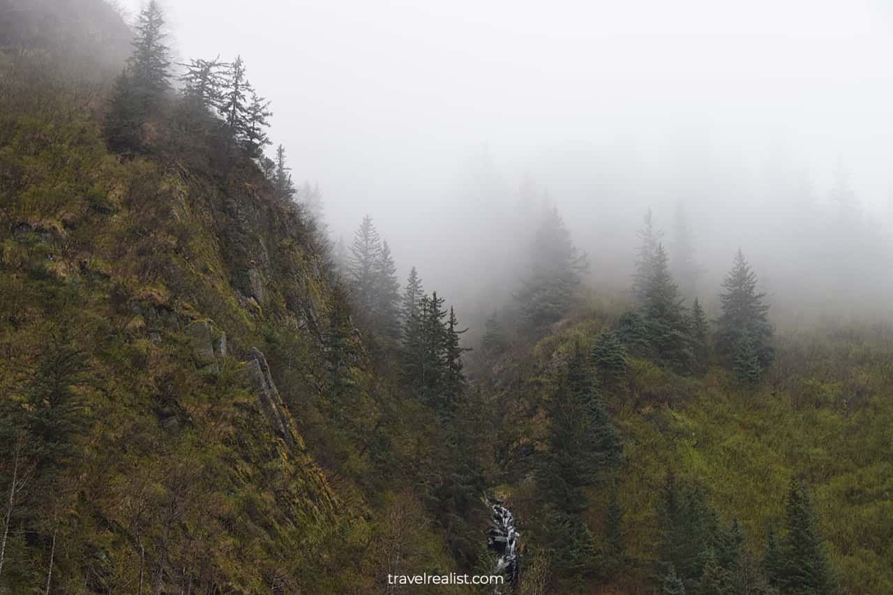
Keystone Canyon
The canyon is home to several sights. You need to budget at least 15 minutes to drive this stretch of the highway. This way, you could stop at the numerous overlooks and capture the canyon’s beauty.
Rudleston Falls
Rudleston Falls is the first waterfall on the southbound Richardson Highway. The viewpoint appears on the left side of the highway after a sharp road turn. It is safest to stop at this overlook when traveling northbound.
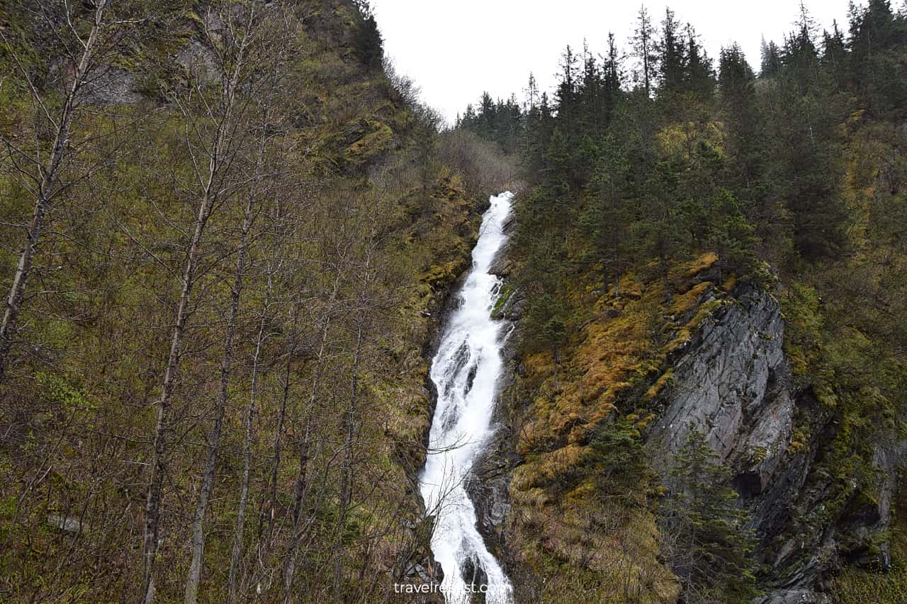
The same viewpoint also has an Old Railroad Tunnel.
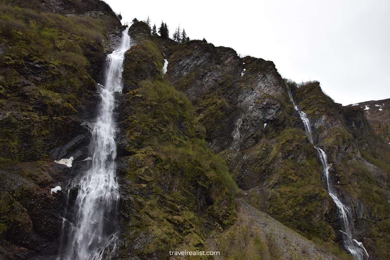
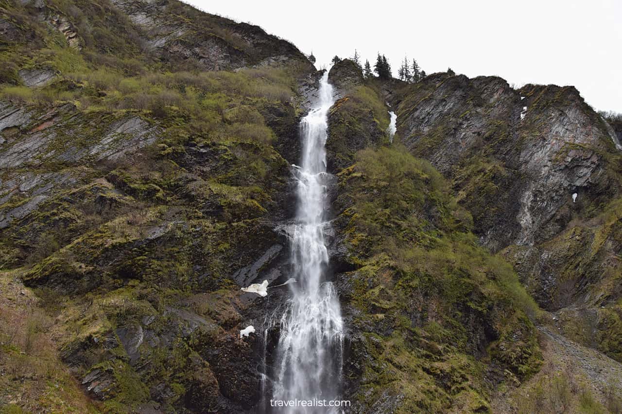
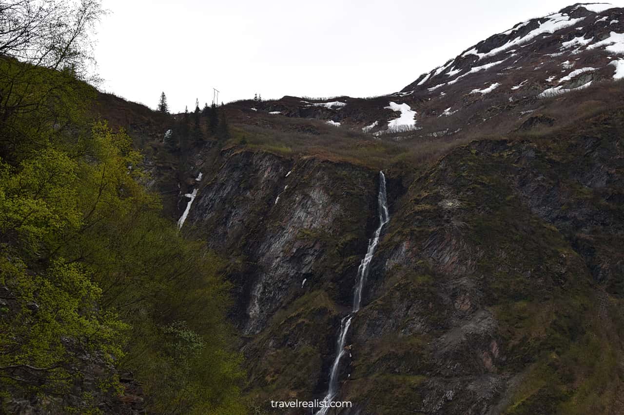
Bridal Veil Falls
The Richardson Highway brings you to Bridal Veil Falls a mile later. It is a beautiful waterfall that flows into the Lowe River.
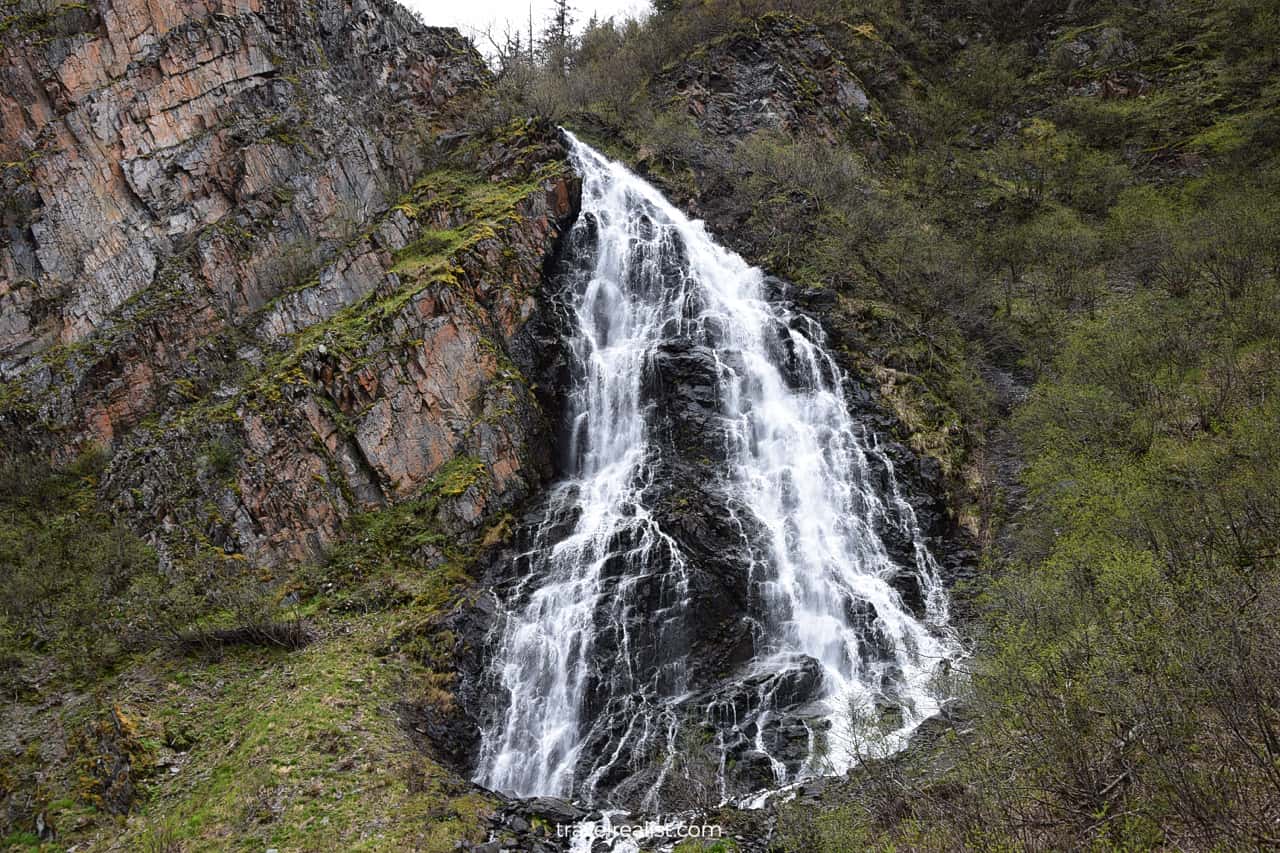
Horsetail Falls
Horsetail Falls are right around the corner from Bridal Veil Falls. This waterfall falls 328 ft (100 m) from the canyon wall. It is the last waterfall in Keystone Canyon.
Valdez
The Richardson Highway exits Keystone Canyon right after the viewpoint. It continues to follow the Lowe River all the way to the its mouth. The highway reaches Valdez after a short final stretch.
This town is great stop to get dinner. But note the opening hours for the dining places. It is not uncommon for a restaurant to stop accepting clients at 7pm.
Continue with our Richardson Highway Alaska Guide. You will learn more about ways to get to the sights, entrance requirements, and places to stay.
Getting to Richardson Highway Alaska
Most visitors drive the South Segment of the Richardson Highway. You can get to this stretch from Valdez or Anchorage.
- Anchorage is the largest city in the state. It is also the main airport in Alaska.
- Valdez is an important port. Many cruise ships to Alaska make a stop in Valdez.
Fairbanks and Delta Junction are the main gateways to the highway’s North Segment.
- Fairbanks is another gateway to the state.
- And Delta Junction is on a land route that connects Alaska with Canada.
Where to Stay
- Fairbanks has the most lodging options for drivers on the Richardson Highway.
- Delta Junction is another spot with several places to stay on the North Segment of the highway.
- Glennallen and Valdez have the most places to stay on the South Segment.
- Gas stations and restaurants are usually in the same towns as places to stay.
Entrance Requirements & Passes
It is free to drive on the Richardson Highway in Alaska. But some of the sights charge parking or day use fees.
- Salcha River: $5 per vehicle.
- Birch Lake: $5 per vehicle or free at the public rest area.
- Wrangell-St. Elias National Park Visitor Center: free but the gate closes at 5pm year round.
- Worthington Glacier: $5 per vehicle.
Takeaways: Richardson Highway Alaska
The Richardson Highway in Alaska is a very scenic route. The oldest highway in Alaska lives up to its fame.
The South Segment is a more scenic part of the highway. You can see volcanoes, glaciers, and waterfalls on that route. Keystone Canyon and Thompson Pass alone make the drive worth the time.
The North Segment is most beautiful between Black Rapids and Rainbow Mountain. Other areas are nice. But they not as visually stunning.
Here is how to make the most from a drive on the Richardson Highway.
- Set aside a whole day to complete the entire drive.
- Or skip the North Segment and start your adventure in Glennallen.
- Either way, budget more time to stop at the overlooks.
- Do your grocery shopping at the starting points of the highway.
- Keep an eye on the gas level and fill up in large towns.
- Remember that many dining places and sights close early.
- Enjoy the drive, scenic views, and wildlife spotting.
Take a look at our Richardson Highway Alaska Video Guide. And visit our YouTube channel for the latest videos.
Frequently Asked Questions
The entire length of the Richardson Highway is paved.
The Richardson Highway connects Fairbanks with Valdez.
The Richardson Highway has a lot of sights.
– Stop at Santa Claus House.
– Enjoy viewpoints near Salcha, Tanana, and Delta Rivers.
– Fish in the Birch Lake.
– See the Rainbow Mountain and Black Rapids.
– Spot wildlife.
– Hike a trail to the glacier.
– Stop at Thompson Pass, the snowiest place in Alaska.
– Take a picture of the waterfalls in Keystone Canyon.
– Get dinner in Valdez.
The Richardson Highway is the oldest highway in the state of Alaska. It started as a trail in 1898. The highway became car ready in the 1920s.
The Richardson Highway runs 368 miles.
Thompson Pass on the Richardson Highway is the snowiest place in the state. It receives 500 inches of snow each year.
Safe realist travels!