12 Stops on Austin Hike and Bike Trail along Lady Bird Lake
This realistic Austin Hike and Bike Trail Guide helps you plan your next adventure along Lady Bird Lake.
The Ann and Roy Butler Hike and Bike Trail is a loop path around Town Lake in Austin, Texas. This trail is an Austin highlight. It attracts some 2.6 million visitors in any given year.
This post includes affiliate links that will earn us commission if you make a purchase via these links.
Sights & Places of Interest
Different parks and paths at Lady Bird Lake existed for years. But the 10-mi (16-km) Butler Hike and Bike Trail is a bit of a new addition to the city. It carries the names of the former Austin mayor and his wife.
This path has been part of the Austin trail map for just a decade. The Boardwalk at International Shores and Northwood Tract was completed in 2014. It created a loop along most of Town Lake.
Its central location helped the Butler Hike and Bike Trail become a city favorite. Outdoor enthusiasts among residents and visitors come to this path to keep in shape and enjoy the views.
This Austin Hike and Bike Trail Guide documents the main sights along this scenic path. It follows a clockwise route starting from Shoal Beach on the north shore.
1. Shoal Beach
The Butler Hike and Bike Trail is a loop path. You are welcome to start at any park that is closest to your hotel. Shoal Beach is a great starting point if you take the trail after visiting Flower Hill and Texas Capitol.
This section of the Hike and Bike Trail has a handful of sights. The Austin Central Library is near the center of Shoal Beach. Shoal Creek flows into the Colorado River and creates a scenic peninsula.
You could take the Pfluger Pedestrian Bridge if you would like to cross the river right away. This shortcut brings you to Auditorium Shores in the least amount of time. You should not worry about traffic either.
Despite its name, Shoal Beach is not suitable for swimming. In fact, it is not a good idea to swim anywhere in Lady Bird Lake. Toxic algae is present in the water. It is harmful to both pets and humans.
2. Waller Beach
The Butler Hike and Bike Trail continues along the shore. You will go below the 1st Street Bridge and Congress Avenue Bridge. The path will bring you to Waller Creek next.
This creek flows for a dozen miles along Interstate Highway I-35. The Elisabet Ney Museum in Hyde Park is on its shores. The creek walkway brings you to Waterloo Park, Texas Capitol, and UT Austin campus.
You will find a boathouse near the confluence of Waller Creek and the Colorado River. You could rent a kayak, canoe, or a paddle board. As long as you do not go into the water, it is a safe and fun activity.
It could be a good idea to stop at the Trail of Tejano Legends. An exploration of this art installation and mural wall is worth a few minutes of your time.
3. Edward Rendon Sr. Metro Park
The Austin Hike and Bike Trail follows the Colorado River southeast. You will hear some traffic noise as you go below Interstate Highway I-35. You will arrive in Edward Rendon Sr. Metro Park quite soon.
This park has an inlet of Lady Bird Lake. You could take the main trail closest to the Colorado River. The other option is to go around the inlet on a slightly longer path.
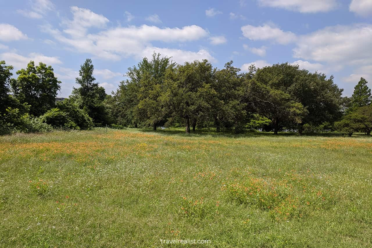
Both paths will bring you to the same place in the end. Edward Rendon Sr. Metro Park is a beautiful spot to visit. Blooming flowers, lots of shade, and plenty of parking await its visitors every spring.
4. Holly Shores
You will start going northeast as Lady Bird Lake widens before the Longhorn Dam. You are about to arrive at Holly Shores. It is a section of the Austin Hike and Bike Trail that continues on and near Holly Street.
Holly Shores have complicated history. The Holly Street Power Plant was on these shores from 1974 to 2007. It has been a major source of controversy for nearly as long as it existed.
Pollution from this power plant is believed to have an effect on the surrounding neighborhoods and the lake. Chemical spills and noise pollution were other by-products of this structure.
The power plant no longer exists. But you might still not feel at ease when passing Holly Shores. This is an example when a peaceful landscape hides deep scars.
5. Longhorn Shores
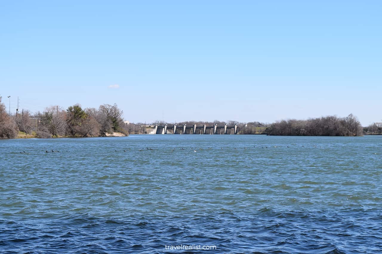
Longhorn Shores Metro Park starts as soon as you cross the Colorado River via Pleasant Valley Road. Lady Bird Lake is at its widest point near the Longhorn Dam.
The Ann and Roy Butler Hike and Bike Trail goes a little inland. But you could still see the lakeshore behind a few trees. While further away, Austin Downtown skyscrapers will still be in sight.
Longhorn Shores is a gateway to Roy G. Guerrero Colorado River Metro Park. This park continues on the south bank of the Colorado River between the Longhorn Dam and the Historic Montopolis Bridge.
There are softball fields, volleyball courts, and a disc golf course in this park. The park multi-use trails wind between these fields. They are a great way to extend your visit to the Butler Hike and Bike Trail.
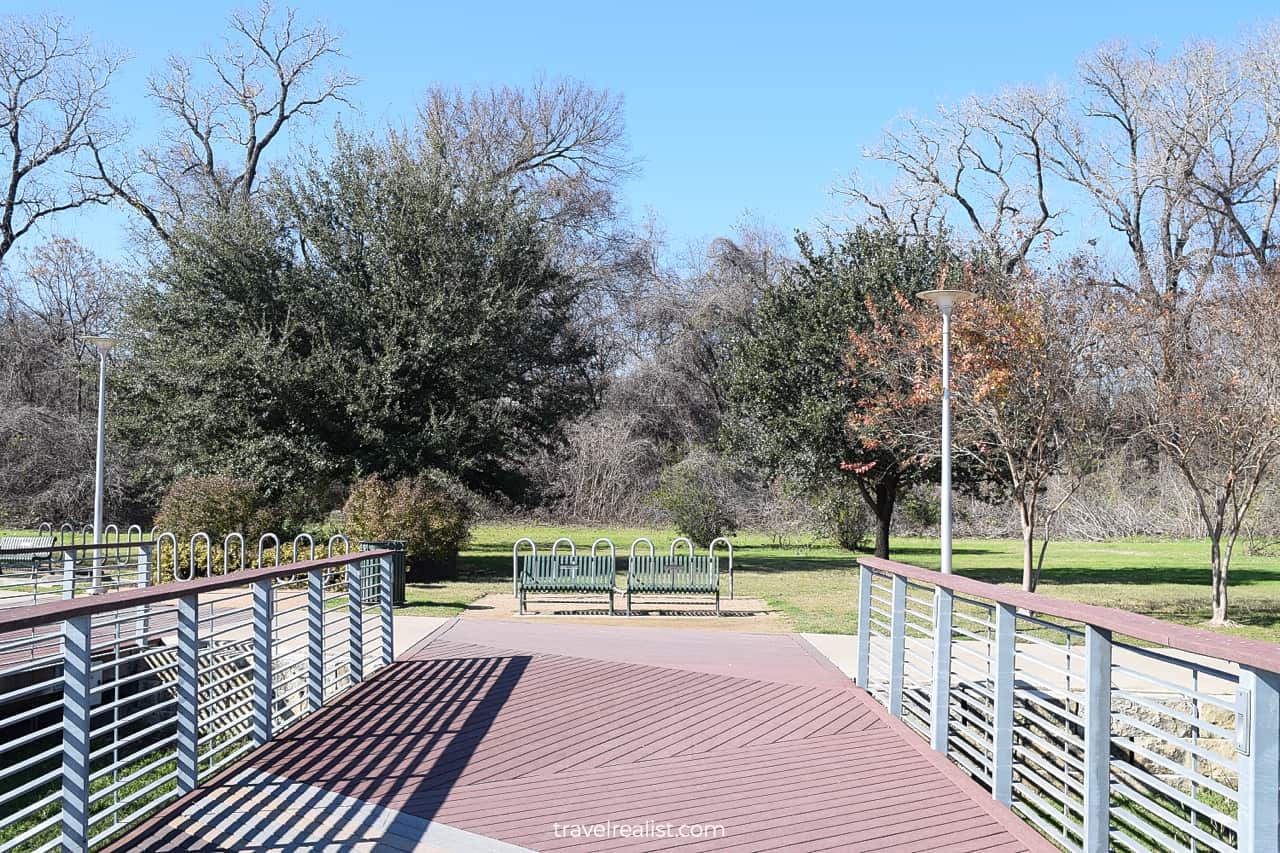
6. Lakeshore
Once you are ready to return to the main hike and bike trail, you should head to Lakeshore. This park is on the southern shore of Town Lake, along Lakeshore Boulevard.
It is one of the main gateways to the Ann and Roy Butler Hike and Bike Trail. There are a lot of parking spots on this street. Practice your parallel parking skills on westbound Lakeshore Boulevard.
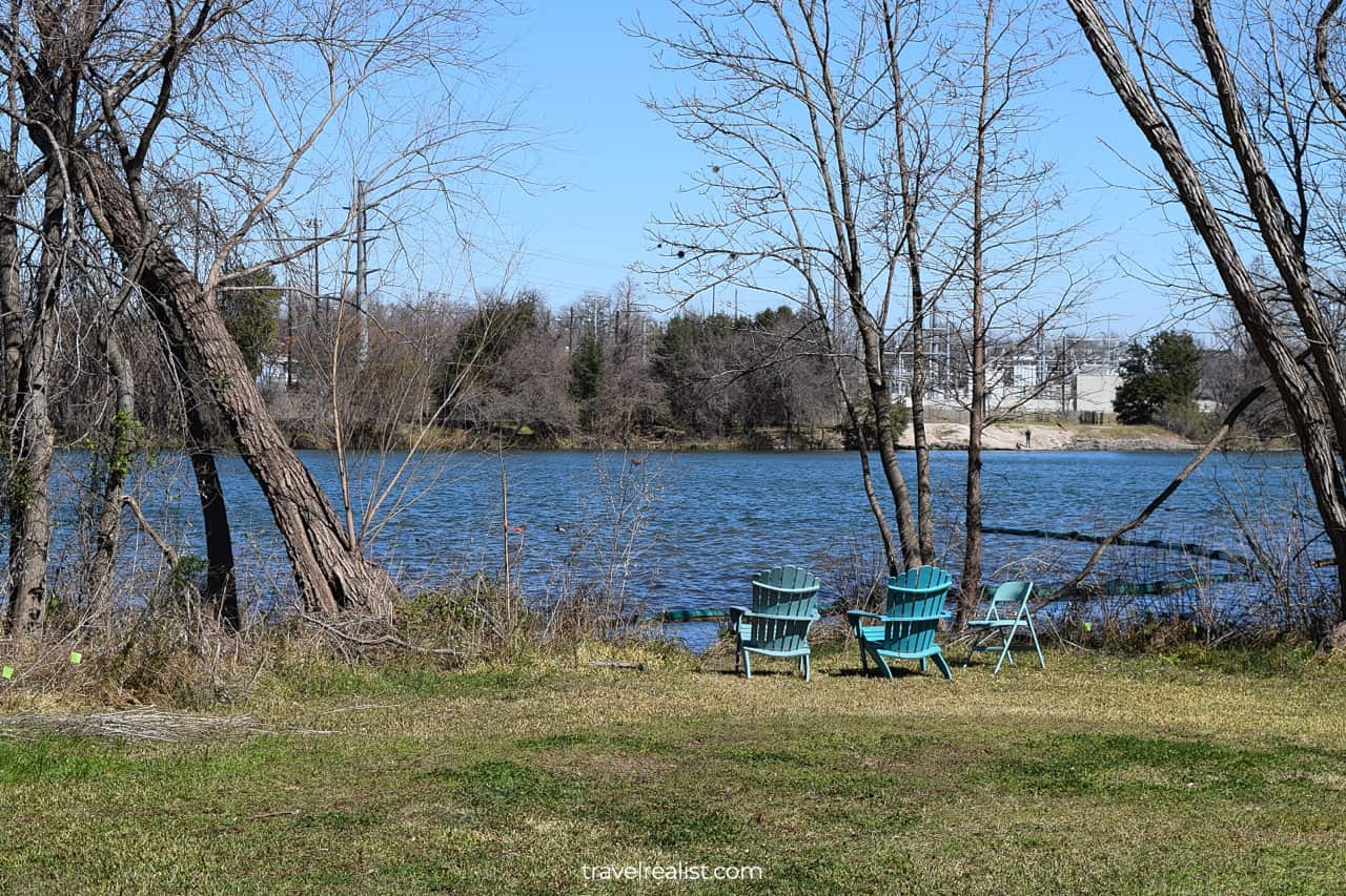
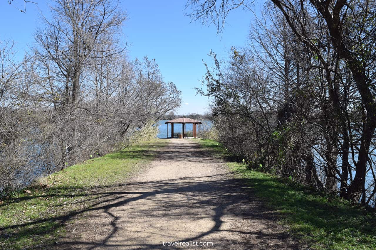
If you have some extra time, you should take a side trail to the Peace Point. This peninsula is home to the John Zenor Picnic Pavilion. Water surrounds it from three sides. You will get a good look at an island, too.
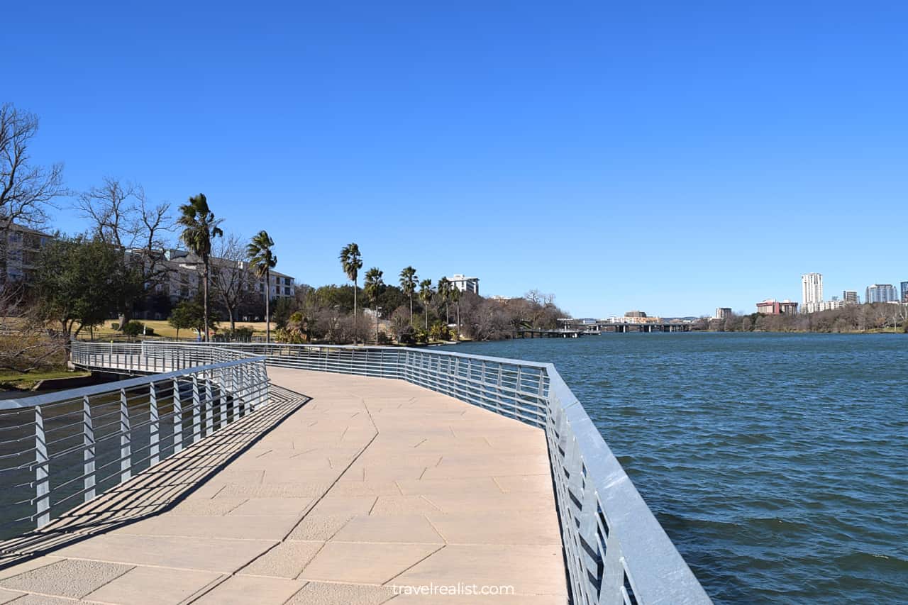
7. Boardwalk
Once you pass the Peace Point, you will enter International Shores. The Butler Hike and Bike Trail continues onshore for a few hundred feet (meters). You are about to enter the most exciting trail section.
The Boardwalk at Lady Bird Lake is a 1.4-mi (2.2-km) path. It goes directly above the surface of Lady Bird Lake. This engineering wonder was the last link in the Butler Hike and Bike Trail.
This section of the trail has almost no shade outside of a couple metal shade canopies. You should apply sunscreen and wear a hat year round. Do not play games with sunlight that reflects from the water.
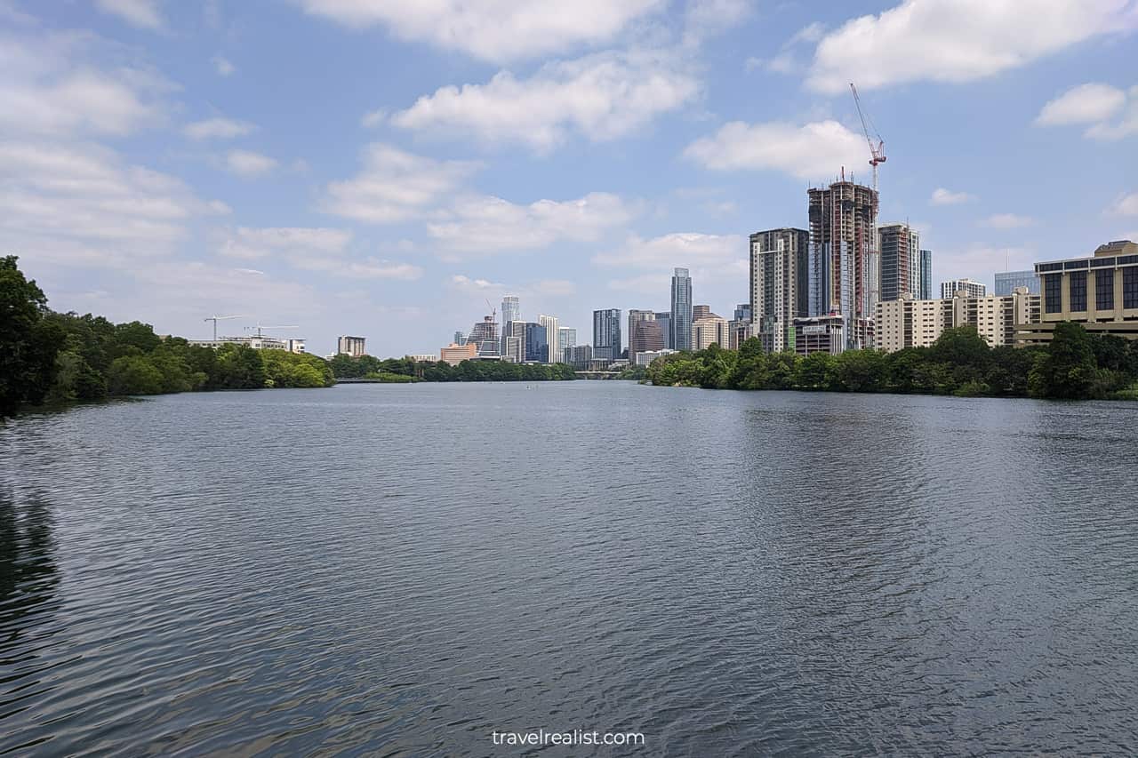
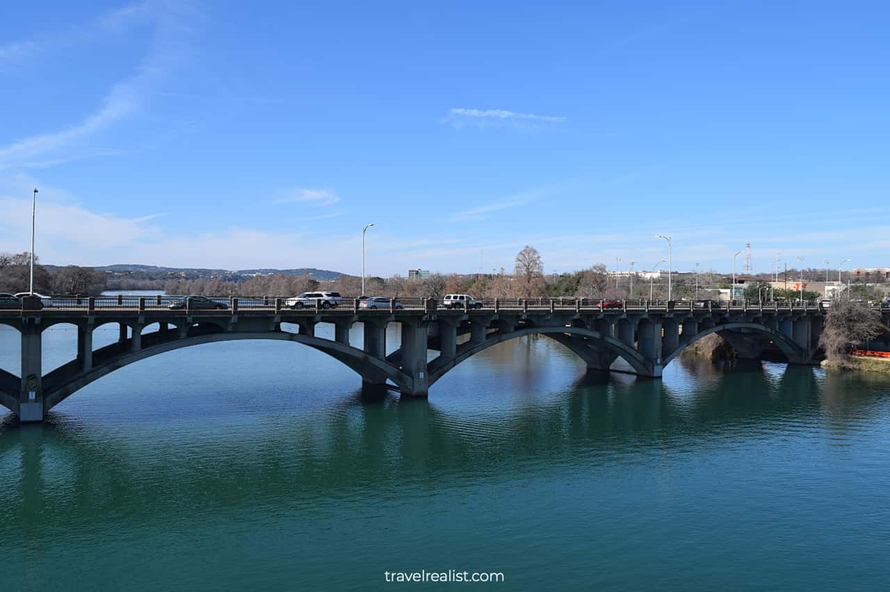
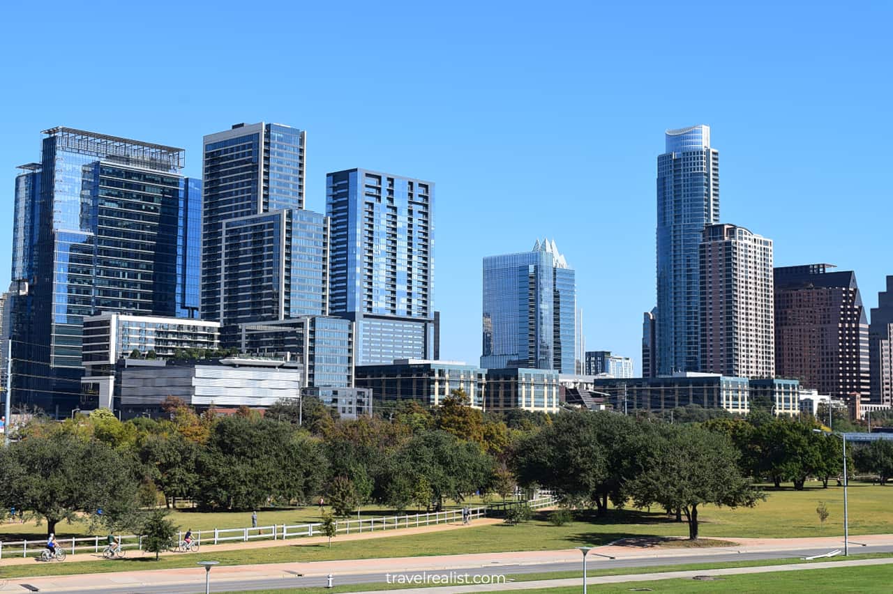
Interstate Highway I-35 Bridge will be in the view for the first part of the boardwalk. Once you cross this bridge, Austin Downtown panorama will be in sight. This scenic trail section will only get better.
8. Auditorium Shores
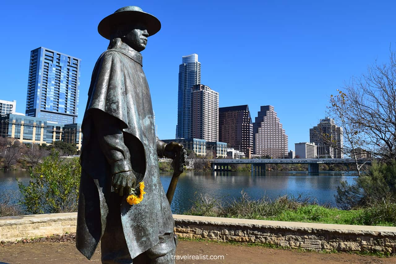
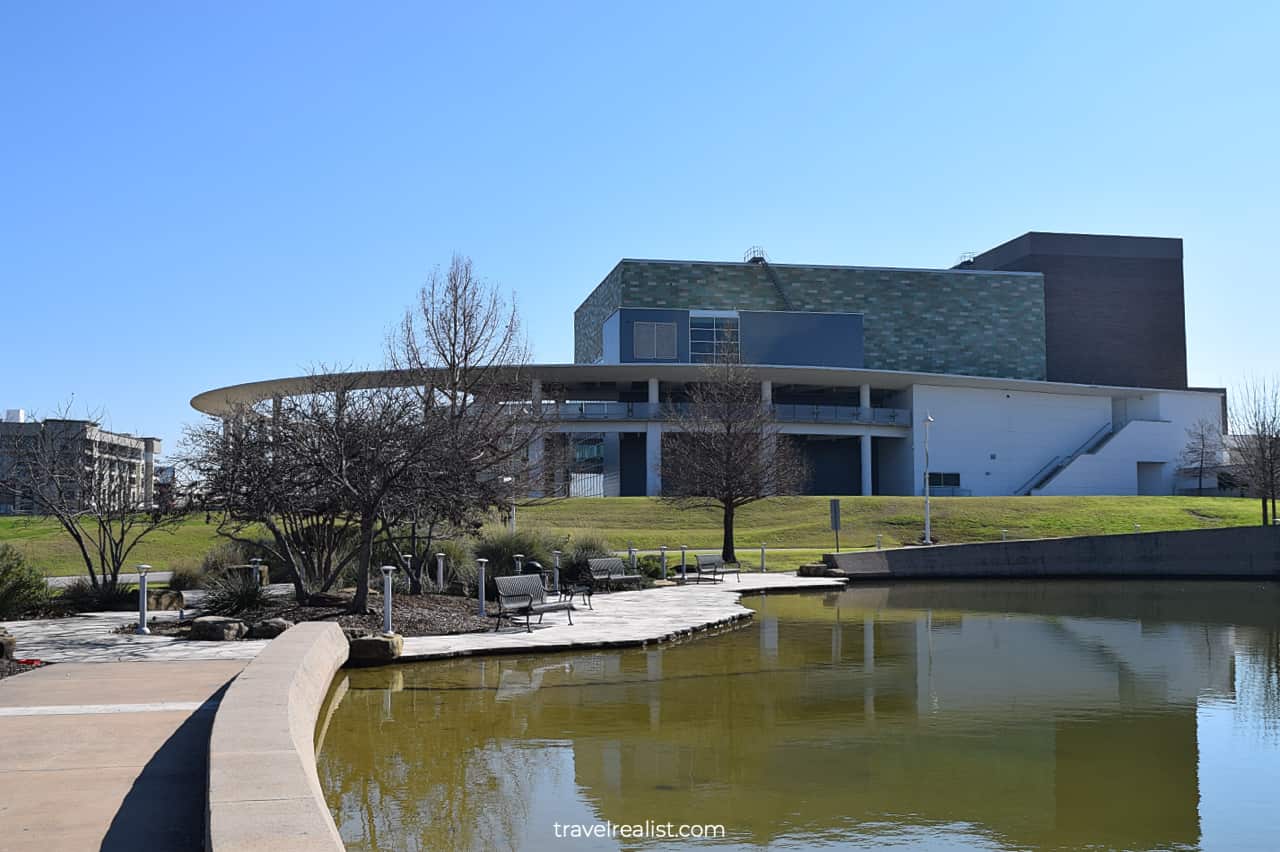
Auditorium Shores at Town Lake Metro Park is a crown jewel of the Butler Hike and Bike Trail. This park spans between 1st Street and Lamar Boulevard. It is home to an impressive number of sights.
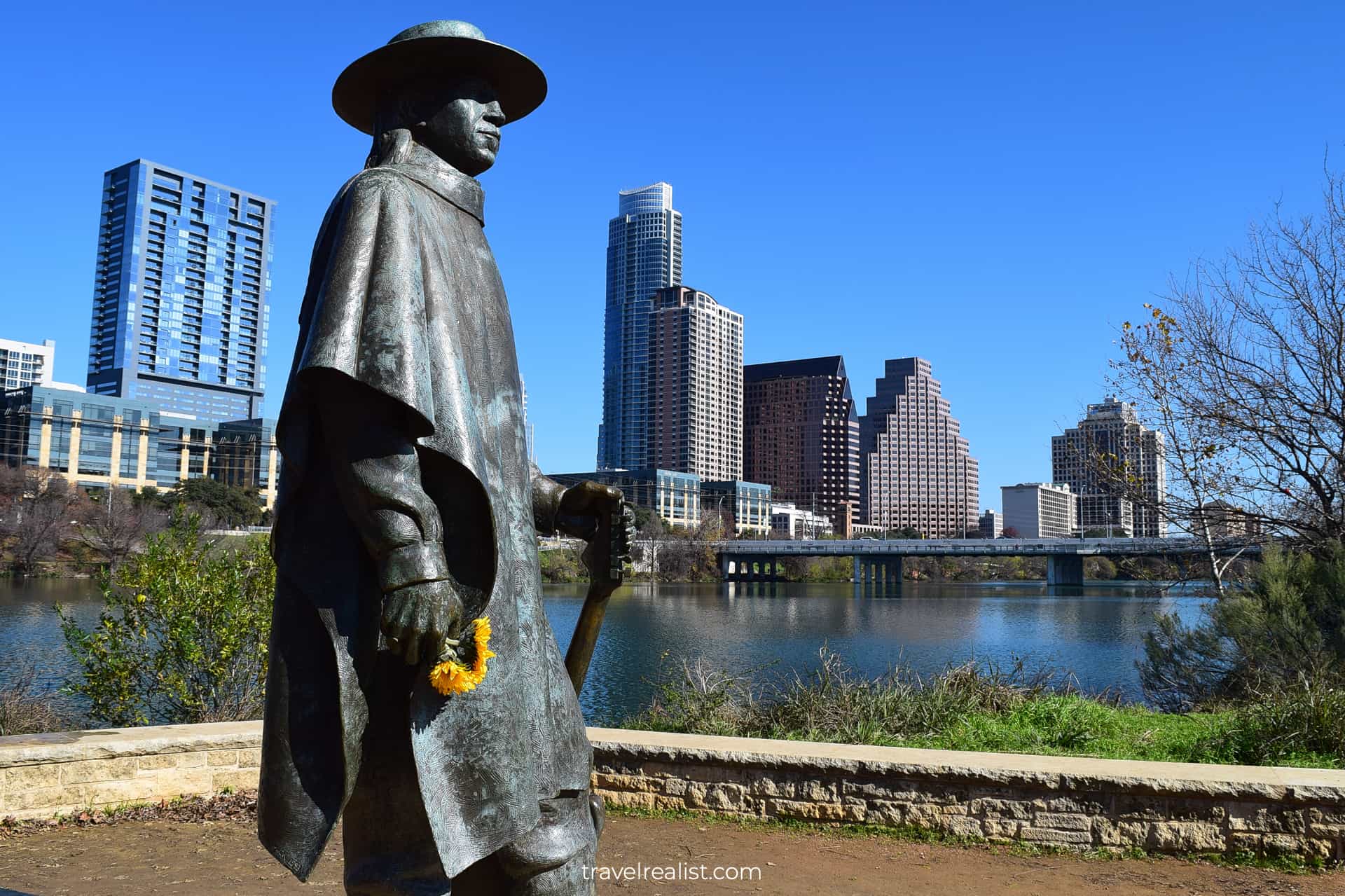
You could find the Palmer Events Center and the Dougherty Arts Center in Auditorium Shores. Fannie Davis Town Lake Gazebo and Stevie Ray Vaughan Statue are also in this park.
There are plenty of landscape features, too. Palmer Pond brings moisture during Texas summer. Doug Sahm Hill Summit is a great spot to enjoy the Downtown skyline and 4th of July Fireworks.
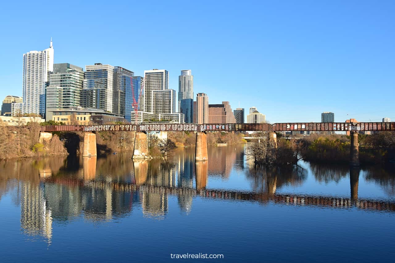
If this is not enough, head to Butler Metro Park for a splash pad and a playground. Or take the Pfluger Pedestrian Bridge to reach Shoal Beach. Enjoy the graffitis on the MoPac Colorado River Railroad Bridge.
9. Butler Shores
As soon as you cross Lamar Boulevard, you will enter Butler Shores. This park continues to Barton Creek between the Colorado River and Toomey Road.
Compared to Auditorium Shores, Butler Shores might look like a black sheep. ZACH Theatre and a handful of athletic fields are in this park.
But do not write off Butler Shores too soon. You should make a stop at the Austin River Skyline View. You could see the Downtown skyline from beneath the Lamar Boulevard Bridge.
Beyond the viewpoint, there might not be much to see at Butler Shores. Keep on hiking or biking until you reach Barton Creek. This decision will help you save time and energy for other, more scenic trail sections.
10. Barton Creek
The Butler Hike and Bike Trail will turn south, away from the Colorado River. You will start to follow Barton Creek instead. This path will be quite short at 0.2 miles (0.3 km).
When the Barton Springs Bridge appears in sight, you will reach the Barton Creek Pedestrian Bridge. This is the main route for hikers and bikers. Cross the creek to the other side.
You should turn right after the bridge if you prefer to continue on the Butler Hike and Bike Trail. The path will bring you to the Lou Neff Point at the confluence of Barton Creek and the Colorado River.
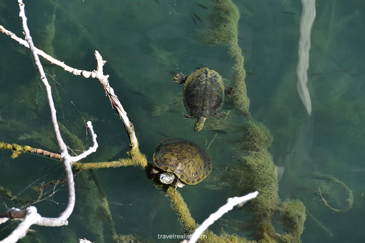
It is a great place to take a short break. The Lou Neff Point has a few benches, a Downtown viewpoint, and some shade. Countless turtles will be visible at or near the shore.
11. Zilker Park
The next few miles (km) of the Austin Hike and Bike Trail continue in-between the Colorado River and Zilker Park. This area is always busy. Parkgoers come to Zilker to play sports and reconnect with nature.
There are two periods of the year when Zilker Park gets extra busy. You will find the Hike and Bike Trail hard to navigate during Austin City Limits and the Trail of Lights.
Austin City Limits or ACL is a music festival. It takes place on two weekends in late September and early October. The exact timing of the festival differs by year. Major bands and performers come to ACL.
The Trail of Lights is another annual tradition. This Christmas lights installation takes place in Zilker Park between Thanksgiving and Christmas. Both ACL and Austin Trail of Lights charge admission fees.
12. Lamar Beach
The Austin Hike and Bike Trail will bring you to its westernmost point soon. You will find yourself below Mopac Expressway and the Roberta Crenshaw Bridge. There is always noise in this area due to traffic.
You could take a pedestrian bridge below the road one to cross the Colorado River. The Butler Hike and Bike Trail continues east on the north bank of the river.
You will reach Lamar Beach in a few minutes. As the name suggests, this area borders Lamar Boulevard on the east. There are two viewpoints, Jolin Lookout and North Shore Overlook.
Lamar Beach is another nice place to rent or launch your own kayak or paddle board. Head to Texas Rowing Center or Austin High Boat Launch depending on your needs and preferences.
Continue with this Austin Hike and Bike Trail Guide. You will learn more about ways to get to the sights, entrance requirements, and places to stay.
Getting to Butler Hike and Bike Trail
The Ann and Roy Butler Hike and Bike Trail is in the center of Austin, Texas. The path goes along both shores of Lady Bird Lake of the Colorado River.
Mopac Expressway is the trail’s westernmost point. The Longhorn Dam at Pleasant Valley Road is the easternmost point of this path. This location gives a few starting points for the Butler Hike and Bike Trail.
A car is a no-brainer way to reach the path. But you have to be strategic about parking. You could park at Zilker Park. It costs $7 to park there on the weekends and holidays. Weekday parking is free.
If you prefer to park for free elsewhere, your options are quite limited. Waiting till Sunday is your best bet. Meter parking is free on that day.
You could try your luck with 2-hour free parking along Riverside Drive. There are a couple of parking lots in this area. But each of them fits just a dozen of cars.
Your other option is to drive to Lakeshore Drive. Street parking is free along this street every day of the week. It is the closest parking option to the Boardwalk at Lady Bird Lake.
A bike is a great way to reach the Butler Hike and Bike Trail. This path connects to Shoal Creek Greenbelt and Barton Creek Greenbelt. These biking routes bring you to the areas up north and down south.
The latter trail goes to the Lady Bird Johnson Wildflower Center via the Violet Crown Trail. There are plans to extend it all the way to San Antonio in the future.
The Southern Walnut Creek Trail starts 2 miles (3.2 km) northeast of the Butler Hike and Bike Trail. It is another great gateway to the trail for the residents of East Austin.

Where to Stay near Butler Hike and Bike Trail
The Austin Hike and Bike Trail is in the heart of the Capital of Texas. On the hand, it means that you have plenty of hotels to choose from. On the other hand, these places to stay could get quite expensive.
You should take a look at The Carpenter Hotel and Hyatt Regency Austin at the south shore. Up north, consider Austin Proper Hotel, a Member of Design Hotels and JW Marriott Austin.
All of these places to stay are either on or just a few blocks from the Hike and Bike Trail. It means that you could skip a car rental and enjoy the city on foot.
If you decide to rent a car to explore other Austin sights, you should stay outside of the city center. Homewood Suites by Hilton Austin South and Residence Inn Austin South are great options.
You could reach the Austin Hike and Bike Trail by car in 15 minutes or less. This could be a good trade-off to get free parking and breakfast at a fraction of the price.
Staying near Austin Airport could also be a viable option to explore. There are a lot of newly built places to stay in Montopolis neighborhood.
Check out Atwell Suites Austin Airport, an IHG Hotel, Cambria Hotel Austin Airport, and Tru By Hilton Austin Airport, Tx. These places to stay give you easy access to McKinney Falls as well.
Entrance Requirements & Passes
The Ann and Roy Butler Hike and Bike Trail is open from 5 a.m. to 12 a.m. every day. No holidays or maintenance breaks close down the whole trail. There will always be a way to hike it all.
It is free to visit the trail and the sights along the way. But if you reach the Butler Hike and Bike Trail by car, you need to account for parking.
There are a few free parking lots along Riverside Drive, Lakeshore Drive, and in Edward Rendon Sr. Park. You need to pay to park in Butler Park and Zilker Park on weekends.
Takeaways: Austin Hike and Bike Trail
The Butler Hike and Bike Trail is a must-do attraction for every outdoor enthusiast in Austin. Whether you live in Austin or are just visiting, you will find this path worthwhile.
You could reach Zilker Park and Barton Creek, Shoal Creek and Auditorium Shores, the Boardwalk and Lakeshore. Pick a park or two along the way if you cannot complete the whole 10-mi (16-km) journey.
The Boardwalk at Lady Bird Lake could rival the Chicago and Tampa River Walks. It brings you above water for a different view at Austin Downtown and surrounding neighborhoods.
Few free parking spots are the only downside of the Austin Hike and Bike Trail. You could try your luck in Butler Shores and Auditorium Shores. Or head to Lakeshore Boulevard to increase your chances.
Take a look at this Austin Hike and Bike Trail Video Guide. And visit the YouTube channel for the latest videos.
Frequently Asked Questions
The Ann and Roy Butler Hike and Bike Trail is a 10-mi loop path along Town Lake in Austin, Texas. It connects Zilker Park in the southwest with Holly Shores in the northeast.
The Ann and Roy Butler Hike and Bike Trail in Austin, Texas is 10 miles long.
Most parks along the Butler Hike and Bike Trail charge a parking fee. But there are a few exceptions. You could park along Riverside Drive if you could finish your visit in 2 hours or less.
Go to Lakeshore Boulevard, Roy G. Guerrero Park, or Edward Rendon Sr. Park for free parking longer than 2 hours.
The Austin Hike and Bike Trail along Lady Bird Lake has dirt, paved, and boardwalk sections. Unless you take this path after heavy rain, you could keep your shoes and bike tires clean.
You could take the Austin Hike and Bike Trail from 5 a.m. to 12 a.m. every day of the year.
The Ann and Roy Butler Hike and Bike Trail passes through a handful of lake parks and sights:
– Doug Sahm Hill Summit in Auditorium Shores
– The Boardwalk in Norwood Tract
– Barton Creek at Butler Shores
– Lou Neff Point near Zilker Park
– Austin Central Library near Shoal Beach
– Roy G. Guerrero Colorado River Metro Park near Longhorn Shores
– Peace Point at Lakeshore
– Lake viewpoints at Lamar Beach
– Edward Rendon Sr. Metro Park
– Boathouse and Trail of Tejano Legends at Waller Beach
Safe realist travels!