Colorado Bend: 15 Trails in A Central Texas Hiking Paradise
This realistic Colorado Bend Hiking Trails Guide helps you plan your next adventure in this Texas State Park.
Colorado Bend is a state park along the Colorado River in the Texas Hill Country. The park protects a serene landscape while giving visitors a chance to explore most areas.
- Sights & Places of Interest
- 1. Tie Slide Trail
- 2. Gorman Falls Trail
- 3. Gorman Spring Trail
- 4. Tinaja Trail
- 5. Cedar Chopper Loop
- 6. Old Gorman Road
- 7. Dogleg Canyon Trail
- 8. River Trail
- 9. Spicewood Springs Trail
- 10. Spicewood Canyon Trail
- 11. Lemon Ridge Pass
- 12. Lively Loop
- 13. Windmill Trail
- 14. Dry Creek Junction
- 15. Gorman-Windmill Connection
- Getting to Colorado Bend
- Where to Stay near Colorado Bend
- Entrance Requirements & Passes
- Takeaways: Colorado Bend Hiking Trails
This post includes affiliate links that will earn us commission if you make a purchase via these links.
Colorado Bend is a fantastic destination in the Hill Country. This state park could rival a few national parks and monuments in versatility of sights.
Colorado Bend is so much more than a simple river park. It has Gorman Falls, Spring, and Cave, Spicewood Springs and Canyon, Dogleg Canyon, Tinaja, and Tie Slide.
It is quite difficult to visit all sights in this park on a day trip. You would want a weekend to see everything in Colorado Bend. This Colorado Bend Hiking Trails Guide helps you prioritize the park sights.
Sights & Places of Interest
Hiking a trail or two is the best ways to see most of the natural wonders in the park. There are 35 miles (56 km) of hiking trails in Colorado Bend. This is more than in a handful of Texas state parks combined.
Most of the hiking trails in Colorado Bend have a sizable elevation gain. They will test your limits. Long distances, steep sections, unstable surfaces, slippery rocks, and lack of shade await hikers in this park.
This Colorado Bend Hiking Trails Guide describes every single trail in the park. You will get a realistic picture of what to expect on each of the 15 hiking trails in Colorado Bend.
1. Tie Slide Trail
- Distance: 2.3 miles (3.7 km)
- Elevation Gain: 180 ft (55 m)
- Type: out-and-back or loop
- Difficulty: moderate
- Trailhead: Gorman Falls
The Tie Slide Trail is the closest hiking trail to the entrance of Colorado Bend State Park. This path starts from the Gorman Falls trailhead. Take a first left turn onto a gravel road from Colorado Park Road.
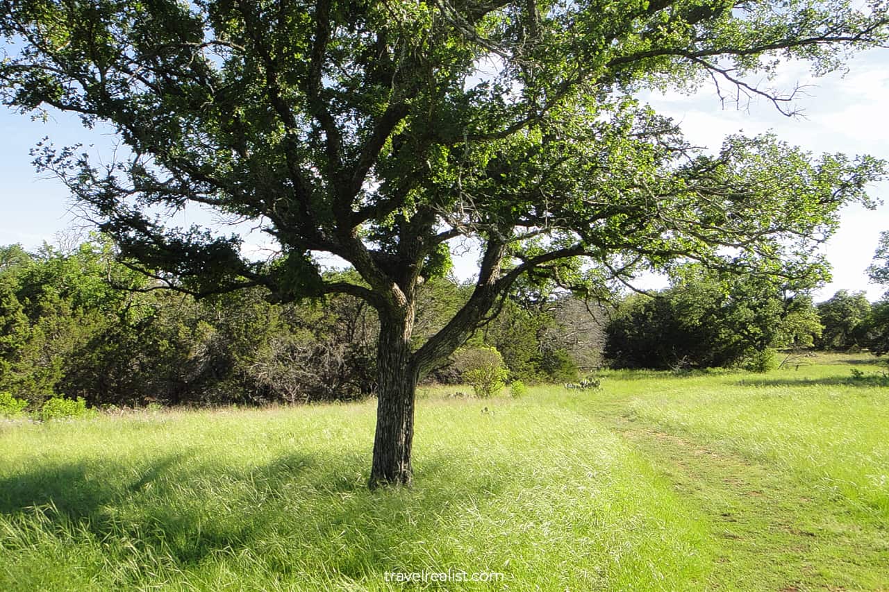
The Tie Slide Trail gives you a good idea what to expect from the rest of the park. You will be hiking next to cedar groves and meadows. A rocky and dirt trail brings you through a few different terrain types.
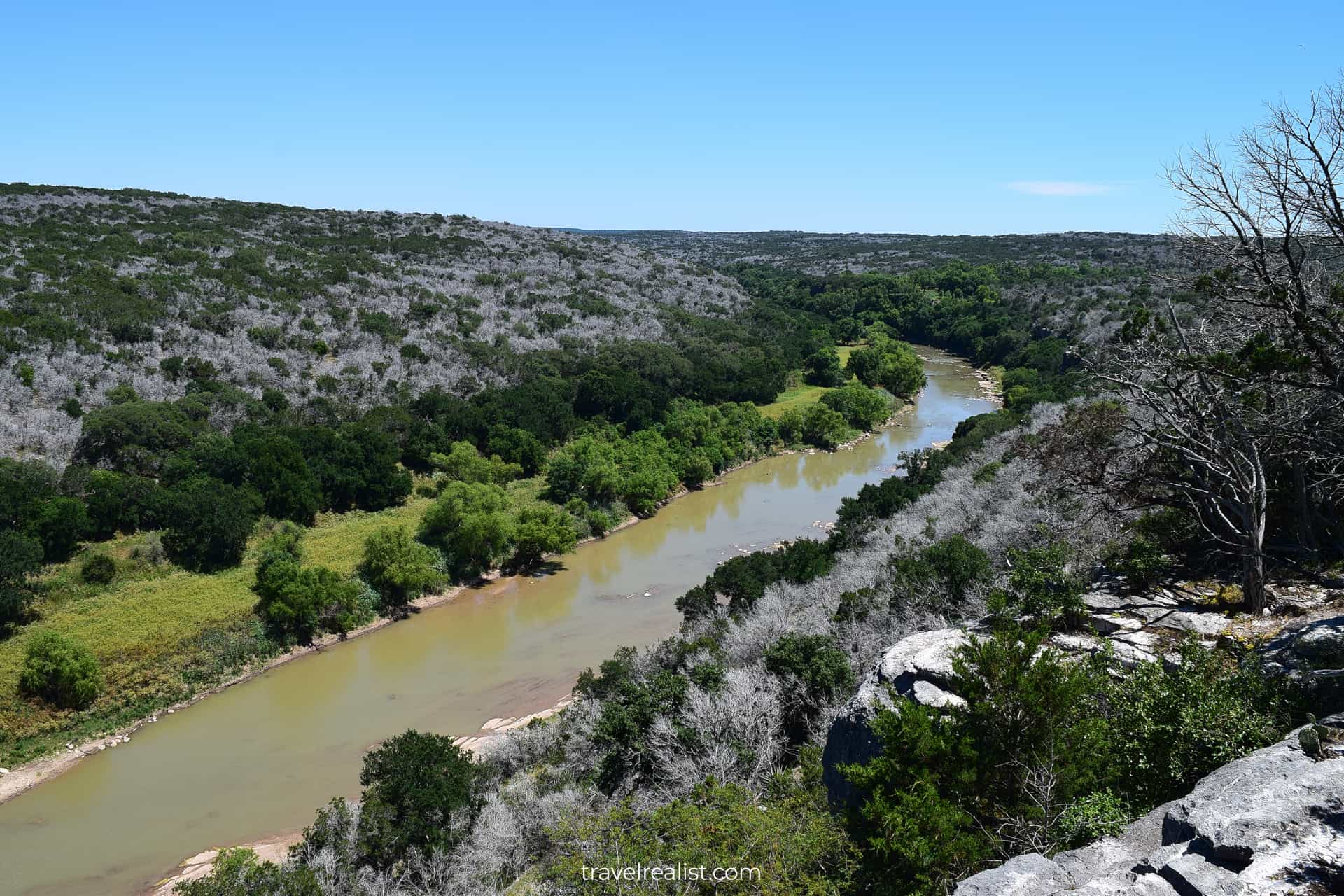
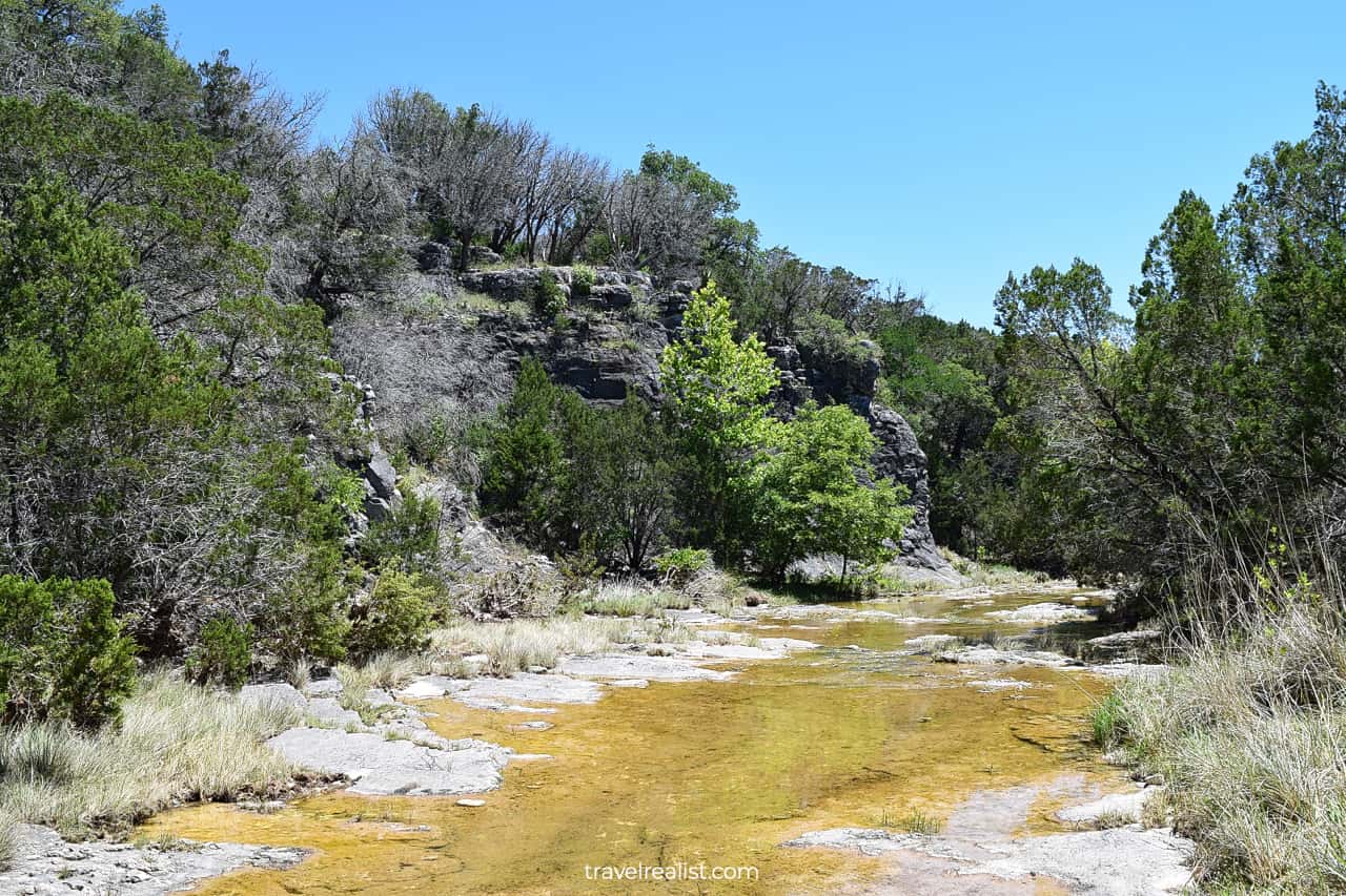
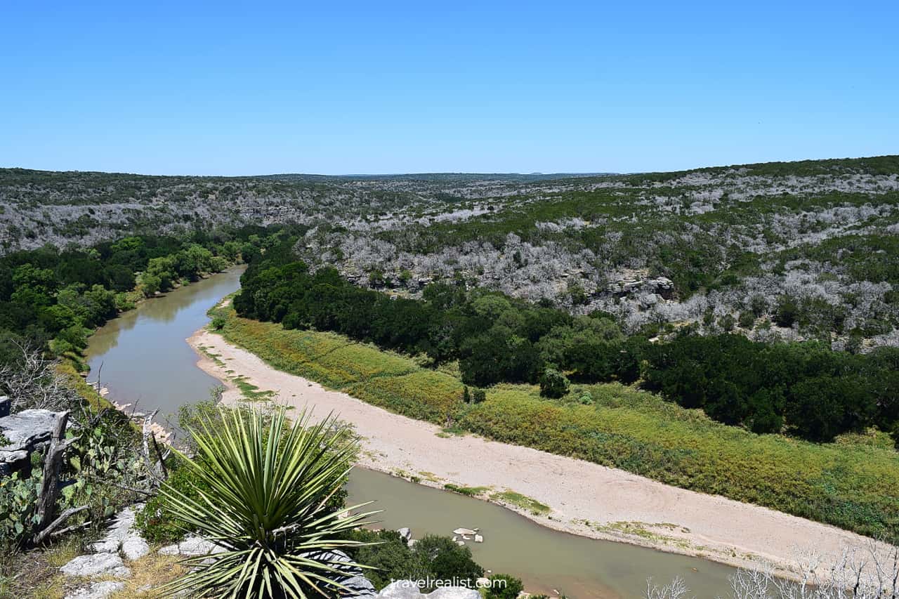
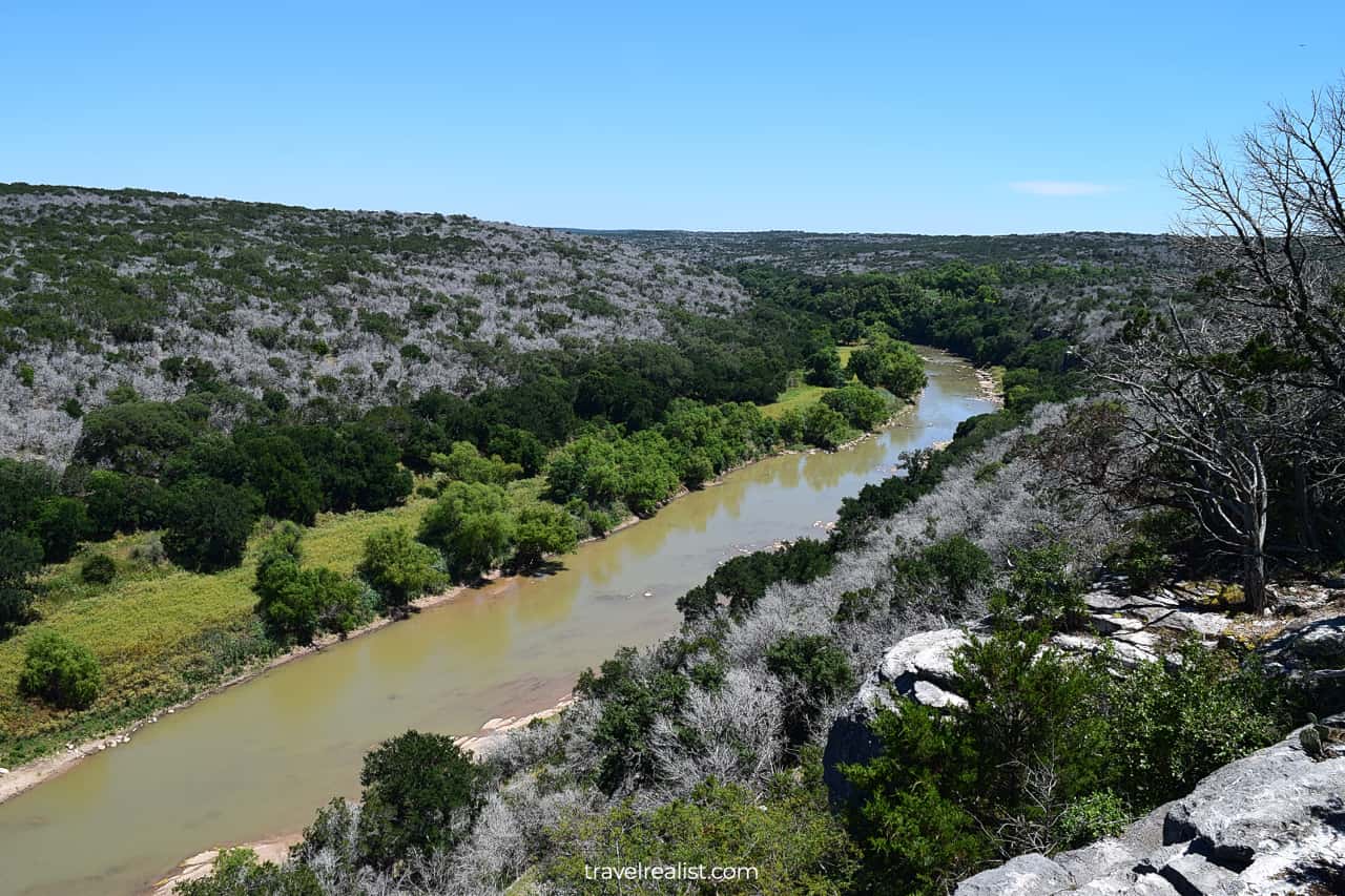
The trail goes next to the park’s boundary for a while before arriving at a scenic viewpoint. The TieSlide Overlook has excellent views of the Colorado River below.
Depending on the time of the year, the river might look muddy and shallow or full-flowing and deep. Once you finish admiring the views, you could complete the loop or continue to Gorman Falls.
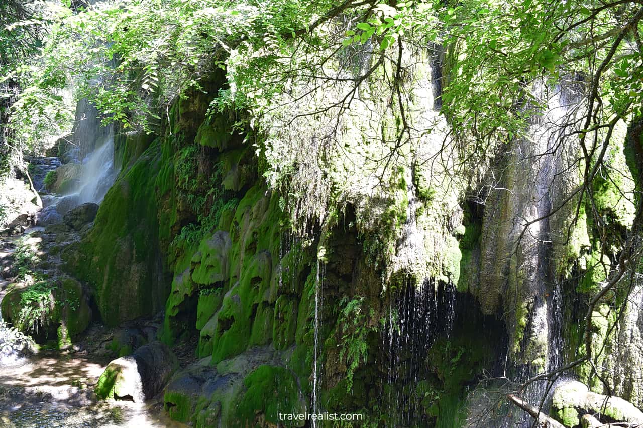
2. Gorman Falls Trail
- Distance: 3 miles (2.4 km)
- Elevation Gain: 331 ft (101 m)
- Type: out-and-back
- Difficulty: moderate to challenging
- Trailhead: Gorman Falls
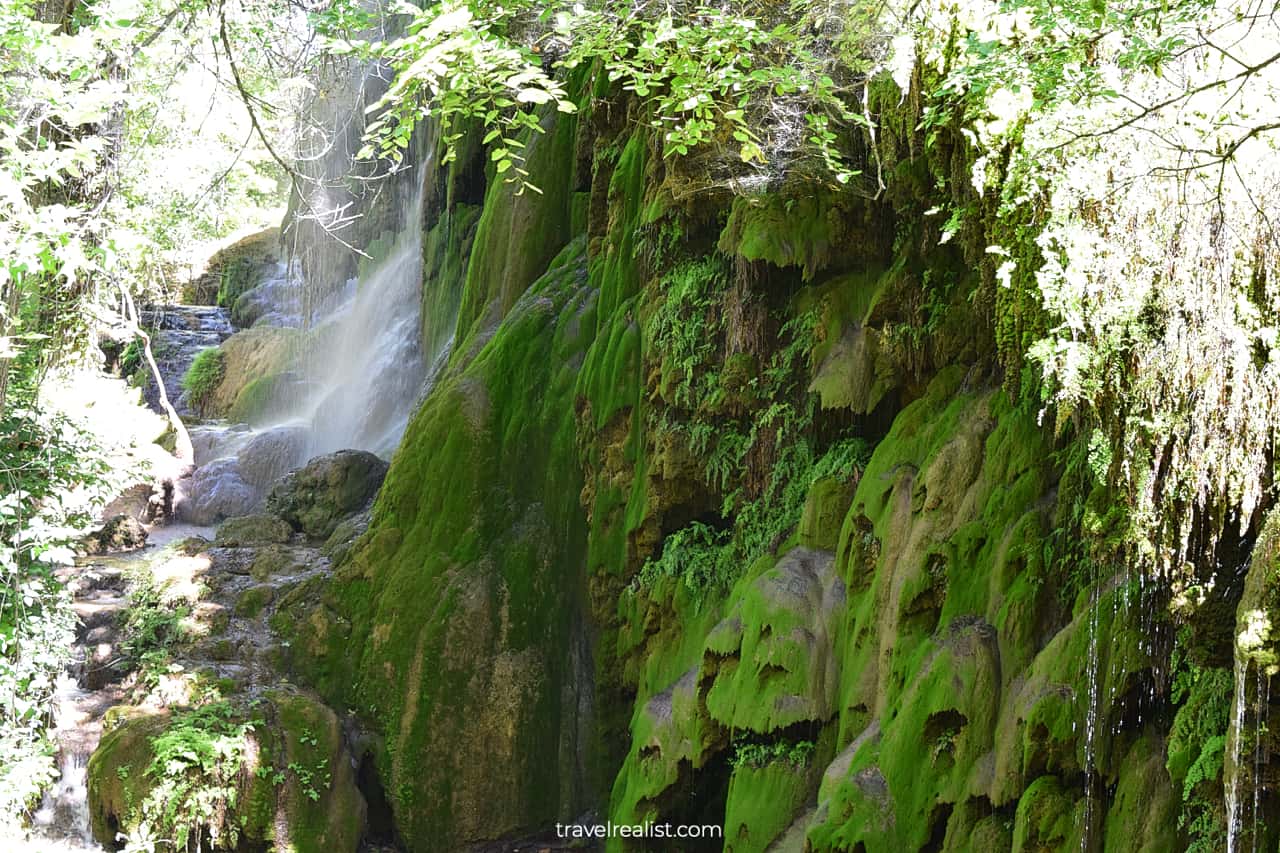
The Gorman Falls Trail is one of the most popular hikes in Colorado Bend. This path brings you to the 70 ft (21 m) high and 650 ft (200 m) wide falls.
Gorman Falls is no Niagara Falls, waterfalls in Delaware Water Gap or in Iceland. But it is among the prettiest waterfalls in Texas.
Most of the Gorman Falls Trail is quite flat. You will be hiking across cacti fields, rock ledges, and cedar groves. These views will get old if you visited Balcones Canyonlands and other parks in the region.
But do not write this trail off right away. The last section has a steep drop on the way in and an uphill climb on the way out. These 0.1 miles (0.2 km) are dangerous since the rocky trail is slippery when wet.
You cannot swim or hike next to the falls. This rule protects their fragile ecosystem. The same reason explains why bikes are off limits on the Gorman Falls Trail.
3. Gorman Spring Trail
- Distance: 1 miles (1.6 km)
- Elevation Gain: 26 ft (8 m)
- Type: out-and-back
- Difficulty: easy
- Trailhead: Gorman Falls or Cedar Chopper
Most Colorado Bend visitors take the Gorman Falls Trail back to the parking lot. But since you already made it this far, you might want to explore other trails in the area first.
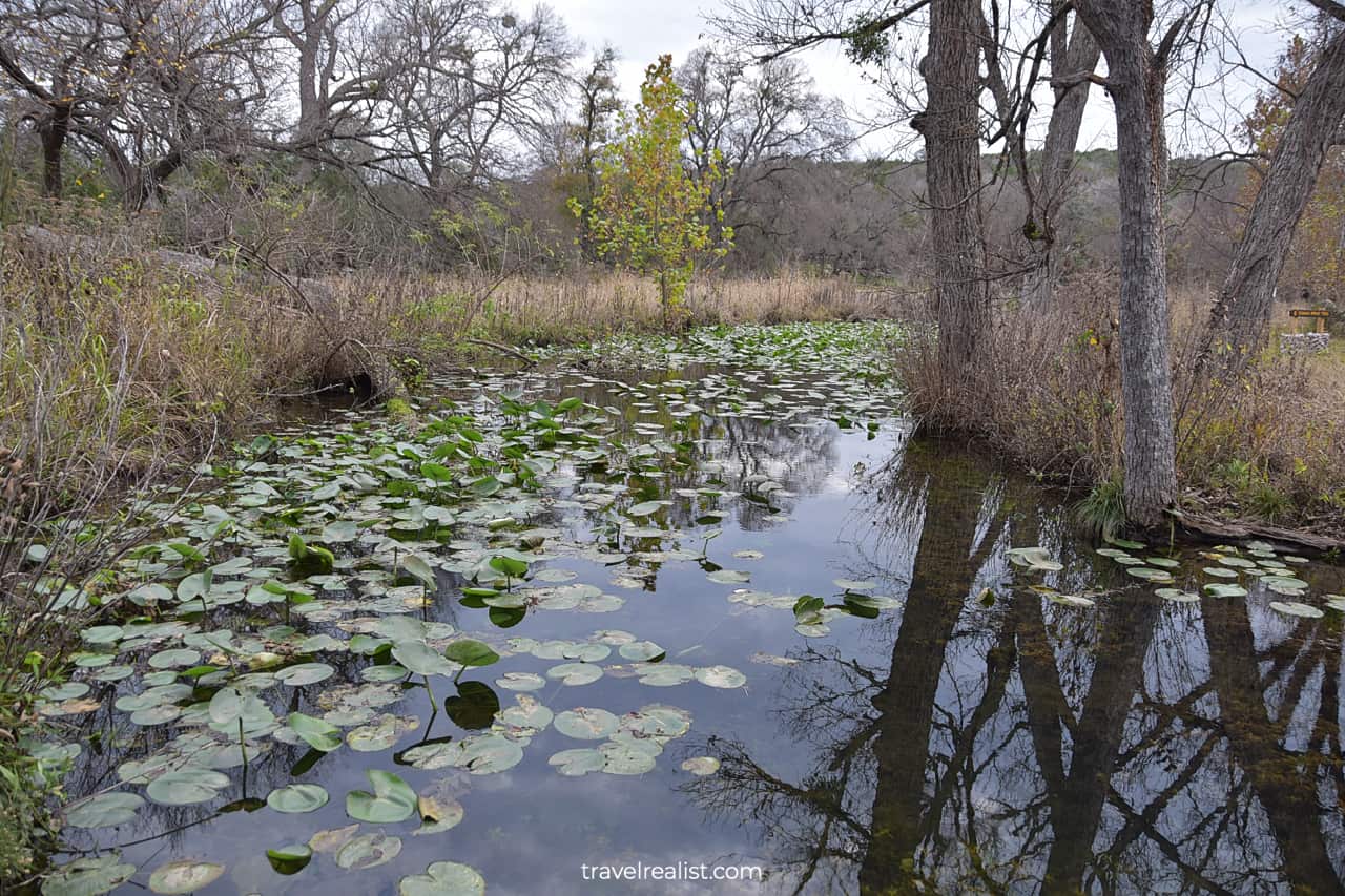
The Gorman Spring Trail is a great easy path to take. It follows the spring that feeds the same name waterfall all the way to its source.
You could enjoy water lilies and other aquatic plants in the spring. There might be a few fallen trees on the trail that you would have to climb over or under. Also, beware of snakes on the trail.
The Gorman Springs Trail comes close to Tinaja Trail at times. But there is no connecting path between them. You have to return all the way back to the Old Gorman Road Trail after visiting the spring.
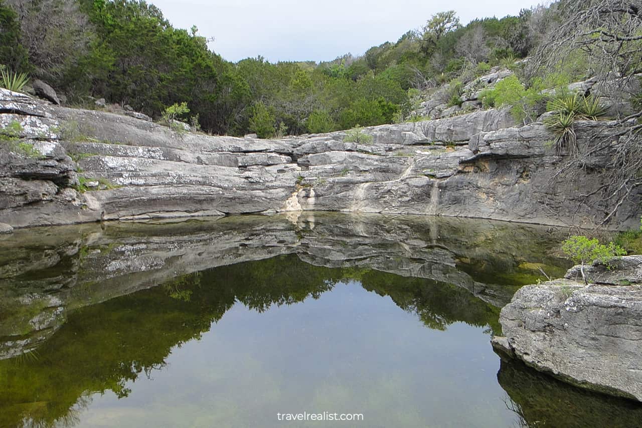
4. Tinaja Trail
- Distance: 2.8 miles (4.5 km)
- Elevation Gain: 869 ft (265 m)
- Type: out-and-back
- Difficulty: challenging
- Trailhead: Gorman Falls or Cedar Chopper
The Tinaja Trail could be your next hiking trail in Colorado Bend. But do not let the ease of the Gorman Spring Trail fool you. The Tinaja Trail is a challenging trail is not suitable for beginner hikers.
You are looking at a sizable elevation gain on this trail. It is double the height of Enchanted Rock. On top of that, the path constantly changes between uphill and downhill sections.
When you think this trail could not get more difficult, note that there is where little shade. As a result, it is best to budget 2.5 to 3 hours to complete this hiking trail.
You will see a rock bowl and a lake roughly halfway into the trail. This formation is the main attraction on the most challenging trail in the park.
5. Cedar Chopper Loop
- Distance: 2.3 miles (3.7 km)
- Elevation Gain: 78 ft (24 m)
- Type: loop
- Difficulty: moderate
- Trailhead: Cedar Chopper
You will hike at least a section of the Cedar Chopper Loop if you embark on the Tinaja Trail. This path is a breath of fresh air. It is a much easier trail to complete.
You should still expect to have a handful of uphill climbs and downhill sections. Yet, they will feel nowhere near as difficult as the Tinaja Trail.
It is hard to recommend the Cedar Chopper Loop on its own. There is little to see on this path beyond endless cedar trees, cacti, and occasional wildflowers.
But it is a nice connector trail. You could use its trailhead parking to reach the River Trail via the Old Gorman Road or Dogleg Canyon Trails.
6. Old Gorman Road
- Distance: 2 miles (3.2 km)
- Elevation Gain: 266 ft (81 m)
- Type: out-and-back
- Difficulty: moderate
- Trailhead: Cedar Chopper
The Old Gorman Road gives you an easier alternative to Tinaja Trail. You could also use it to reach Gorman Falls from The Cedar Chopper Loop.
It is an old service road. Its wide path is a fairly easy hiking and biking trail. Elevation gain and incline are the only things that makes it moderately difficult.
You will use the elevation drop to your advantage on the way to the river. But this same trail is far less enjoyable when you climb back up to the parking lot.
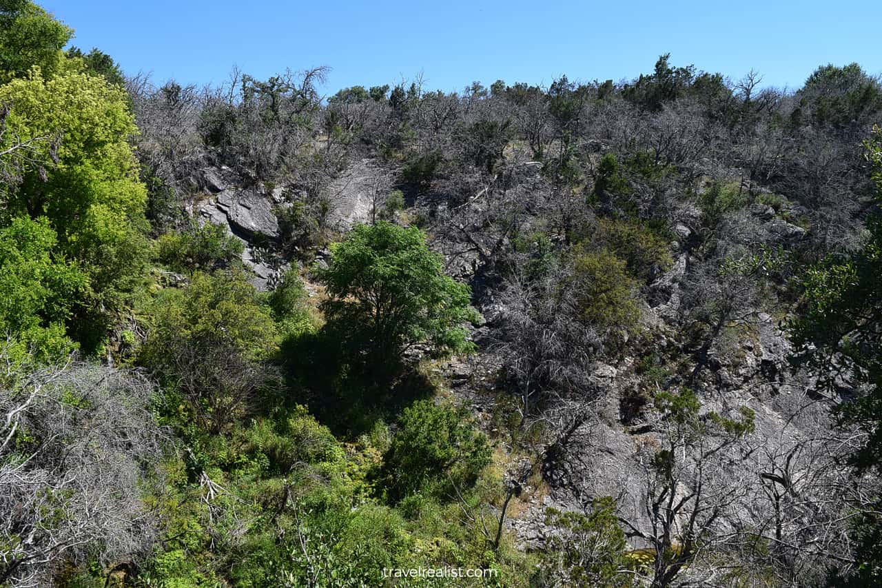
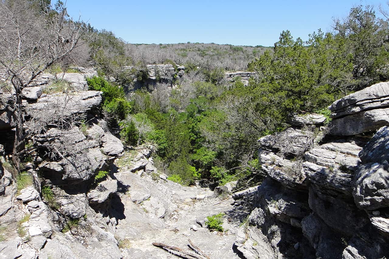
7. Dogleg Canyon Trail
- Distance: 2.6 miles (4.1 km)
- Elevation Gain: 377 ft (115 m)
- Type: out-and-back
- Difficulty: difficult
- Trailhead: Cedar Chopper
The Dogleg Canyon Trail is the second most challenging trail in Colorado Bend. You could think of it as a fairly easy path if you only take it down to the river level.
In this case, you need to find another way back. The Old Gorman Road Trail or Lemon Ridge Pass might help you out. As the name suggests, this path brings you via the Dogleg Canyon to the Colorado River.
The canyon is a beautiful place to visit. Just like the Bouldering Rocks in McKinney Falls, it is a popular rock climbing destination.
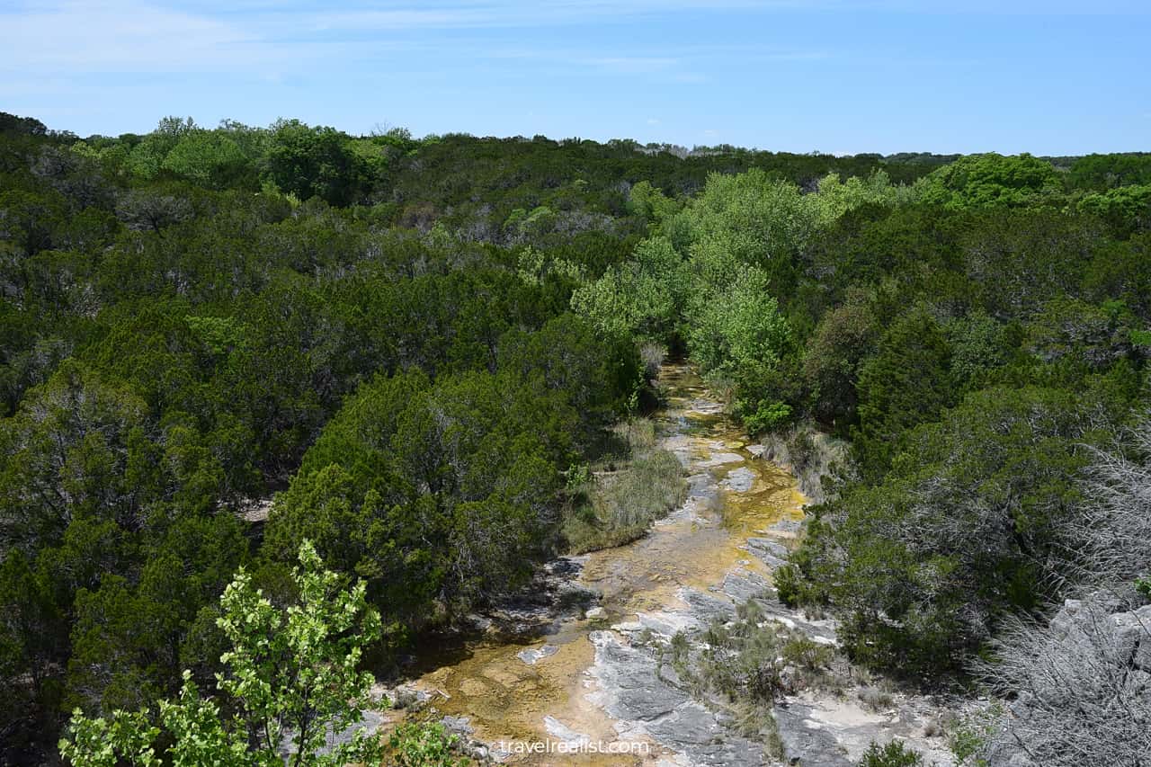
8. River Trail
- Distance: 6.8 miles (10.9 km)
- Elevation Gain: 158 ft (48 m)
- Type: out-and-back
- Difficulty: easy
- Trailhead: North Camping Area or Gorman Falls
The River Trail gives you a great change of pace on your hiking trip to Colorado Bend State Park. This easy path is the third longest park trail even if you take it in one direction.
The trail starts at an intersection with the Old Gorman Road Trail. Afterwards, it follows the southern shore of the Colorado River to the North Camping Area.
The River Trail is the easiest way to get from Gorman Falls to Spicewood Canyon. It is open to hikers, bikers, and horseback riders. Enjoy easy access to the river, too. It is a place to go if you like fishing.
You should not miss Gorman Cave if you take the River Trail. You could only see it from the outside on most days. Or consider joining a wild cave tour to go inside. It is a lot cheaper than Longhorn Cavern.
9. Spicewood Springs Trail
- Distance: 1.3 miles (2 km)
- Elevation Gain: 188 ft (57 m)
- Type: out-and-back
- Difficulty: moderate
- Trailhead: Spicewood Springs
You could hike 0.8 miles (1.2 km) on a gravel road along the river to the Spicewood Springs Trailhead. This road is also open to cars if you feel like driving. It goes past the Park Headquarters to the boat ramp.
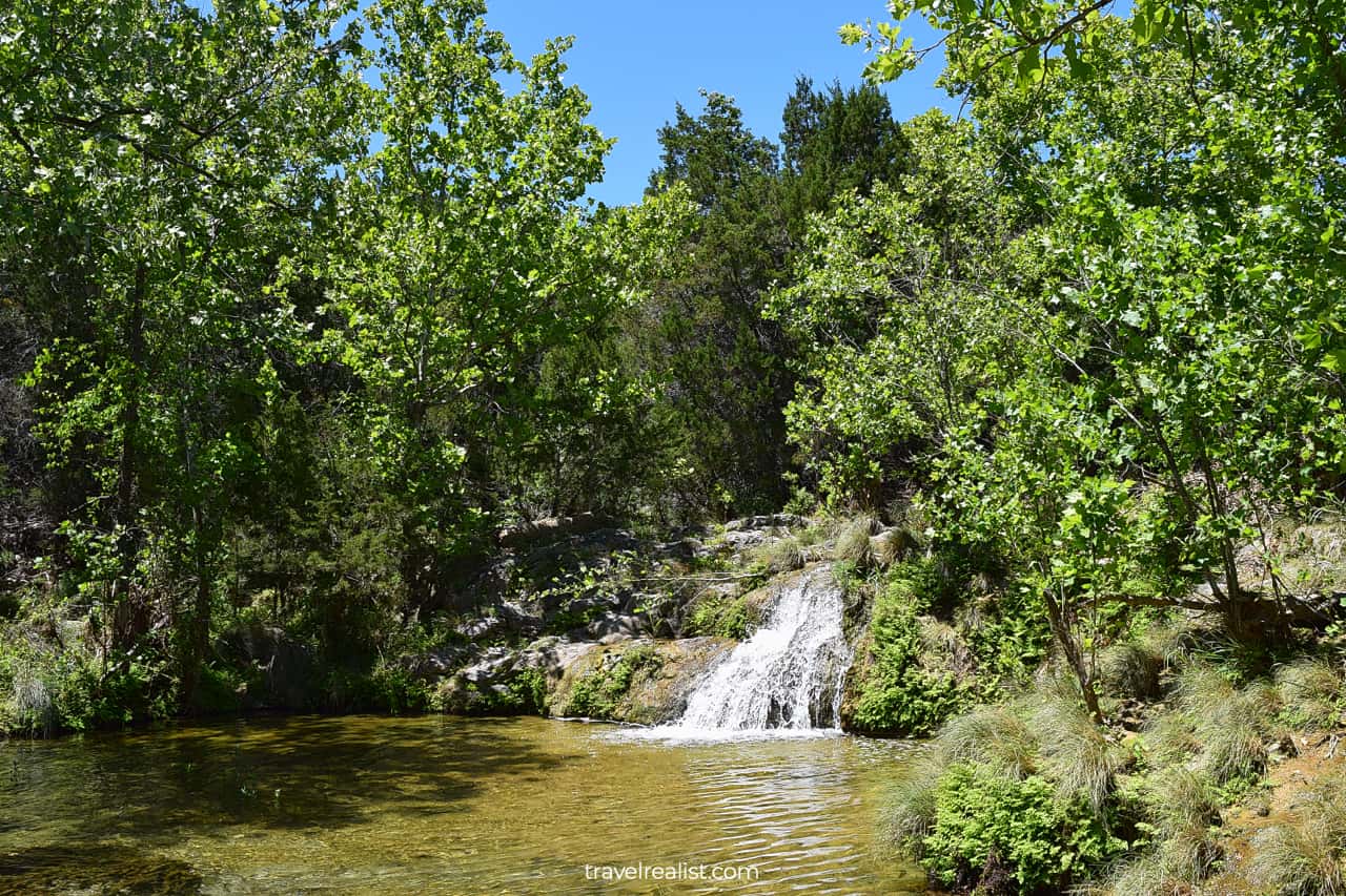
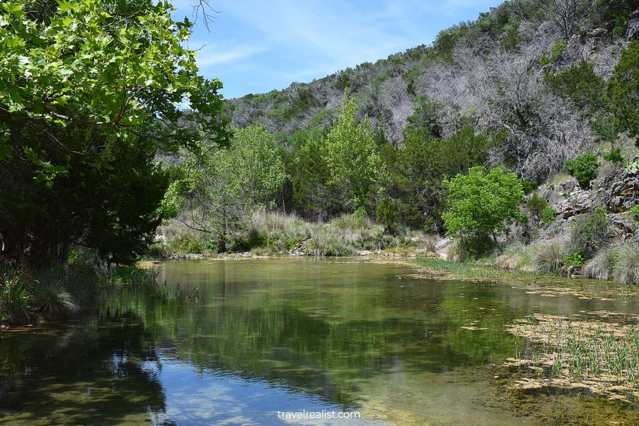
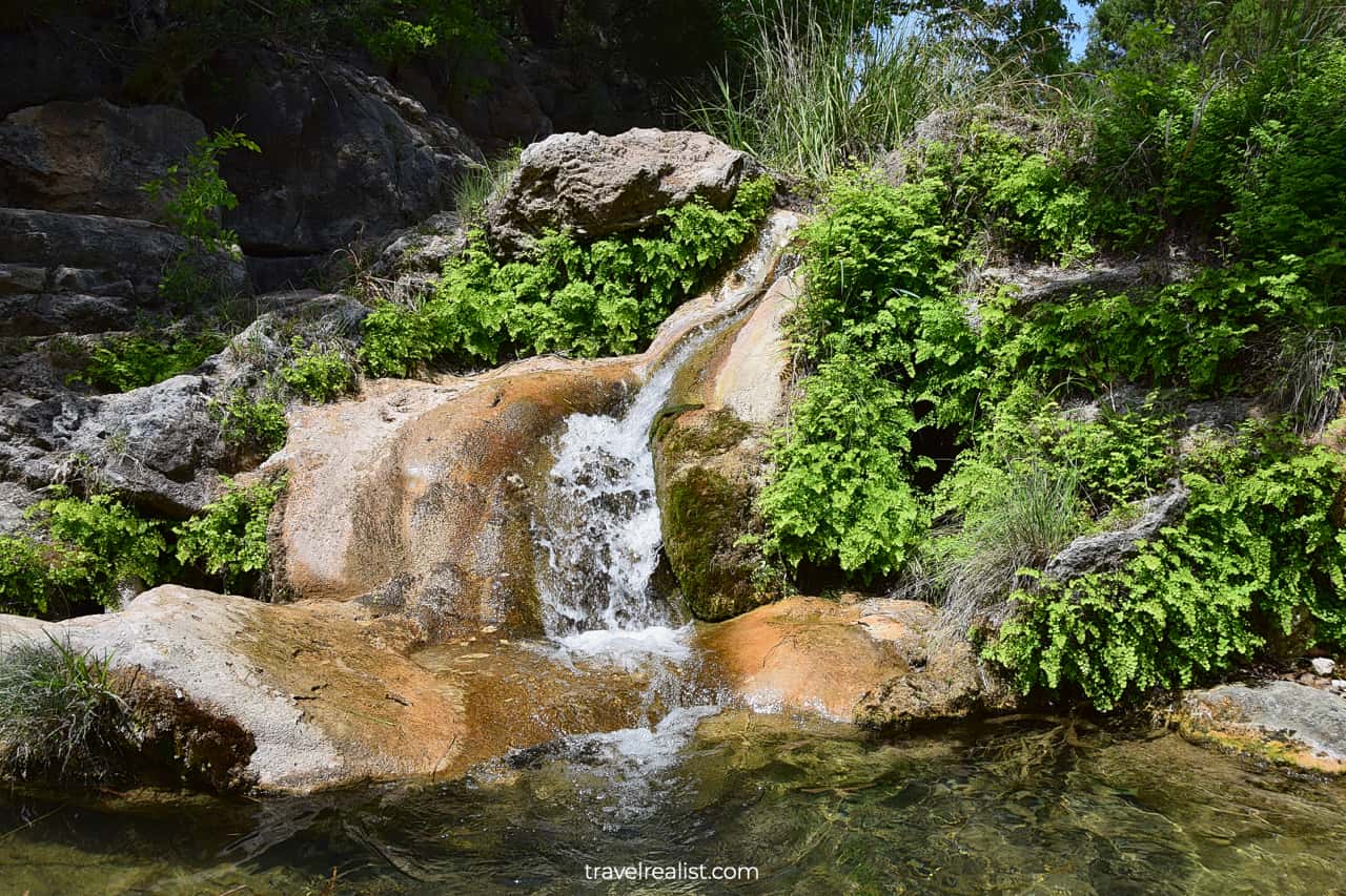
This trailhead is in the southernmost corner of the park. But you should travel all this distance. It is home to two most scenic hikes in Colorado Bend State Park: Spicewood Springs and Spicewood Canyon.
The Spicewood Springs Trail is a path along the same name spring. It starts with an unpaved country road. The trail then reveals a few pools and waterfalls. Some of them are deep enough to take a dive.
There are also countless water crossings on the Springwood Springs Trail. Get ready to jump on rocks and wear waterproof hiking boots to keep your feet dry.
10. Spicewood Canyon Trail
- Distance: 3 miles (4.8 km)
- Elevation Gain: 290 ft (88 m)
- Type: out-and-back
- Difficulty: moderate
- Trailhead: Spicewood Springs
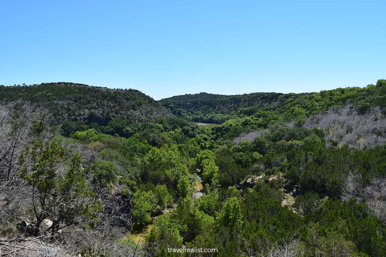
The Spicewood Springs Trail merges with the Spicewood Canyon Trail uphill. This is another amazing hike in Colorado Bend State Park. It follows the spring a few hundred feet (meters) above the creek bed.
As a result, it is a great place to get beautiful views of the surroundings. A scenic viewpoint reveals Spicewood Springs below and the Colorado River in the distance.
This trail has a few uphill and downhill sections. It takes you deeper into the woods before coming back to the spring again. Together, the Spicewood Canyon and Spicewood Springs Trail make a great loop.
You could explore both trails on a day trip to Colorado Bend. It is the second most popular hiking spot in the park after Gorman Falls. But the Spicewood Canyon Trail also connects to the Lemon Ridge Pass.
11. Lemon Ridge Pass
- Distance: 5 miles (8 km)
- Elevation Gain: 219 ft (67 m)
- Type: out-and-back
- Difficulty: moderate
- Trailhead: Spicewood Canyon, Cedar Chopper, or Windmill
The Lemon Ridge Pass is the single longest trail in the Colorado Bend State Park. It goes from the River Trail to the Lively Loop. The trail has connections to the Cedar Chopper and Spicewood Canyon Trails.
This connectivity makes the Lemon Ridge Pass an essential route for completing the full loop of Colorado Bend. If you have a full day or a weekend in the park, you could cover all trails on foot.
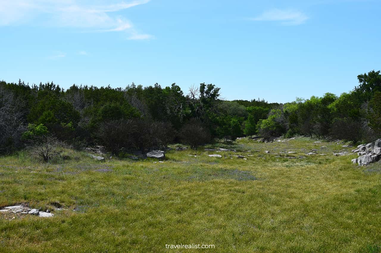
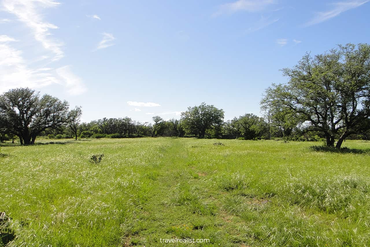
The Lemon Ridge Pass follows the park boundary after crossing Colorado Park Road. There are two lakes and a few wildflower meadows to see in the spring. Otherwise, it is not the most scenic path.
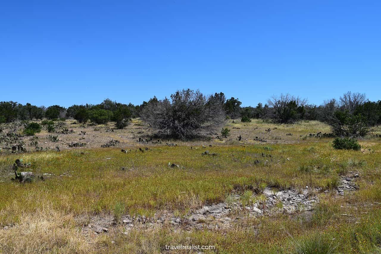
12. Lively Loop
- Distance: 4.8 miles (8 km)
- Elevation Gain: 318 ft (97 m)
- Type: loop
- Difficulty: easy
- Trailhead: Windmill
The Lively Loop is the second longest hiking trail in Colorado Bend State Park. This path makes a loop around the Windmill Backcountry Camping Area.
The name of this hiking trail could be a bit misleading. This trail is far from being lively during summer and winter. The lack of shade makes it dangerous to hike this loop in the summer.
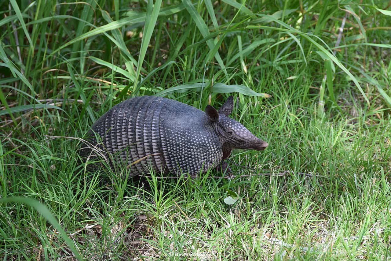
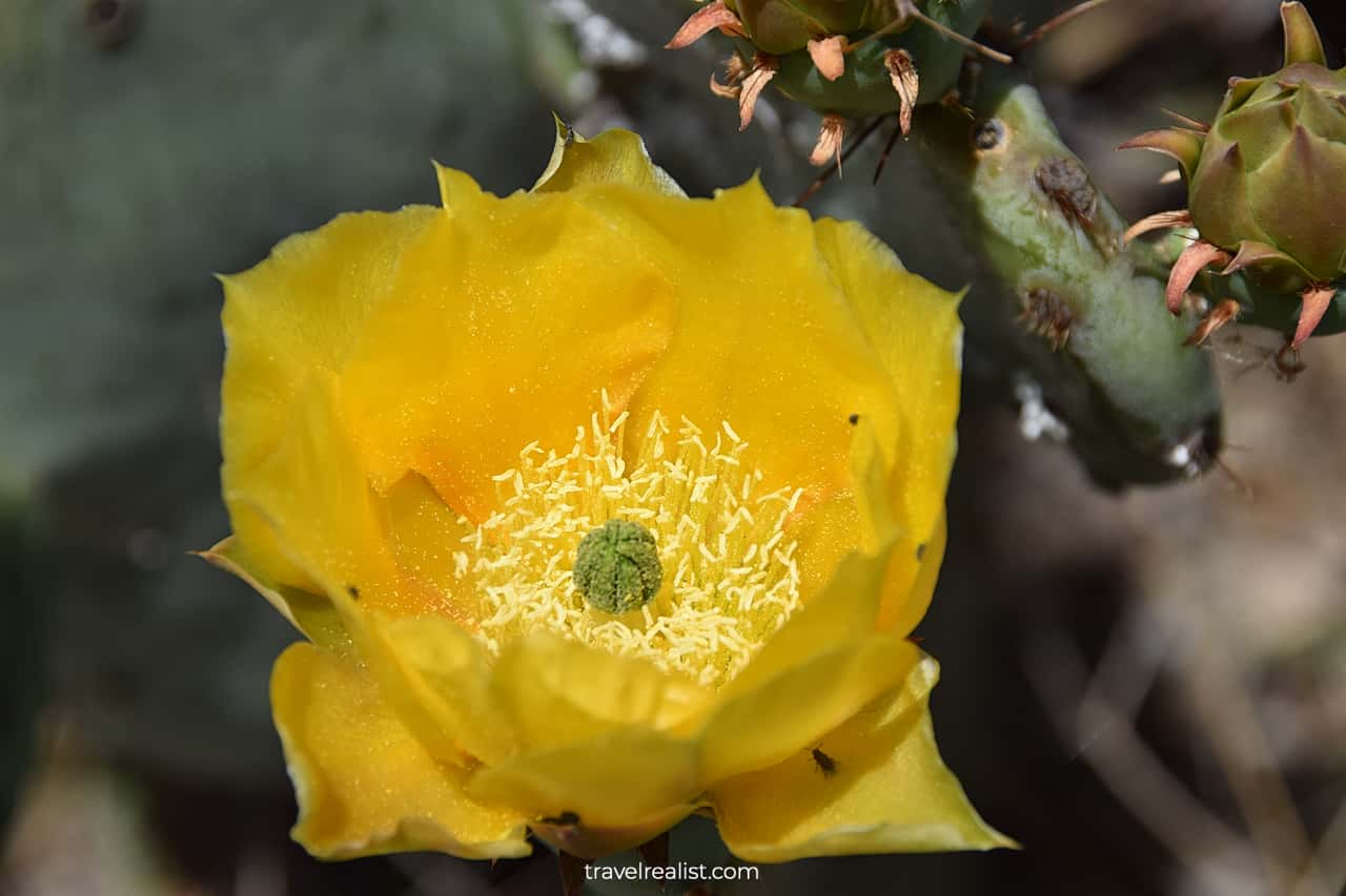
The views are underwhelming during the colder seasons. But you could enjoy blooming wildflowers and wildlife up close on this trail in the spring and fall. Look out for red cardinals, armadillos, and snakes.
13. Windmill Trail
- Distance: 1.6 miles (2.6 km)
- Elevation Gain: 219 ft (67 m)
- Type: out-and-back
- Difficulty: moderate
- Trailhead: Windmill
The Windmill Trail cuts the Lively Loop in two halves. The first intersection is near the trailhead on Colorado Park Road. The second one is past the Backcountry Camping Area.
This trail is far from the prettiest hike in Colorado Bend. You will be hiking through a prairie during the majority of the path.
Occasional oak trees and cedar groves will liven up the view a bit. Still, a windpump remains the main landmark to see on the trail.
14. Dry Creek Junction
- Distance: 0.3 miles (0.5 km)
- Elevation Gain: 36 ft (11 m)
- Type: out-and-back
- Difficulty: moderate
- Trailhead: Windmill
The Dry Creek Junction is one of the shortest hiking trails in Colorado Bend. This connecting trail is not a destination on its own.
Yet, it could save you quite a bit of time. This trail allows you to get from the Lemon Ridge Pass to the Windmill Trail. You only need to hike a short section of the Lively Loop.
This shortcut matters to those who camp at the Windmill Backcountry Camping Area. Hikers looking to complete the full loop of the park could also find this path worthwhile.
15. Gorman-Windmill Connection
- Distance: 0.6 miles (1 km)
- Elevation Gain: 33 ft (10 m)
- Type: out-and-back
- Difficulty: easy
- Trailhead: Gorman Falls or Windmill
Most Colorado Bend Hiking Trails Guides do not cover the Gorman-Windmill Connection. It might not feel like this short trail even deserves a mention.
But you will find it very useful if you are trying to complete the full loop of Colorado Bend. This short but mighty path helps you stay away from Colorado Park Road.
You might be surprised to learn how many people speed on this road. Hiking or riding gets quite uncomfortable with cars flying by.
Continue with this Colorado Bend Hiking Trails Guide. You will learn more about ways to get to the sights, entrance requirements, and places to stay.
Getting to Colorado Bend
Colorado Bend is a state park in Central Texas. The park is in the southeastern part of San Saba County. It is about equally far from the towns of San Saba, Cherokee, and Lampasas.
When you enter Colorado Bend State Park on Google Maps, you get a pin at the park entrance. The park headquarters are exactly 6 miles (10 km) east from that entrance.
The whole road is paved. But driving this distance under a speed limit of 30 mph (48 kmh) could easily take 15 to 20 minutes. Do not speed since hikers, bikers, and wildlife cross the road frequently.
There are a handful of parking lots in Colorado Bend. Gorman Falls trailhead is the closest to the park entrance. It gets quite crowded on the weekends. The same is true for Spicewood Springs trailhead.
Other parking lots will usually have open spots. But you might have to hike a lot longer to reach the main sights in Colorado Bend. Pick a trailhead and explore nearby trails before driving to the next parking lot.
Austin is the closest major city to Colorado Bend. A trip to this park from the Capital of Texas will take slightly less than 2 hours. A drive from Waco is about 10 minutes longer. San Antonio is 2.5 hours south.
As a result, Austin and San Antonio are the best airports to fly to for out-of-state visitors. There are a handful of direct flights to both airports. But Austin tends to have slightly more options.
You need a car to explore Colorado Bend State Park. You will be driving in a fairly remote part of the state. Fill up in Lampasas or Fredericksburg.
Where to Stay near Colorado Bend
There are very few places to stay around Colorado Bend State Park. In fact, camping might be your best bet if you would like to hike all trails in the park.
At least a 30-minute drive is necessary to reach any hotel from Colorado Bend. Lampasas is the closest town with a few hotels. Check out Quality Inn & Suites and Best Western Plus Lampasas Inn & Suites.
You need to drive even further to have more choices. Killeen, Gatesville, and Leander are all around an hour away from the park. Staying in these towns could make sense depending on your next destinations.
Hampton Inn Harker Heights and Best Western Harker Heights Killeen are on the way to Interstate Highway I-35. Comfort Inn & Suites Gatesville near Fort Cavazos is about halfway to Meridian State Park.
Holiday Inn Express & Suites Leander, an IHG Hotel works best for visiting Balcones Canyonlands, Longhorn Cavern, and Inks Lake.
If you make it as far as Leander, you could consider places to stay in the Greater Austin area. Hampton Inn & Suites Cedar Park North Austin, Tx and Hyatt Place Austin Cedar Park are nice hotels.
So are Homewood Suites By Hilton Austin/Cedar Park-Lakeline, Tx and SpringHill Suites by Marriott Austin Northwest Research Blvd. There are plenty of other places to stay in Austin.
No matter what hotel or vacation rental you choose, visit McKinney Falls. This state park is within the city limits next to the airport. It could be a great stop before your flight or drive.
Entrance Requirements & Passes
Colorado Bend State Park is open from 6 a.m. to 10 p.m daily. You could hike the park trails from sunrise to sunset. Only visitors with camping reservations could remain in the park past 10 p.m.
The park charges entrance fees. Anyone 13 and up needs to pay $5 per person. A Texas State Parks Pass grants free admission to a pass holder and up to 14 adult guests. Kids under 12 visit free.
Colorado Bend is a popular destination year round. But the park usually reaches capacity on spring, summer, and fall weekends. A day pass reservation helps you secure a spot.
You are risking it if you visit the park without a pass. Arrive early in this case. You may enter the park if there is no one in the toll booth. In this case, use a self pay station next to the park entrance.
This way, you will skip a 12-mi (20-km) return trip to the headquarters. This way, you could start hiking the park trails almost 30 minutes sooner. There is also no risk of getting a ticket from a park ranger.
You are in luck if you would like to see Gorman Falls but hike less than 0.75 miles (1.2 km). Join a ranger-led guided tour of Gorman Falls on select Saturdays.
You should look into booking a caving tour if this is your cup of tea. An adventure tour takes 90 minutes and costs $25 per person (8+).
Rent a kayak that start from $10 per hour. You will even get a 10% discount as a Texas State Parks Pass holder. You have to return your rental by 4 p.m.
Takeaways: Colorado Bend Hiking Trails
Colorado Bend State Park is stunning during every seasons. It offers visitors a great variety of activities. You could go hiking, biking, rock climbing, caving, wading, kayaking, or birding in this park.
Hikers are certain to enjoy the park trails. Some of them are among the most challenging in Central Texas. You could even embark on a full hiking loop of Colorado Bend State Park.
Make sure to stop by Gorman Falls, a must-see natural wonder. And head to Spicewood Springs afterwards. This trail is a close contender for the most beautiful spot in Colorado Bend.
There are plenty of things to do if you prefer water sports. Bring your own gear or rent a kayak to enjoy paddling on the Colorado River.
At $5 per adult, Colorado Bend is a steal. There are very few parks that give you as much at a similar price point. Even a wild cave tour ($25 per person extra) is affordable in this park.
Take a look at this Colorado Bend Hiking Trails Video Guide. And visit the YouTube channel for the latest videos.
Frequently Asked Questions
Colorado Bend State Park is in San Saba County in Central Texas. The park is about 30 minutes from Lampasas, San Saba, and Cherokee. A drive from Austin or Waco takes about 2 hours. San Antonio is 2.5 hours from Colorado Bend.
There are 400 caves in Colorado Bend State Park. Gorman Cave is the most famous of them. It is near the River Trail intersection with the Dogleg Canyon Trail.
You should meet a tour guide at the Park Headquarters if you book a wild caving tour.
The nearest places to stay to Colorado Bend are in Lampasas. Best Western Plus Lampasas Inn & Suites and Quality Inn & Suites are 30 minutes east from the park.
There are 15 hiking trails in Colorado Bend. They cover a total distance of 35 miles. Here is a ranking of the park trails:
1. Spicewood Springs Trail (moderate)
2. Spicewood Canyon Trail (moderate)
3. Gorman Falls Trail (moderate)
4. Tie Slide Trail (moderate)
5. Gorman Spring Trail (easy)
6. River Trail (easy)
7. Tinaja Trail (challenging)
8. Dogleg Canyon Trail (challenging)
9. Cedar Chopper Loop (moderate)
10. Lemon Ridge Pass (moderate)
11. Lively Loop (easy)
12. Old Gorman Road Trail (moderate)
13. Windmill Trail (moderate)
14. Dry Creek Junction (easy)
15. Gorman-Windmill Connection (easy)
Colorado Bend offers visitors a lot of things to do:
– Go hiking or biking on multi-use trails
– Admire Gorman Falls and Spicewood Springs
– See Tinaja rock bowl
– Rock climb at Dogleg Canyon
– Book a wild caving tour
– Kayak or fish in the Colorado River
Safe realist travels!