Delaware Water Gap Waterfall Hikes in The Mountains
This realistic Delaware Water Gap Waterfall Hikes Guide helps you plan an adventure in this national recreation area.
Delaware Water Gap is a park on both sides of the Delaware River in New Jersey and Pennsylvania. This area has rugged mountains, powerful waterfalls, abundant wildlife, and fantastic fall colors.
This post includes affiliate links that will earn us commission if you make a purchase via these links.
Sights & Places of Interest
Delaware Water Gap is a picturesque section of the Delaware River. This national recreation area beats a handful of national monuments and state parks in beauty.
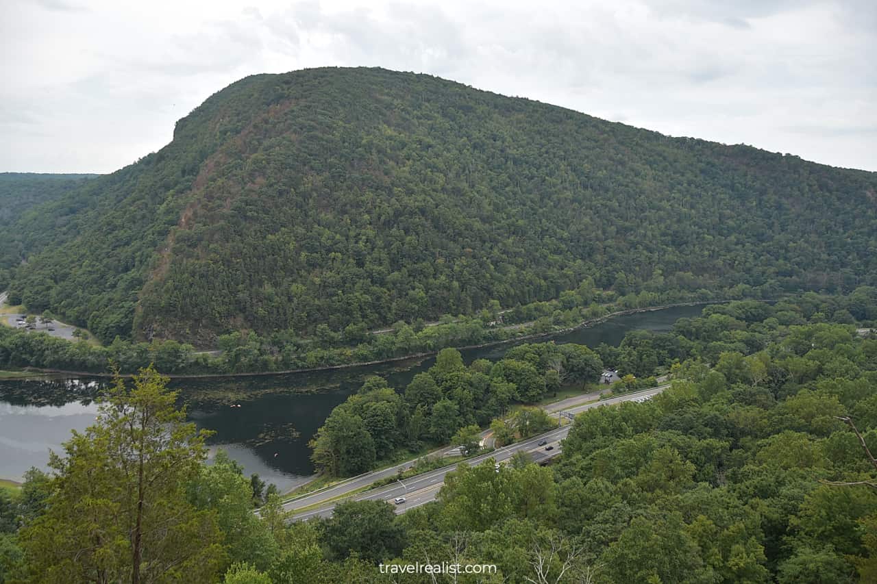
Most visitors come to Delaware Water Gap to admire scenic landscapes. The park has a few viewpoints in the Gap area. You could see Mt. Tammany, Point of Gap, and Arrow Island from these viewpoints.
But you would need to hike to enjoy most of Delaware Water Gap. There are over 150 miles (241 km) of trails in the park. Some 28 km (45 km) of the Appalachian National Scenic Trail go through the park.
Not all Delaware Water Gap trails are equally beautiful. But a combination of rugged mountains and powerful waterfalls should be enough to have you start packing your hiking boots.
1. The Gap
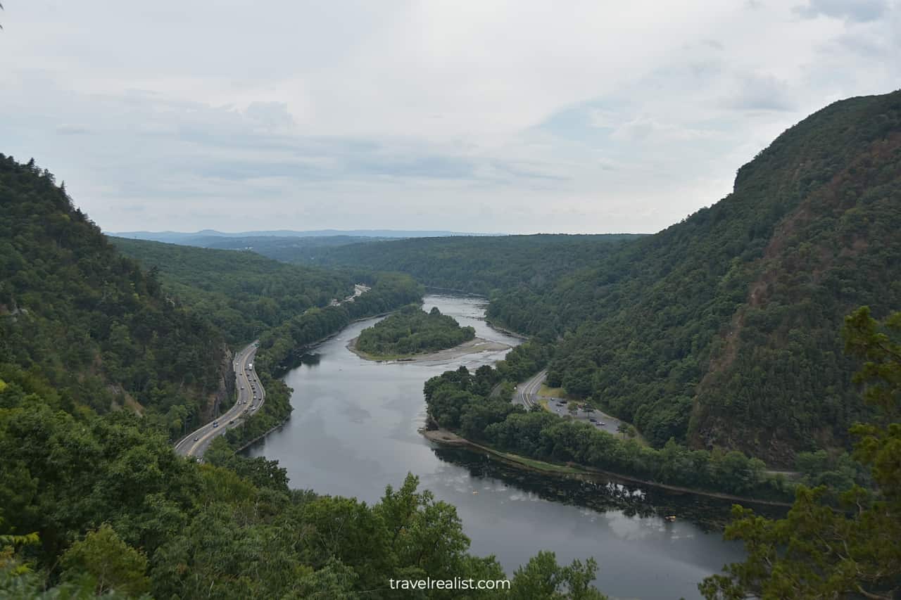
The Gap is a great place to start your visit to Delaware Water Gap. This area is the easiest to reach part of the park. It also gives you a good idea about the geology of the Delaware Water Gap.
The Gap is the narrowest part of the Delaware River between the Kittatinny Mountain Ridge. The Delaware River managed to create this gap thousands of years ago.
The Kittatinny Point Visitor Center and Mt. Tammany Trailhead Parking are just off Interstate Highway I-80. You can just pull over at a parking lot and start enjoying the park.
You might want to visit the park early in the morning on the summer weekends. This way, you could beat the crowd and get a trailhead parking spot.
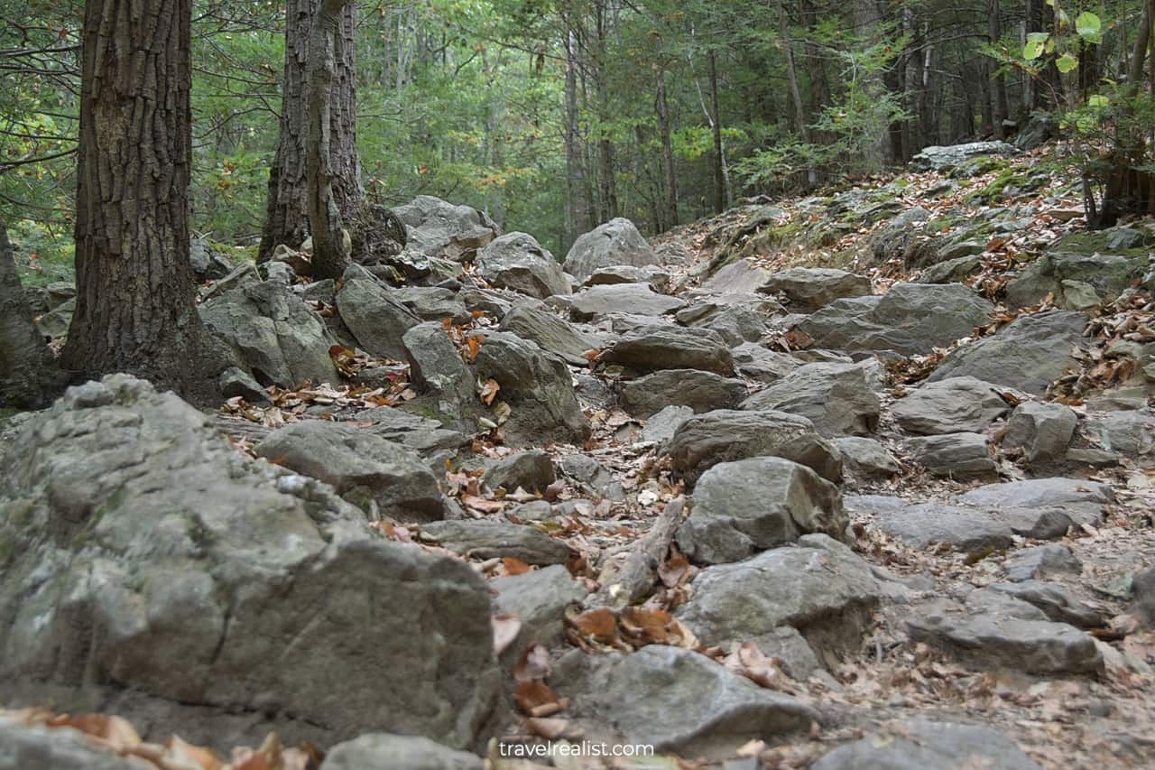
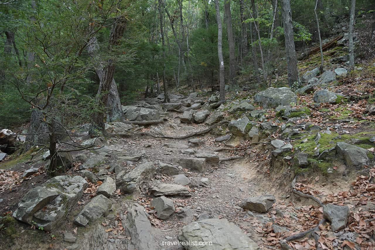
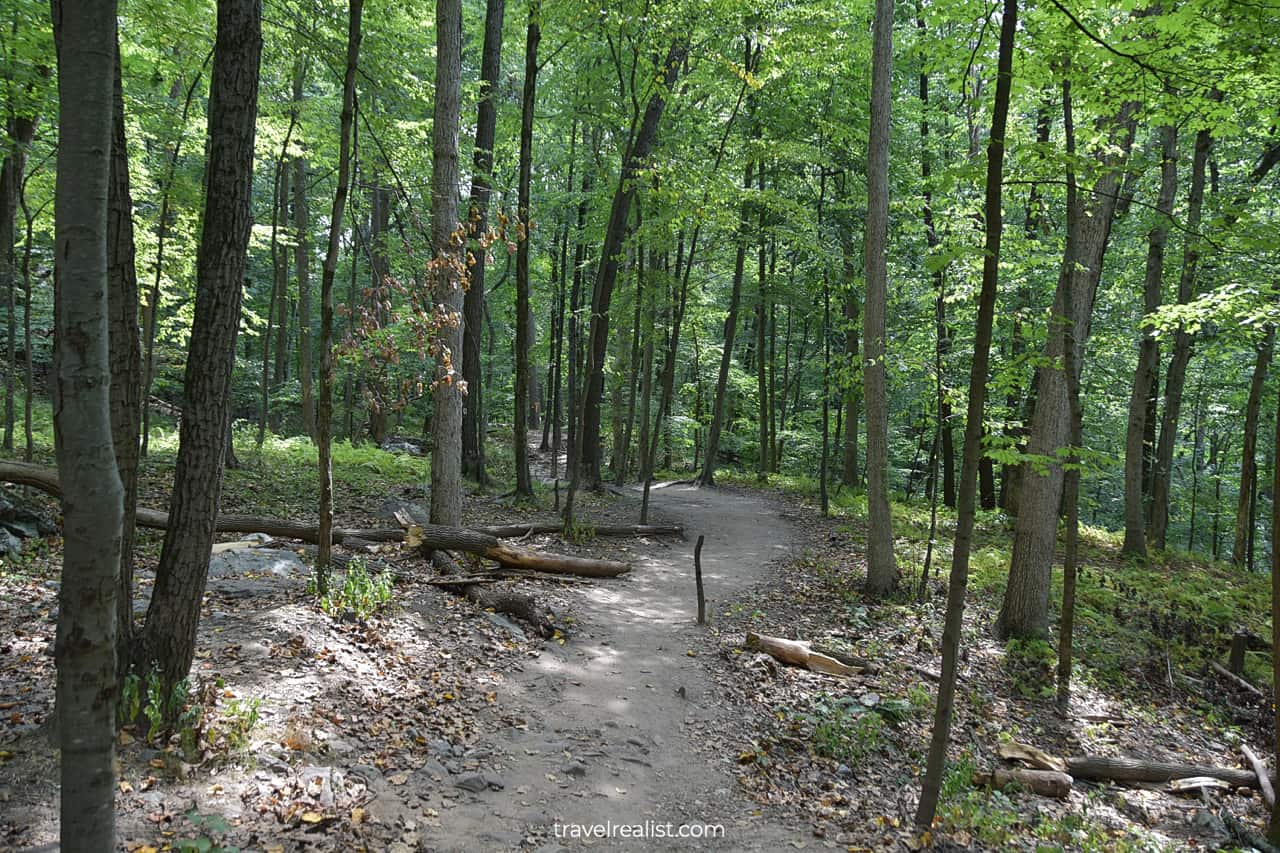
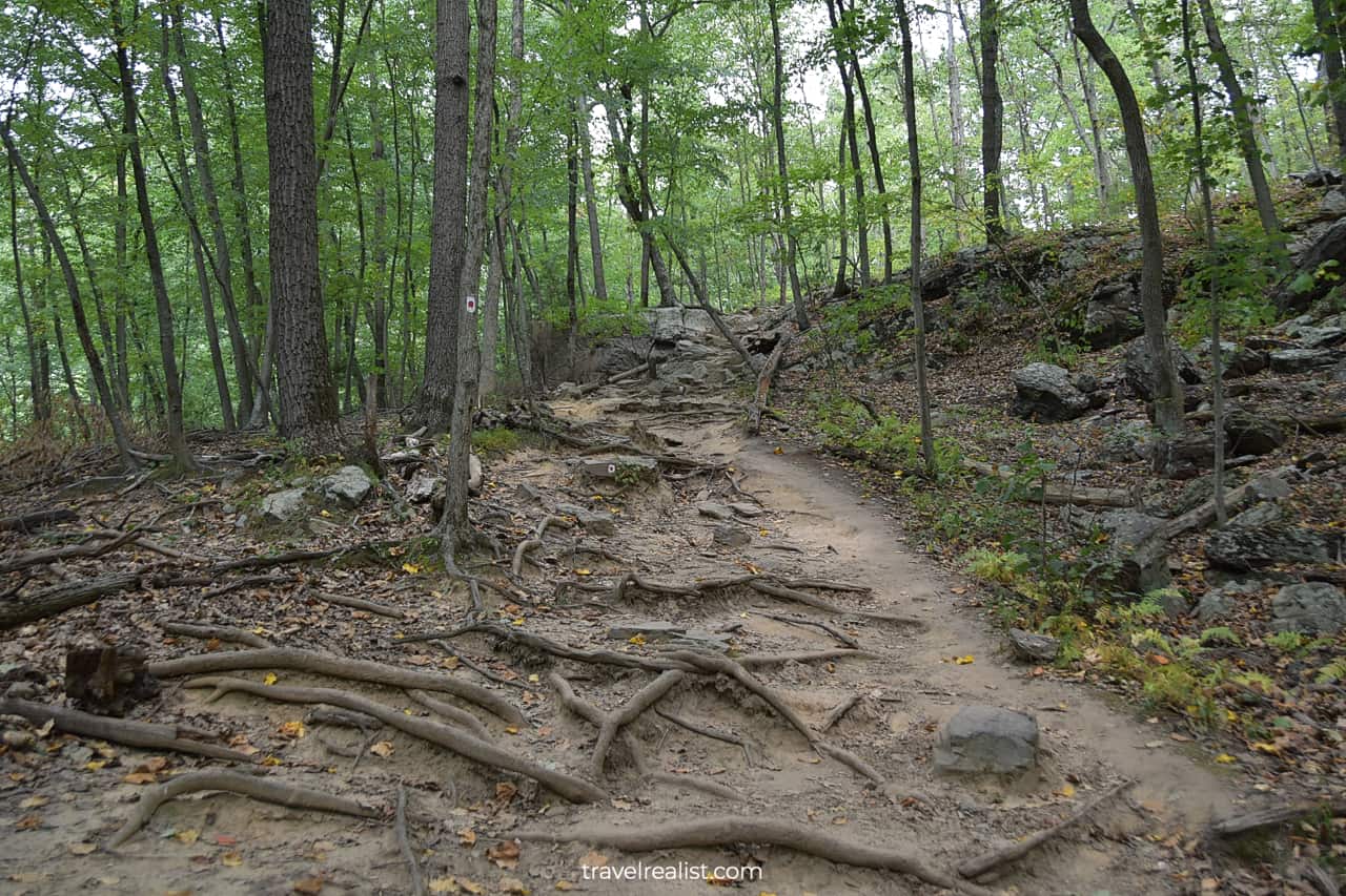
The Mt. Tammany or Red Dot Trail is a 2.4-mi (3.9-km) out-and-back path. The trail gains 1,200 ft (366 m) in elevation if you hike to the top of the mountain.
You could make it a loop if you take the Blue Blaze Trail back. This would bring your total hiking distance to 3.6 miles (5.8 km) with 1,243 ft (379 m) in elevation gain.
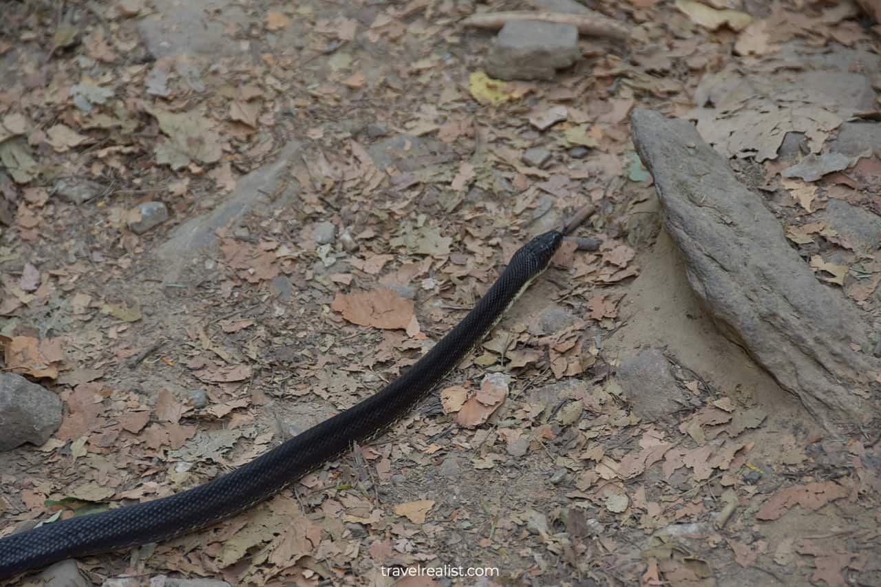
Be careful as you hike this trail. Boulders, rocks, and foliage hide snakes, like this black racer. While this snake is nonvenomous, it is still better to leave it alone.
2. Arrow Island
You will arrive at the First View about 0.4 miles (0.6 km) into the trail. You would have gained 390 ft (119 m) in elevation by the time you reach this viewpoint. The First View is the best place to see the Gap.
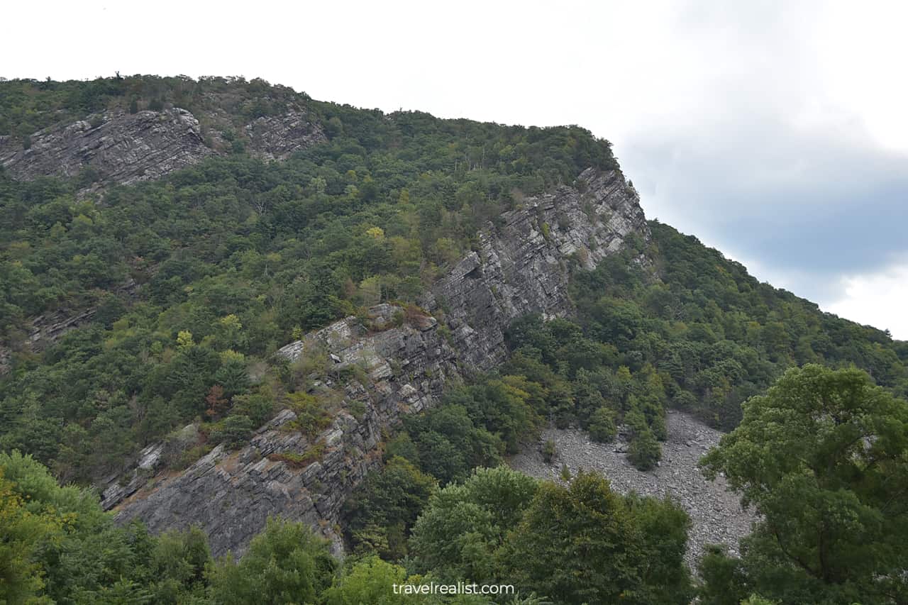
Mt. Minsi and Mt. Tammany on both sides of the Delaware river have steep, nearly vertical drops. This view gave a name to the entire area, not unlike the Scalp in Ireland.
If you look east, you will see a large island downstream. This is Arrow Island. There are no surprises about its name either. The island got its name thanks to its arrowhead shape.
3. Mt. Minsi
As you are catching your breath, take a look across the Delaware River. Mt. Minsi will be on full display. This mountain has an elevation of 1,463 ft (446 m).
The Appalachian Trail goes on top of this mountain. The day and thru hikers first need to cross Delaware River via a pedestrian bridge. The trail quickly gains elevation from the river level.
This part of Delaware River Gap looks a lot like the parks further south. Shenandoah, Blue Ridge Parkway, Great Smoky Mountains, and New River Gorge are similar to Delaware River Gap.
All of them but the Blue Ridge Parkway are national parks. Is it a sign that Delaware River Gap could become one in the future?
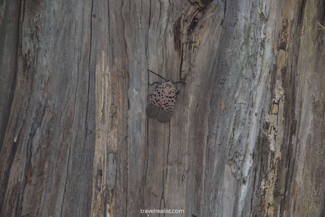
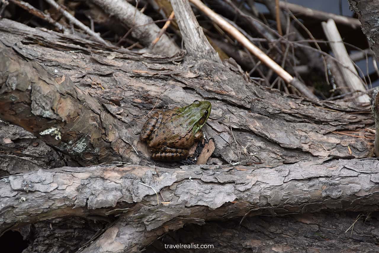
The First View is not just a great viewpoint. It is also a nice wildlife watching spot. This might come as a surprise given how crowded the trailhead parking gets on the weekends.
Still, you should be on a lookout for wildlife. Snakes are not the only animals to see on the Mt. Tammany Trail. Birds and insects are other common species.
You are quite likely to see spotted lanternflies. These insects do not attack people. But they are invasive species that kill crops and hardwood trees.
A few states have taken action to prevent spotted lanternflies from spreading. You are expected to kill any lanternfly you see according to the Pennsylvania Department of Agriculture.
4. Mt. Tammany
Mt. Tammany has an elevation of 1,527 ft (465 m). There is a Gap viewpoint near the top of the mountain. You could get amazing views of the Delaware River and its valley in New Jersey and Pennsylvania.
But you not might feel like gaining another 800 ft (243 m) in elevation. In this case, drive to the Point of Gap Overlook. This viewpoint will give you distant views of Mt. Tammany without you needing to hike.
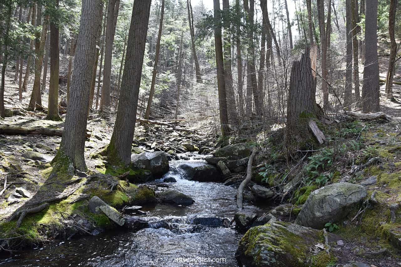
5. Dunnfield Creek
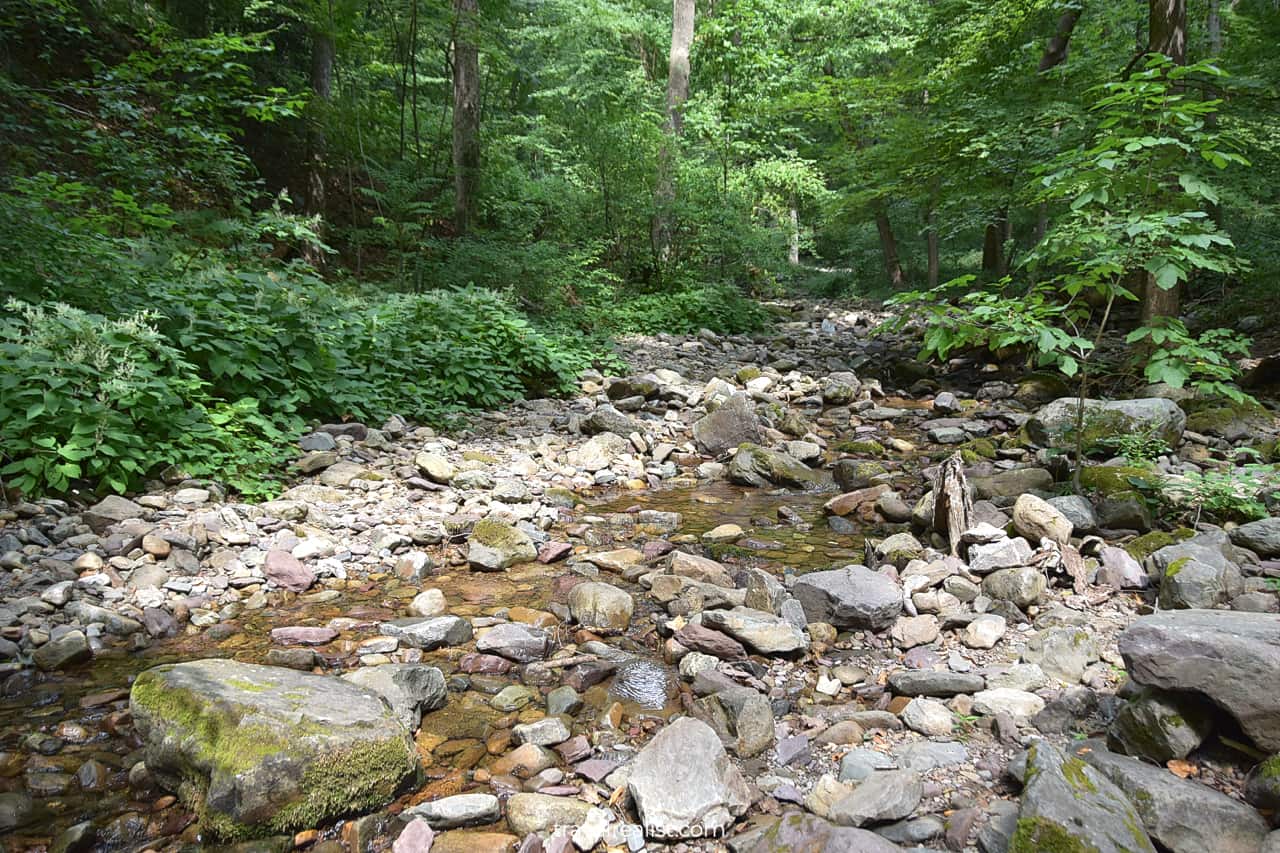
There is one last area at the Kittatinny Point for you to explore. Dunnfield Creak is a slow running rocky creak. It connects Upper Yards Creek Reservoir with the Delaware River.
There are no waterfalls on this creek. But you could still chose to hike the trail alongside it. A 3.5-mi (5.6-km) one-way path will bring you to Sunfish Pond. You could return via the Appalachian Trail.
Dunnfield Creek and Sunfish Pond might be better suited for your future trips to Delaware Water Gap. But you should still swing by its trailhead on your way back from Mt. Tammany or the First View.
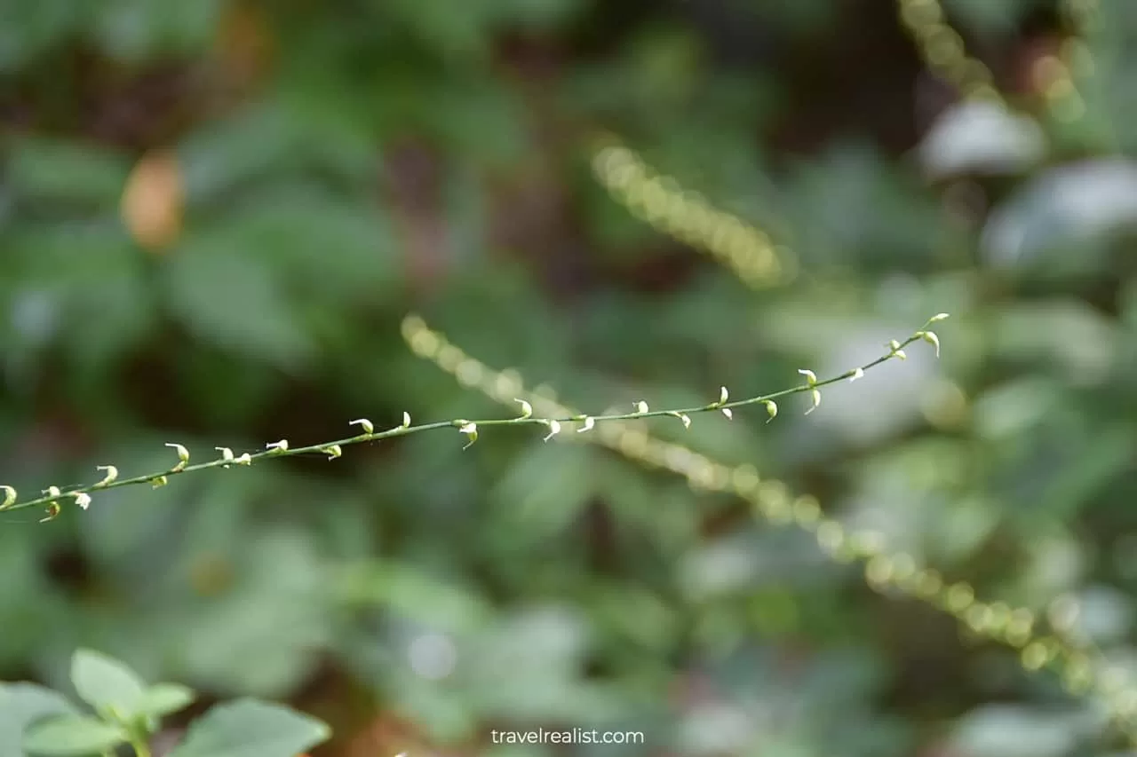
There are fields of Virginia Knotweed near the mouth of Dunnfield Creek. This plant is native to the region. You could study it without needing to go to Garfield Park or Lincoln Park Conservatories.
6. Dingmans Creek
Once you finish exploring the Gap area, you would need to make a decision. You could stay in New Jersey or cross the toll bridge to Pennsylvania.
If waterfall hikes are the main focus of your trip to Delaware Water Gap, you need to go to Pennsylvania. Dingmans Falls, Silverthread Falls, and Raymondskill Falls are all in “The Keystone State”.
It costs $1.25 per car to cross the Delaware Water Gap (I-80) Bridge with an E-Z pass. The same crossing with a cash payment carries a $3 price tag.
Get ready to drive on Highway US-209 for about 40 minutes. The last few miles to Dingmans Falls Visitor Center are on a narrow paved road.
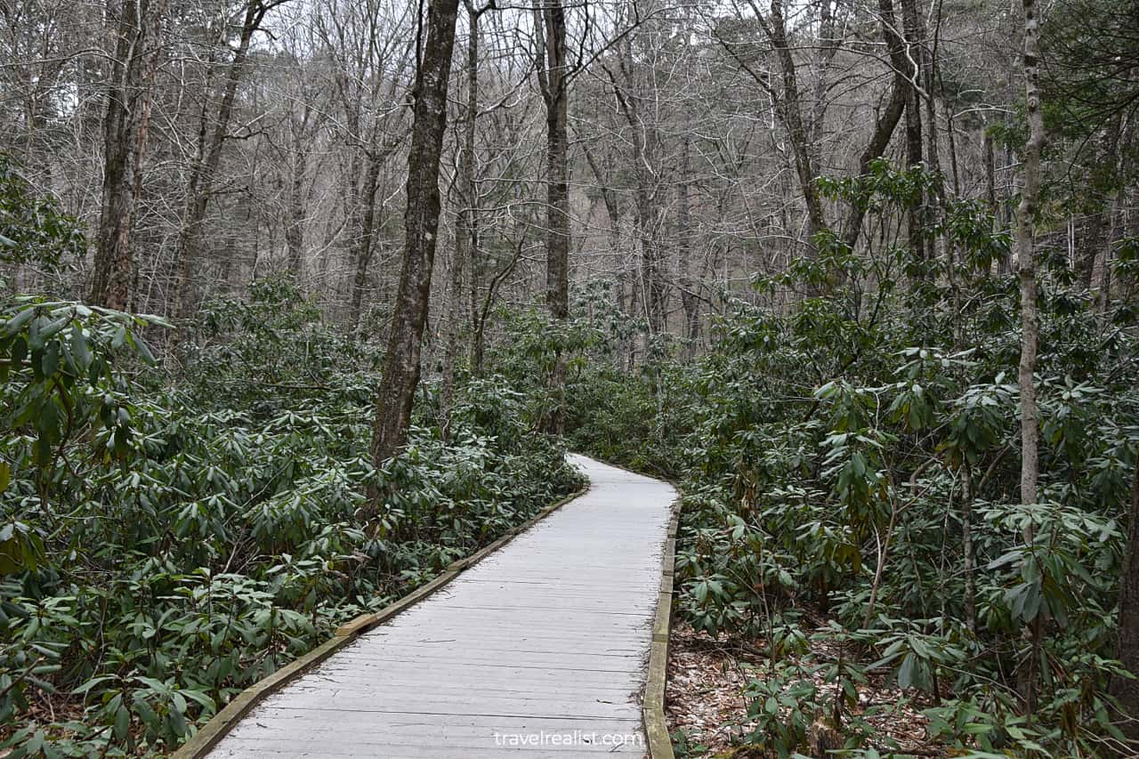
Once you arrive at the parking lot, you can take a 0.8-mi (1.2 km) out-and-back Dingmans Creek Trail. The trail goes on a well maintained wooden boardwalk over wetlands.
7. Silverthread Falls
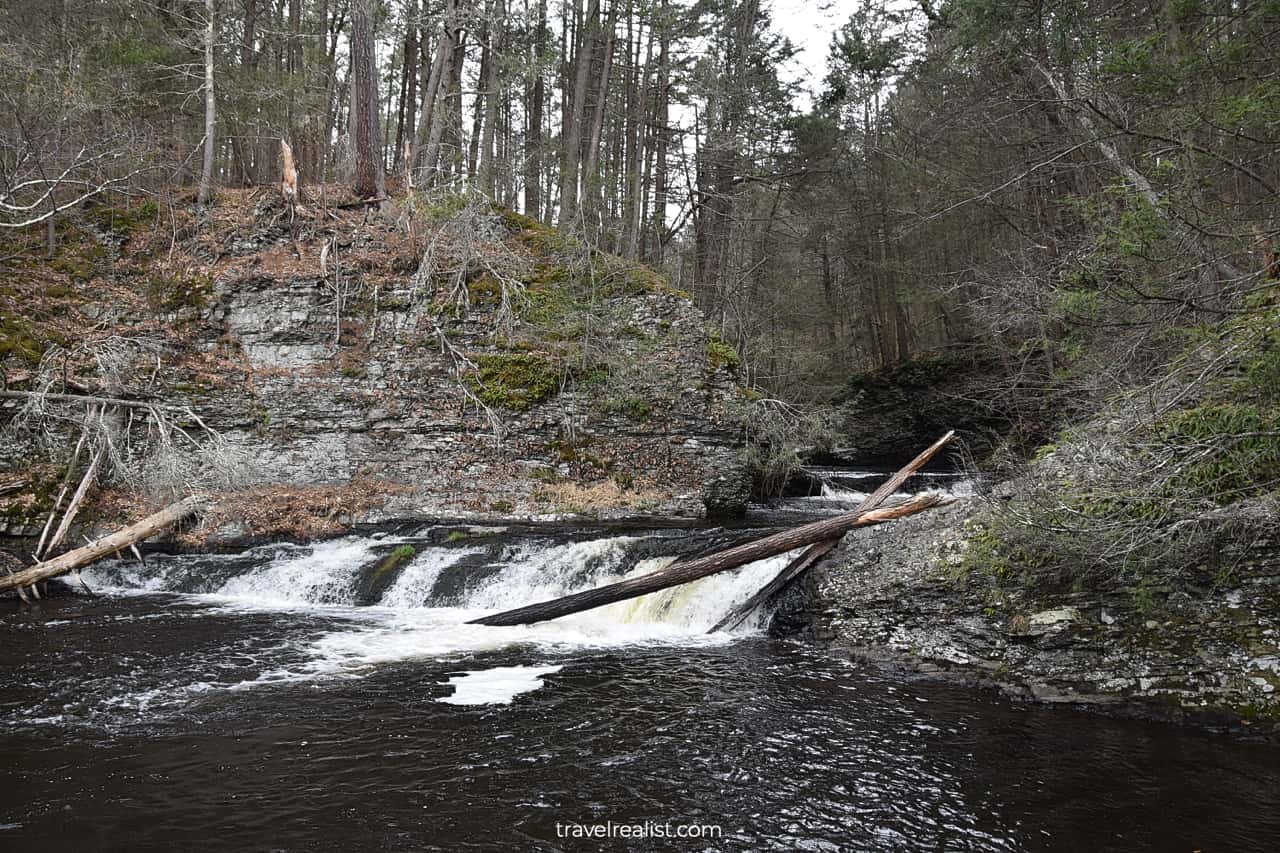
You would not have to wait long to see the first waterfall in Delaware Water Gap. Silverthread Falls are next to the trailhead.
These falls drop 80 ft (24 m) in a narrow ribbon with a few cascades. A narrow stream gave the falls their name. They do look like a silver thread.
Silverthread Falls have a number of fallen logs and branches. The stream is not powerful enough to move them. It will take years before they rot and fall apart. In the meantime, you will have to enjoy the falls as is.
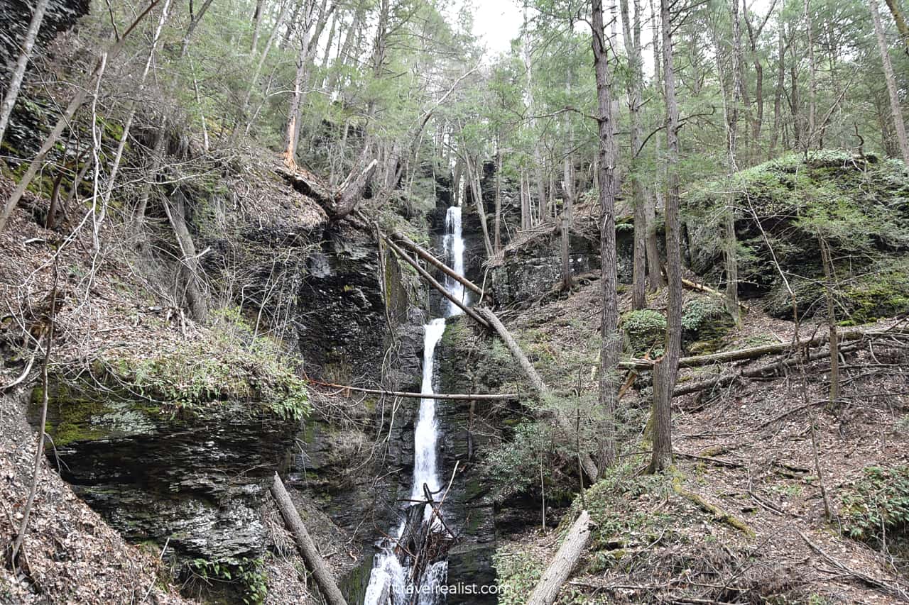
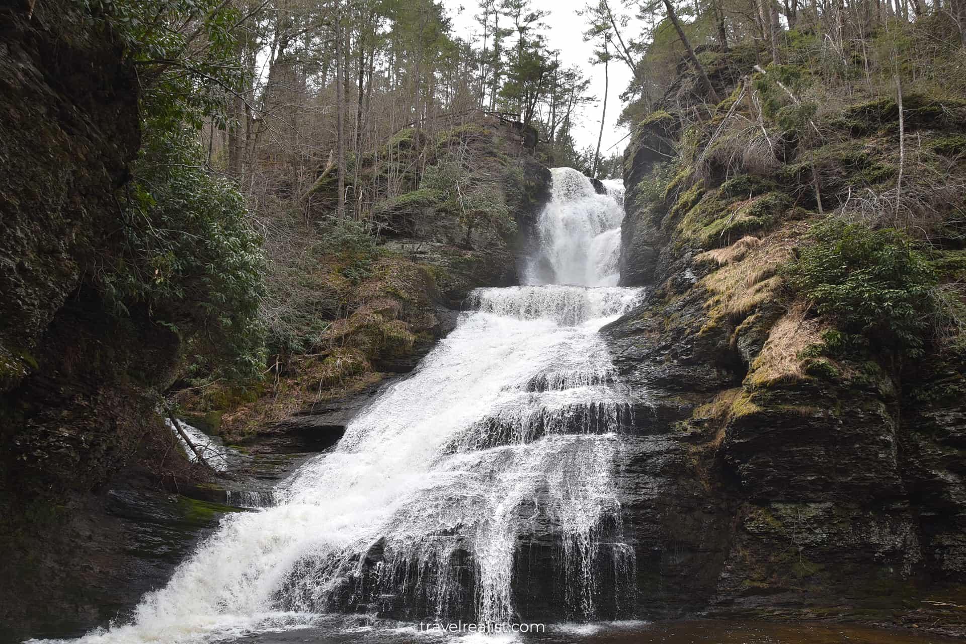
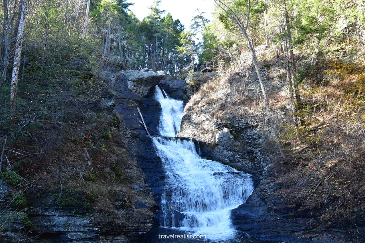
8. Dingmans Falls
Having seen Silverthread Falls so close to the trailhead, you should feel empower to continue the hike. The trail has just 55 ft (17 m) in elevation gain until the first Dingmans Falls viewpoint.
You will get a great view of this 130-ft (40-m) waterfall. The water of Dingmans Creek roars through a narrow canyon before dropping from a terrace.
Dingmans Falls are some of the most powerful falls in Delaware Water Gap. The views are well worth an out-and-back hike.
You could extend the hike by another 0.1 miles (0.2 km). There is a trail spur that brings you to an upper observation deck. This short hike adds another 107 ft (33 m) in elevation gain.

9. Upper Raymondskill Falls
Raymondskill Falls is the next waterfall hike in Delaware Water Gap. It is also in Pennsylvania. You would need to drive back to Highway US-209 and continue north for about 5 miles.
A narrow winding mountain road will bring you to a small parking lot. It could fit at most a dozen of cars. As a result, the park introduced a few restrictions from 10 a.m. to 4 p.m. on weekends and holidays.
You should park at the Milford Knob Trailhead and take a free shuttle if you visit during these hours. This requirement could add 30 minutes to an hour to your visit.
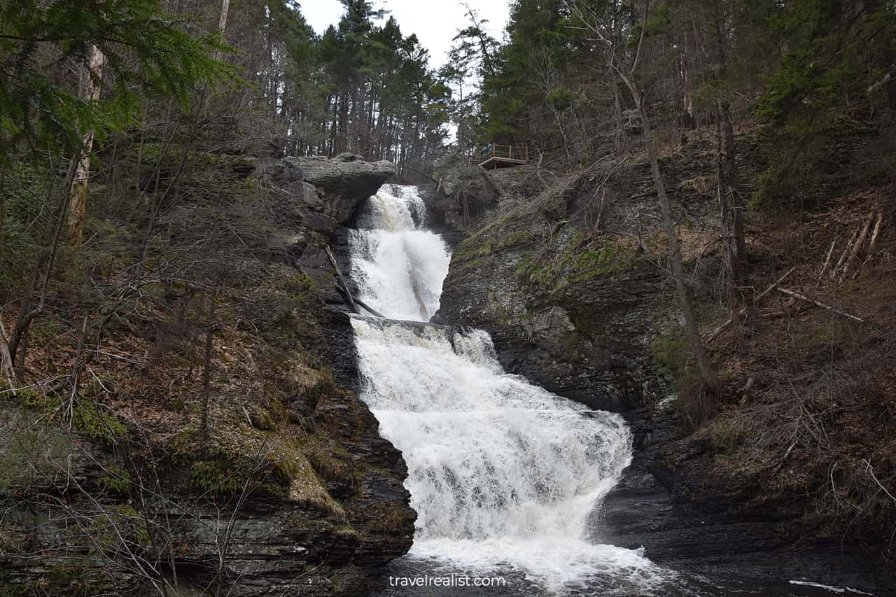
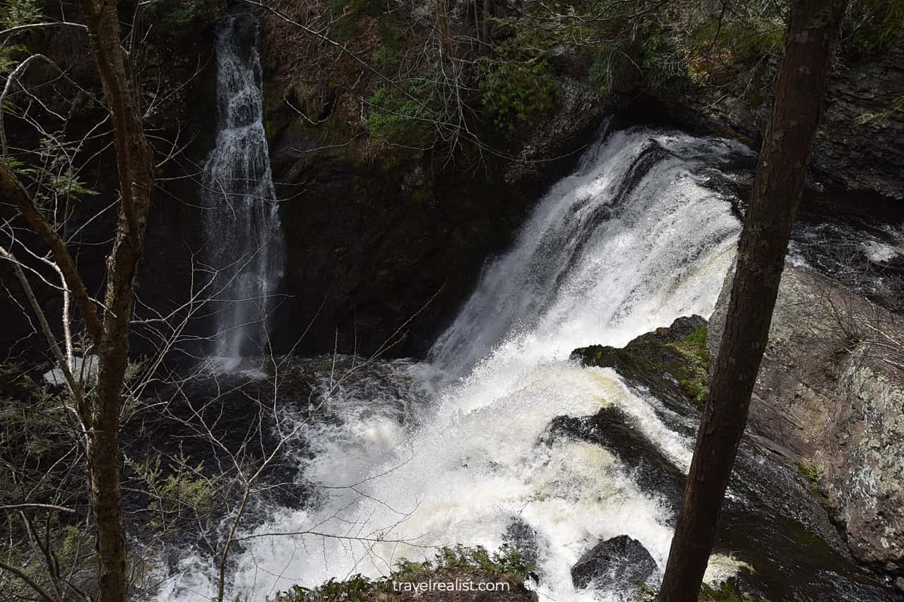
There is a good reason why Raymondskill Falls attract so many visitors. This 150-ft (46-m) waterfall is the tallest in Pennsylvania. This is a respectable height even in the land of waterfalls.
The waterfall has three cascades. The upper cascade is the smallest of the three. The middle section has the highest drop.
The Raymondskill Falls Trail is a 0.3-mi (0.5-km) loop path. It has 178 ft (54 m) in elevation gain. The trail connects the parking lot with two observation decks.
The upper observation deck is easier to reach. But it does not have the best views of the falls. Still, you could enjoy powerful Raymondskill Creek. It is also a good area for wildlife watching.
10. Lower Raymondskill Falls
You would want to go to the lower observation deck for the best views of Raymondskill Falls. You would need to hike downhill to reach the lower falls viewpoint.
In fact, most visitors only go to that observation deck. Therefore, it is hardly a surprise that it gets quite crowded. Wear sturdy shoes and take your time as you hike down.
You will see the middle cascade of Raymondskill Falls. This section looks a bit similar to Dingmans Falls a few miles south.
The flow of this waterfall depends on the season. A more powerful stream is present during snowmelt or after a heavy rainfall. The waterfall has a less impressive flow in the summer.
The lower observation deck gives you a sneak peak into the third cascade of Raymondskill Falls. You could stand right next to the powerful stream.
The Raymondskill Falls Trail has a 0.5-mi (0.8-km) out-and-back spur. It brings you to Raymondskill Creek about half a mile downstream from the falls.
It means that no viewpoint in the park gives you a full view of the tallest waterfall in Pennsylvania. This is quite unfortunate. But it has to do with the landscape in this part of Delaware Water Gap.
11. Walpack Ridge Trail
Buttermilk Falls are the last waterfall hike to explore in Delaware Water Gap. These falls are some of the most remote sights in the park. You would first need to return to New Jersey.
Take the Dingmans Ferry Toll Bridge or the Milford-Montague Toll Bridge. The former bridge costs $2 in cash. The latter bridge is cheaper ($1.25) if you have an E-Z Pass but cost more ($3) if pay in cash.
You need to drive on Old Mine Road and Walpack Flatbrook Roads to Walpack Center. You could choose to hike the Walpack Ridge Trail or Military Trail if you have enough time.
These trails do not lead to Buttermilk Falls. But they provide nice views of the pond and the historic buildings.
12. Buttermilk Falls
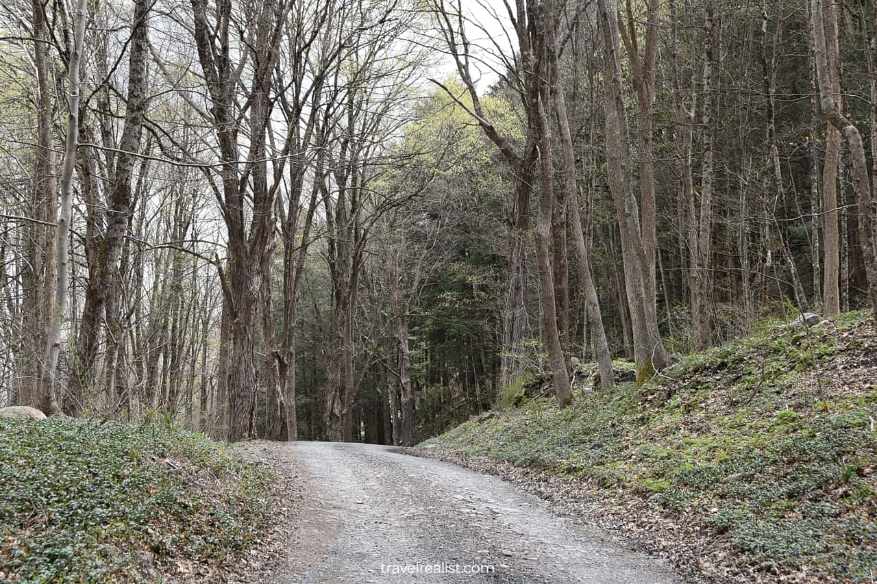
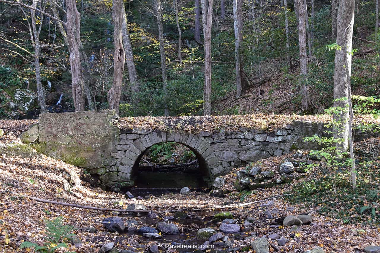
You would need to take a dirt road to the waterfall from Walpack Center. Brook Road has a few potholes. But it is mostly in a good condition.
Buttermilk Falls will be on the east side of the road. You should slow down as soon as you see a stone bridge. It is quite easy to miss the parking lot.
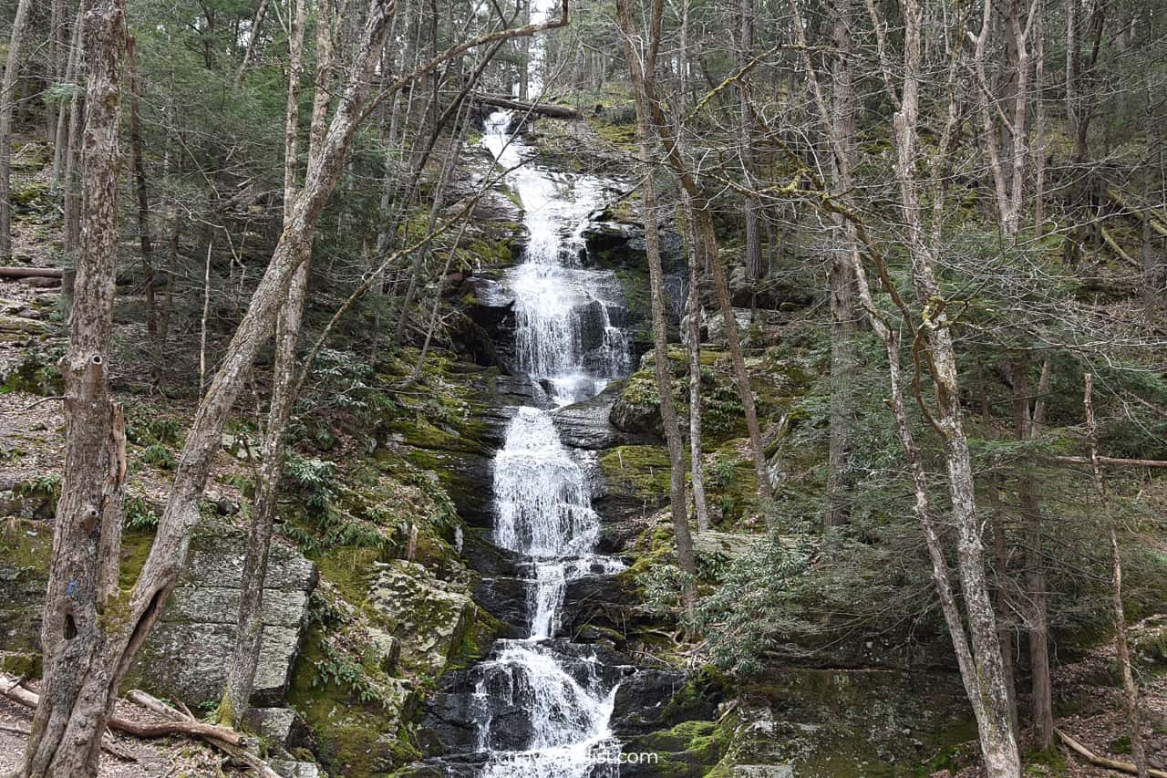
You will be able to see Buttermilk Falls right from the road. Park your car in the nearby gravel lot and enjoy the views. This 85-ft (26-m) waterfall is the tallest in New Jersey.
You could just admire the waterfall from the viewpoint. But there is also a trail that will bring you to another observation deck.
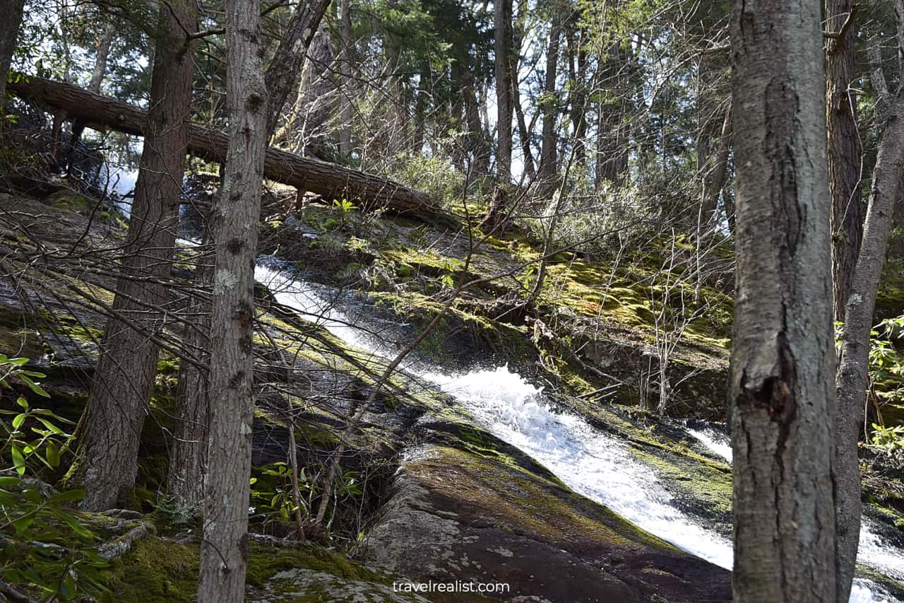
A 2.8-mi (4.5-km) out-and-back trail shows you the falls from a different angle. Get ready to climb up the mountain. Most of the trail’s 1,118 ft (340 m) in elevation take place during the initial ascend.
You will be hiking right next to the powerful stream. The views of the waterfall should give you strength to keep climbing.
The grueling ascend will be well worth it. The views from atop of the ridge are very picturesque. But, like with the Raymondskill Falls upper terrace, it will not be the falls that will grab your attention.
13. Appalachian Trail
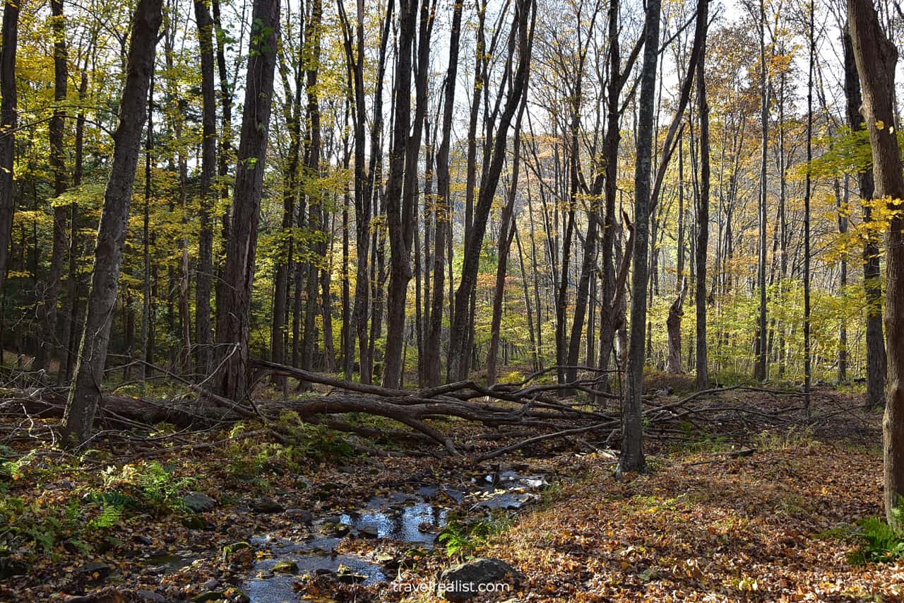
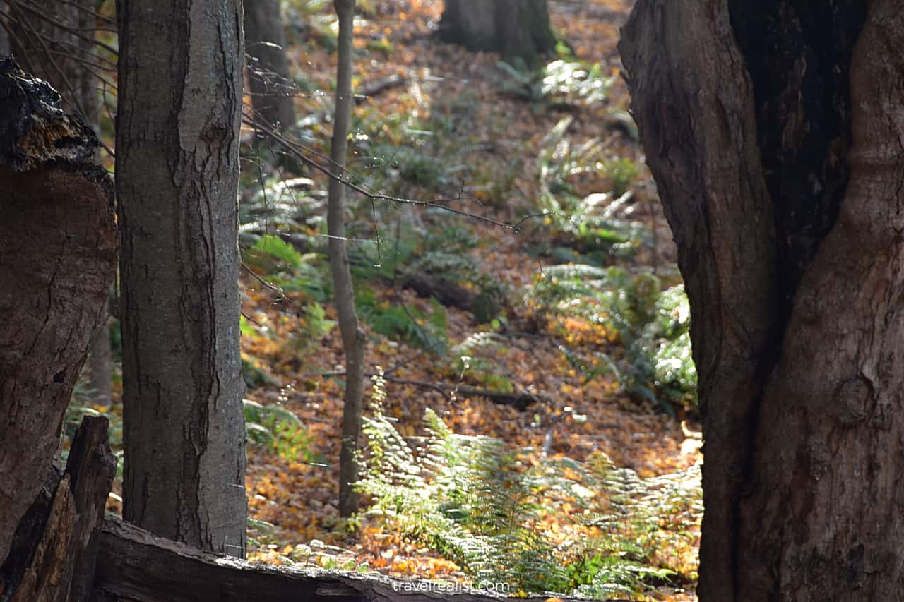
Instead, you could enjoy the views of the creek running through a forest. The area will be even more magnificent if the sun comes out.
It will be hard to believe that you are still on the East Coast. This forest looks just like Lassen Volcanic, Redwood, and Oregon Caves in the Pacific Northwest.
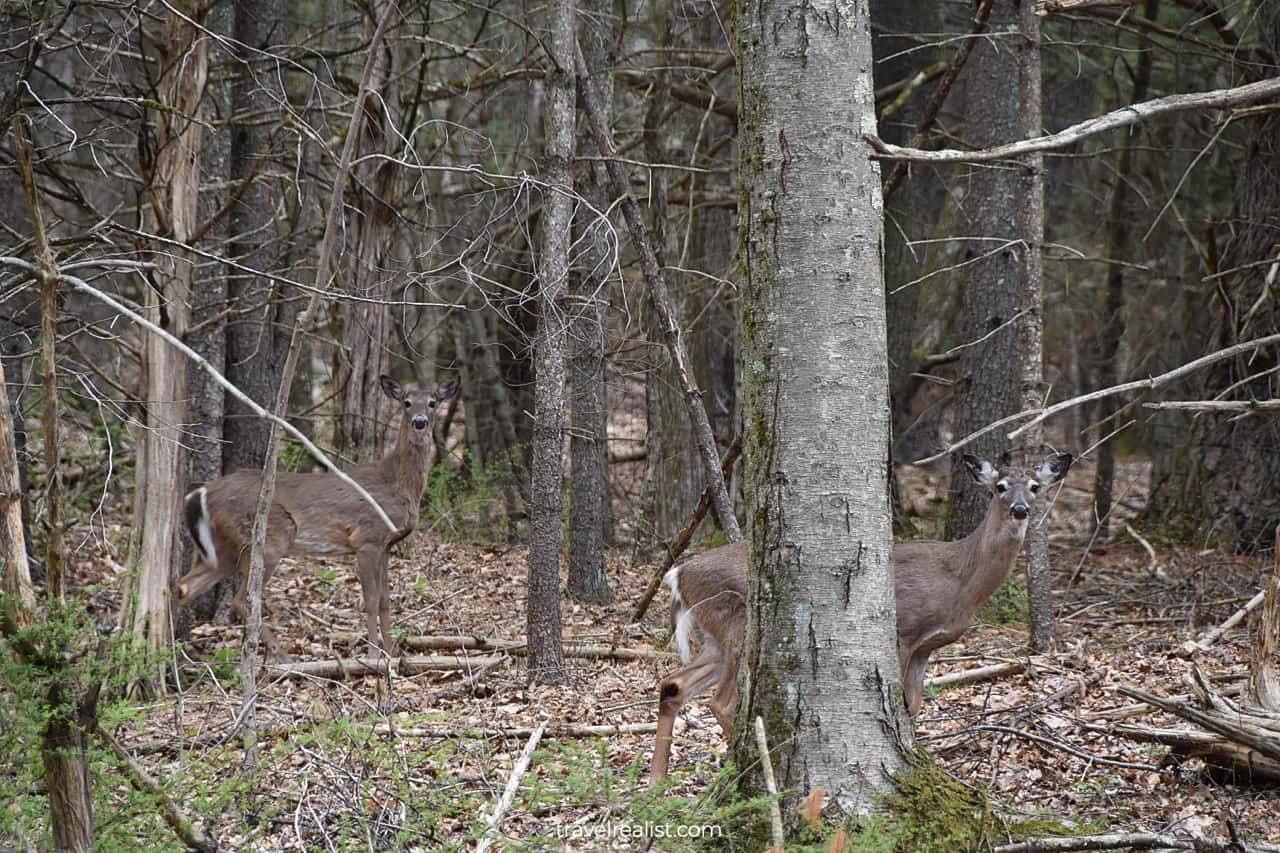
The remote location of this section of Delaware Water Gap makes it another good spot for wildlife watching. Deer encounters are very common in this part of the park.
Be extra careful if you drive back from Buttermilk Falls at dawn or dusk. The narrow dirt and paved roads might not give you enough time to react. Obey the speed limit to keep everyone safe.
If you continue further on the Buttermilk Falls Trail, you will be hiking away from the falls. But you will be getting closer to the Appalachian Trail.
This National Scenic Trail covers 19 miles (31 km) between the Kittatinny Point and Buttermilk Milk Falls. It might not sound like a long distance. But wait till you add 2,500 ft (762 m) in elevation gain.
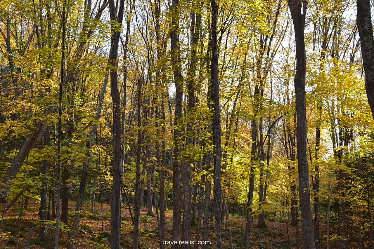
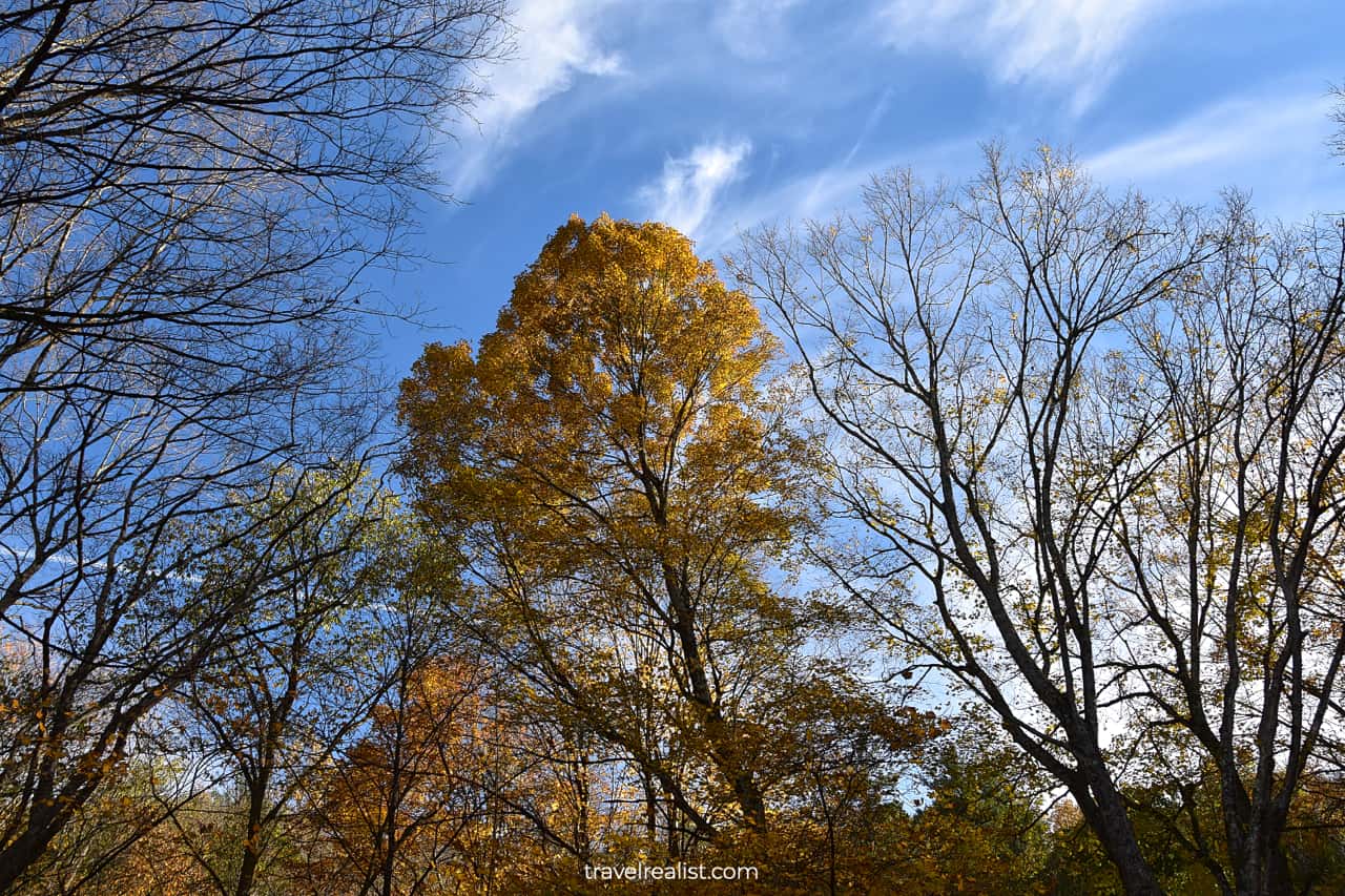
The forest near Buttermilk Falls and Appalachian Trail is picturesque during every season. But it might be at its best if you visit Delaware Water Gap during fall foliage.
The trees will have green, yellow, orange, and red leaves. The entire forest floor will be covered in recently fallen foliage. Hiking in this colorful grove will be a great end to your Delaware Water Gap visit.
Continue with this Delaware Water Gap Waterfall Hikes Guide. You will learn more about ways to get to the sights, entrance requirements, and places to stay.
Getting to Delaware Water Gap
Delaware Water Gap is a National Recreation Area along the Delaware River. The area spans for almost 40 miles (63 km) next to the Pennsylvania and New Jersey State Line.
There are a few units in Delaware Water Gap. Some of them, like Kittatinny Point Visitor Center, are right off Interstate Highway I-80. Others, like Buttermilk Falls, involve a drive on an unpaved country road.
As a result, you could spend vastly different amounts of time getting to Delaware Water Gap. Driving times within the park also add up. It takes an hour to reach Buttermilk Falls from the Kittatinny Point.
Out-of-state visitors need to fly to visit Delaware Water Gap. Wilkes-Barre Scranton (AVP) and New York Stewart (SWF) are the closest airports to the park. They are 1.5 hours from Delaware Water Gap.
You would likely need to look into other, larger airports when traveling to the park. Newark Liberty (EWR) is the closest major airport to Delaware Water Gap. It is also a 1.5-hour drive away if there is no traffic.
Philadelphia (PHL), LaGuardia (LGA), and John F. Kennedy (JFK) airports are all over 2 hours from the park. You also need to budget for the toll roads like Manhattan Bridges and Pennsylvania Turnpike.
A car or a rental is necessary to explore all the hiking trails and waterfalls in Delaware Water Gap. There are no good public transport options when visiting this park.
Where to Stay near Delaware Water Gap
There are few places to stay right in Delaware Water Gap. You would need to camp if staying in the national recreation area is important to you.
But you should not worry if camping is not your thing. There are a handful of places to stay within a short drive from the park. But the number of hotels and vacation rentals depends on the park area you visit.
You will have much better time finding a place to stay in the southern section of the park. Stroudsburg, Pennsylvania is just 6 miles from Kittatinny Point Visitor Center.
The Penn Stroud, Stroudsburg – Poconos, Ascend Hotel Collection is a great hotel in the center of the city. You could even choose to walk to Thai Orchid restaurant or Sweat Creams Cafe from this hotel.
Club Wyndham Shawnee Village and Hampton Inn & Suites Stroudsburg Bartonsville Poconos are further away from the city. Still, both hotels are good options for visiting Delaware Water Gap.
Your options are more limited if you need a place to stay in the northern section of Delaware Water Gap. Milford and Matamoras are the only cities in this part of the Minisink Valley Tri-State Area.
Look into Hotel Fauchere for a boutique experience in a historic hotel. Hampton Inn Matamoras could work better if you prefer a chain hotel.
Check out John’s of Arthur Ave or Two Rivers Grille for dinner. You could also stop by Grey Towers National Historic Site in Milford on your way to the hotel.
Middletown, New York, Scranton, Pennsylvania, and Newark, New Jersey are cities further away from Delaware Water Gap. Yet, they could be good destinations if they align with your travel itinerary.
Entrance Requirements & Passes
Delaware Water Gap is open 24 hours a day year round. But it does not mean that you could see all attractions of this park 365 days a year. A few park roads and areas close in the winter.
Dingmans Falls and Blue Mountain Lakes become inaccessible after the first heavy snowfall of the season. These areas reopen after snow has melted, which could take up to mid April.
You should be able to visit most other areas of the park year round. It is still best to check the weather forecast before taking a trip to Delaware Water Gap.
Be careful when hiking to Mt. Tammany and Raymondskill Falls during winter months. These and other trails could be slippery after rain and snow.
A free shuttle to Raymondskill Falls runs between 10 a.m. and 4 p.m. on weekends and holidays. You will not be able to park at the trailhead during that time.
The park does not charge entrance fees. You can hike the waterfall trails in Delaware Water Gap free of charge.
But you would need to pay expanded amenity fees if you visit the park from mid April to mid October. These fees apply at the park beaches like Turtle Beach, Milford Beach, and Smithfield Beach.
The expanded amenity fee is $10 per car with up to 7 people. Cyclists and pedestrians pay $2 per person. A seasonal pass costs $45.
America the Beautiful annual pass does not give any discounts on the amenity fee. Only Access, Military, and Senior passes provide a 50% discount to their holders.
Takeaways: Delaware Water Gap Waterfall Hikes
Delaware Water Gap is must-visit destination in the Tri-State Area. Outdoor lovers who enjoy scenic views will find this national recreation area worth the drive.
Delaware Water Gap is a paradise for waterfall hikes. The highest waterfalls in both New Jersey and Pennsylvania are in this park.
Raymondskill, Silverthread, Buttermilk, and Dingmans Falls are powerful and impressive. You could explore all these waterfalls but Raymondskill Falls at your own pace.
You might need to take a shuttle to see the highest falls in Pennsylvania if you visit on a weekend. This is a minor challenge for exploring the beautiful waterfall.
Unless you go to the Delaware River beaches, you could enjoy the park for free. Head down to Delaware Water Gap to get away from the stress of the city.
Take a look at this Delaware Water Gap Waterfall Hikes Video Guide. But visit the YouTube channel for the latest videos.
Frequently Asked Questions
Delaware Water Gap is a National Recreation Area along the Delaware River. The river goes through a gap in the Kittatinny Mountains, which gave the park its name.
Delaware Water Gap is in Minisink Tri-State Area. The park is in both New Jersey and Pennsylvania. Stroudsburg, PA, Milford, PA, and Port Jervis, NY are the closest towns to Delaware Water Gap.
There are plenty of things to do in Delaware Water Gap:
– Hike the Mt. Tammany Trail to see the Gap, Mt. Minsi and Arrow Island
– Head to Dingmans Creek to admire powerful Dingmans Falls and delicate Silverthread Falls
– Explore Raymondskill Falls, the highest waterfall in Pennsylvania
– Enjoy fall foliage near Buttermilk Falls, the highest waterfall in New Jersey
– Hike a section of the Appalachian Trail
– See wildlife
There are three toll bridges that connect New Jersey and Pennsylvania in Delaware Gap.
– Delaware Water Gap Toll Bridge and Milford-Montague Toll Bridge cost $1.25 each way for E-Z pass holders. A cash payment costs $3.
– Dingmans Ferry Toll Bridge costs $2 in cash.
Stroudsburg and Milford are the closest towns to Delaware Water Gap in Pennsylvania.
You could hike and see four scenic waterfalls in Delaware Water Gap:
– 150-ft Raymondskill Falls; highest waterfall in Pennsylvania
– 130-ft Dingmans Falls
– 85-ft Buttermilk Falls; highest waterfall in New Jersey
– 80-ft Silverthread Falls
Delaware Water Gap is a great destination for a day trip from NYC. A chance to see waterfalls, rugged mountains, picturesque river, and wildlife is well worth the drive.
Safe realist travels!