Garner Hiking Trails: From The Frio River to Old Baldy Summit
This realistic Garner State Park Hiking Trails Guide helps you plan your next adventure in this Hill Country park.
Garner State Park is a very popular Texas park. It protects the ecosystem of the Texas Hill Country in the Frio River Valley. There is no better way to explore Garner than on one of its hiking trails.
This post includes affiliate links that will earn us commission if you make a purchase via these links.
Sights & Places of Interest
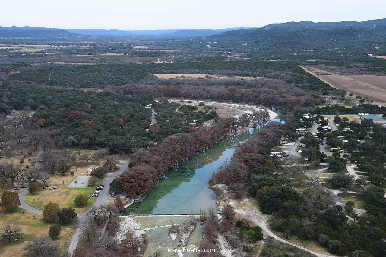
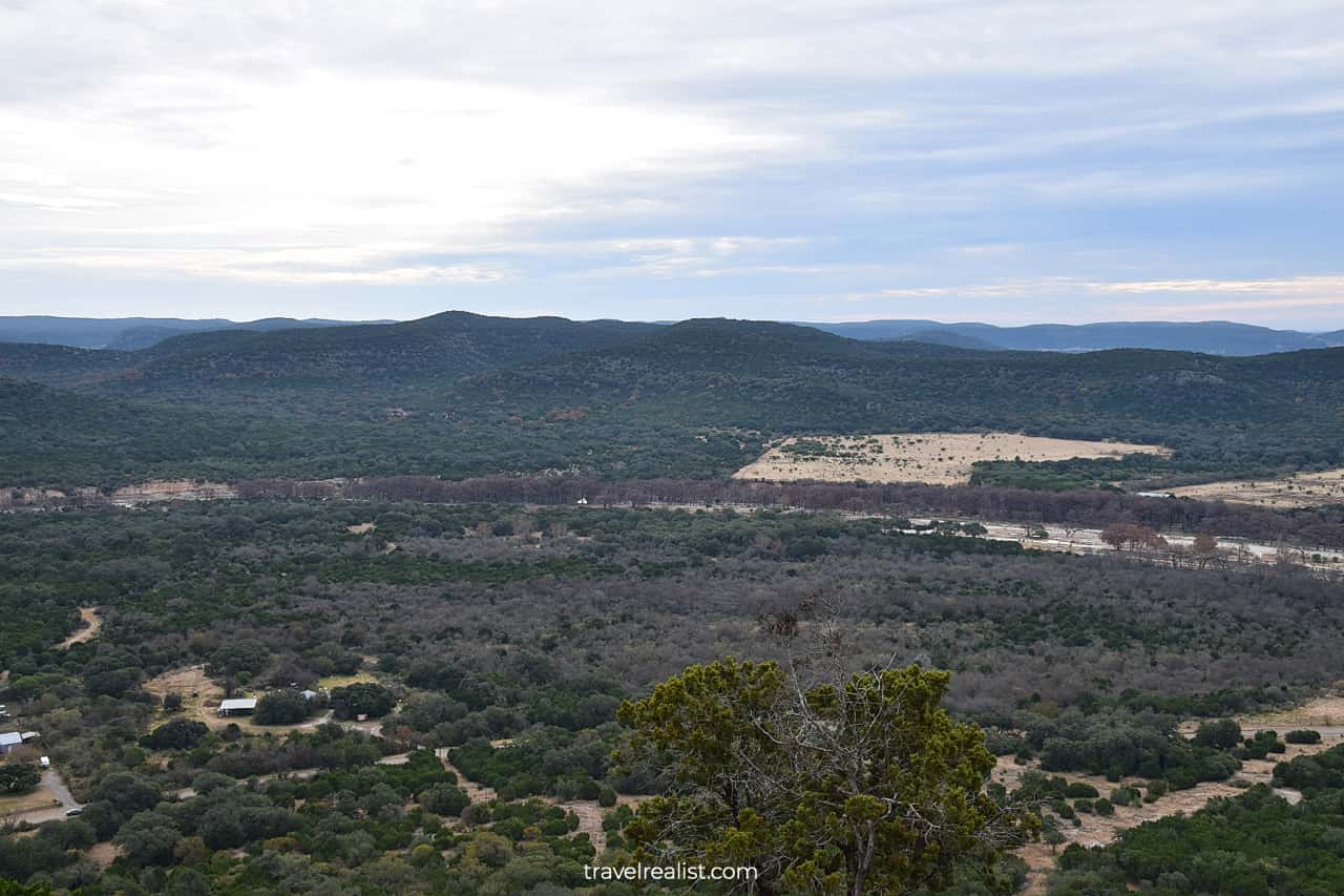
Garner State Park is one of the crown jewels of the Texas State Parks system. The park has a lot of sights to be proud of. The Frio River flows through this park, providing options for swimming and water sports.
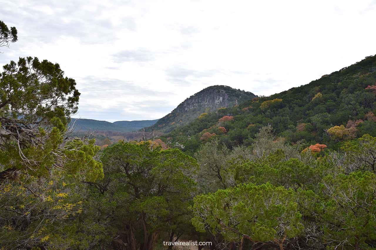
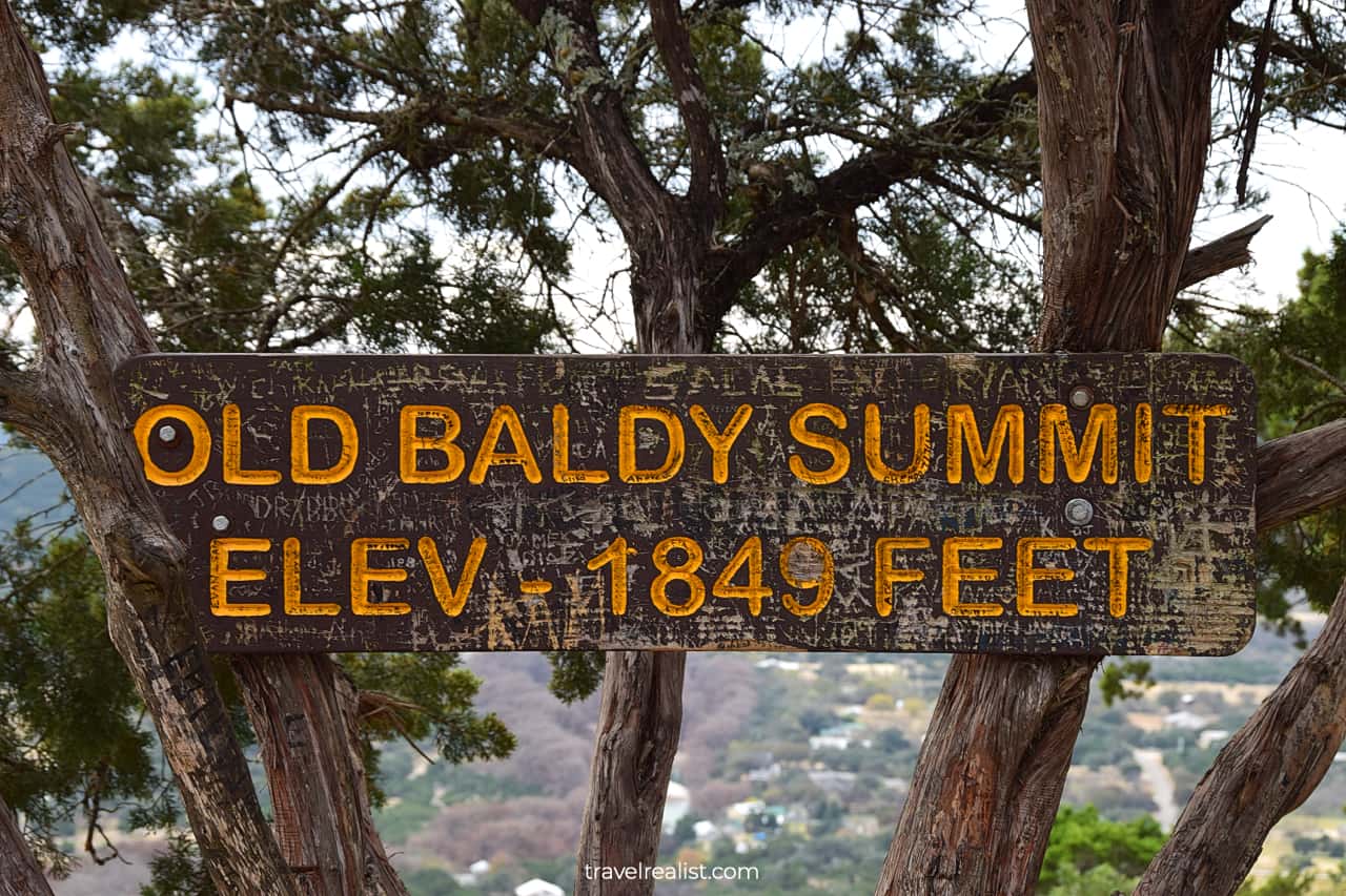
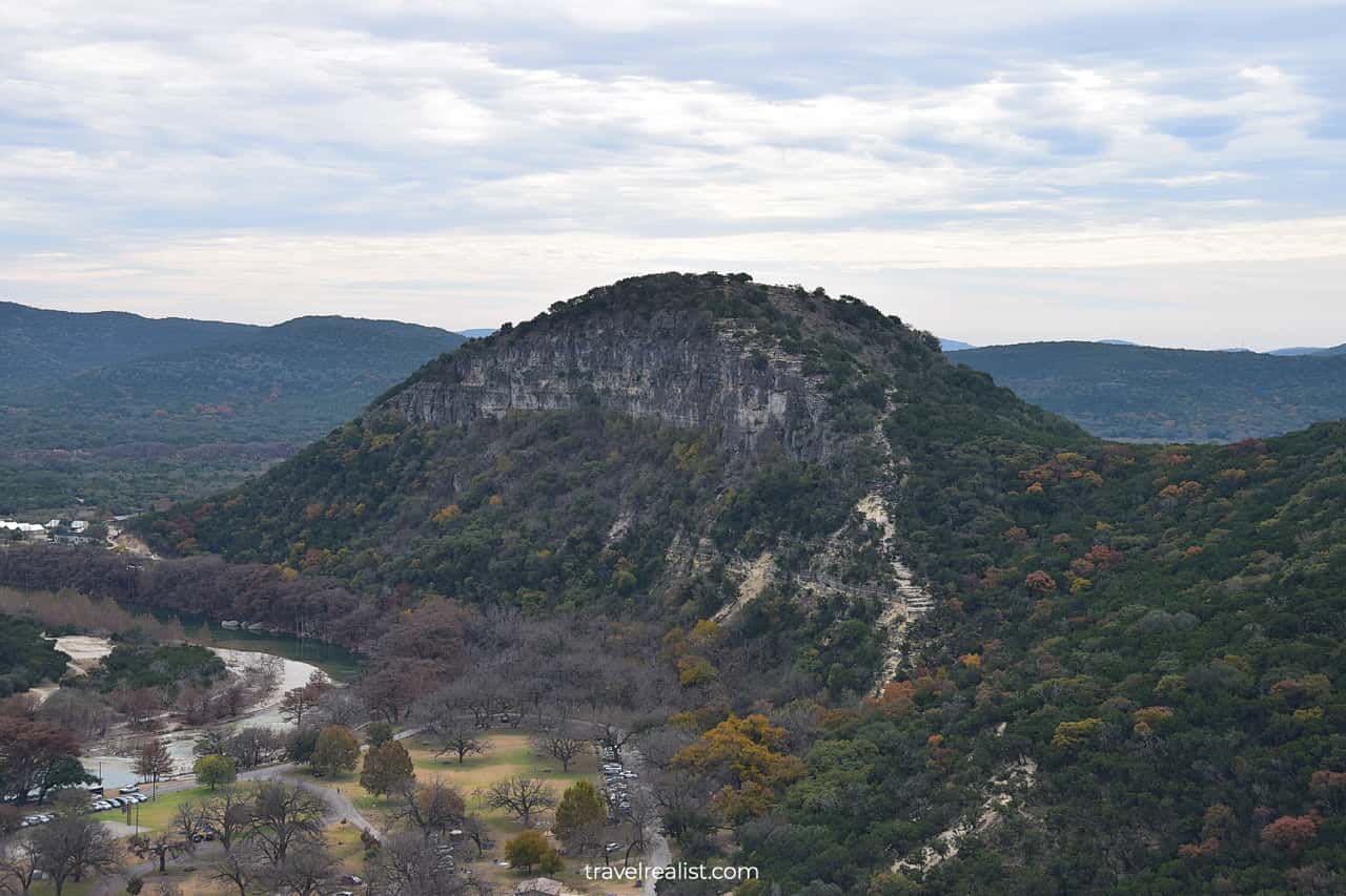
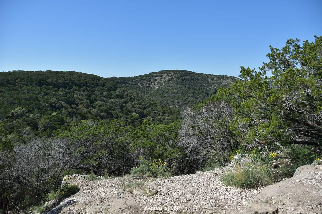
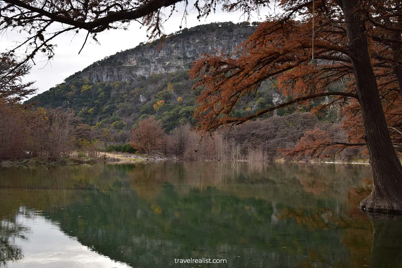
Old Baldy Summit is a prominent peak in the Texas Hill Country. Its elevation is 1,849 ft (564 m) above the sea level. There are 16 miles (26 km) of hiking trails that take you to this and other summits.
If the river and hills are not enough, you could choose to join a Summer Dance. This tradition takes place every summer evening since the 1940s. Dances take place during some holidays like a Spring Break, too.
A lot of visitors come to Garner to enjoy the river and trails every year. It could be a bit overwhelming to see everything on a day trip to Garner State Park. This is where this Guide comes to your rescue.
The next few sections of this Garner State Park Hiking Trails Guide cover the main hiking trails in the park. They start with the must-do day hikes and continue with options to extend your hiking adventure.
1. Old Baldy Trail
- Distance: 1 miles (1.6 km)
- Type: out-and-back
- Difficulty: challenging
The Old Baldy Trail is the most popular trail in Garner State Park. This hike is not very long. But the steep uphill and downhill sections make it quite strenuous. The trailhead is near Pecan Grove Camping Area.
The total elevation gain of this trail is 449 ft (136 m). This is higher than famous Enchanted Rock summit near Fredericksburg. Your knees will feel this steep incline on the way up.
The first few hundred feet (meters) go over a rocky terrain. Expect loose rocks as you hike up. Be careful where you step to avoid an injury. Pace yourself to finish this section unscathed.
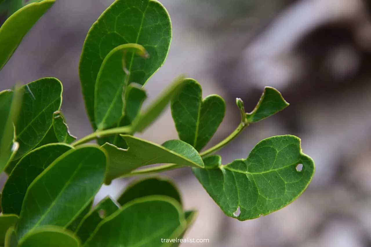
The trail continues through a cedar grove then. This trail section is fairly flat with minimal elevation gain. It is not much different from other Texas Hill Country trails from Lost Maples to Balcones Canyonlands.
Things change again once you pass an intersection with the Foshee Trail. Another steep uphill climb reveals amazing views of the Frio River valley.
You will continue enjoying the views all the way to the summit. Allow a total of 30 to 45 minutes to reach Old Baldy. Your fitness level and hiking experience will make a difference on this trail.
Old Baldy summit is quite flat. It takes up a large area. Only a carved out wooden sign and an American flag will tell you that you reached the top. Enjoy panoramic views of the surrounding hills and valleys.
2. Foshee Trail
- Distance: 1.7 miles (2.7 km)
- Type: out-and-back
- Difficulty: moderate
Once you finish admiring the views, you need to take a section of the Old Baldy Trail downhill. You could continue on the same path to the trailhead. But switching to the Foshee Trail might be a better idea.
This connecting path goes downhill at the beginning. It then levels off and turns into an easy trail with little elevation gain. It is a good recovery hike after the challenging Old Baldy Trail.
There is little to see on the Foshee Trail. Enjoy Texas Hill Country trees and bushes on the path. But you will not be descending all the way to the river level. This fact will make it easier to hike a few more trails.
You should stop at the Old Rock Fence right before an intersection with the Old CCC Trail. This human made fence is the only notable attraction on this trail.
3. Bridges Trail
- Distance: 0.7 miles (1.1 km)
- Type: out-and-back
- Difficulty: challenging
You will reach a major trail intersection at 0.9-mi (1.4-km) mark of the Foshee Trail. There are a lot of options for you to choose from.
The Bird and White Rock Cave Trails (0.45 miles or 0.72 km) will bring you to the Old Baldy trailhead. A 1-mi (1.6-km) Wilks Trail takes you in an opposite direction to Donavan, Highway, and Ashe Juniper Trails.
The tiny Rim Trail (0.06 miles or 0.1 km) runs parallel to the Foshee Trail. It brings you to the Campos Trail and Old Entrance Road. Last but not least, you could switch to the Bridges Trail.
In fact, this short trail is the best path forward. You will reach the Painted Rock Overlook just 0.25 miles (0.4 km) later. It is no Painted Wall in Black Canyon in Colorado. But it has amazing views of Old Baldy.
4. Crystal Cave Trail
- Distance: 0.6 miles (1 km)
- Type: out-and-back
- Difficulty: challenging
Like most trails in Garner State Park, the Bridges Trail gives you a few options. You could start the downhill hike to the river level. But you might want to hang around at higher elevations for a little longer.
There is one more natural attraction nearby. It requires you to hike back a few hundred feet (meters) to an intersection with the Crystal Cave Trail.
You are free to explore this cave at your own risk. No need to have a tour guide or register at the visitor center. This makes Crystal Cave more similar to Bear Gulch Cave in Pinnacles than other cave parks.
It is a good idea to bring a phone or flashlight. This way, you could see the calcite crystals that gave the cave its name. It is certainly no Jewel Cave. But it could be nice spot to visit in Garner.
5. Blinn River Trail
- Distance: 0.5 miles (0.8 km)
- Type: out-and-back
- Difficulty: easy
There are ways to extend your hiking adventure by at least another 2 miles (3 km) after the cave exploration. But it could be as good time as any to return to the Frio River.
Be careful as you hike the steep downhill sections of the Crystal Cave Trail. Few people realize that downhill hikes are more dangerous than uphill climbs. Many hikers end up going too fast and get injured.
Once you reach State Park Road 29, you could take the Madrone Walkway in either direction. Another alternative is to hike the Blinn River Trail.
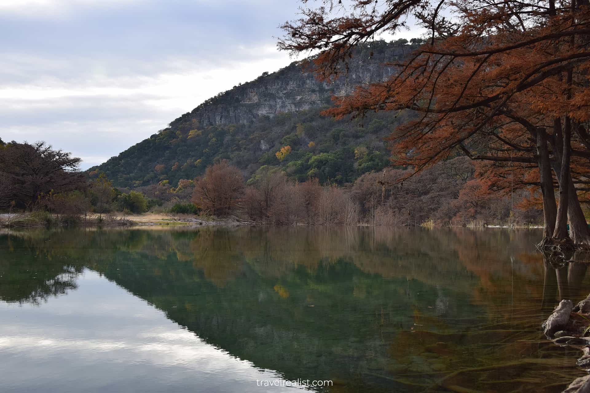
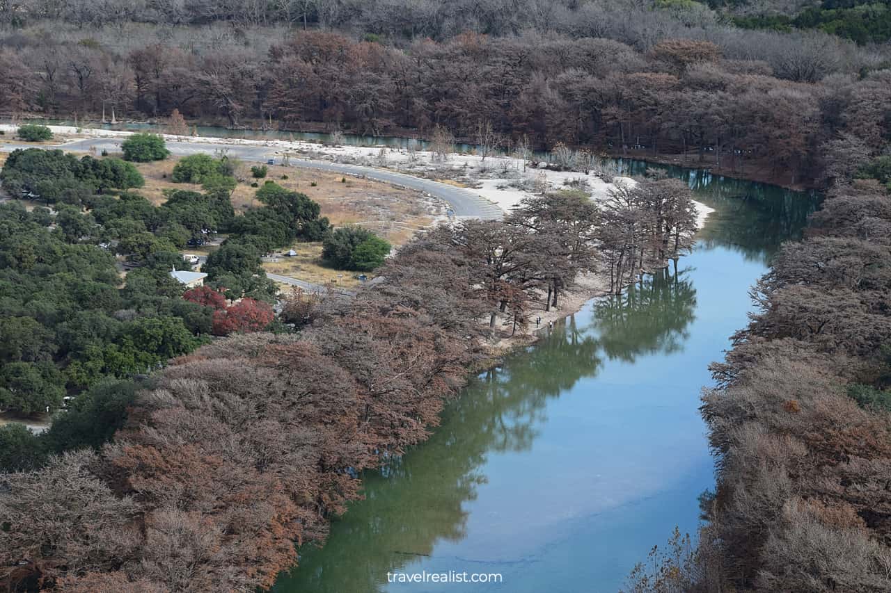
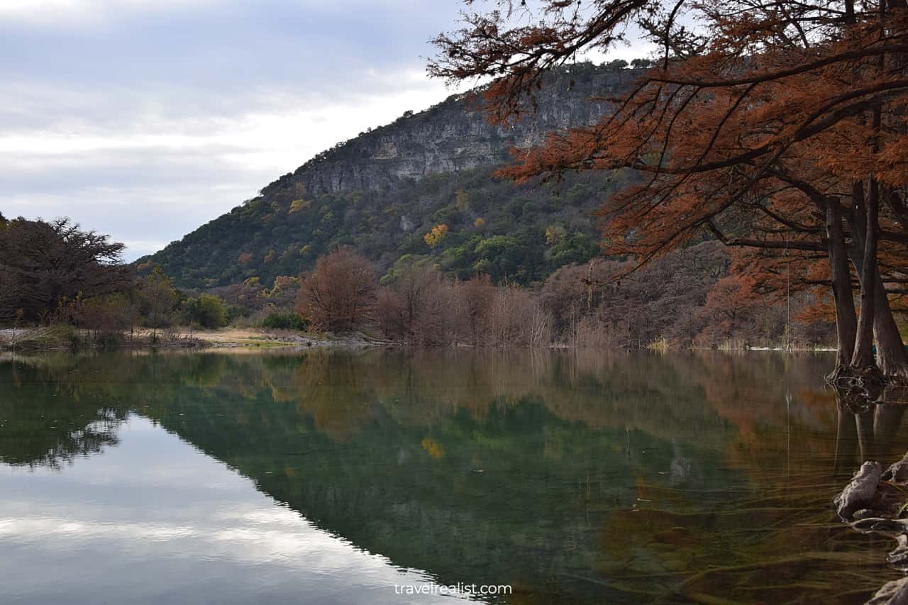
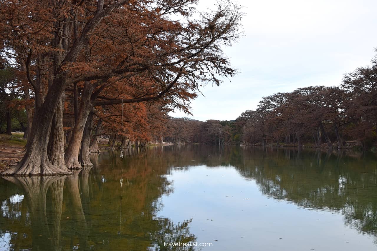
This path is as close as you could get to the Frio River on a hiking trail in the park. Enjoy the cypress trees and calm waters as you hike this trail.
6. Camping Area & Dam Walk
- Distance: 0.5 miles (0.8 km)
- Type: out-and-back
- Difficulty: easy
The Blinn River Trail could be a great end of your day hike in Garner. But you will still need to walk back to a parking lot near the Old Baldy trailhead.
You could take any path along State Park Road 29. But an unmarked trail along the Frio River will be by far the most scenic way.
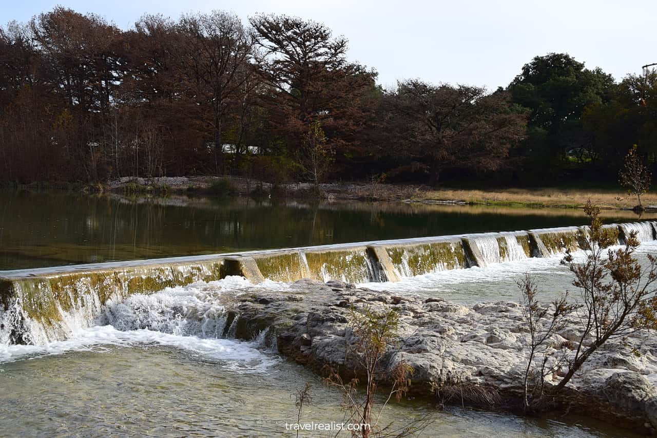
This path takes you past both Oakmont and Pecan Grove Camping Areas. You will arrive at a boat house, river dam, and a bungee. This area is never quiet from spring to fall.
You need to arrive very early to capture Old Baldy reflections in the river. If there is no wind, fantastic pictures will serve as a reward for this walk.
7. Other Trails
A hike on the Old Baldy, Foshee, Bridges, Crystal Cave, and Blinn River Trails is a good 2-3 hour adventure. But these trails make up about 4 miles (6.4 km) total.
You are right to wonder about remaining hiking trails in Garner State Park. There are 11 other trails in the park. Some of them are good connector trails like the Donovan Trail and Wilks Trail.
You would need another half a day to hike these trails. But there might be a better way to cover most of them. You just need to bring your gravel or mountain bike. Here are the best MTB trails in Garner:
- Madrone Walkway: a 0.7-mi (1.1-km) out-and-back path (easy, green).
- Frio Canyon Trail: a 2.9-mi (4.7-km) out-and-back path (easy, green).
- Old Entrance Road: a 0.8-mi (1.3-km) service road (easy, green).
- Highway Trail: a 0.6-mi (1-km) out-and-back trail (easy, green).
- Ashe Juniper Trail: a 2.5-mi (4-km) loop trail (moderate, blue).
- Wild Horse Creek Trail: a 0.5-mi (0.8-km) out-and-back trail (challenging, black diamond).
You might need about 60-90 minutes to ride these trails. Since a few of these trails are out-and-back paths, you are looking at 9 miles (14.5 km) in total distance. This way, you could cover all trails at Garner.
Continue with this Garner State Park Hiking Trails Guide. You will learn more about ways to get to the sights, entrance requirements, and places to stay.
Getting to Garner State Park
Garner is a state park in Uvalde County in Texas. The park is near the southwestern edge of the Texas Hill Country. Concan is the closest community to Garner State Park. Uvalde is the nearest town.
Neither community is large enough to account for the majority of visitors to Garner. In fact, most people visit this state park on a day or a weekend trip from San Antonio.
This is hardly a surprise to anyone. The Alamo City is the nearest large city to Garner State Park. You could reach the park in about 90 minutes from the Alamo City.
It is also the best airport to fly into for out-of-state visitors. San Antonio Airport might not have a lot of direct flights. But you will enjoy the convenience of flying to the Alamo City if a flight works out for you.
Like most Texas State Parks, you need a car to reach Garner. Rent a car and hit the road to this state park. You could choose to visit other attractions on the way, like Lost Maples or Government Canyon.
Put 234 RR 1050, Concan, TX 78838 into your navigator. Some maps send visitors to a closed entrance on State Park Road 29. It is a short detour away but why waste precious time you could spend hiking?
Where to Stay near Garner
Garner State Park is in a very remote part of Texas. There are few places to stay right next to the park. All of them are vacation rentals and campsites. If you prefer to stay in a hotel you need to drive for a while.
Uvalde is the closest town with places to stay. Consider staying at Hampton Inn Uvalde. This chain hotel offers visitors a consistent experience throughout the United States.
Kerrville is another worthwhile destination. It takes about 80 minutes to reach the park from this town. Check out Hampton Inn Kerrville.
You might be better off staying in San Antonio and its suburbs. Hillside Boutique Hotel is a good destination in Castroville. You could reach Garner State Park in just over an hour.
There are a lot more places to stay once you cross TX-1604 Loop Highway. Consider Candlewood Suites – San Antonio Lackland AFB Area, an IHG Hotel and Best Western Plus Lackland Hotel and Suites.
These hotels are solid choices along Highway US-90. Take a turn to the north on Interstate Highway I-410. You will reach even more hotels.
They include La Quinta Inn & Suites by Wyndham San Antonio Seaworld LAFB and Homewood Suites by Hilton Lackland AFB/SeaWorld, TX. As you drive towards San Antonio Airport, you will have great options.
Consider Holiday Inn Express – San Antonio Airport, an IHG Hotel and SpringHill Suites by Marriott San Antonio Medical Center/Northwest. You cannot go wrong with either place to stay.
Entrance Requirements & Passes
Garner State Park is open from 8 a.m. to 10 p.m. year round. The park closes to day visitors for two weeks every winter to accommodate hunters. The closures are usually in December or January.
The park charges per person entrance fees. Anyone 13 and older needs to pay $8 to visit Garner. Kids 12 and younger visit the park for free.
A Texas State Parks Pass is a good investment when you visit Garner. This park’s daily entrance fee makes up more than 11% of the total pass cost. A pass is a no-brainer purchase for an adult travel group.
Despite its fairly remote location, Garner State Park enjoys high visitation. The busy season is from Memorial Day to Labor Day. The park could also be packed on most spring and fall weekends.
Garner closes for the day once it reaches capacity. The only way to guarantee admission is to get a day use or camping reservation in advance. An annual pass allows you to get a day pass reservation for free.
Takeaways: Garner State Park Hiking Trails
Garner State Park is a scenic but remote park. Unless you live in San Antonio or nearby towns, you might not visit Garner frequently. Even more so, the admission fee is the highest among Texas State Parks.
You should make a stop at Garner if you are in the area and have a Texas State Parks Pass. Without an annual pass, a visit to Garner is not a cost effective decision.
Make sure you book a day pass before starting a trip. Few things are worse than being turned away at the park gate.
The hiking and biking trails in Garner State Park will not disappoint you. The Old Baldy, Bridges, and Crystal Cave Trails are real highlights for every hiker.
Keep in mind that Garner State Park has few trails that are suitable for beginner hikers. You might want to start with easier parks first, like Guadalupe River or McKinney Falls.
The park works best if you are into camping. There are few places to stay near the park. And the amenities in nearby towns might be below your expectations.
Take a look at this Garner State Park Hiking Trails Video Guide. And visit the YouTube channel for the latest videos.
Frequently Asked Question
Garner State Park is in Uvalde County in Texas. The park is half an hour north of Uvalde on Highway US-83.
You could reach Garner State Park in about 90 minutes from San Antonio.
You do not have a lot of options when choosing a place to stay near Garner State Park.
– You could camp in the park if you prefer. There are screened shelters, cabins, and campsites.
– Vacation rentals are main places to stay within a short drive from Garner.
– Hampton Inn Uvalde is the closest chain hotel to the park.
– The best places to stay will be in San Antonio, some 90 minutes east of Garner State Park.
– They include Hillside Boutique Hotel and Candlewood Suites – San Antonio Lackland AFB Area, an IHG Hotel.
There 16 miles of hiking trails in Garner State Park. Here are the best hiking trails in this park:
1. Old Baldy Trail
2. Bridges Trail
3. Crystal Cave Trail
4. Blinn River Trail
5. Campos Trail
6. Foshee Trail
7. Old Entrance Road.
8. Highway Trail.
9. Madrone Walkway.
Garner State Park gives visitors a lot of things to do:
– Hike or bike a few trails.
– Enjoy the Hill Country views from Old Baldy Summit and viewpoints.
– Go tubing, kayaking, or paddle boarding on the Frio River.
– Visit CCC structures.
– Camp at a cabin or a shelter.
– Join an evening dance.
Highway US-90 is the fastest route to Garner State Park. Obey the speed limit to avoid speed traps in Medina and Uvalde Counties.
Safe realist travels!