Black Canyon of the Gunnison: Scenic Rim Drive Guide

This realistic Black Canyon Gunnison Scenic Drive Guide helps you to plan your next adventure in this national park.
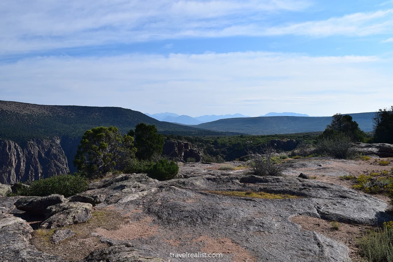
Black Canyon is a fascinating national park along the Gunnison River in Colorado.
This post includes affiliate links that will earn us commission if you make a purchase via these links.
Sights & Places of Interest
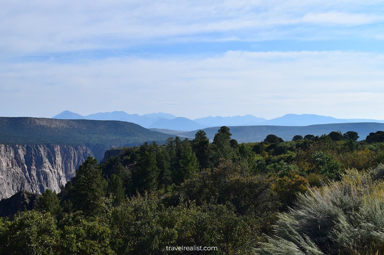
Black Canyon of the Gunnison National Park is a full name of this park. It is a relatively new park. Black Canyon has been a national monument since 1933. But it only became a national park in 1999.
Black Canyon has three districts.
- North Rim is the park district near the towns of Crawford and Maher. It has unpaved roads and a ranger station.
- South Rim is the main unit of the park. It has a scenic drive with viewpoints. The park headquarters is also in South Rim.
- East Portal is the district of the park at the Gunnison River level.
South Rim
South Rim is the easiest unit to visit in Black Canyon. It has a 7-mi (11-km) paved scenic drive. There are 12 viewpoints on the South Rim Road.
The park will capture your attention right away. The viewpoints start shortly after the South Rim Entrance Station.
This section of the Black Canyon Gunnison Scenic Drive Guide will describe the South Rim Unit. You will learn about all viewpoints and hikes on the South Rim Road.
1. Tomichi Point
Continue straight on the South Rim Road after the Entrance Station. You will pass the South Rim Campground with an amphitheater. A 3-minute wait is worth it.
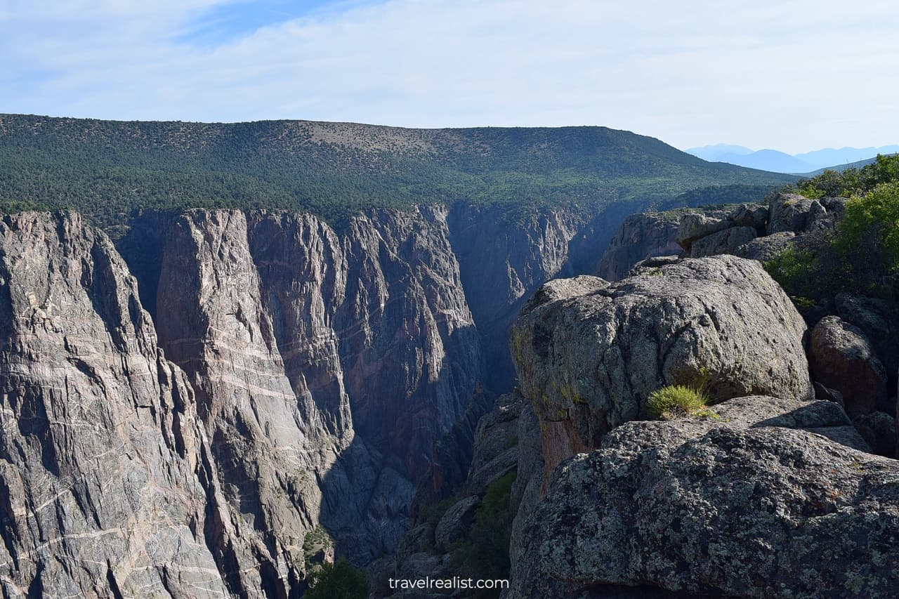
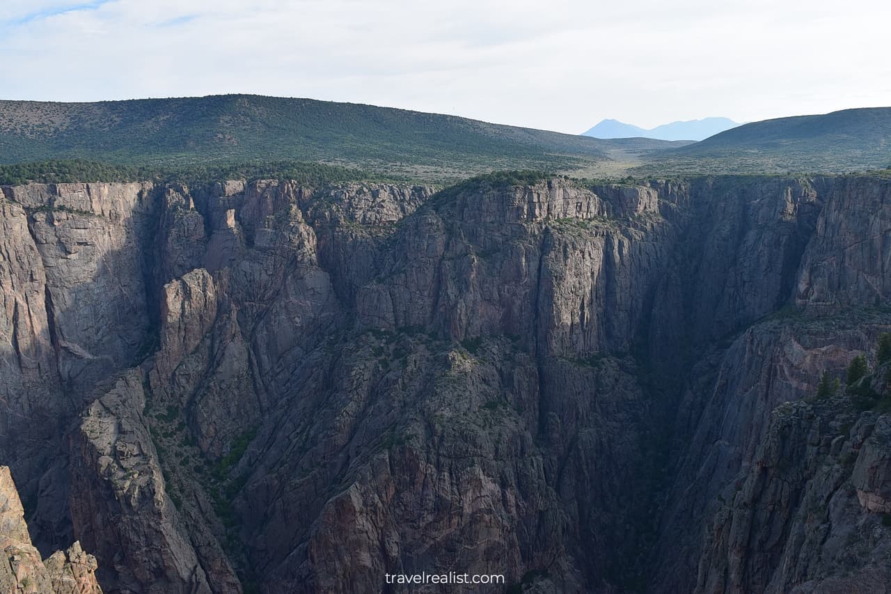
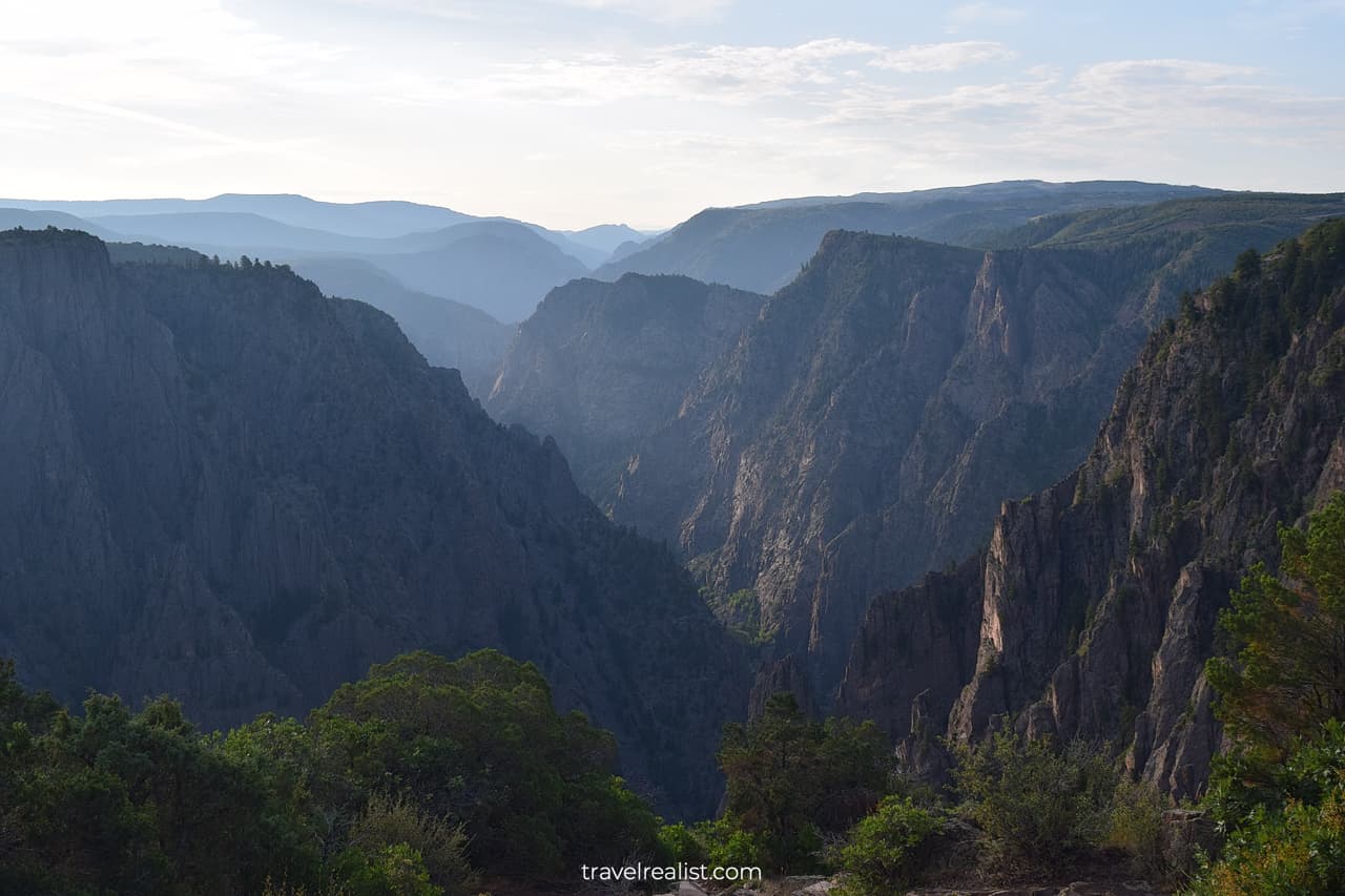
You will get a first good look at Black Canyon at the Tomichi Point. This is the first viewpoint in the park. But it happens to have some of the best views.
You will see the mountains that created the Gunnison River Gorge. The distant mountain ridges would look just like the Blue Ridge Parkway and Shenandoah National Park.
There is a trail that runs below the Tomichi Point. You might feel like taking it to enjoy this beautiful canyon. But it is worth pointing out that most viewpoints in the park have short out-and-back hikes.
You would have to hike these mini trails to reach the viewpoints. These trails set Black Canyon apart from other parks with scenic drives.
The Rim Rock Nature Trail from the Tomichi Point simply follows the South Rim Road. You can just drive to the Visitor Center from the Tomichi Point if time is an issue.
2. Gunnison Point
The South Rim Visitor Center is the next stop on Black Canyon Gunnison Scenic Drive. It is a great rest area. The Visitor Center is also a major trailhead.
You could hike Oak Flat Loop Trail, Uplands Trail, or Rim Rock Nature Trail.
- Oak Flat Loop Trail: a 2-mi (3.2-km) round trip hike. The trail is moderate. It involves 334 ft (102 m) in elevation gain. You will see two viewpoints on this hike.
- Uplands Trail: a 2-mi (3.2-km) round trip hike. This is an easy trail. It connects the Visitor Center with the Campground. The elevation gain is 291 ft (87 m).
- Rim Rock Nature Trail: also a 2-mi (3.2-km) round trip hike. It is a moderate trail with 206 ft (63 m) in elevation gain. This is a more scenic way to get to the Campground.
The Oak Flat Loop Trail is the only trail worth hiking from the Visitor Center. But if you do not have 45 minutes to an hour, just go to the Gunnison Point. You will reach it in 5 minutes from the parking lot.
3. Pulpit Rock
The Pulpit Rock Overlook is the next stop on the South Rim Road. There is a 0.2-mi (0.3-km) trail to the viewpoint. This overlook gives you the first good look at the Gunnison River below.
If you visit the park in the morning, this viewpoint will be facing the sun. You might find it difficult to get a great picture there due to the shadows.
4. Cross Fissures
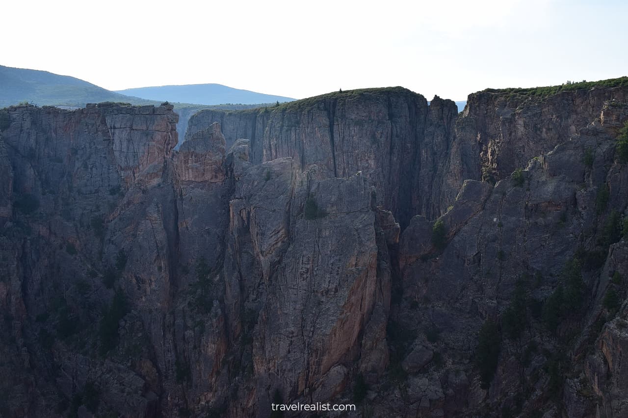
The viewpoints will become plentiful after you pass the Pulpit Rock Overlook. You will be heading to a series of viewpoints. Three viewpoints are right next to one another.
While these viewpoints are close, each of them provides a different look at the canyon. The Cross Fissures View is the first one in this set.
The return hike to the viewpoint is 0.3 miles (0.5 km). You will get a glimpse of Black Canyon through the opening in the cliffs.
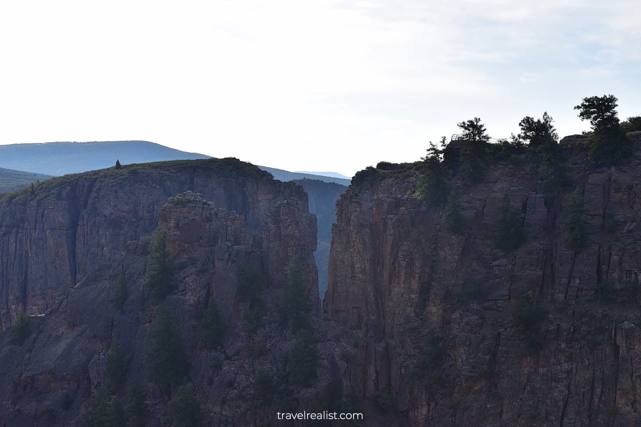
5. Rock Point
The Rock Point is the next stop on the South Rim Road. It has a slightly longer hike than the Cross Fissures View.
You would need to budget about 15 minutes to cover this trail. It is just 0.4 miles (0.6 km) long. The elevation gain is mere 22 ft (7 m).
This viewpoint has a few cliffs that come very close to one another. You could see the North Rim through the gap between them. This makes the Rock Point a very beautiful viewpoint.
This viewpoint also has an island like rock. It looks much like the landscapes from Avatar. You do not need to travel to Pandora or China to see such views. Welcome to Black Canyon of the Gunnison.
6. Devils Lookout
The Devils Lookout is the third viewpoint in this set of overlooks. You might start to wonder if this viewpoint will offer anything new in terms of the views. The answer is a resounding maybe.
The Devils Lookout has also the longest trail of the three. You would need to hike 0.5 miles (0.8 km) round trip. The elevation gain is about 65 ft (20 m).
You will see two cliff ridges. These rugged cliffs resemble the Cross Fissures View. But you get to see the cliffs from a closer distance.
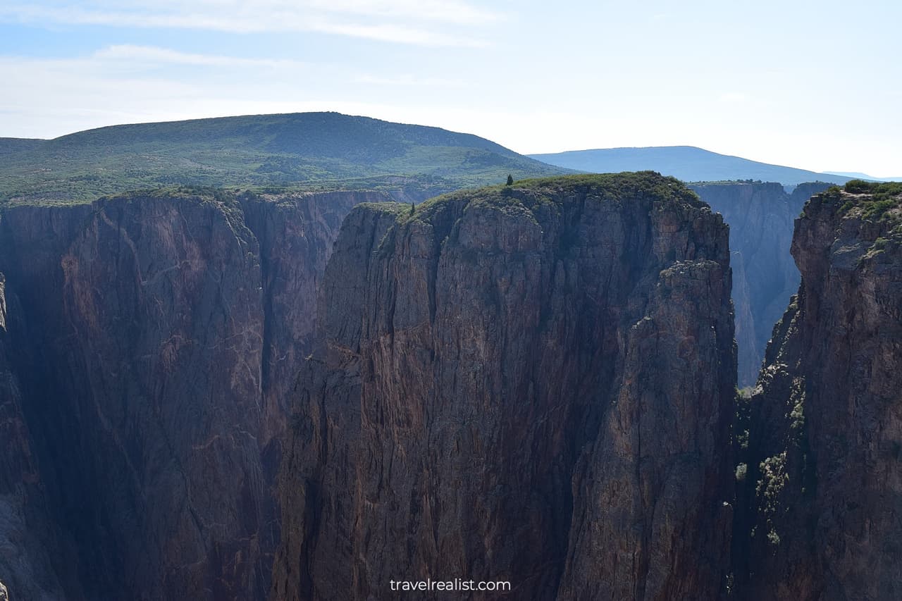
7. Chasm View
There will be no new viewpoints for about a mile (1.6 km). This might be hardly enough time for you to catch your breath. At least, the next viewpoint does not involve a hike.
As soon as the South Rim Road makes a sharp turn to the left, you will reach the Chasm View. You would need to walk for just a couple of minutes to get breathtaking views.
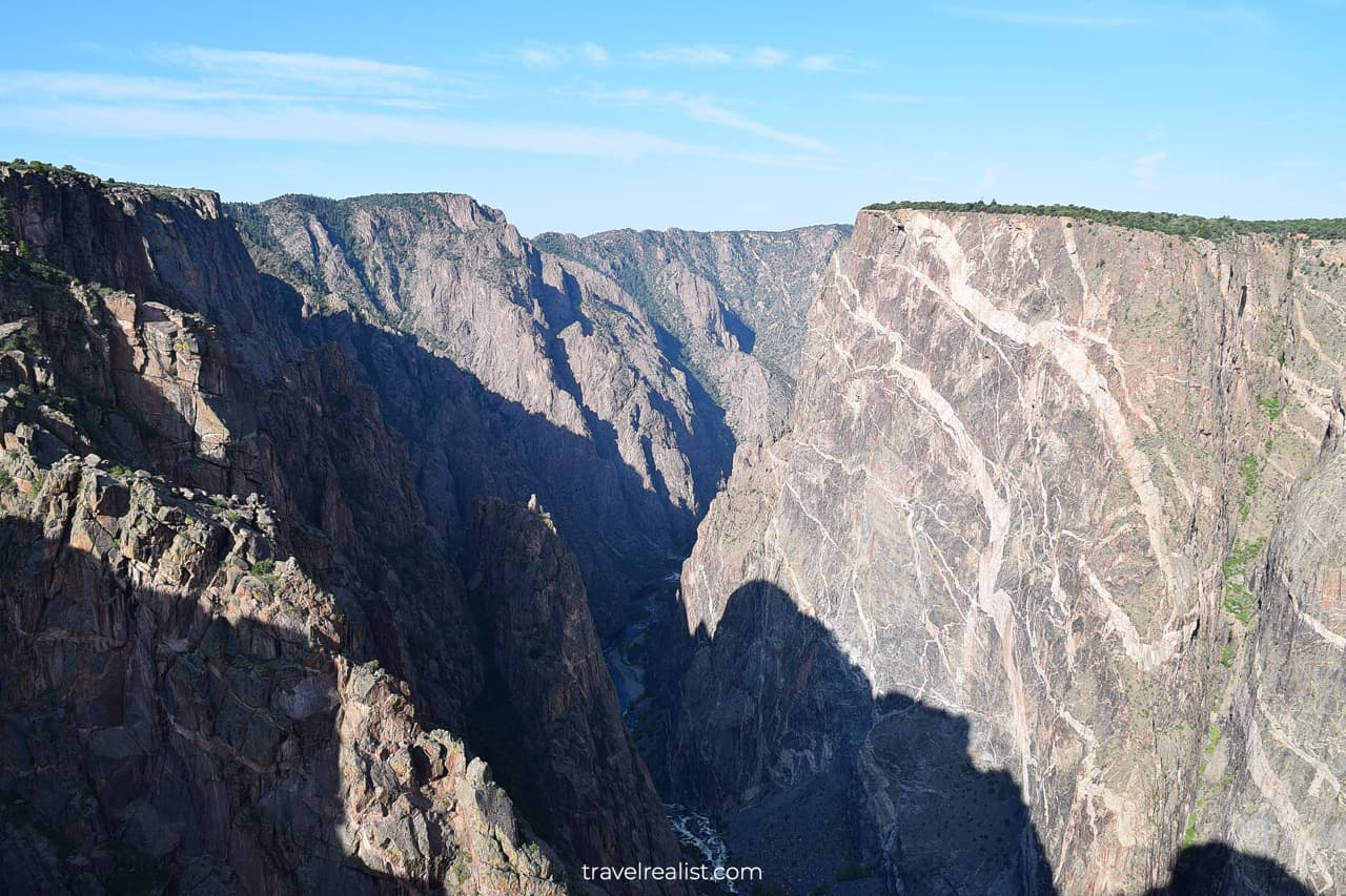
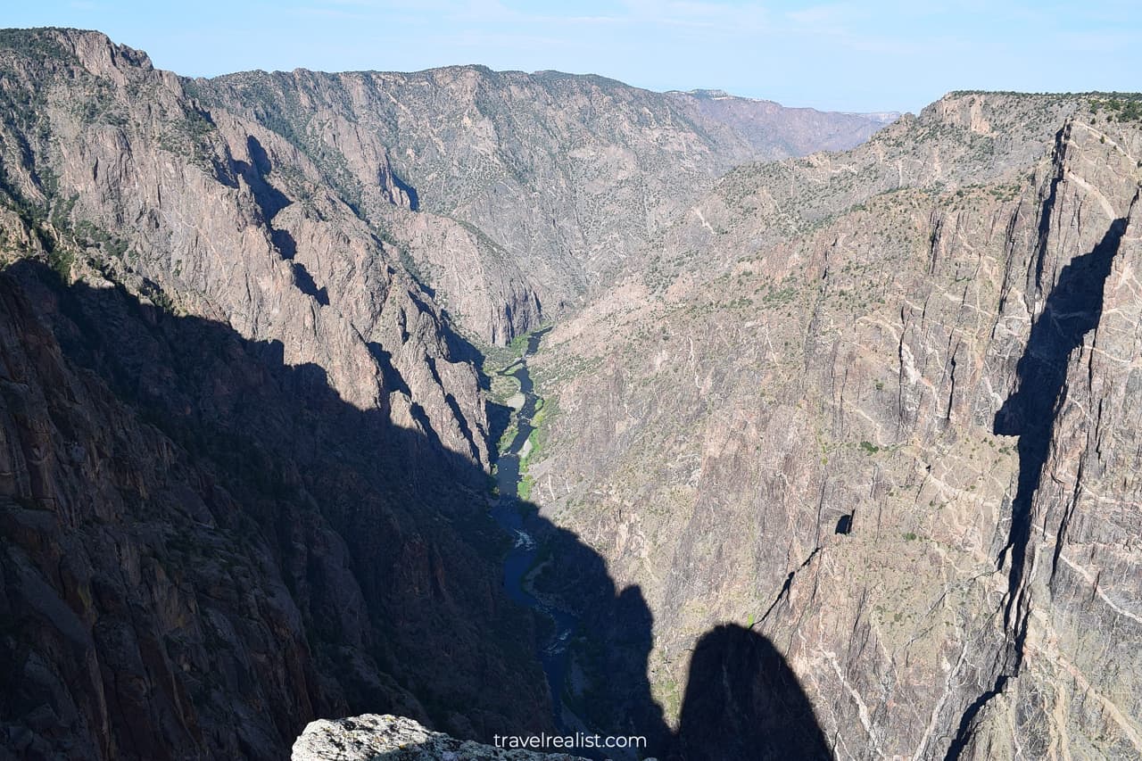
The Chasm View is another viewpoint where you can see the canyon floor. The Gunnison River is flowing some 2,250 ft (685 m) below.
The Chasm cliff is also a sight to see. This massive cliff is a great rival to the Painted Wall in beauty. The Chasm View is also the last point on the North Rim Drive.
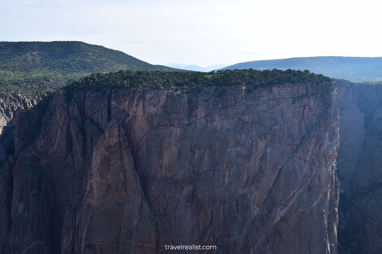
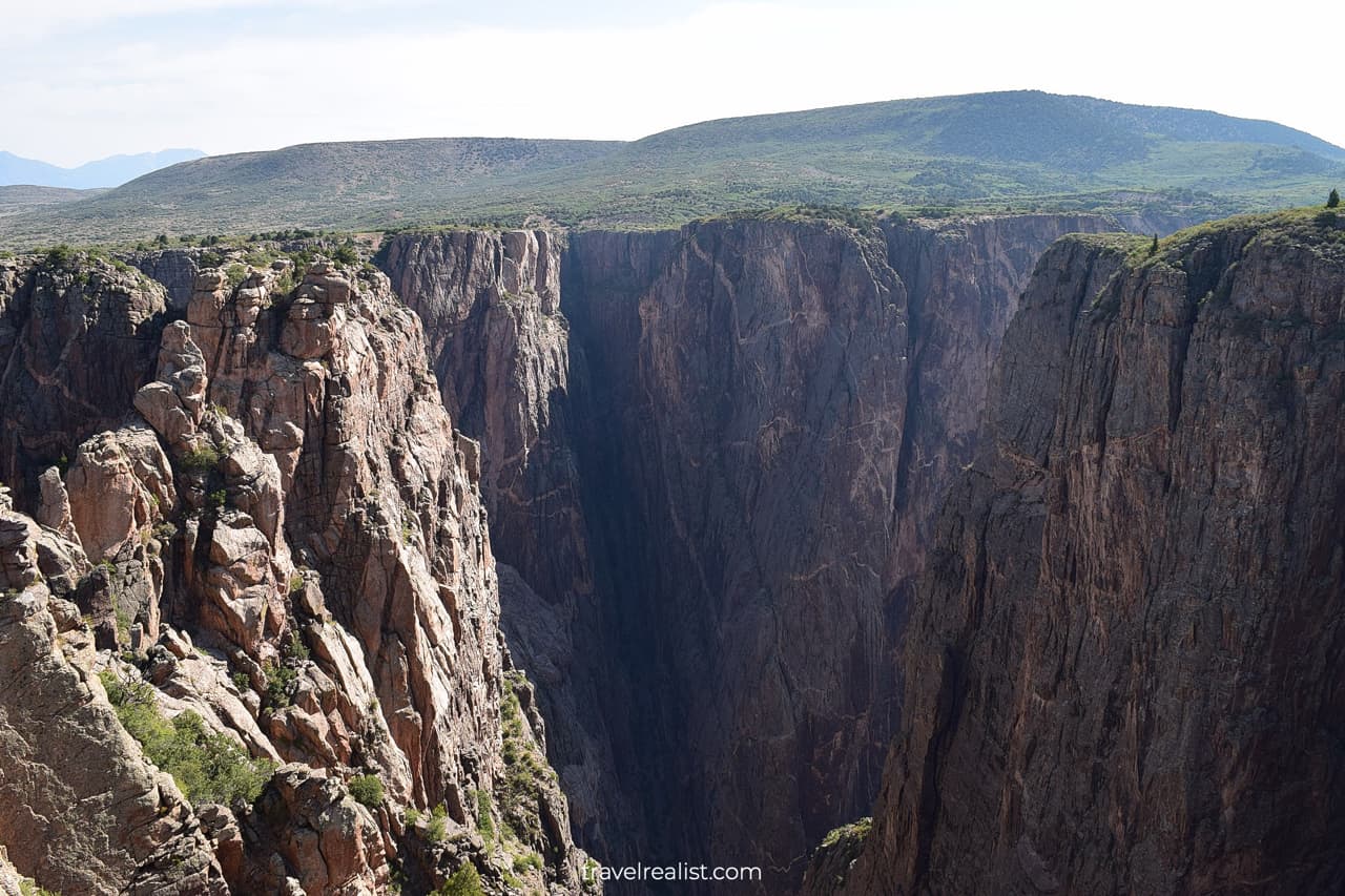
8. Painted Wall
You will be entering the Wilderness Area as you continue on the South Rim Road. The Painted Wall View is right around the corner from the Chasm View.
The Painted Wall View is one the most beautiful points in the park. But you would need to hike a bit to see it.
A 0.3-mi (0.5-km) hike has 22 ft (7 m) in elevation gain. It is a short and easy path. It brings you to the highest cliff in the entire park.
This cliff is taller than Eiffel Tower in Paris, Willis Tower in Chicago, and Tokyo Skytree. Only Burj Khalifa in Dubai is a taller human made structure than the Painted Wall.
9. Cedar Point
The Cedar Point is the next stop on the South Rim Road. There is another hike to get to the canyon rim from the parking lot.
The Cedar Point Nature Trail covers 0.75 miles (1.2-km) round trip. It is longer than all viewpoint trails in the park but the Warner Point Trail.
But there is a reason to hike to the Cedar Point. As the name suggests, this trail is a great place to learn about the native plants of Black Canyon.
You are in luck if you ever wondered about the name of a certain tree or a plant. A handful of plants have metal plaques. You will learn the names and key facts about each plant.
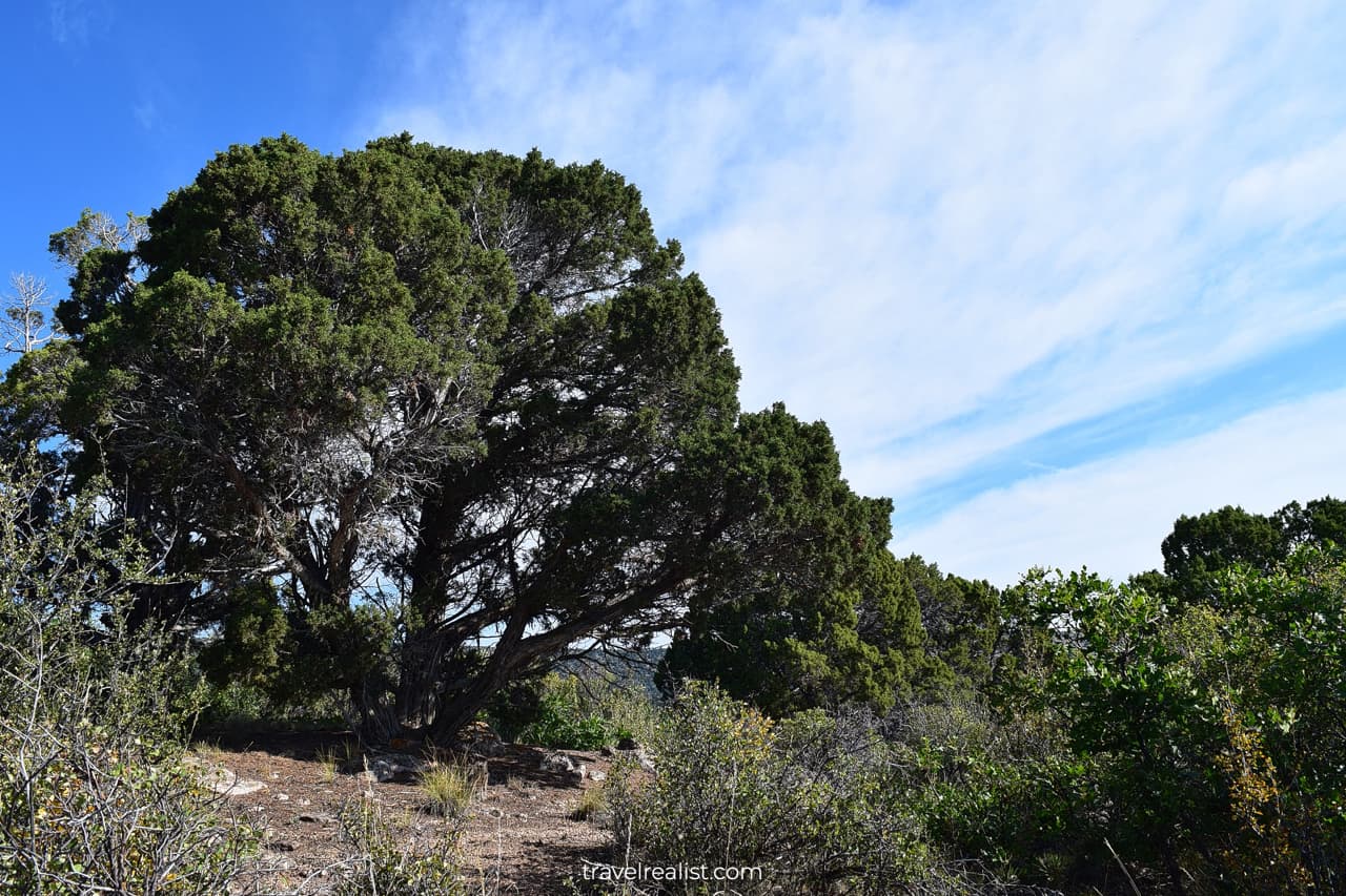
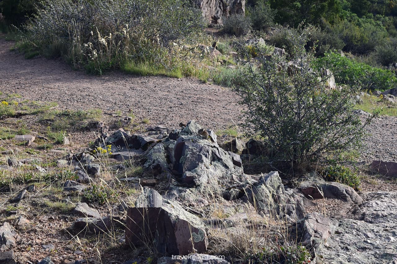
The Cedar Point Nature Trail is a great place for wildlife viewing. You might not see bears there. But you are likely to spot a few golden-mantled ground squirrels.
These rodents are not afraid of tourists. You can often see them up-close, just like in Rocky Mountain or Pinnacles.
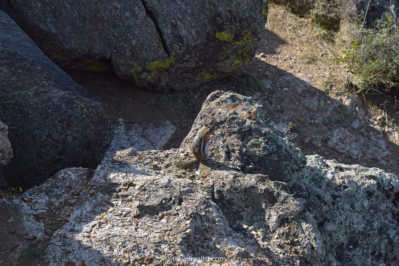
How many can you spot here?
The views of Black Canyon at the Cedar Point are a bit similar to the nearby Painted Wall View. But the plants and wildlife make this stop worth another short hike.
10. Dragon Point
Do not get too comfortable in your car after returning from the Cedar Point. The Dragon Point is barely a minute away from the previous viewpoint.
Get ready for another short hike. The path to the Dragon Point is a 0.3-mi (0.5-km) round trip hike. The elevation gain is about 50 ft (15 m).
The trail is easy. But all the small hikes will start to add up at that point. Yet, the Dragon Point is worth your time.
This viewpoint has fascinating views. The canyon starts to widen around the Dragon Point. The shadows will get in the way. As a result, the pictures might give the full beauty of this canyon.
11. Sunset View
The next stop on the Black Canyon Gunnison Scenic Drive does not involve a hike. This is one of the few viewpoints you can enjoy right from the parking lot.
That makes the Sunset View a no-brainer stop when visiting the South Rim of Black Canyon. The name of this viewpoint speaks for itself.
You will get the best views of the canyon at sunset. The views might be slightly less breathtaking when you visit the viewpoint during the rest of the day.
12. High Point
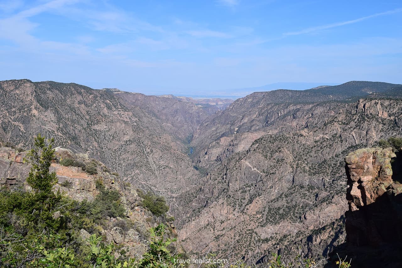
You will reach the end of the paved South Rim Road at the High Point. This viewpoint is the highest point on the drive. It reaches 8,289 ft (2,523 m).
You can barely see the canyon from the High Point. The best views are towards the North Rim. The mountain ridges behind the canyon will have a blue hue if you visit during the day.
Just like the Sunset View, the High Point is at its best in the afternoon. You will get favorable light and shadow combinations then.
13. Warner Point
There is one more viewpoint in the park if you are not too tired of hiking yet. You can only reach the Warner Point on a trail.
The trailhead is at the High Point. A round trip hike takes 1.5 miles (2.4 km). It is the longest out-and-back trail in the park.
Get ready for 423 ft (129 m) in elevation gain. You will be constantly gaining and losing elevation on this trail. The park defines it as a moderate hike.
East Portal
Most of the trails in the park are out-and-back trails. The South Rim Road is no different. This scenic drive in Black Canyon of the Gunnison National Park requires a U-turn at the High Point.
You would need to drive back all the way to the entrance station. You will pass all of the viewpoints and trailheads on your way back to the headquarters.
But your exploration of Black Canyon does not have to end here. There is an easy way to extend your visit by driving to East Portal.
This Black Canyon Gunnison Scenic Drive Guide will now describe a visit to East Portal.
Many visitors overlook this area of the park. It is easy to see why.
- There are no named viewpoints in this park section.
- The drive down to the river level and back could add another 45 minutes to your trip.
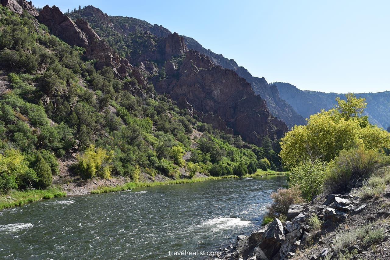
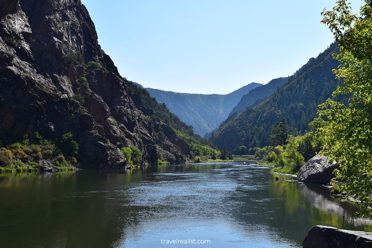
But East Portal gives you the best views of the Gunnison River and Black Canyon from its floor. If you have another hour to spare, do not think twice about visiting East Portal.
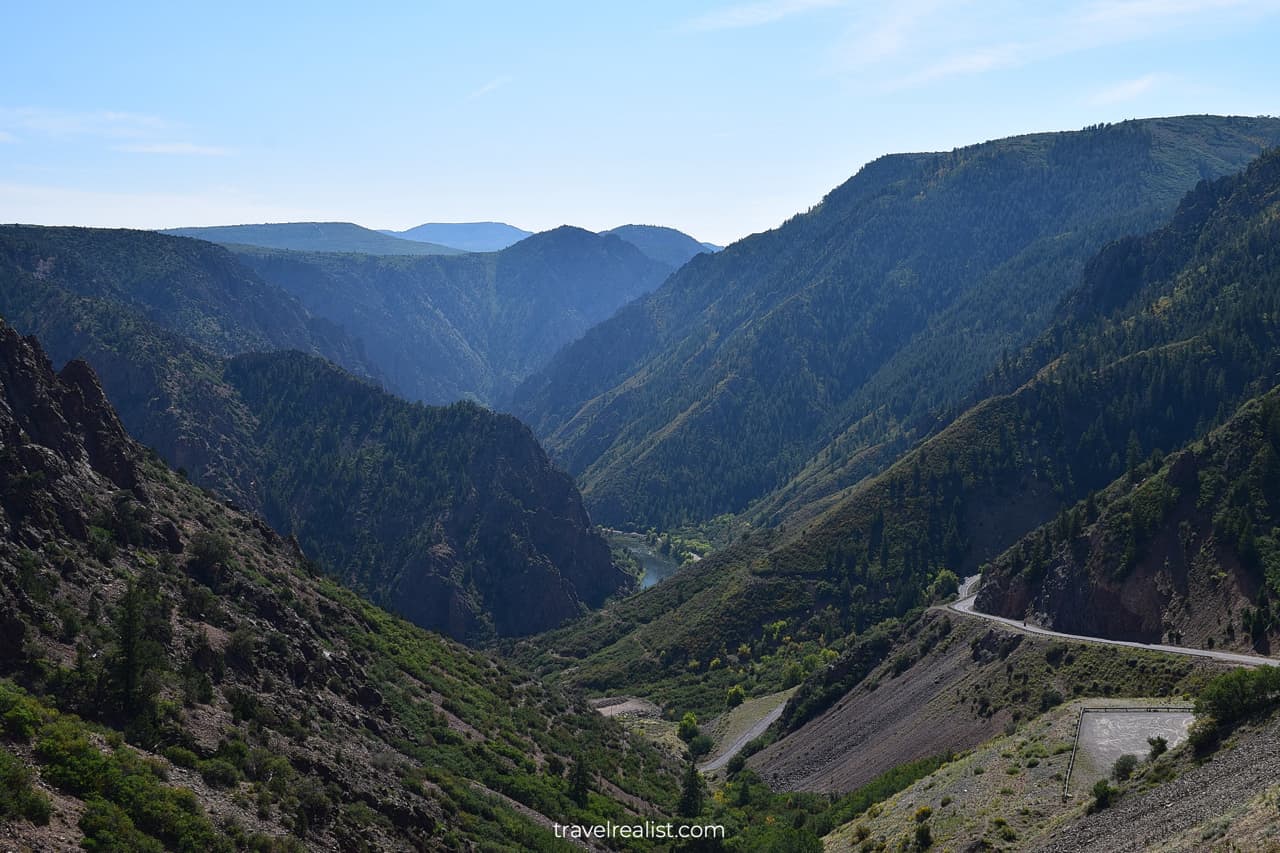
The East Portal Road drops 2,500 ft (762 m) in just 7 miles (11 km). It is a winding mountain road.
- You will be using brakes a lot while going downhill.
- Accelerate responsibly while driving back up to the canyon rim.
- Beware of fallen rocks on the road.
Once you are down at the river level, stop at the East Portal Picnic Area and Campground. You can enjoy the powerful current at the Gunnison Diversion Dam.
Continue with this Black Canyon Gunnison Scenic Drive Guide. You will learn more about ways to get to the sights, entrance requirements, and places to stay.
Getting to Black Canyon
Black Canyon is far less known than other national parks in Colorado, like Rocky Mountain or Great Sand Dunes. It is a real gem hidden far from interstate highways and major cities.
The park is in Southwestern Colorado. Montrose and Delta are two towns closest to the Canyon. Each of them has under 20,000 residents.
You would need to fly to Denver or Albuquerque, New Mexico to reach Black Canyon. A drive from the capital of Colorado takes over 5 hours.
Albuquerque is even further away. It takes over 6 hours to reach the park from the largest city in New Mexico.
Denver is not just closer to the park. It is also a bigger airport hub. You can find cheaper and more plentiful flights to Denver from all over the United States.
There are two entrances into Black Canyon of the Gunnison National Park. The South Rim Road and North Rim Drive are not connected within the park.
You will have to take a nearly two-hour detour if you take the wrong entrance. Keep in mind that Google Maps pick the North Rim by default if you drive to the park from Denver.
The South Rim Road is the main drive in the park. It is a paved road with main viewpoints and the park headquarters. You can reach it from highway US-50.
You can only reach the North Rim via an unpaved road. The last 7 miles into the park and the entire North Rim Drive are unpaved.
Where to Stay near Black Canyon
Black Canyon National Park is in a somewhat remote area of the state. It is hardly a surprise that there are few places to stay near Black Canyon.
Montrose is the closest town to the South Rim unit of the park. It is still about 30 minutes away from the entrance station. There are a handful of hotels and vacation rentals in Montrose.
You will be able to pick a place to stay. But your options in this town are fairly limited.
You would need to drive further from the park to choose from more places to stay. Grand Junction is the biggest town in this part of the state.
There are a lot more places to stay there. A longer drive is a trade-off for staying in Grand Junction. You would need to drive for about 90 minutes to reach the park.
On the bright side, Grand Junction is a great stop for visiting the sights in Eastern Utah. You can visit Arches and Canyonlands during the same trip as Black Canyon.
Entrance Requirements & Passes
Black Canyon is open to visitors year round. But there are a handful of restrictions in the winter.
The entire South Rim Road is open between late April and mid November.
- You can only drive to the Gunnison Point in the winter.
- This leaves just the Tomichi Point, Gunnison Point, and the South Rim Visitor Center.
- You can get to other South Rim viewpoints only by skiing or hiking in the winter.
The North Rim Road and East Portal Road both close in the winter. You can only reach these areas of the park around late April and early May.
The South Rim Visitor Center works between 8 a.m. and 5 p.m. in the summer. Winter hours are an hour shorter on both ends. Note that the Visitor Center is closed between 12 p.m. and 1 p.m. year round for a lunch break.
Black Canyon charges admission fees of $30 per car. Take your America the Beautiful annual pass and get a free admission.
Takeaways: Black Canyon Gunnison Scenic Drive
In a nutshell, Black Canyon of the Gunnison is an impressive national park. It is well worth a visit. You should stop by this park even if it requires a reasonable detour.
The Gunnison River formed an astonishing canyon and cliffs. Forests cover the granite canyon slopes. Steep cliffs and rugged landscape provide breathtaking views that rival those of Grand Canyon National Park.
Do not get fooled by a short distance of the South Rim Drive. You would hike about 3 miles if you only take the shortest hikes to the viewpoints.
Budget at least an hour to complete the drives to the High Point and East Portal and back. Add another hour or two to hike and enjoy the viewpoints.
Take a look at this Black Canyon Gunnison Scenic Drive Video Guide. And visit the YouTube channel for the latest videos.
Frequently Asked Questions
You should drive one of three scenic drives in Black Canyon.
– Take the paved South Rim Road and stop by 12 viewpoints.
– Drive to the river level via the East Portal Road.
– Or venture into the wilderness on the unpaved North Rim Drive.
You can complete the return South Rim Drive in Black Canyon in under 40 minutes without stopping. Since most viewpoints involve short hikes, add another 1-2 hours to explore the park.
Black Canyon of the Gunnison National Park is in Southwestern Colorado. Montrose is the closest town to the park.
Montrose is the closest town to Black Canyon with places to stay. You should also look into Grand Junction if you do not mind a longer drive.
Black Canyon has three units: South Rim, East Portal, and North Rim. You can reach South Rim and East Portal via a paved scenic drive. North Rim is only accessible via an unpaved road.
The Painted Wall is the most well known formation in Black Canyon.
Black Canyon of the Gunnison is over 2,700 feet or 830 m. It is higher than Burj Khalifa, the tallest building in the world.
You can drive to the East Portal unit of Black Canyon. The unit is at the river level. There are no trails that bring you to the bottom of Black Canyon.
Safe realist travels!