Starved Rock Trails: Hiking in Antelope Canyon of Illinois

This realistic Starved Rock Trails Guide helps you plan your next hiking adventure in this Illinois State Park.
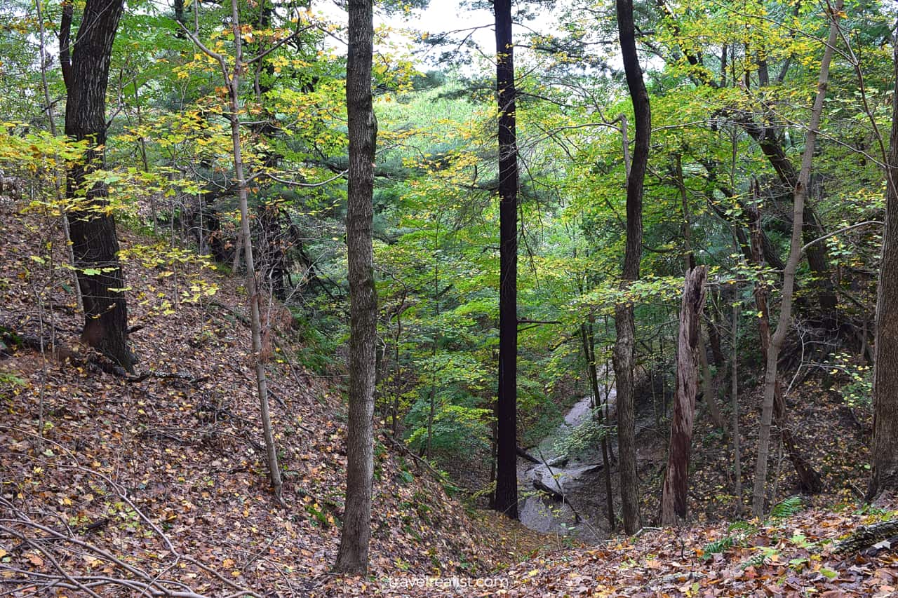
Starved Rock is a park known for its canyons, rivers, creeks, waterfalls, and trails. Together with the nearby Matthiessen State Park, Starved Rock is a perfect destination for a fall day trip from Chicago.
This post includes affiliate links that will earn us commission if you make a purchase via these links.
Sights & Places of Interest
Sandstone canyons are the main attraction at both Starved Rock and Matthiessen State Parks. While you need a car to reach these parks, you have to hike to see their full beauty.
Together, these parks have 27 miles of hiking trails. These trails are split almost evenly between Starved Rock and Matthiessen State Parks.
This Starved Rock Trails Guide discusses hiking trails and sights in both parks in detail.
Starved Rock State Park
There are 13 miles of hiking trails in Starved Rock State Park. You could use a couple of trail maps to plan your hiking adventure in Starved Rock.
You could choose between River Trail, Bluff Trail, and a handful of Canyon Trails.
- River Trail: a 2-mi (3.2-km) out-and-back route with 177 ft (54 m) in elevation gain.
- Bluff Trail: a 3-mi (4.8-km) out-and-back path with 2 sections and 164 ft (50 m) in elevation gain.
- Canyon Trails: 7 trails of 8 miles (13 km) in total length.
The first two trails run parallel to the Illinois River. Their trail names are quite descriptive. Just see their naming convention and decide for yourself.
The River Trail brings you right to the river bank, exactly as its name suggests. The Bluff Trail goes at higher elevations, further away from the river.
The Interior Canyon Trails are out-and-back trails that bring you inland. Some of them also serve as connecting trails.
The River and Bluff Trails start in the Western part of the park, near the Visitor Center. Most Canyon Trails are in the eastern part of Starved Rock. But there are a couple of trails near the Visitor Center.
You will likely hike on parts of all three trails at Starved Rock without even knowing it. This is true even if you take just a short hiking trip to Starved Rock State Park.
The next section of this Starved Rock Trails Guide will walk you through the sights near the Visitor Center.
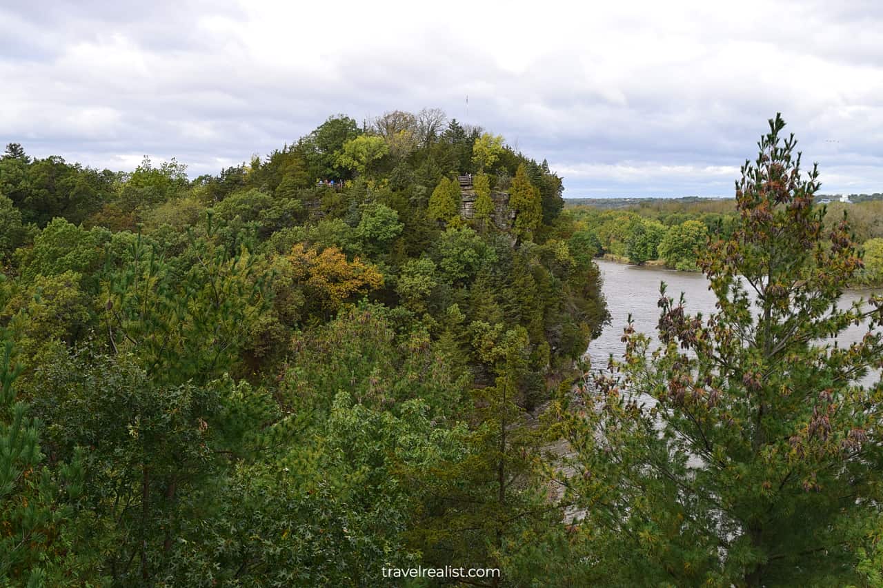
1. Starved Rock
A hiking trip to Starved Rock State Park starts from the Visitor Center Parking Lot for most visitors. It should not take you long to reach the signature formation of this park.
You will arrive at Starved Rock in about 10 minutes from the Visitor Center. Starved Rock is on the Canyon Trail. This 0.5-mi (0.8-km) trail has 82 ft (25 m) in elevation gain.
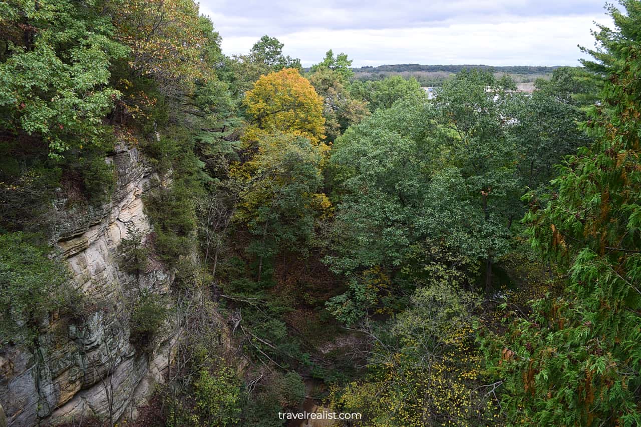
A wooden path circles around Starved Rock. Tall trees surround the path from both sides. They have largely outgrown the viewpoints. It is a bit challenging to see Plum and Leopold Islands from this trail.
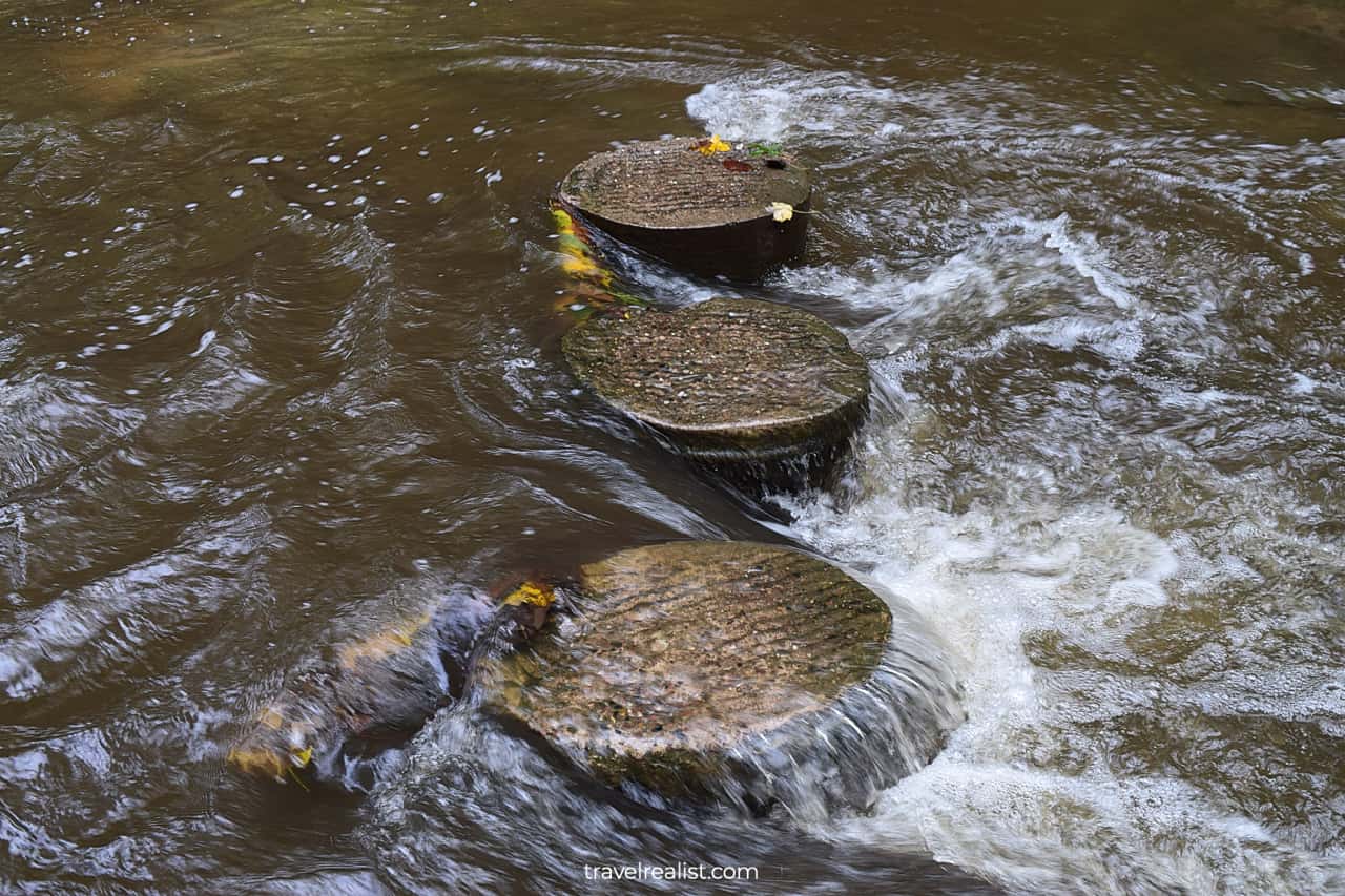
The views are a little clearer from the viewpoint facing Lover’s Leap. You could see Starved Rock Lock and Dam on the Illinois River. Both played a role in reversing the Chicago River flow.
2. Pontiac Canyon
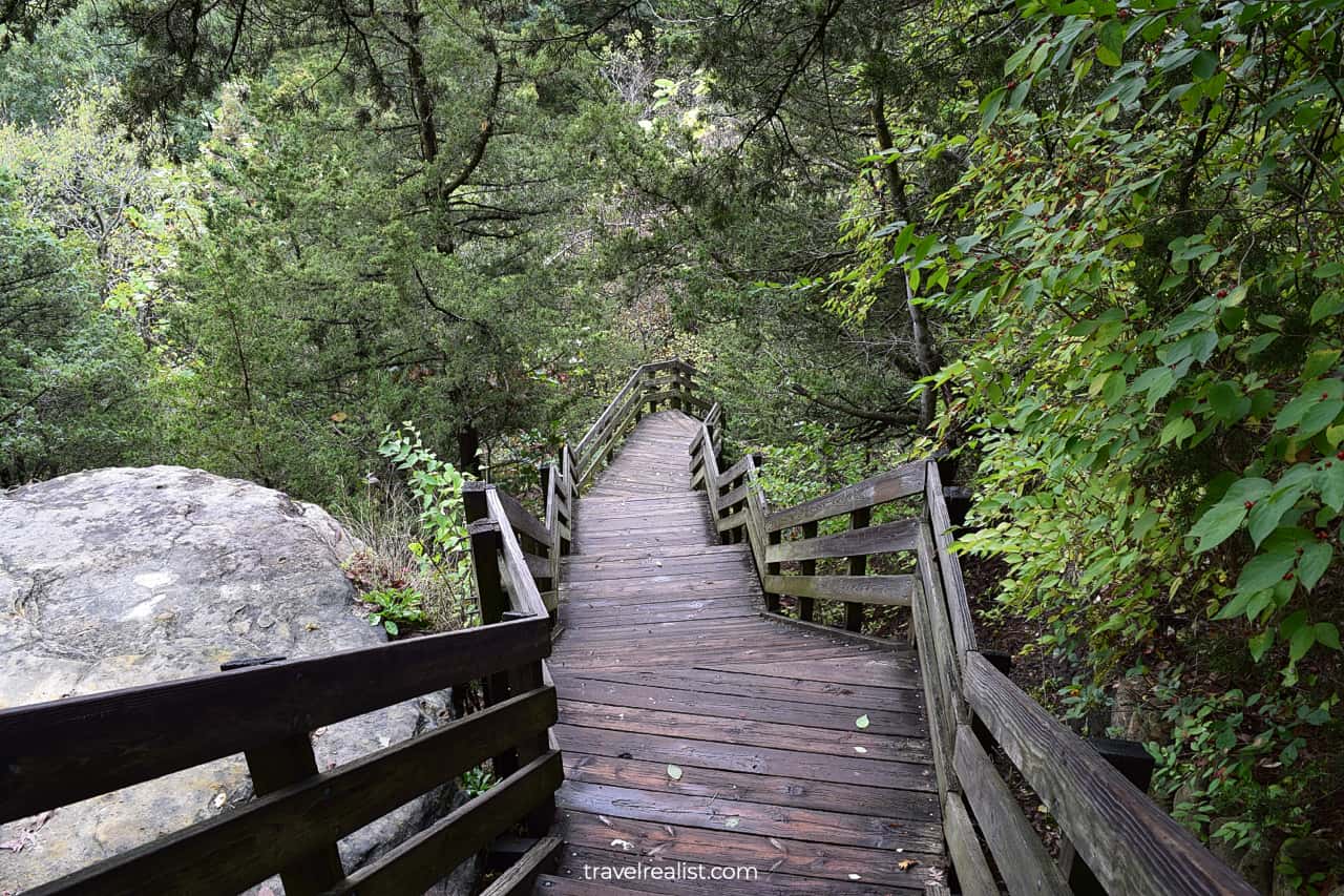
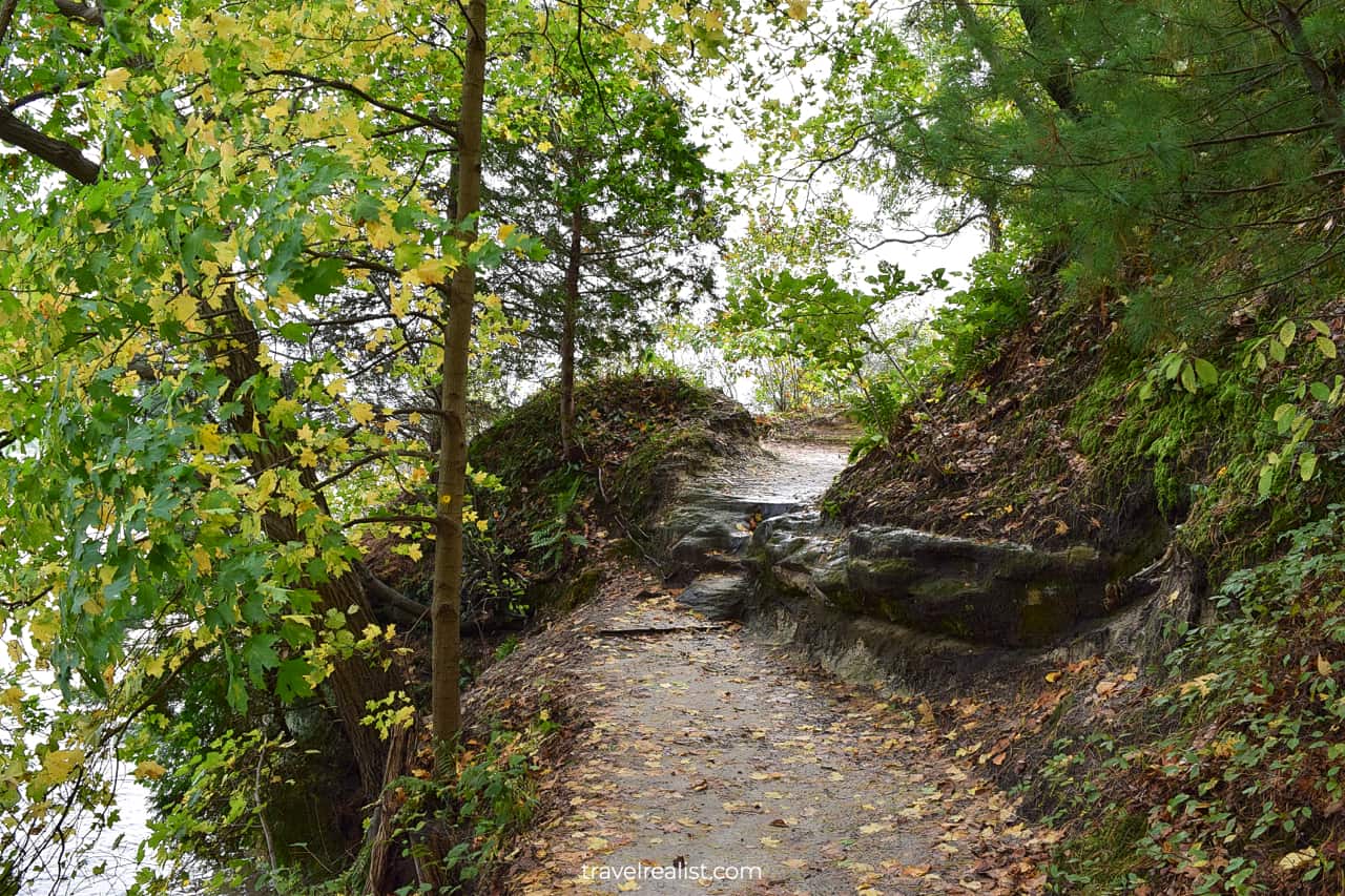
It is a good idea to switch to the River Trail next. This trail has four viewpoints close to one another. This 0.6-mi (1-km) trail section has 121 ft (37 m) in elevation gain.
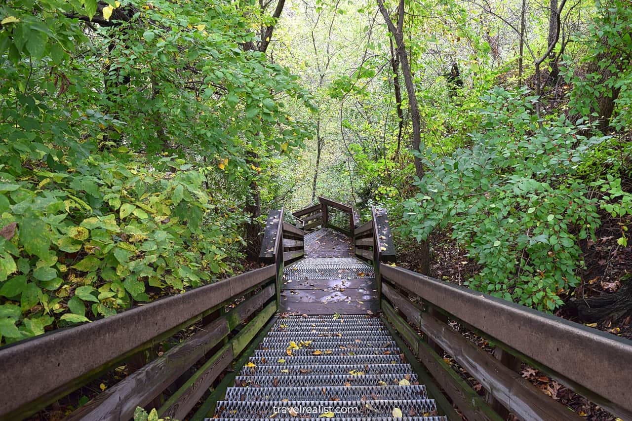
Get ready to go up and down the wooden stairs and boardwalks. These boardwalks are a real highlight of Starved Rock State Park.
The first viewpoint is at Pontiac Canyon. It pales in comparison to other canyons in Starved Rock. But you could see the formations right from the boardwalk.
3. Lover’s Leap
You could reach the Lover’s Leap Overlook in about 15 minutes from Starved Rock. A hike from Pontiac Canyon is about 4 minutes. Lover’s Leap is a good viewpoint to see Leopold Island.
This island is shaped like a heart. It might have given the viewpoint its name. But a few overgrown trees might stand in your way of enjoy these views.
These very same trees become an attraction if you visit Starved Rock in the fall. This park is one of the best places in Illinois to enjoy the fall foliage season.
4. Eagle Cliff
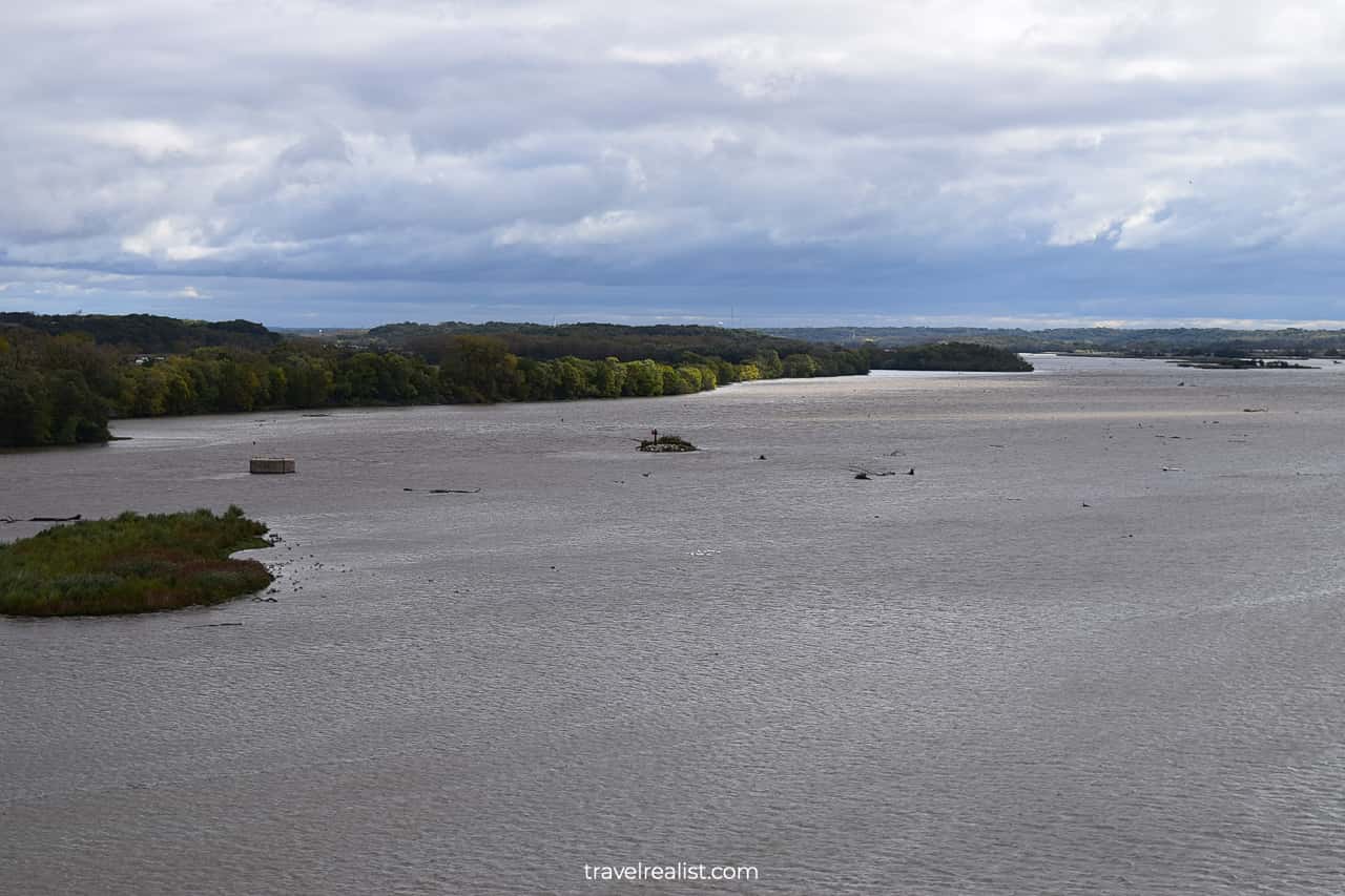
You might start to wonder whether all viewpoints at Starved Rock will have obstructed views. In this case, you are in luck. The next viewpoint on the River Trail will give you panoramic views.
The Eagle Cliff Overlook is a mere 0.1 miles (0.2 km) from the Lover’s Leap Overlook. But these viewpoints could not be more different. The Illinois River is on full display at the Eagle Cliff.
You could see for miles from this viewpoint. Enjoy the views of the countless small islands on the river. The eastern boundary of the park is near Delbridge Island, a bigger island visible from this viewpoint.
The Illinois River might flood after heavy rain. Keep this in mind if you visit Starved Rock State Park during the fall foliage season.
5. Beehive
The River Trail gradually loses 49 ft (15 m) over the next 0.3 miles (0.5 km). You will be almost at the river level by the time you reach the Beehive Overlook.
This viewpoint is an exception at Starved Rock. Its name has little to do with the views. There are no bees to see at this viewpoint. Instead, you will see the Illinois River from a forest.
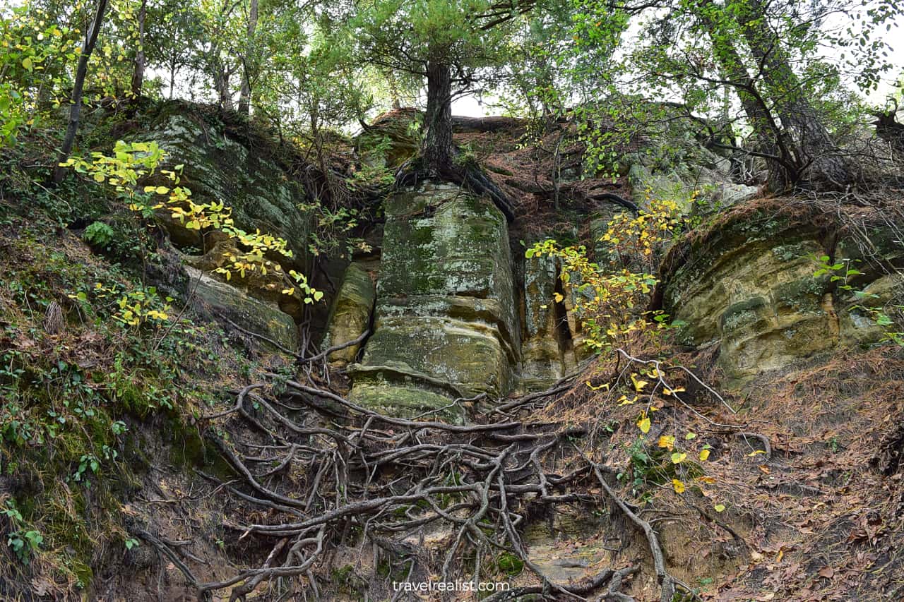
6. Sandstone Point
The River Trail becomes flat from this point onwards. Outside of a few brief sandy sections, this trail is very easy to follow. The kack of viewpoints is a trade-off for an easy hike.
There is little to see on this section of the River Trail outside of the Sandstone Point Overlook. You will see a tree with an exposed root system growing on and around the rock.
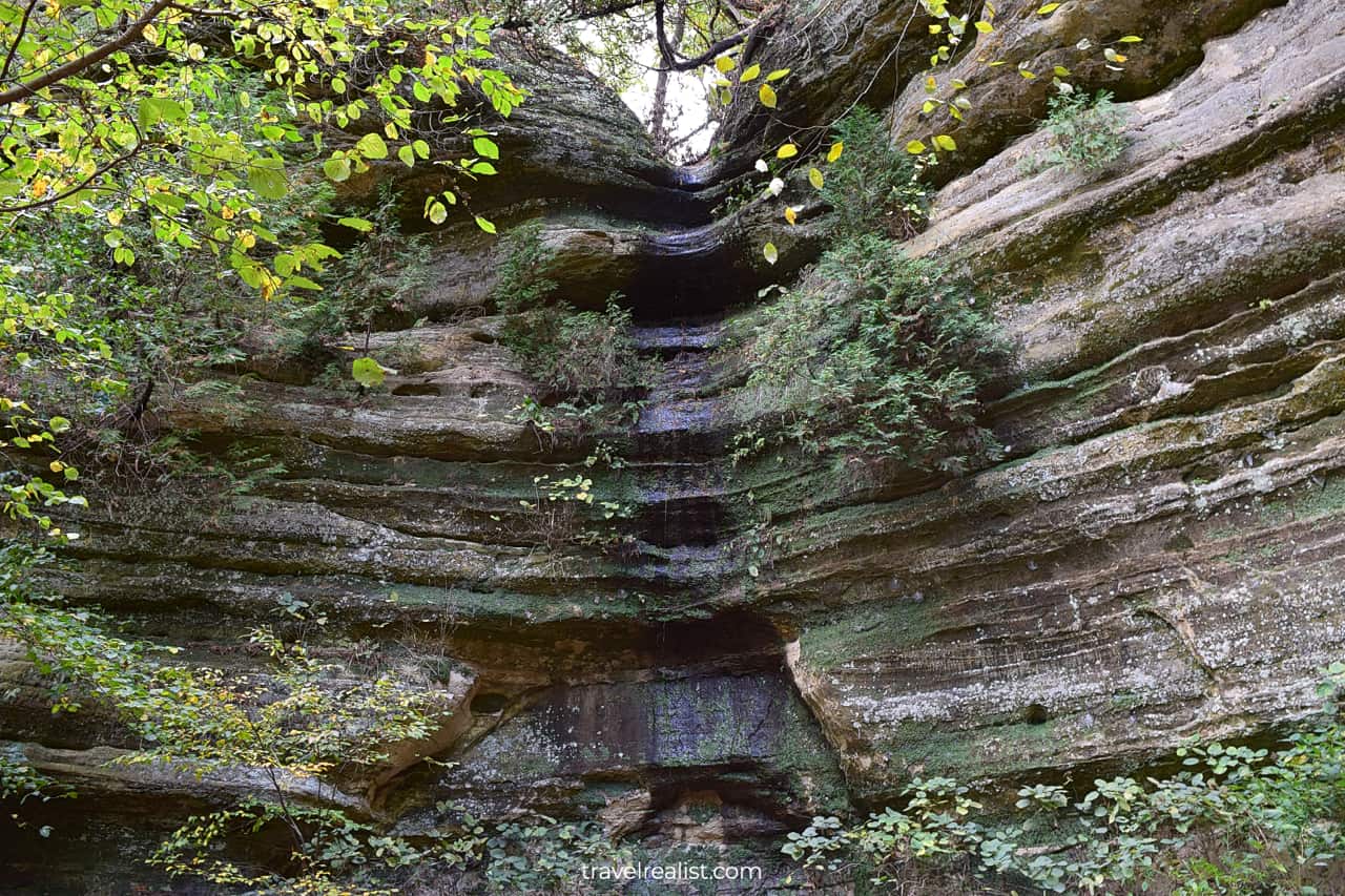
7. LaSalle Canyon
You could continue on the River Trail for another 0.8 miles (1.3 km). The River Trail will merge with the Bluff Trail around Owl Canyon. It could then bring you to the canyons in the eastern part of Starved Rock.
But you would need to hike all 13 miles of trails at Starved Rock on the same day. Unless this is your plan, there is an easier way to explore Hennepin, Ottawa, Kaskaskia, and Illinois Canyons.
In this case, you need to return to the Visitor Center via the Bluff Trail. You could then drive to the Parkman’s Plain, Hennepin Trailhead, Ottawa Canyon Trailhead, and Illinois Canyon Parking Lots.
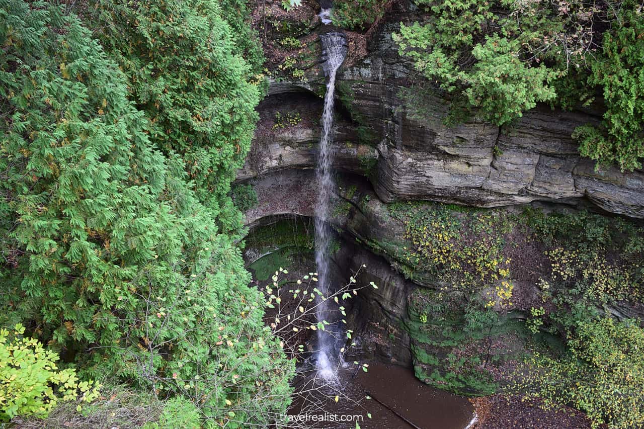
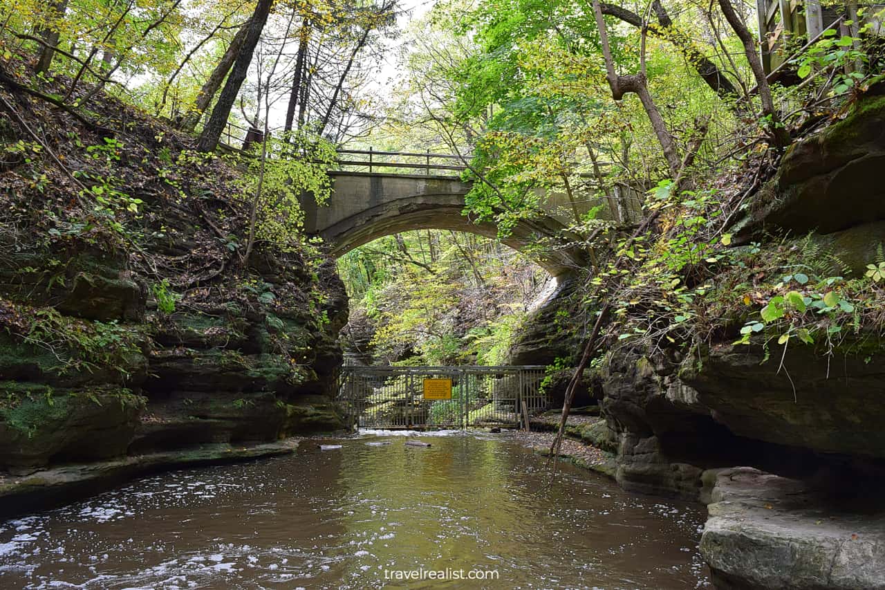
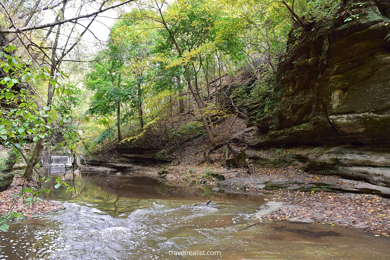
This way, you could still explore these ravines without taking the lengthy hikes. But before you head back, you should stop by LaSalle Canyon. This canyon has a beautiful waterfall.
Try visiting it in the spring or after a heavy rainfall. You will get the best views of a waterfall with a small grotto at the end of this canyon. Just be extra careful when hiking on slippery rocks.
8. Lonetree Canyon
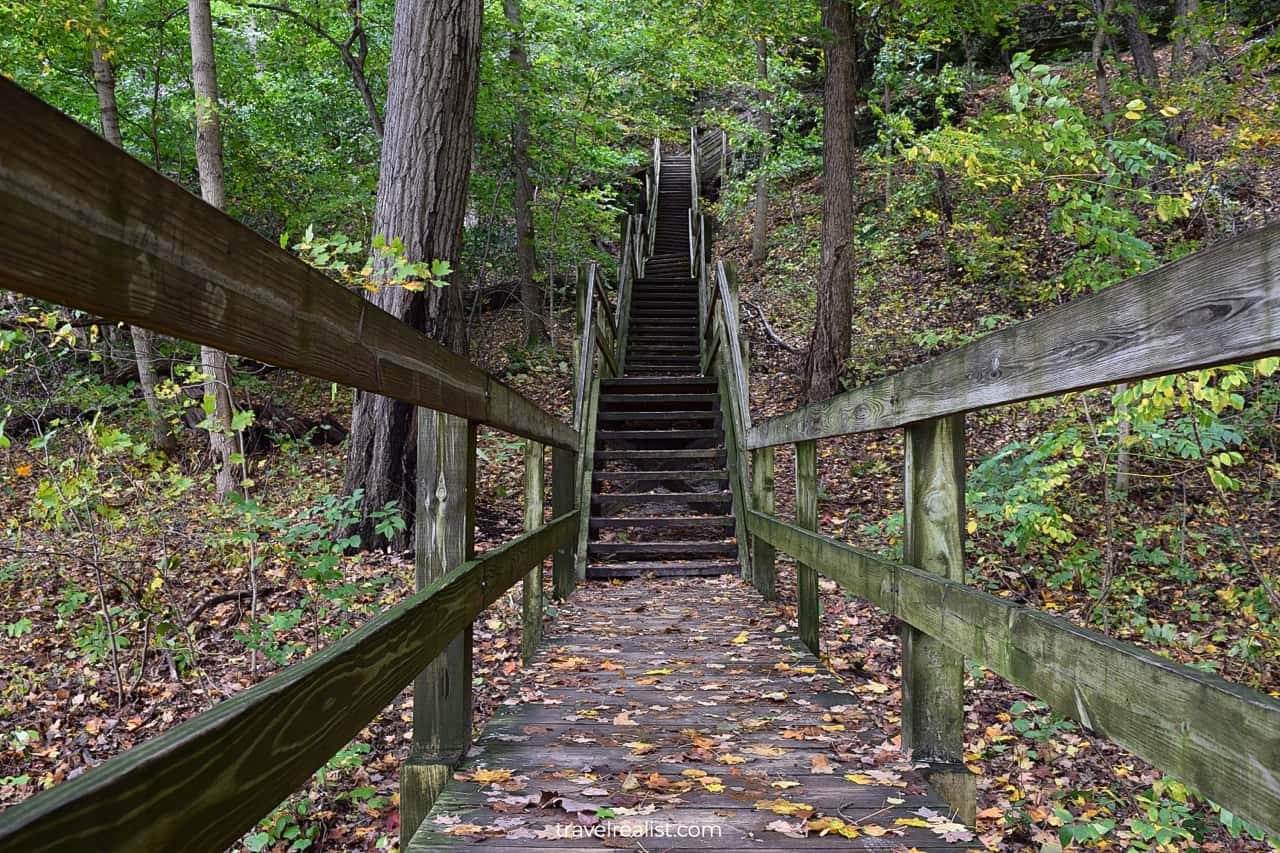
Regardless of whether you take an extra hike to LaSalle Canyon or not, you should not skip Lonetree Canyon. This canyon is on the Bluff Trail but near the River Trail.
You would need to take long wooden stairs from the river level. Get ready to gain 75 ft (23 m) in just 300 ft (91 m). Beautiful sandstone formations and trees will make the uphill hike a bit more enjoyable.
9. Basswood Canyon
This uphill section is the most strenuous part of the hike. But it is easier to handle the constant elevation gain and loss thanks to the wooden staircases.
The views also get better once you reach the bluff. You would see Sandstone Point and Basswood Canyon from above.
Both viewpoints have uneven surface and lack railings. Rocks, roots, and sand are a poor combination in rainy weather. Be safe and stay away from the edge.
10. Wildcat Canyon
The next 0.4 miles (0.6 km) towards the Visitor Center are a walk in the park. There is barely any elevation gain on this section of the Bluff Trail. The views are also far from breathtaking.
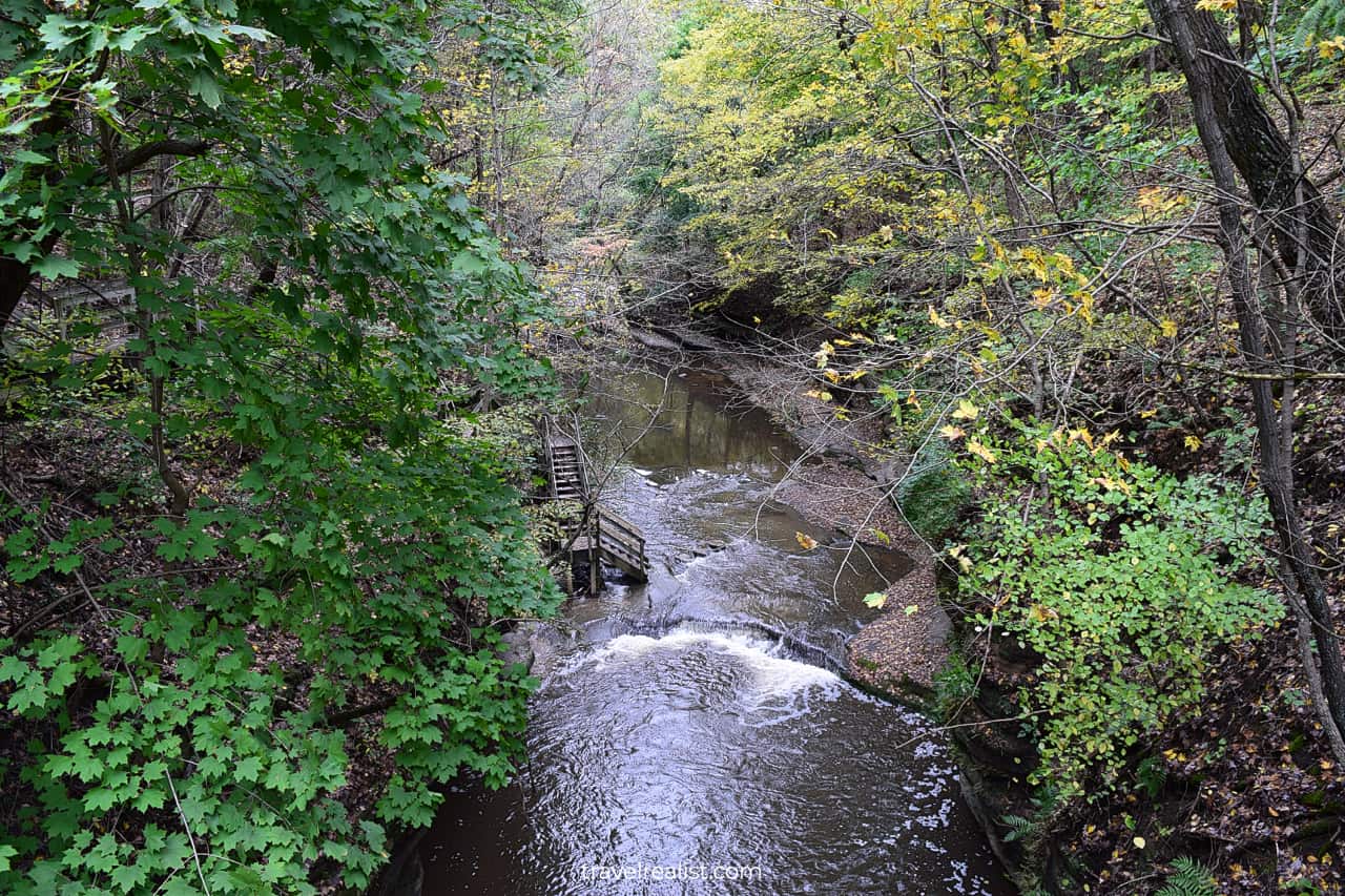
But it will all change once you reach Wildcat Canyon. This canyon is a major attraction in this part of Starved Rock State Park. There is even a proper observation deck.
You could see into this deep canyon without hiking to its floor. A beautiful waterfall drops from a creek into a ravine. It is easy to lose track of time admiring the scenery of Wildcat Canyon.
11. French Canyon
Crowds of hikers are the one thing that will bring you back to reality. Wildcat Canyon is at the intersection of all three trails in Starved Rock. It means that you have a few options after the viewpoint.
You could continue on the Bluff Trail, hike down to the Illinois River, or switch to the Canyon Trail. The Canyon Trail might be the best option. It brings you to French Canyon.
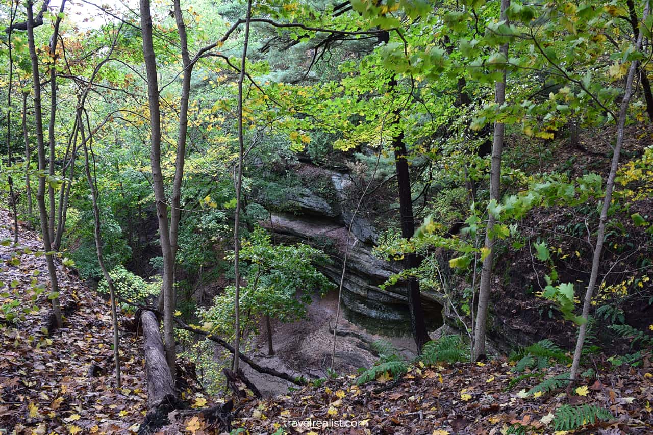
This canyon is one of the last sights near the Visitor Center. You would need to take a long and narrow path to reach French Canyon. As a result, it looks a lot like slot canyons in the Southwest.
It is hardly a surprise that Starved Canyon cannot rival Antelope Canyon, Valley of Fire, or Cathedral Gorge. But French Canyon is closest Starved Rock canyon to the most picturesque canyons in the USA.
12. St. Louis Canyon
You could take the Bluff Trail past the Visitor Center and Starved Rock Lodge. But Aurora Canyon, Sac Canyon, and Kickapoo Canyon are not the prettiest sights in Starved Rock.
On the other hand, St. Louis Canyon deserves your attention. It is the westernmost canyon in the state park. You could reach it by taking a 5-min drive to the St. Louis Canyon parking lot.
This way, you could take a shorter but more scenic Canyon Trail. The path has a lot of stairs and boardwalks. You will reach St. Louis Canyon Falls at the end of the trail.
If you decide to hike Ottawa Canyon or Illinois Canyon, you would also need to drive. But these canyons are on the other side of the park.
In fact, there are further away than trails in the Dells area of Matthiessen State Park. It could be a better idea to first hike some of the trails in the nearby state park.
The next section of this Starved Rock Trails Guide explores the trails in Matthiessen State Park.
Matthiessen State Park
Matthiessen State Park is a large park along the Vermillion River. There two park units, Dells and Vermillion River. Both units have trails and sights but hikers would find the Dells Area more rewarding.
The park has 5 miles of hiking trails and another 9 miles of multiuse trails. The latter trails are open to hikers, mountain bikers, and horseback riders. Cross country skiers use some of these trails in the winter.
There are three trails worthy of a closer look. There is one trail in each of the park units. The longer trail is a connector between the two.
- Dells Canyon and Bluff Trail: a 2-mi (3.2-km) loop with 206 ft (63 m) in elevation gain.
- Vermillion River Trail: a 2.3-mi (3.7-km) loop with 200 ft (61 m) in elevation gain.
- Dells Area to Vermillion River Area Trail: a 6.1-mi (10-km) loop with 603 ft (184 m) in elevation gain.
Each of these trails will keep you busy for a few hours. But Dells Canyon and Bluff Trail is the best option for any first time visitors to Matthiessen State Park.
13. Dells Canyon
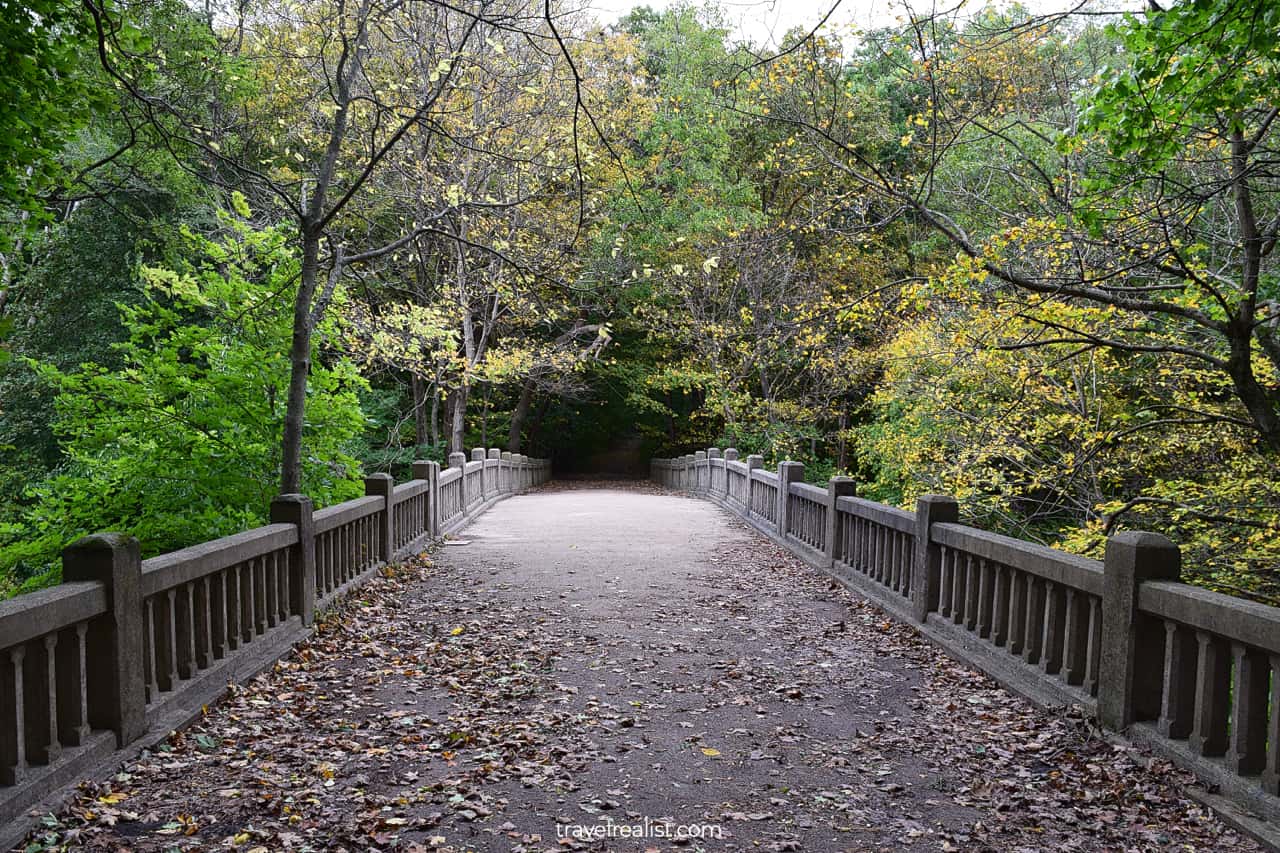
The hike to Dells Canyon starts from Matthiessen State Park Fort. You will first take a short connecting trail from the parking lot to the main loop.
You would then need to cross the bridge above Cascade Falls. Continue on the Bluff Trail on the other side of the canyon.
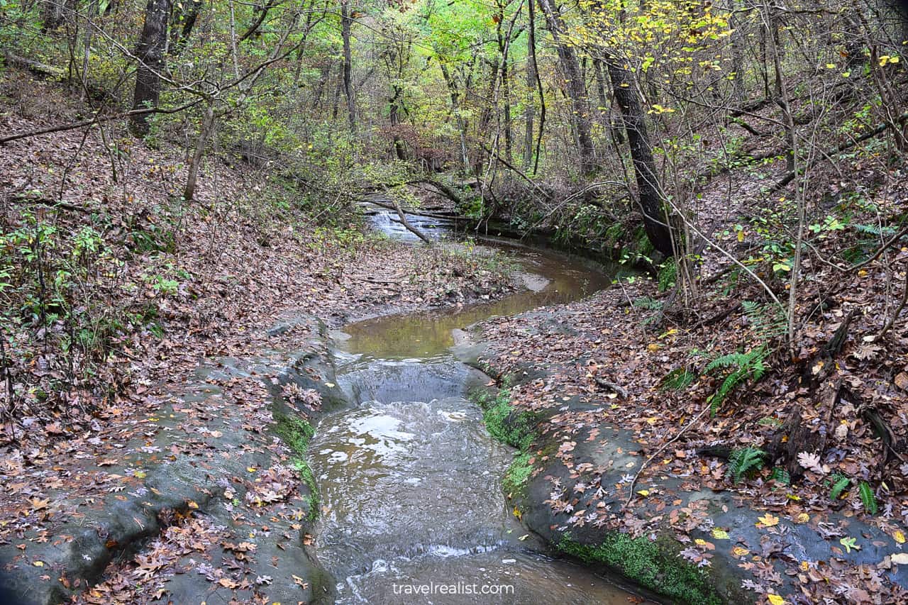
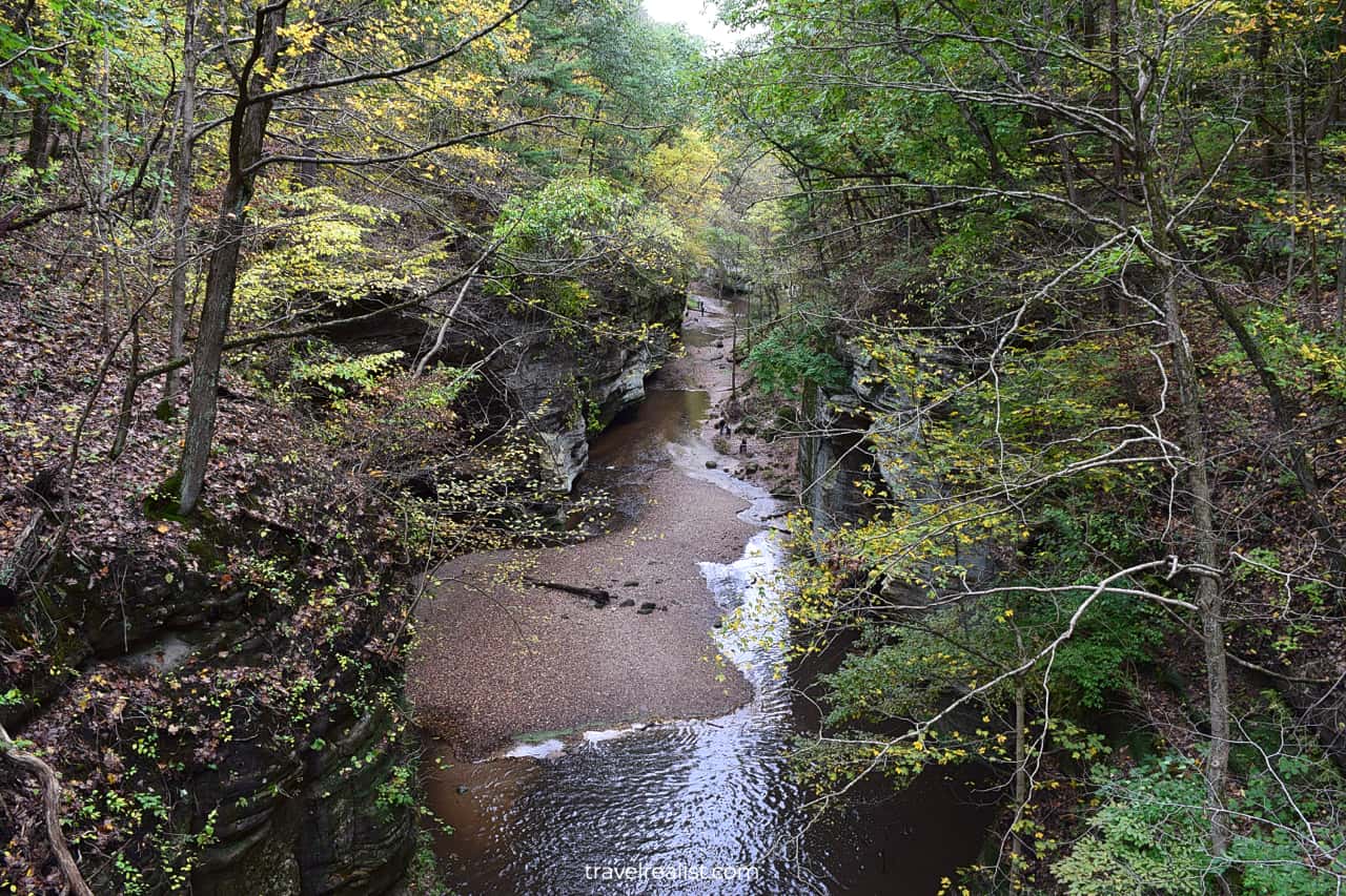
You will soon see a connecting trail. This downhill path brings you to the creek at the floor of Dells Canyon. This is a start of a picturesque Dells Canyon trail.
You should continue hiking this trail along the creek. Enjoy the views of Cedar Point, Giants Bathtub, and Lake Falls. The trail reenters the Bluff Trail loop near Lake Falls and Matthiessen Lake.
Of course, this is only true if the creek levels are low. Otherwise, you might have to cut your exploration short. The creek is often impassable after heavy rainfall. You would need to take the same path back.
14. Matthiessen Lake
You could still see a thing or two in Matthiessen State Park even if Dells Canyon is flooded. First, you could take the Bluff Trail to Matthiessen Lake.
The Lake Bridge Dam is right above Lake Falls. The bridge is very scenic in the fall. But you might not enjoy this area. The smell of the lake water leaves much to be desired.
15. Devils Paint Box and Strawberry Rock
You could continue the Bluff Trail Loop in either direction after Matthiessen Lake. The clockwise loop is a longer path. It is also less scenic.
The counterclockwise path will bring you back to the Cascade Falls Bridge. You will have an option to take a shortcut to the parking lot.
But there is a good reason to keep going south. The Bluff Trail will bring you to Devils Paint Box and Strawberry Rock. Both sights are near the southernmost point of the trail.
The former also serves as a gateway to the canyon floor. You could take a section of the Dells Canyon Trail all the way to Cascade Falls. Just check that the water levels are low enough.
The hike into the canyon is a downhill path. But you would need to take the same path on the way back. You will get a good look at the Strawberry Rock from that path.
Devils Paint Box and Strawberry Rock are next to the Connector Trail. You could hike all the way to Vermillion River Area. The river is quite scenic and resembles the Pedernales River in Texas.
But the other trails in both park units has few sights. You might not enjoy these trails if sightseeing is your primary reason for a visit.
In this case, it is best to return to the parking lot at Matthiessen State Park Fort. You might be hungry after a long day of hiking in Starved Rock and Matthiessen.
Drive to LaSalle or Ottawa. Haze Smokehouse and Uptown Grill are good options in LaSalle. B.A.S.H. Burger and Sushi House and Iniga Pizzeria Napoletana are worthy restaurants in Ottawa.
Continue with this Starved Rock Trails Guide. You will learn more about ways to get to the sights, entrance requirements, and places to stay.
Getting to Starved Rock
Starved Rock and Matthiessen are Illinois State Parks. The parks are in Northern Illinois near the towns of Ottawa, North Utica, and Oglesby.
Starved Rock is about 100 miles southwest of Chicago. Yet, it takes just 90 minutes to get there from the Chicago Loop. The park location next to Interstate Highways I-80 and I-39 is to thank for this travel time.
Starved Rock and Matthiessen State Parks are just 4 miles of one another. You could get to Matthiessen in under 10 minutes from Starved Rock.
Both parks have rivers and canyons. Starved Rock is along the southern bank of the Illinois River. Matthiessen is on the eastern bank of the Vermillion River, a tributary to the Illinois River.
This location makes picking Chicago area airports a no-brainer decision when visiting Starved Rock. Chicago Midway (MDW) is slightly closer than Chicago O’Hare (ORD) unless you take toll roads.
If Chicago does not work out, you could fly into St. Louis, Missouri (STL) or Indianapolis, Indiana (IND). But you are looking at 3.5+ hours of driving to Starved Rock.
A car or a rental is a must when hiking the trails at Starved Rock. It is by far the easiest way to reach the park. Your public transport options are quite limited.
Where to Stay near Starved Rock
There are plenty of places to stay near Starved Rock and Matthiessen State Parks. You could find one that works with your budget and preferences.
Starved Rock has a hotel right in the middle of the park. If staying next to the trails is a must for you, book a stay at Starved Rock Lodge. This historic lodge charges a premium. Still, it often sells out.
You should not worry if the lodge is sold out during your dates. Staying a little further away from the park could bring sizable savings.
There are a handful of places to stay in Oglesby, Peru, North Utica, and Ottawa. The last town has the best selection in the area.
Take a look at Holiday Inn Express & Suites – Ottawa, an IHG Hotel or Hampton Inn Ottawa – Starved Rock Area. Both hotels are excellent choices within a 15-minute drive from the park.
You could also look for a place to stay along Interstate Highway I-80. Morris, Minooka, and Joliet offer you plenty of choices.
If no nearby place to stay works out, you could always stay in Chicago. The third largest city in the United States has an astonishing variety in hotels and vacation rentals.
Entrance Requirements & Passes
Starved Rock State Park is open from 7 a.m. to sunset. The Visitor Center is open from 9 a.m. to 4 p.m. every day except for public holidays.
You could hike in Matthiessen State Park from 7 a.m. to sunset. This park does not have a visitor center. You would need to rely on advance research for planning a trip to Matthiessen.
The parking lots in Matthiessen State Park shut down once they reach capacity. That often happens around 11 a.m. on weekends. The parking lots do not reopen until 3 p.m.
This system is far from ideal since it makes planning challenging. Visit Matthiessen before 11 a.m. or after 3 p.m. to increase your chances of getting into the park.
Starved Rock and Matthiessen State Parks do not charge admission fees. In fact, you could visit most Illinois State Parks free of charge.
There are a few exceptions to this rule. You should expect to pay entrance fees at Lake Michigan beach parks and Wildlife Prairie Park.
Takeaways: Starved Rock Trails
Starved Rock and Matthiessen State Parks are good destinations for a hiking trip from Chicago. You could see some of the most scenic canyons in the Midwest in these parks.
With 27 miles of trails in Starved Rock and Matthiessen, you will find a handful to satisfy your hiking spree. If you visit these parks in the fall, you could catch amazing fall colors.
The hiking trails at Starved Rock follow a few simple patterns. You should not get lost if you remember a couple of things:
- Trail Posts have different colors for each trail: red (River), brown (Bluff), and green (Canyon).
- Yellow Dots mean that you are hiking away from the Visitor Center Parking Lot.
- White Dots mean that you are hiking to the Visitor Center Parking Lot.
Matthiessen State Park has less straightforward navigation. This park also depends far more on the creek water levels. You might not be able to hike Dells Canyon if it rained recently.
If this is your first trip to the area, you should start your hiking adventure in Starved Rock. But take the Dells Canyon Trail in Matthiessen if you could only hike one trail in both parks.
Starved Rock and Matthiessen are not the prettiest state parks in the United States. But they have nice sights and do not charge entrance fees. It makes them good destinations for outdoor enthusiasts.
These parks are worth a trip if you are in Chicago and have a car. You would also need at least 6 hours to explore the trails at Starved Rock and Matthiessen.
Skip these parks right after or during heavy rains. You might find some trails and attractions flooded or impassable.
Take a look at this Starved Rock Trails Video Guide. And visit the YouTube channel for the latest videos.
Frequently Asked Questions
You could start your hike at a few trailheads in Starved Rock State Park.
– Park at the Visitor Center to hike to French Canyon, Starved Rock, and Wildcat Canyon.
– Drive to the St. Louis Canyon parking lot to hike this canyon.
– Park at Owl Canyon, Hennepin Canyon, Ottawa Canyon, or Illinois Canyon trailheads if they are your main destination. Each of these canyons has its own parking lot trailhead.
There are 13 miles of hiking trails in Starved Rock State Park.
You can hike the trails at Starved Rock State Park between 7 a.m. and sunset.
– Start your Starved Rock hike at the Visitor Center.
– Take the Canyon Trail to Starved Rock.
– Switch to the River Trail to Eagle Cliff.
– Take wooden staircases at Lonetree Canyon.
– Enjoy waterfall views at Wildcat Canyon.
– Drive to St. Louis Canyon parking lot and take the trail.
– Drive to the eastern park section to see Owl Canyon, Ottawa Canyon, and Illinois Canyon.
Starved Rock is a 100-mile or a 90-min drive from the Chicago Loop.
There are 5 miles of hiking trails and 9 miles of multi-use trails in Matthiessen State Park.
Matthiessen State Park is open from 7 a.m. to sunset. The parking lots often reach capacity on weekends. If that happens, the park closes around 11 a.m. and reopens at 3 p.m.
The Vermillion River is in Matthiessen State Park.
Safe realist travels!