Zion: A Guide to Best Stops on 3 Scenic Drives

This realistic Guide to Zion Scenic Drives helps you to plan your next adventure in this national park.
Zion is a park of red cliffs and canyons. The park has three scenic drives that bring you through the amazing areas.
This post includes affiliate links that will earn us commission if you make a purchase via these links.
Sights & Places of Interest
Zion National Park has three scenic drives and a handful of hiking trails. The park has three units.
- Zion Canyon is the most popular area of the park. You have to take a shuttle on its scenic drive.
- Kolob Canyons and Kolob Terrace both offer amazing views with much smaller crowds.
Zion Canyon Scenic Drive
The first part of our Zion Scenic Drives Guide will focus on the Zion Canyon Scenic Drive. There are a few sights to explore on this 16-mi (26-km) out-and-back drive.
You could stop at the Angels Landing, Weeping Rock, the Narrows, and Temple of Sinawava. Most of the sights on the Zion Canyon Scenic Drive require hikes to enjoy.
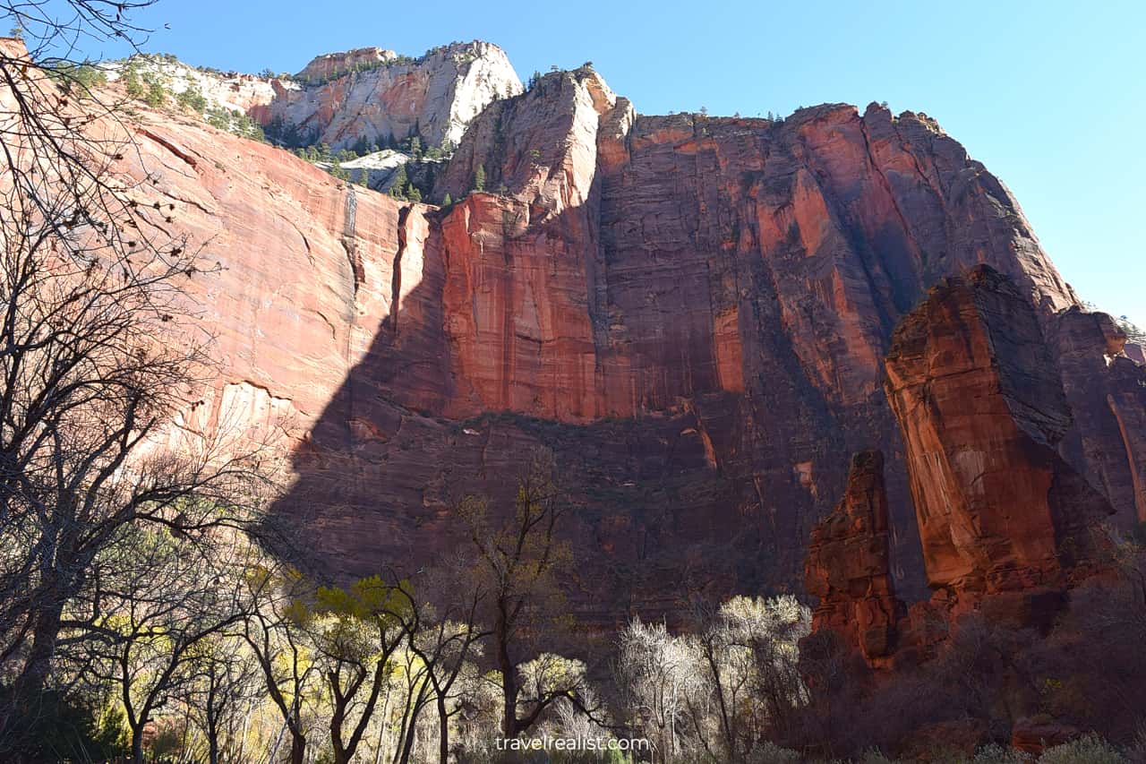
Temple of Sinawava
It is a good idea to drive to the end of the Zion Canyon Scenic Drive first. It does not matter if you drive your car or take a shuttle.
This way, you could get a feel for the different viewpoints. You could then pick the stops that are worth further exploration. You could stop there on your way back.
This advice becomes even more topical if you take a shuttle. If you exit at the first few stops, you might have to hike a few miles.
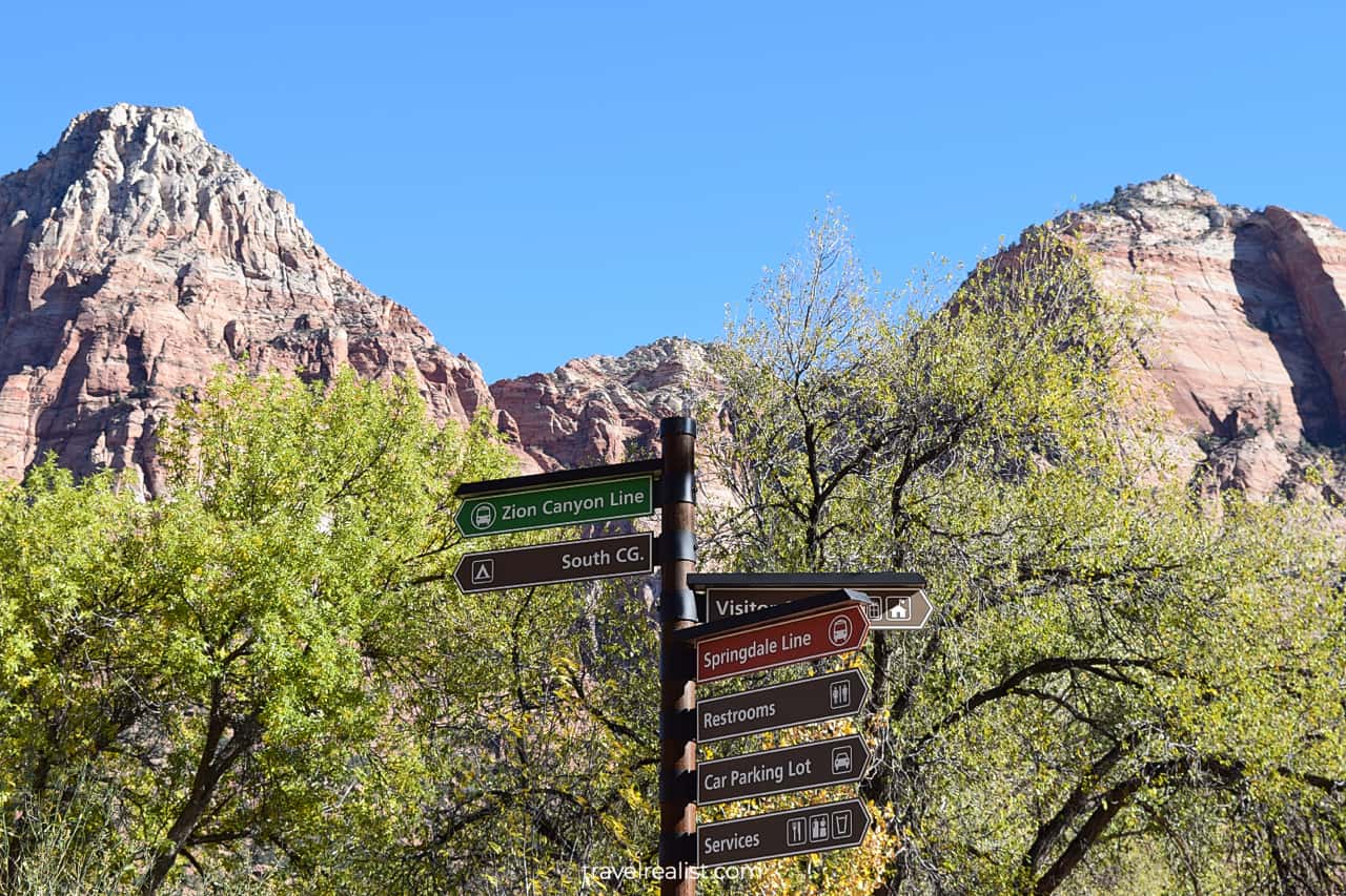
The shuttles are full when they depart from the Visitor Center. There might not be a spot for you on the next shuttle into the park.
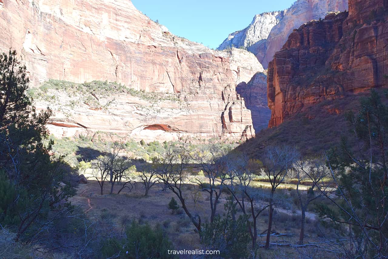
Most visitors go to the Angels Landing and the Narrows. The Narrows hike starts at the Temple of Sinawava. It is also the last stop on the Zion Canyon Scenic Drive.
Riverside Walk
The Narrows hike is a strenuous 8.9-mi (14.3-km) trail. You will gain almost 700 ft (213 m).
But it is not the elevation that makes this hike challenging. You would have to wade in the Virgin River for most of the hike. The park closes the trail whenever the water level is too high.
If you visit Zion in late fall, winter, or early spring, the water level could be too high. But even if the trail is open, you might not want to wade in cold water.
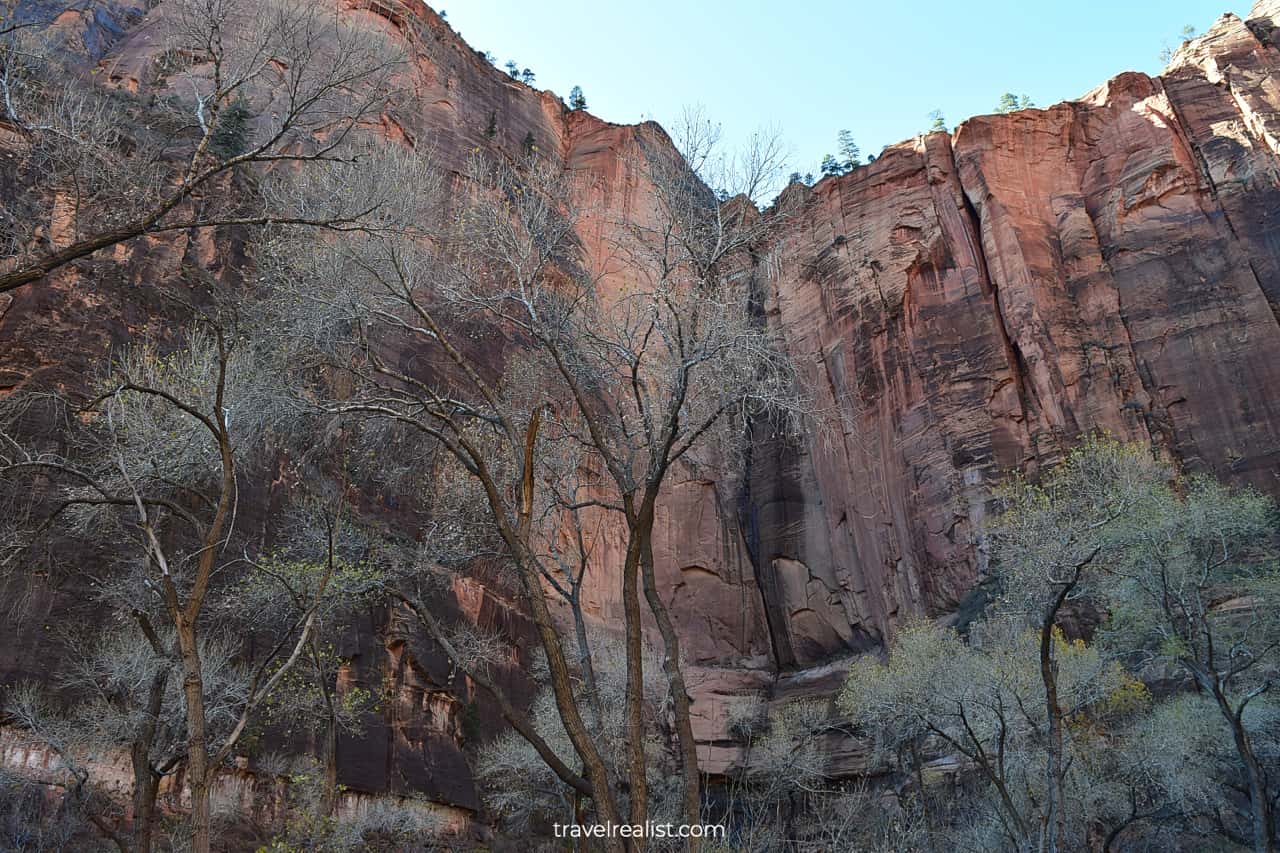
Nobody could blame you. You might want to take a much less demanding Riverside Walk instead.
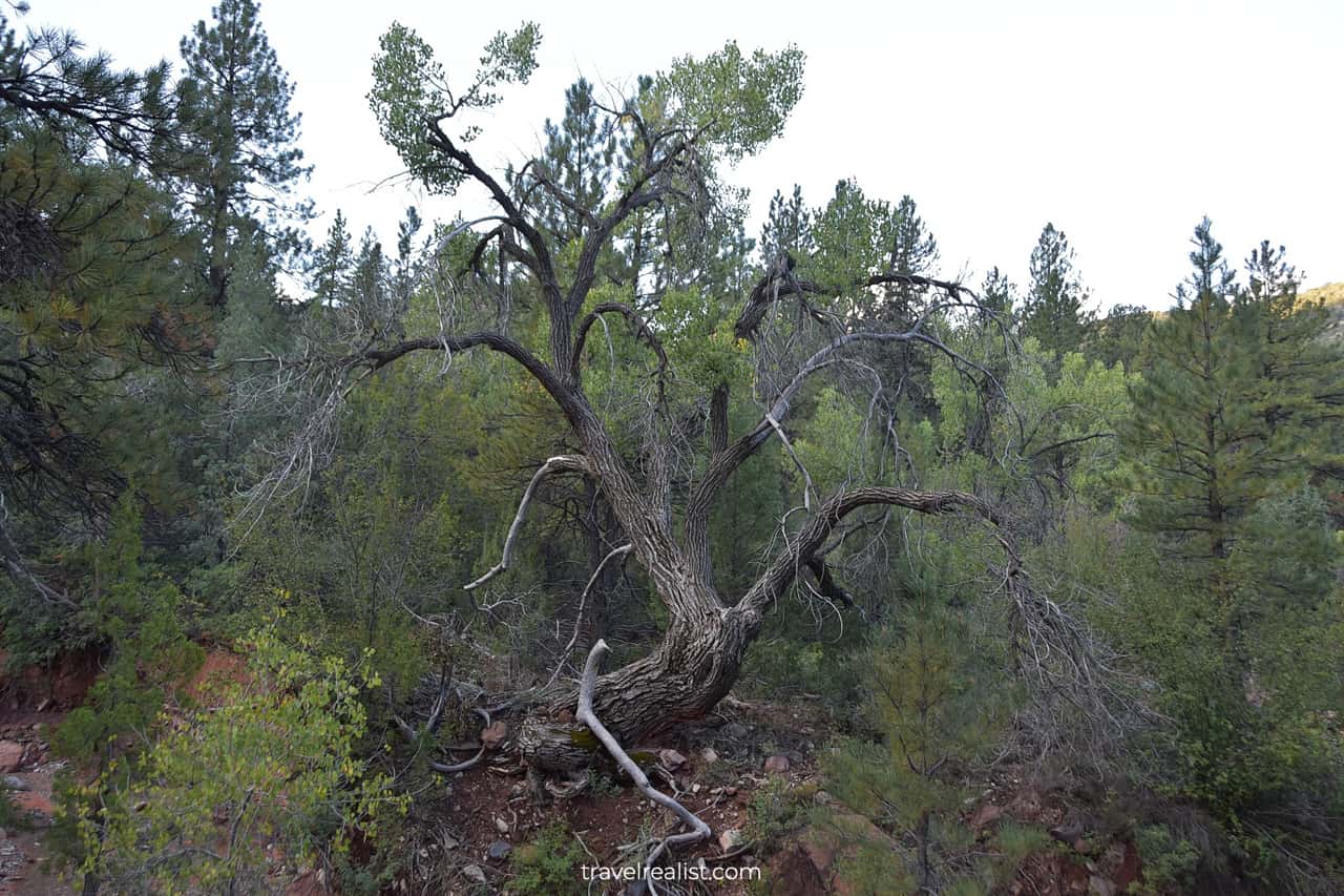
The walk has nice views. You can see the steep canyon walls. You will be walking in a small grove. It feeds of the moisture from the river.
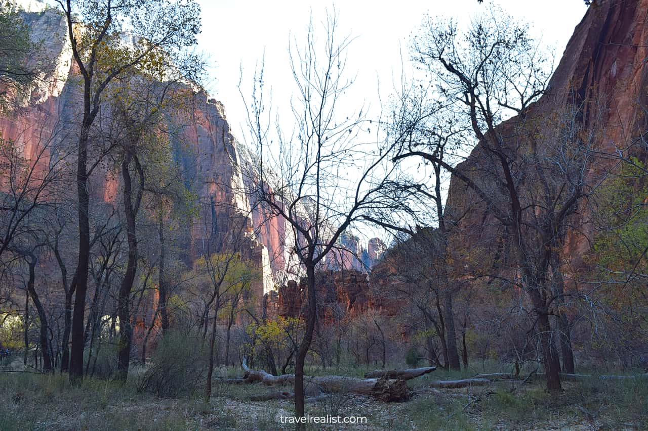
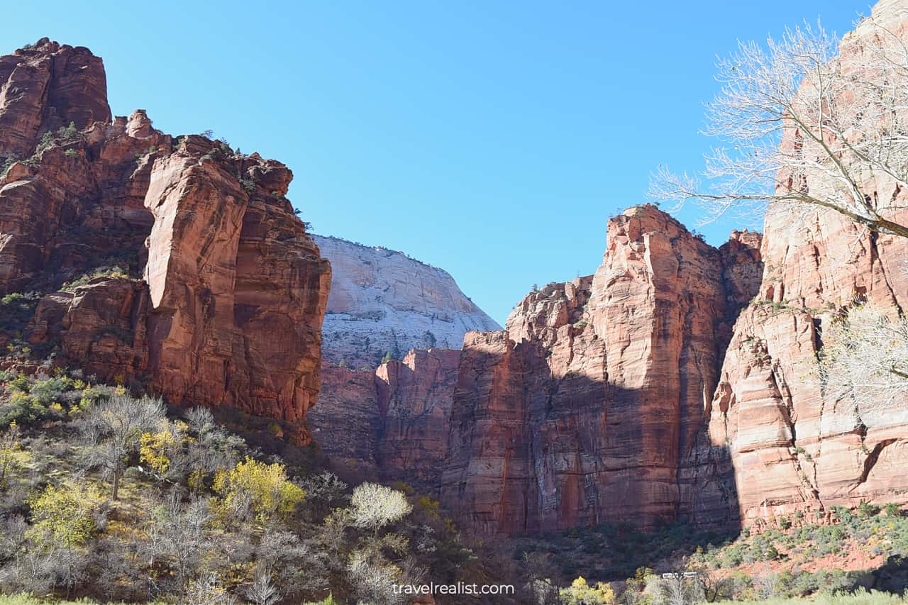
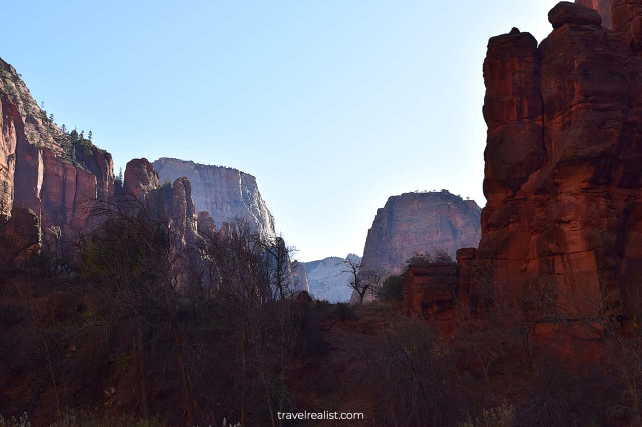
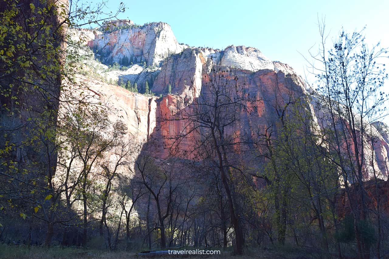
The top of the Zion Canyon consists of white rock. You will see red rock cliffs, white rock tops, and yellow or green leaves during almost any season.
These views look a lot like Capitol Reef and Bryce Canyon. These are two other of Utah’s Mighty 5 National Parks.
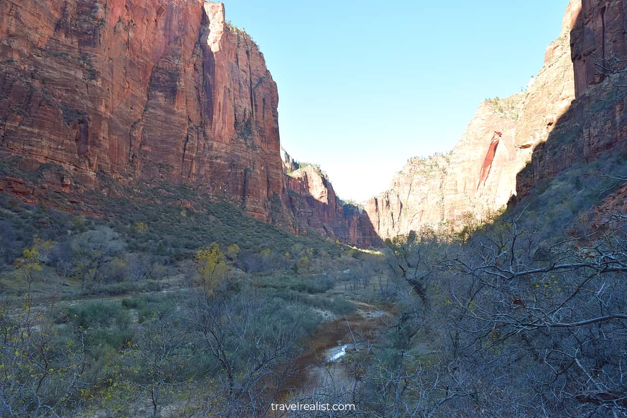
Big Bend Viewpoint
You can start the return part of the scenic drive after exploring the Temple of Sinawava area.
The Big Bend Viewpoint is a nice stop on the Zion Canyon Scenic Drive. It is the first shuttle stop on the way back.
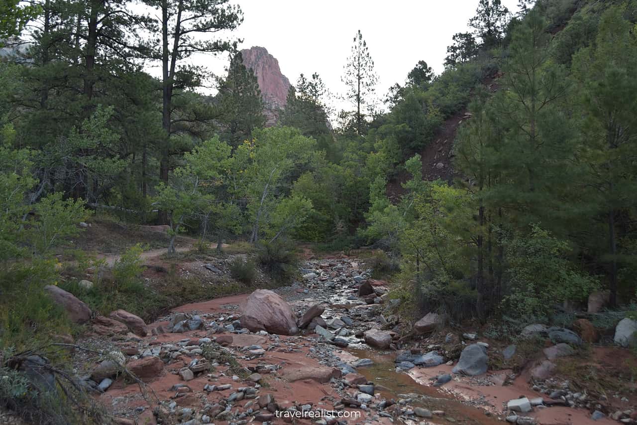
Virgin River
This viewpoint is a great place to catch the views of the Virgin River at the canyon floor. It is one of the few viewpoints in the park that does not involve hiking. There are no trailheads at this viewpoint.
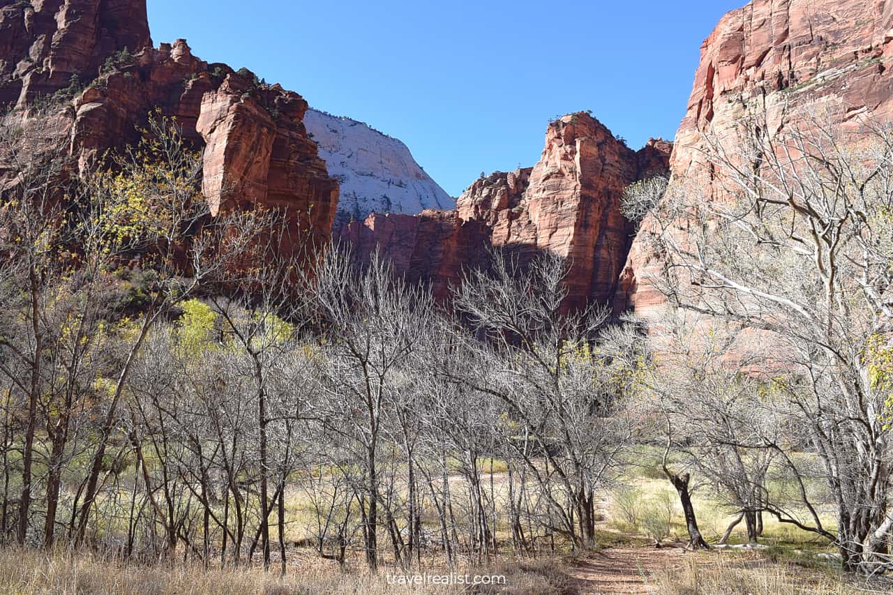
Weeping Rock
You might have to wait for the next shuttle for a while. To save the time you can walk along the Virgin River to the Weeping Rock Trailhead.
You will be hiking in a grove once again. The grove is beautiful during every season. Grass and bushes will make this area colorful long after the leaves fall.
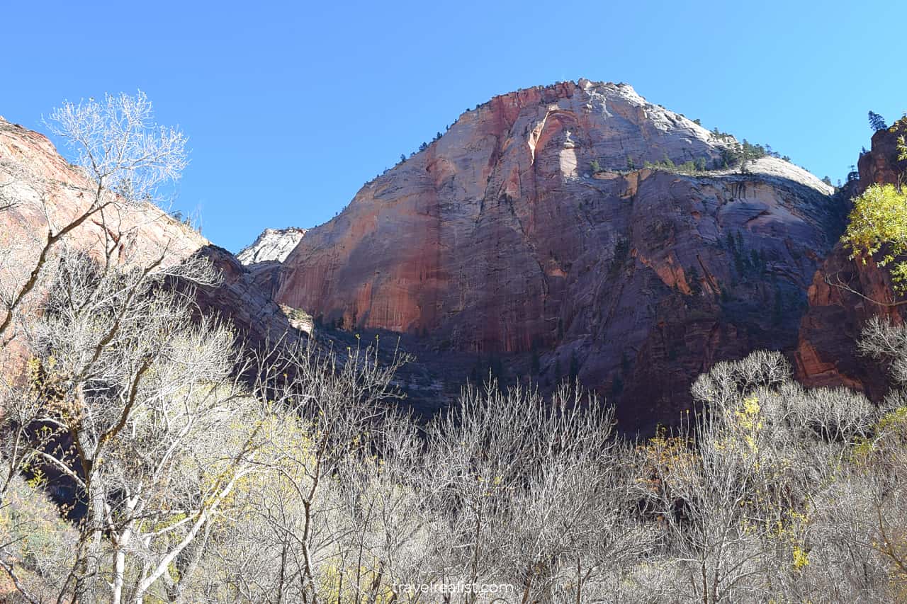
This stop is a starting point to many trails. You can hike the Weeping Rock, Echo Canyon, East Mesa, and East Rim. It is easy to spend a few hours on these trails.
You can hike the Weeping Rock Trail. It is a surprisingly easy hiking trail in Zion. It takes about 15 minutes to complete this 0.3-mi (0.5-km) trail.
While it is not a viewpoint, the level of effort is quite similar to one. Unless you hike to the Weeping Rock, you can explore this area in 5 to 10 minutes.
Board the next shuttle or hop in your car. You can enjoy the drive back to the Visitor Center.
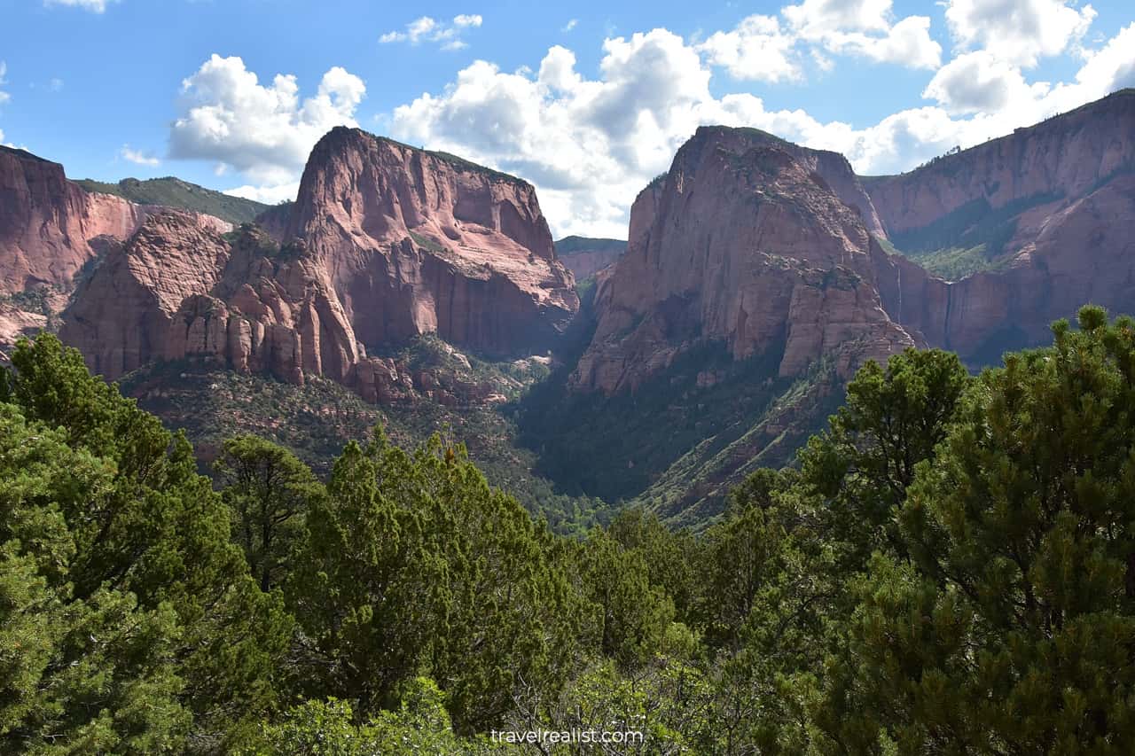
Kolob Canyons Road
This part of our Zion Scenic Drives Guide will focus on Kolob Canyons. There is a 10-mi (17-km) scenic drive in Kolob Canyons. It is an out-and-back drive.
You can explore this unit of the park in your car during the entire year. Well, except for cases of road damage from sinkholes.
Kolob Canyons has a more favorable location than Zion Canyon. This unit is just off Interstate Highway I-15. Still, it attracts far less visitors than the main unit.
This fact has some advantages.
- You do not need to take a shuttle to visit the unit’s sights.
- You can hike the trails without winning the park lottery.
Some parking lots in Kolob Canyons are small. It is still best to get there early if you plan on hiking. This way, you can guarantee a spot at a trailhead.
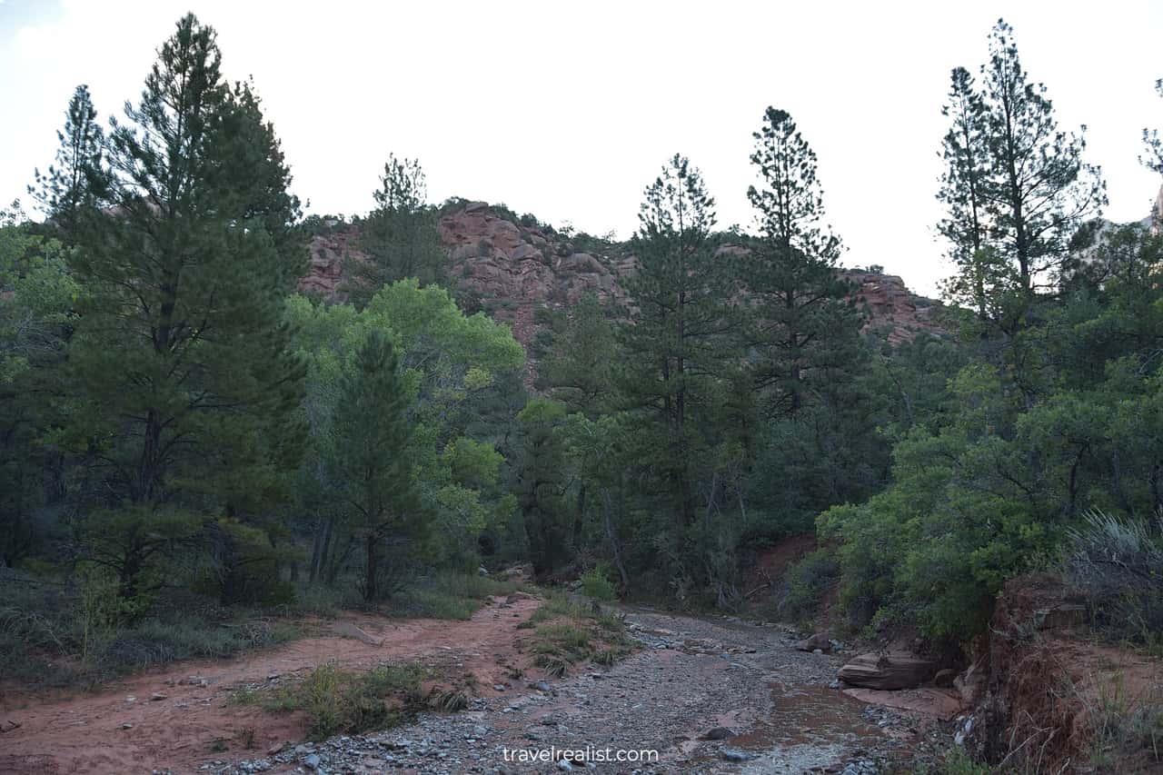
Taylor Creek Trail
The Taylor Creek Trailhead is the first stop on the Kolob Canyons Road. You would need to hike to get the most from this stop.
This section of our Zion Scenic Drives Guide will walk you through the Tailor Creek Trail. Jump to Paria Point if you just visit the park on a Scenic Drive.
Follow these tips to get a good parking spot.
- Arrive early.
- Turn left at the second pullout after the Visitor Center. This parking lot is right next to the trailhead.
- Take any open spot. The lot has room for just a few cars.
- Park at the nearby viewpoints if you hike this trail in the fall or on weekends.
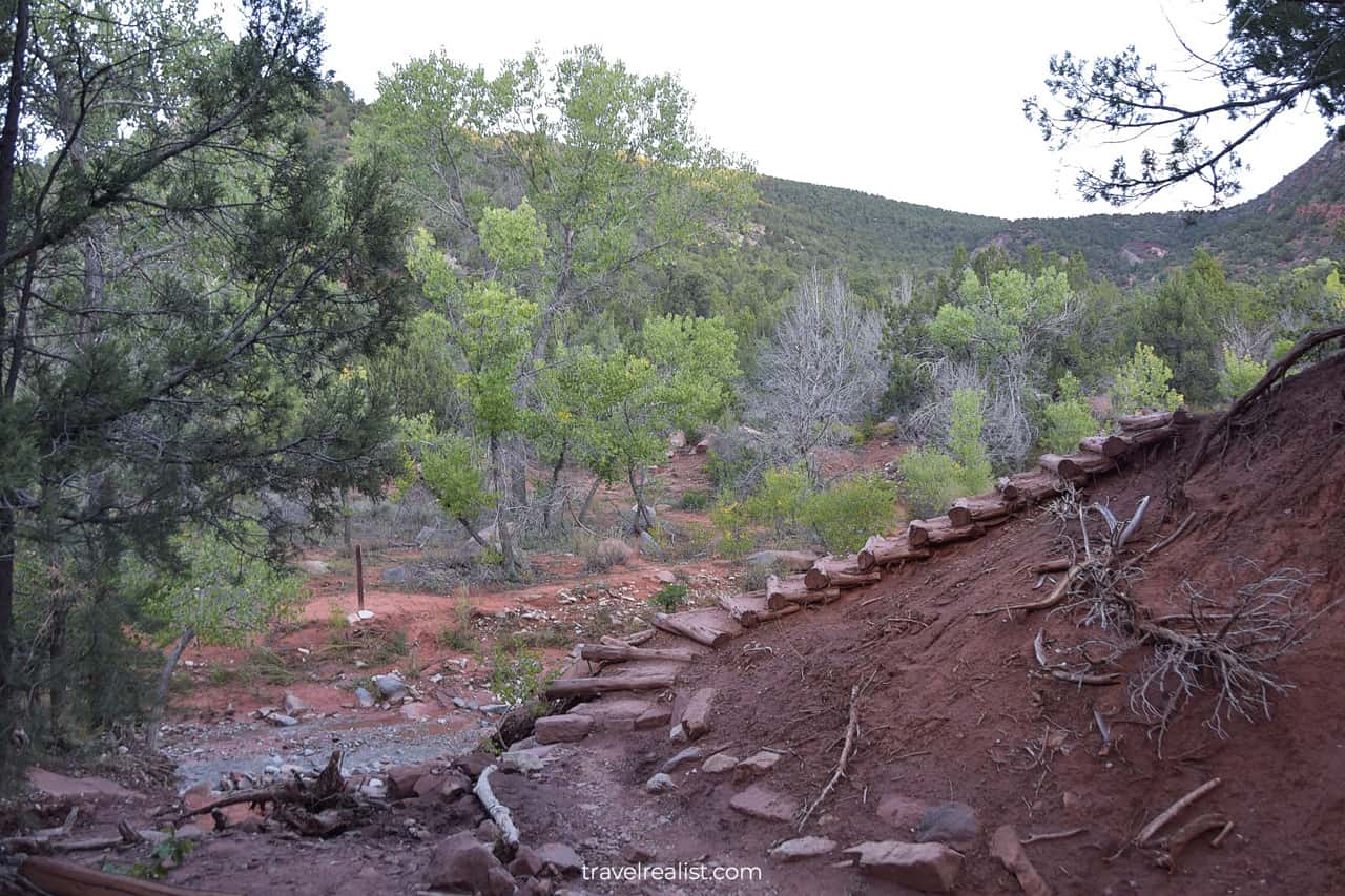
The Taylor Creek trail is a moderate out-and-back hike. You will cover 5 miles (8 km) round trip. The elevation gain is about 450 ft (137 m). Budget about 2.5 hours to finish the hike.
The trail starts with a steep downhill hike to the creek level. You will follow a set of wooden stairs. It is a good idea to wear a few layers if you hike early in the morning.
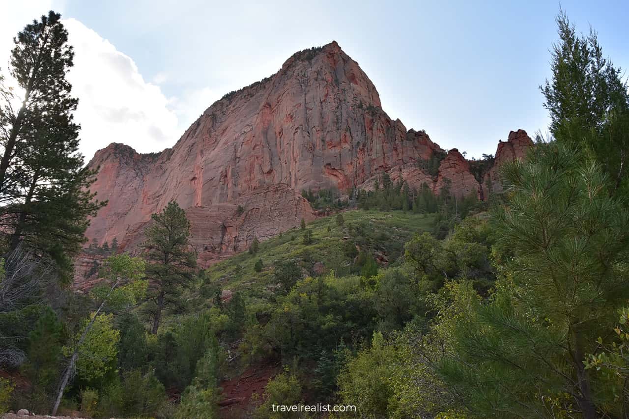
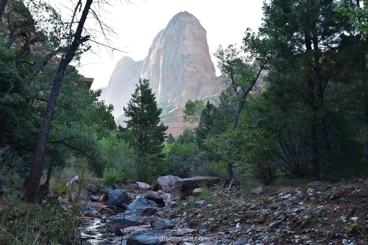
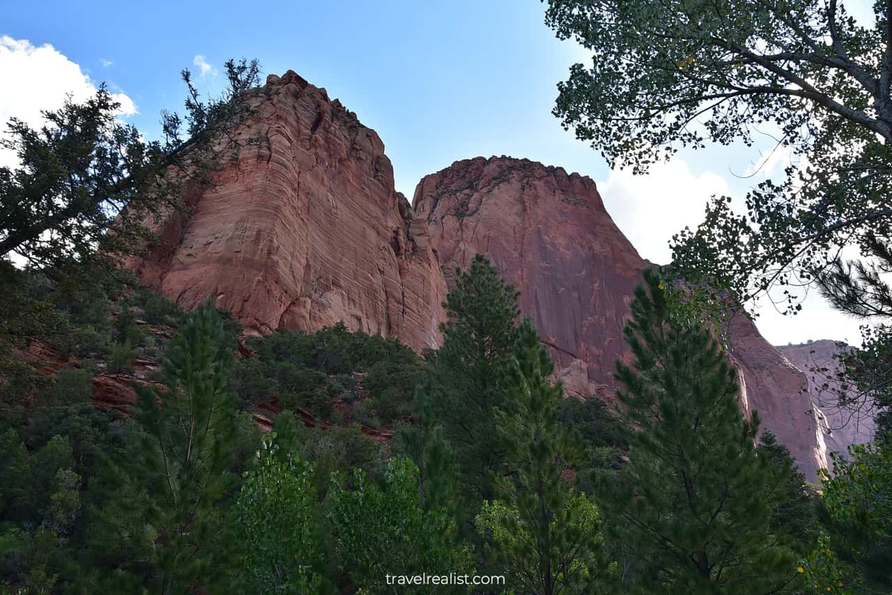
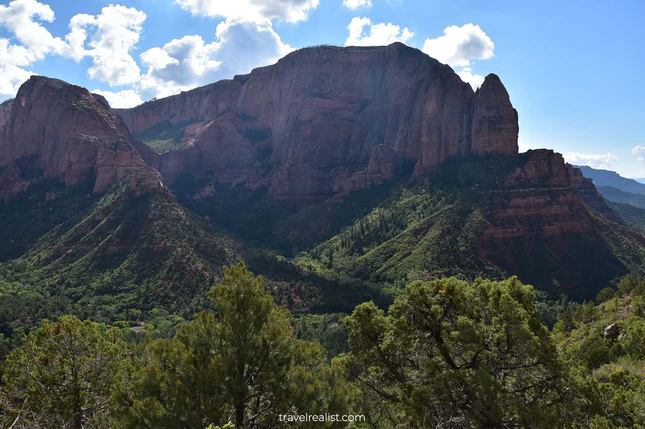
Horse Ranch Mountain
Once you finish the initial downhill section, you will get the first view of the Taylor Creek. The creek could have a lot or almost no water depending on the time of your visit.
But there is one thing you can count on. You will get great views of Horse Ranch Mountain in the distance.
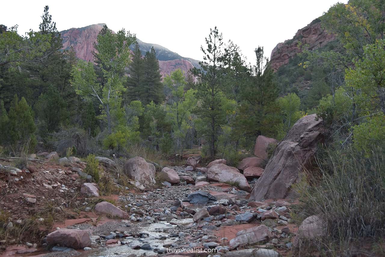
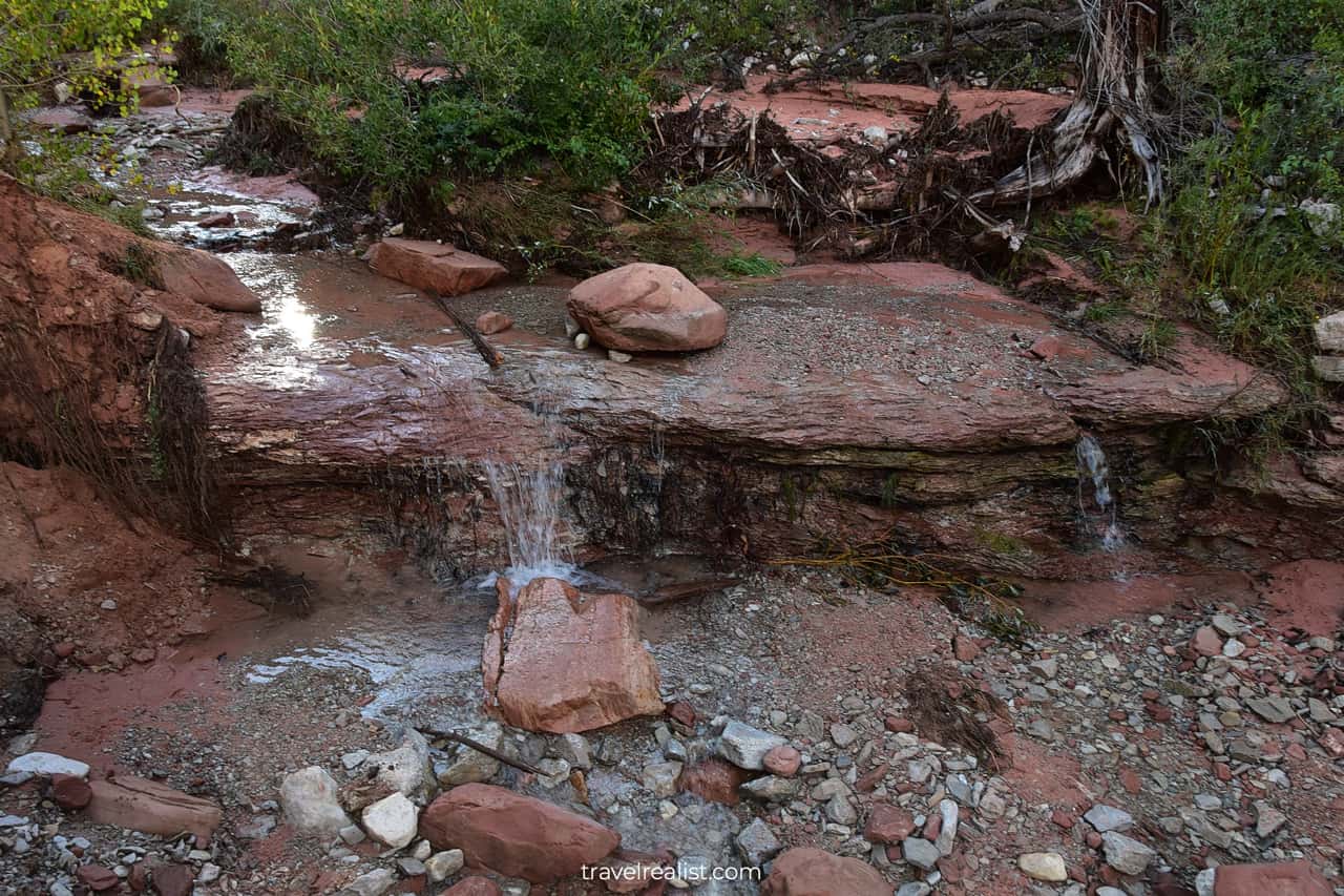
The trail follows the Taylor Creek for the entire duration of the hike. You would have to cross the creek a few times. You would often take the creek crossing, just to take one back a few minutes later.
It is easy to lose track of the creek crossings. There are over ten in total. Most of them involve minimal effort.
But do not get fooled by the low water levels. Washed-out roots and fallen trees suggest that the stream can be more powerful.
This could be a challenge if you are hiking after a heavy rainfall or during the snowmelt. The water levels will be much higher then.
Be careful even if the creek has barely any water. The rocks are still slippery. Take your time when crossing to the other side.
The trail goes from west to east. The rising sun presents a slight issue if you hike early in the morning. Bring sunglasses and a hat to make the hike more enjoyable.
You would also want to use sunscreen during the entire hike. There is some shade on this trail. But you will be in the sun most of the time.
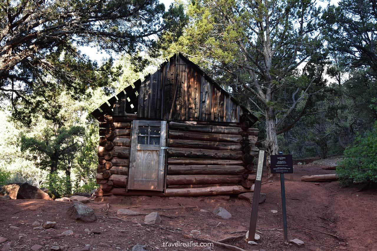
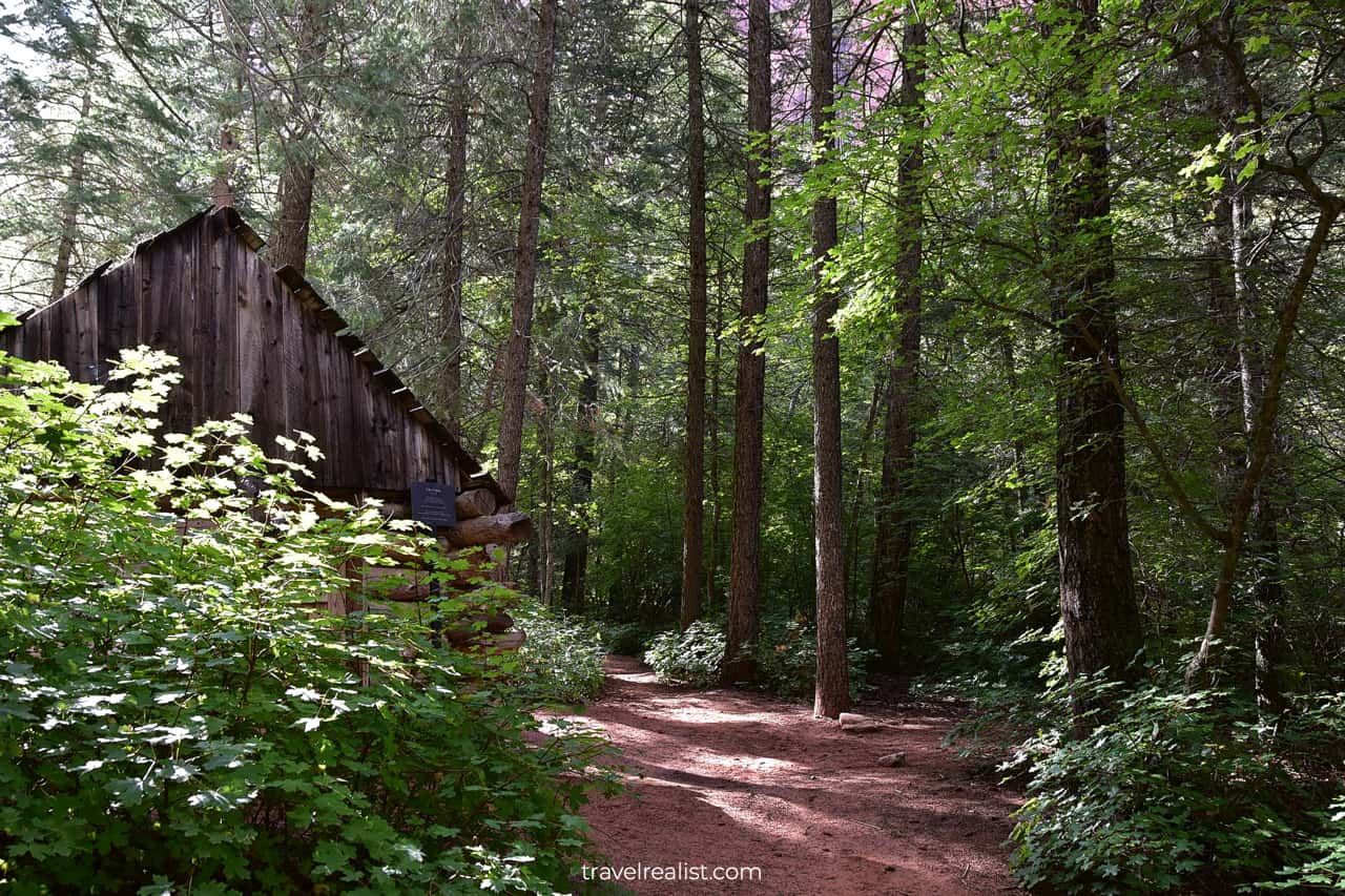
Larson Cabin
You will reach a historic log cabin. The cabin is at the confluence of the North and Middle Forks of the Taylor Creek. It is the first milestone on this trail.
The cabin belonged to Gustive Larson. Larson lived in this cabin in the 1930s. It was before this area became part of Zion National Monument in 1937. Kolob Canyons merged into Zion National Park in 1956.
Despite protection, the cabin is in need of repair and maintenance. You should only enjoy it from a safe distance.
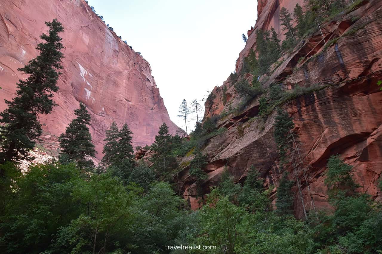
The Taylor Creek Trail continues along the Middle Fork after the Larson Cabin. This section of the trail has breathtaking views of the mountains and canyons.
You will hike through a lavish green forest along the creek. But do not forget to look up. You will see nearly vertical red cliffs. They consist of Navajo sandstone.
Together, red cliffs and green forest make a picturesque combination.
The creek crossings get more challenging in this section of the trail. Parts of the trail could be completely washed out.
In this case, you would have to think on your feet. Try to find an alternative route without getting your feet wet. Waterproof boots would help with this task.
Fife Cabin
The trail enters a forest. There are a few short uphill and downhill sections. You will see the Fife Cabin after one of the climbs.
Arthur Fife lived in this area around the same time as Gustive Larson. The cabin has a small plaque. Other than that, it is in dire straits.
The roof and walls are missing planks. Rainwater and snow get into the cabin during the winter. They slowly destroy it.
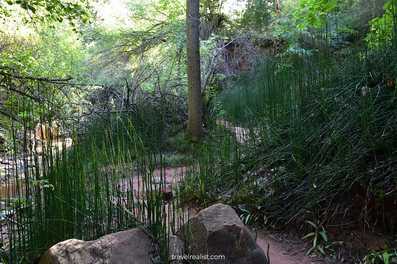
The trail will enter a few swampy areas right after the second cabin. These areas have very lush vegetation.
It is a good sign. It means that you are getting close to the source of the Middle Fork. You will soon reach a key milestone on this hike.
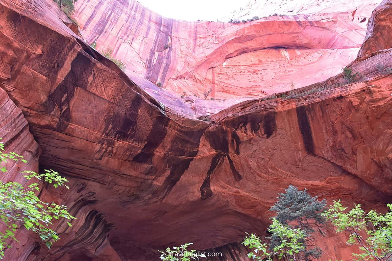
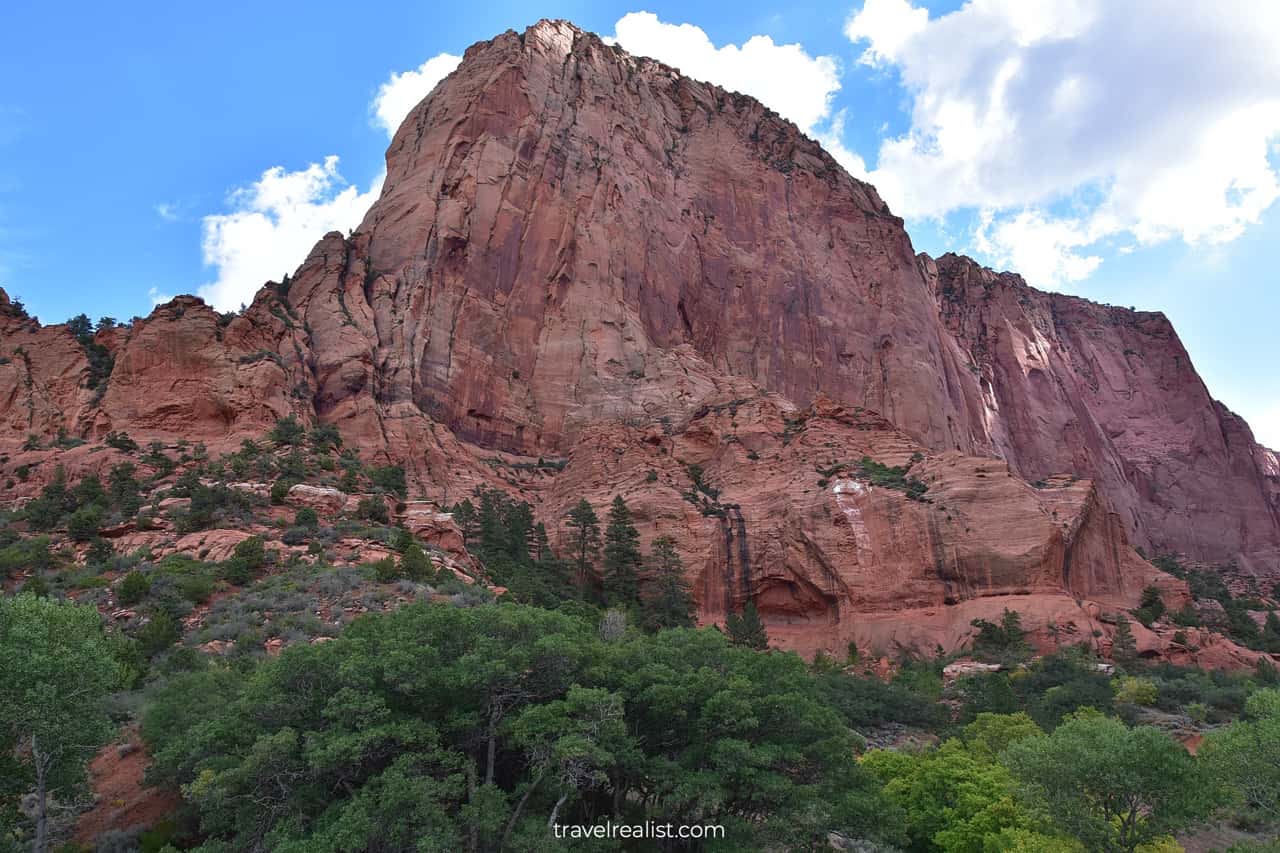
Double Arch Alcove
The Double Arch Alcove will be soon on full display. The name of this formation is very descriptive. You will see two natural arches, just as the name suggests.
The lower arch looks a lot like a small cave. There are trees and bushes growing in the lower arch.
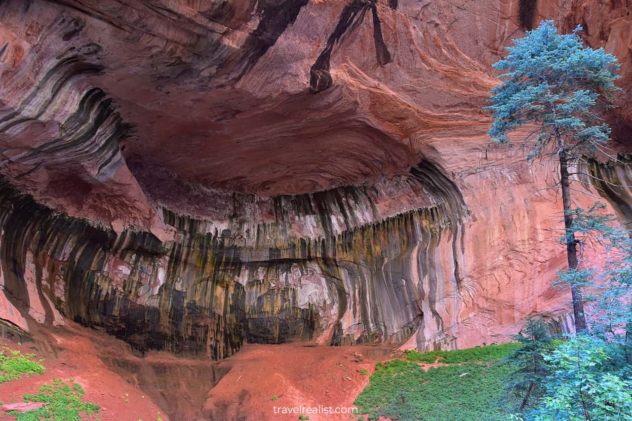
You would have to look up to see the second arch. It is several hundred feet (meters) above the first.
The Double Arch Alcove marks the end of the Taylor Creek Trail. You will have to follow the same path back to the parking lot.
It is best to take this trail early in the morning. There are a few reasons.
- You will get a trailhead parking spot.
- You can enjoy the Double Arch Alcove in solitude.
- Crowds of other hikers will arrive around 10 a.m. There will be a constant stream of people until quite late in the day.
Cold temperatures during the first part of the hike are the only downside for a morning visit. Layer up to enjoy both the journey and the destination.
Paria Point
After you return to the Taylor Creek Trailhead, you can continue the scenic drive in the park. The Paria Point will be your next stop.
You do not have to hike to enjoy the beauty of this viewpoint. The South Fork of the Taylor Creek flows through the red canyons. It is one of the most breathtaking views in the entire national park.
You can enjoy a clear view of the red cliffs of the Paria Point. This is a also good spot for a picnic if you get hungry on your drive.
Lee Pass Trailhead
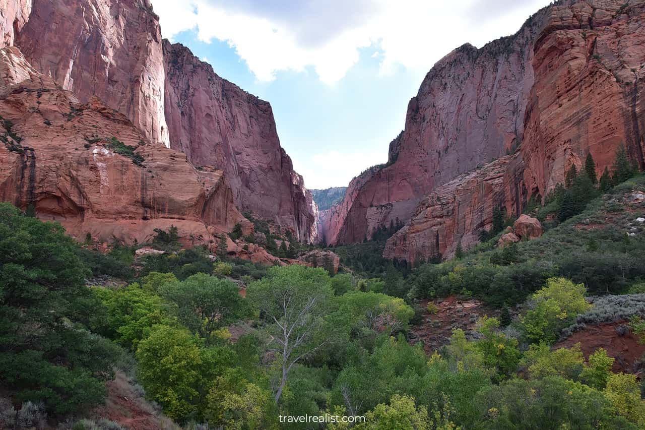
The Kolob Canyons Road will continue climbing. The Lee Pass Trailhead gives the first panoramic view of the stunning Kolob Canyons.
No hiking is required to enjoy the beauty at this stop. But you can take the 14-mi (22-km) trail to Kolob Arch if you are feeling adventurous.
You can even reach Zion Canyon from this trailhead. But you would need multiple days to hike to the main unit of the park. Get a wilderness permit for this and other overnight hikes.
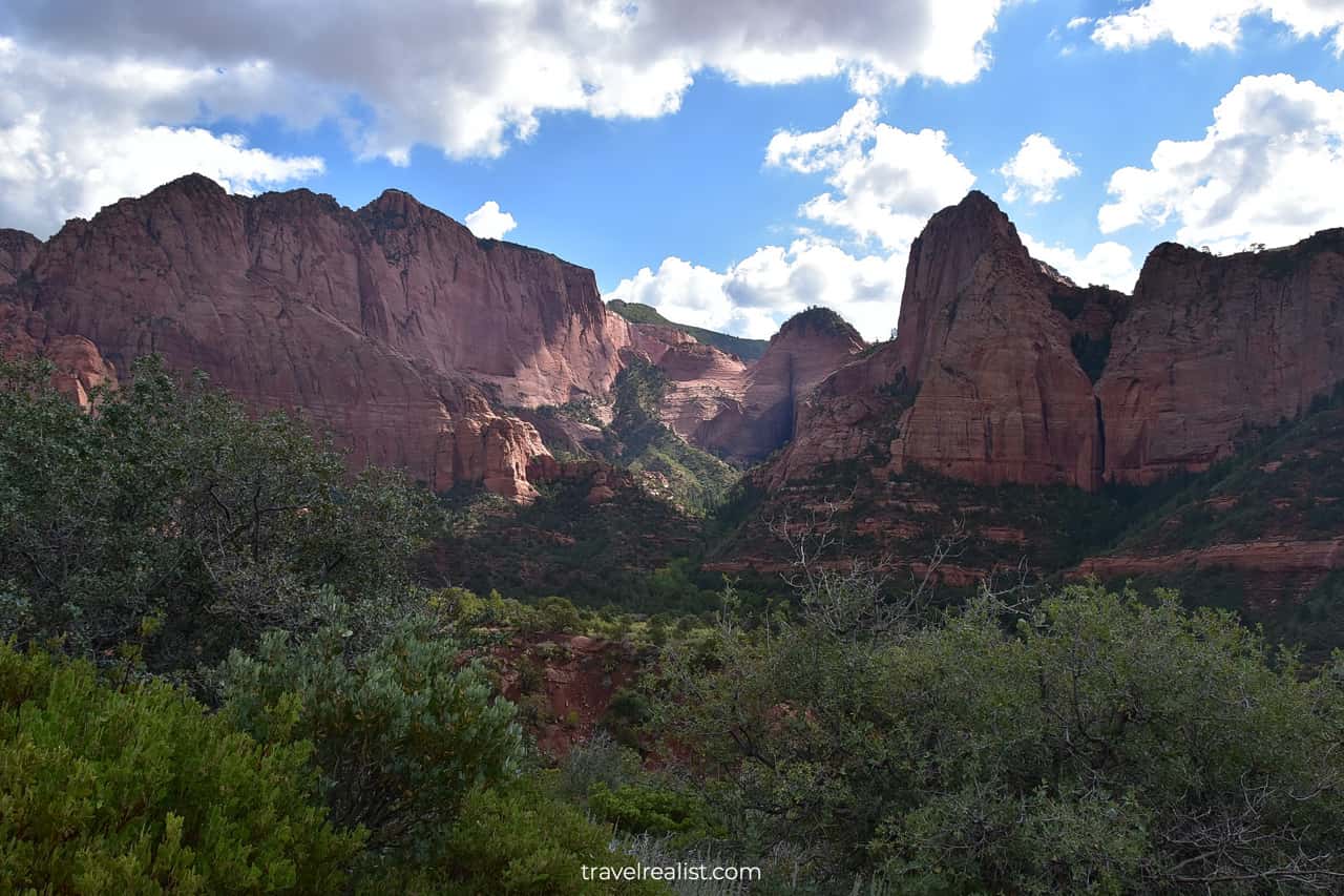
Kolob Canyons Viewpoint
You will be past the midpoint of the scenic drive at the Lee Pass Trailhead. There are a few options for exploration. You can decide whether to:
- Drive all the way to the Kolob Canyons viewpoint.
- Or stop at the no-name viewpoints along the way.
The choice is yours. But it could be a good idea to first reach the Kolob Canyons Viewpoint. This way, the no-name pullouts will be on your right side. You will also have a better idea where to stop.
You will get get great views of Timber Top Mountain, Nagunt Mesa, and hidden valleys at these viewpoints.
Timber Creek Overlook
There is another trail at the end of the scenic Kolob Canyons Road. This 1-mi (1.6-km) trail brings you to another viewpoint. You will enjoy great views of the Hurricane Cliffs and Timber Top Mountain.
The Kolob Canyons Viewpoint marks the end of the Scenic Drive. You would have to take the Kolob Canyons Road back to the Visitor Center.
Continue with our Zion Scenic Drives Guide. You will learn more about ways to get to the sights, entrance requirements, and places to stay.
Getting to Zion Scenic Drives
Zion National Park is in Southwestern Utah.
- The park is fairly close to St. George.
- You can reach the park in about 3 hours from Las Vegas, NV.
- A drive from Salt Lake City will take 5 hours.
Zion has three units: Zion Canyon, Kolob Canyons, and Kolob Terrace.
- You can reach Zion Canyon and Kolob Terrace by car from Highway UT-9. This road connects Interstate Highway I-15 with highway US-59.
- Kolob Canyons is the easiest one to reach among the three units. It is just off Interstate Highway I-15.
No paved road connects the units within the park. All of the scenic drives in the park are dead end roads. You need to budget time for a lengthy detour.
Where to Stay near Zion
There are a lot of places to stay near this national park. This abundance is thanks to a large town and major interstate highway nearby.
Both St. George and Hurricane have a lot of places to stay. They cater to different budgets and audiences. You can find nearly every type of lodging near Zion. The properties range from campsites to resorts.
This selection might give you a false idea to delay booking a place to stay when traveling to Zion. This would be a big mistake.
It is best to book lodging early. Hotels often sell out if your trip is close to any national holiday.
Entrance Requirements & Passes
Zion charges admission fees of $35 per car. America the Beautiful annual pass covers this fee.
This park is extremely popular. It ranks in the top 5 most visited national parks in the US nearly every year.
So many visitors to Zion mean less freedom to explore its scenic drives and trails. The park introduced a few requirements to avoid trail overcrowding and protect scarce resources.
Read through our Zion Scenic Drives Guide to be fully prepared for your Zion adventure.
Shuttle on Zion Canyon Scenic Drive
Nearly all of these restrictions refer to Zion Canyon Scenic Drive. You can drive on the Kolob Terrace Road and Kolob Canyons Road year round.
You cannot drive your car on Zion Canyon Scenic Drive from the beginning of spring to the end of fall. This is a similar restriction to the Hermit Road in Grand Canyon.
Winter is the only time to bring your car to Zion Canyon. You would have to take a shuttle during the rest of the year. Unless you arrive at the Visitor Center early, you will have to wait.
- First, you need to compete for scarce parking spots.
- Next, you have to wait for a spot on the shuttle bus.
The shuttle bus system works reasonably well. But the parking at the visitor center is a bottleneck. The shuttle bus ride could easily add about 2 to 3 hours to your visit to the park.
Permits for Angels Landing Trail
The shuttle bus is not the only requirement. You have to get a permit to hike Angels Landing. It is the most famous trail in the park.
- This trail covers 5.4 miles (8.7 km) round trip.
- You will gain 1,500 ft (450 m) in elevation.
- The views from the trail are breathtaking.
You need to participate in a lottery to get a permit. You need to plan well in advance if you want to hike this trail.
- There is a seasonal lottery and a day-before lottery. You will have at least two chances to get the permit.
- You would need to pay a $3 fee per person and a $6 application fee. All fees are nonrefundable.
Takeaways: Zion Scenic Drives
Zion has three scenic drives. But it is still largely a hikers’ park. You need to hit the trails to get the most from your visit to this park.
The popularity of Zion creates issues when visiting to this park. The facilities of this park are often at capacity. This is true if you visit the park after 9 a.m. during the busy season.
Unless you win the lottery to hike Angels Landing trail, you might not enjoy the main park unit. The Zion Canyon Scenic Drive has few viewpoints. Most stops require lengthy hikes.
The views from the canyon floor are not as superb as views from atop the canyon. They are not worth a lengthy search for parking and a shuttle ride. You deserve a better experience than a drive with a tourist crowd.
On the other hand, Kolob Canyons is a great unit to visit. It is easy to get to. It has less visitors. But, the unit is, arguably, just as beautiful.
You can have a more enjoyable experience in Kolob Canyons. Stop at the viewpoints along the Kolob Canyons Road. Or hike the Taylor Creek Trail to the Double Arch Alcove.
Take a look at our Zion Scenic Drives Video Guide and visit our YouTube channel for the latest videos.
Frequently Asked Questions
Zion National Park has three scenic drives.
– Zion Canyon Scenic Drive: 16 miles round trip, only open in the winter.
– Kolob Canyons Road: 10 miles round trip, open year round.
– Kolob Terrace Road: 43 miles round trip, open year round.
All of the drives are dead end roads. You have to take the same road back.
Kolob Canyons Road is one of the best scenic drives in Zion. You can drive your car on this road year round. And it is a short detour from I-15.
You can only drive your car on the Zion Canyon Scenic Drive from December through February. You have to take a shuttle during the rest of the year.
Zion Canyon Scenic Drive is open to private vehicles from December 1 to February 28.
You do not need a reservation to visit Zion. You only need to get a permit in advance to hike the Angels Landing trail.
Zion charges entrance fees of $35 per car for its scenic drives.
You would need about 2.5 hours to complete the Zion Canyon Scenic Drive on a shuttle. A drive on the Kolob Canyons Road takes about 30 minutes. It takes 2 hours to drive the Kolob Terrace Road.
Zion Canyon has three scenic drives. The Zion Canyon Scenic Drive is closed to cars during most of the year. But Kolob Canyons and Kolob Terrace Roads are worth the drive.
Safe realist travels!