

Capitol Reef Scenic Drive: A Seabed You Can Drive On

This realistic Capitol Reef Scenic Drive Guide helps you plan your next adventure in this national park.
Capitol Reef is a national park in Southwestern Utah. The park has geological formations and historical items. Both outdoor enthusiasts and history lovers would find this park a great destination.
This post includes affiliate links that will earn us commission if you make a purchase via these links.
Sights & Places of Interest
Capitol Reef National Park has a number of sights along the Waterpocket Fold. You could explore an ancient ocean bed in your car and on foot.
Some of the sights are only visible from the Capitol Reef Scenic Drive. But a handful of attractions are in the free part of the park along Utah State Route UT-24. You just need to know what to look for.
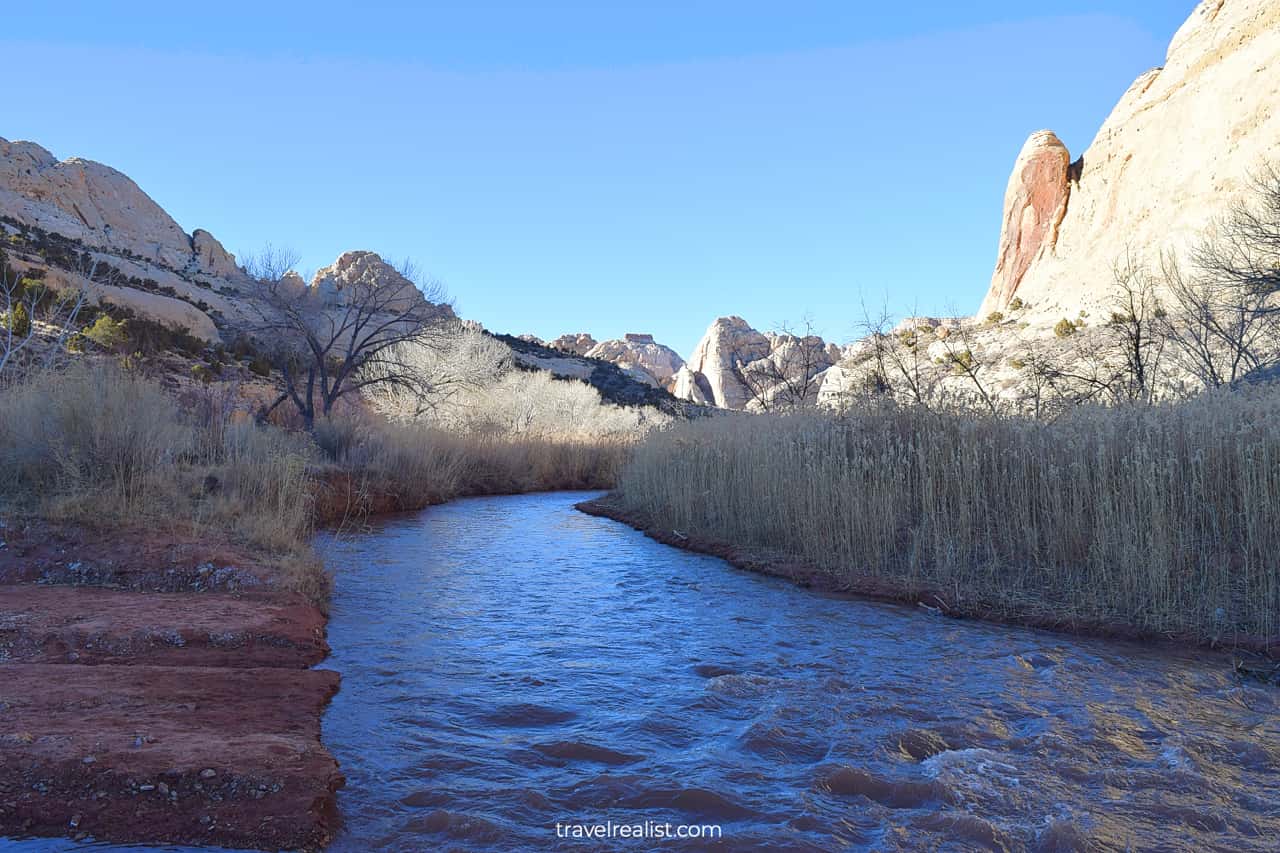
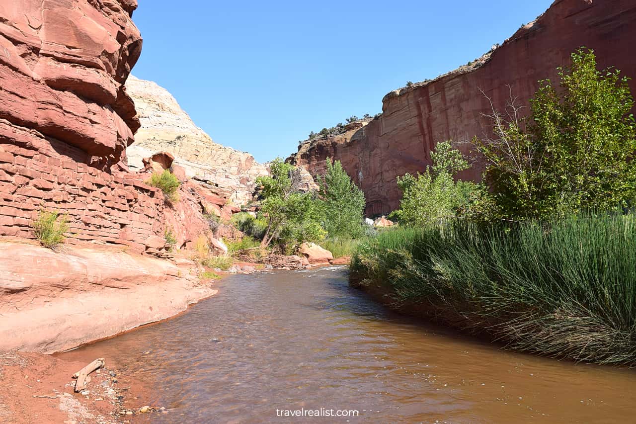
You will not notice a change in scenery when you first enter Capitol Reef. In fact, you might even miss a park sign next to the Fremont River. It is the only thing that suggests that you arrived in a national park.
Be careful not to form a wrong first impression of Capitol Reef. As you continue driving through the park, you will see more of its picturesque and historic sights.
The next section of this Capitol Reef Scenic Drive Guide describes the main sights of the park. It follows a westbound path on Utah State Route UT-24.
1. Orientation Pullout
The Orientation Pullout is the first stop in the park if you travel from Hanksville. It is right next to the park boundary. This viewpoint has very few notable things. It is certainly not the prettiest stop in the park.
But it gives you a chance to stretch your legs after a long journey. Pubic restrooms are also available at this stop. Last but not least, you could take a short and easy path to the Fremont River.
It could come as a surprise but this desert river has a strong current. It looks a lot like rivers and creeks in Rocky Mountain in a Death Valley landscape.
2. Capitol Dome
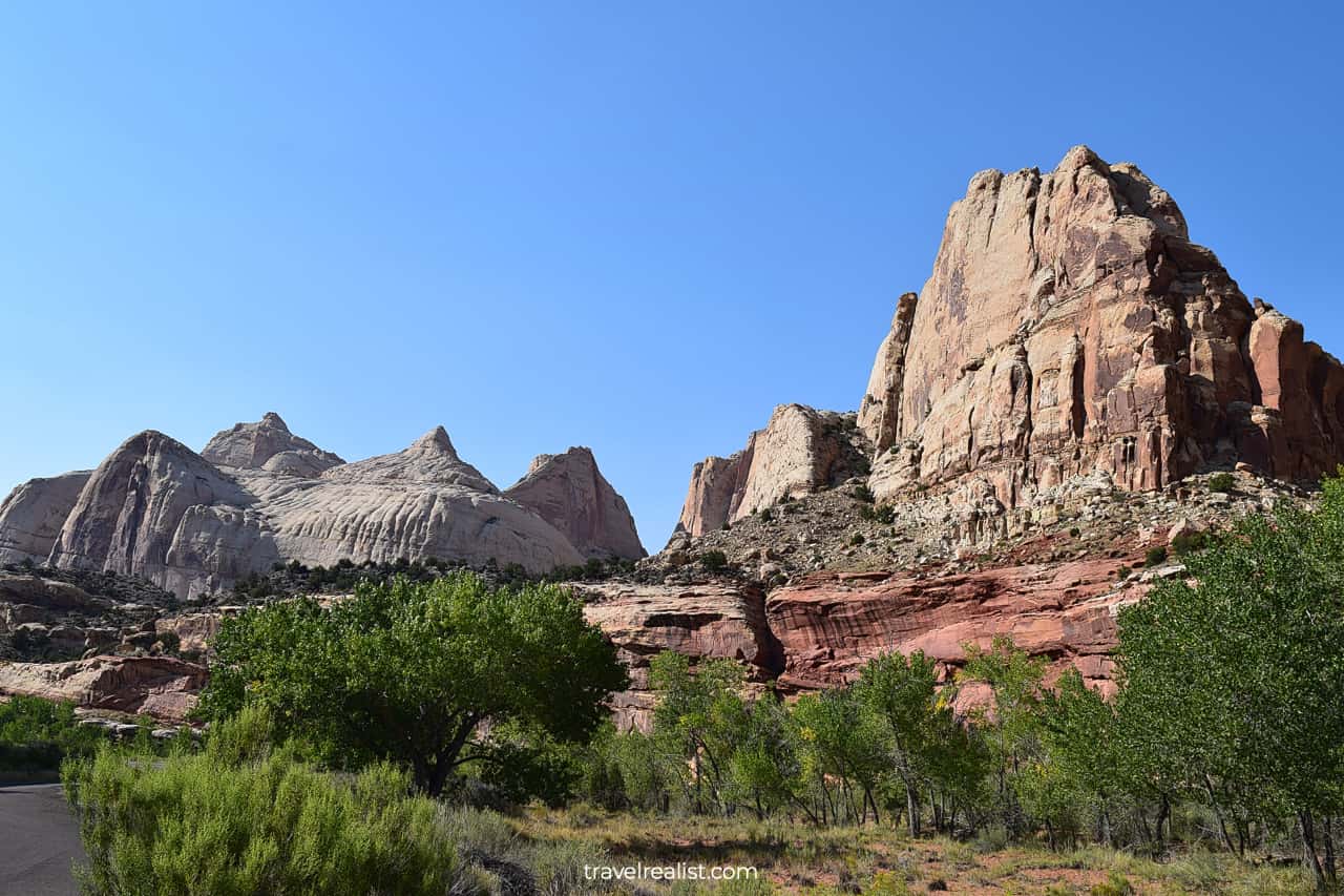
The highway continues to follow the bends of the river. But the scenery will start to change as you drive deeper into the national park.
Higher mountains and narrower canyons bring more shade. Together with the moisture from the river, the shade helps the landscape turn greener.
You will see trees and bushes near the Grand Wash Trailhead and the Spring Canyon Trailhead. It is a quite surreal sight in the desert of Utah.
While their scenery might be similar, these trails could not be more different. The Grand Wash Trail is a 4.4-mi (7-km) out-and-back hike. This easy trail involves 200 ft (61 m) in elevation gain.
The Spring Canyon Trail is a 9.9-mi (16-km) out-and-back trail. It involves 1,305 ft (398 m) in elevation gain. This moderate trail is one of the longest hiking paths in the park.
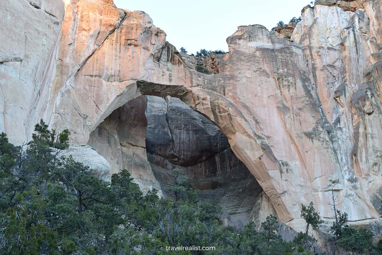
3. Hickman Bridge
You might want to keep on driving through Capitol Reef towards the Scenic Drive. It provides an easier access point to Cassidy Arch, the main attraction on the Grand Wash Trail.
But you should consider stopping at the Hickman Bridge Trailhead. It is the starting point of a moderate 1.8-mi (2.9-km) out-and-back hike. You will gain 400 ft (122 m) on the way to a natural bridge.
This attraction is only accessible from Utah State Route UT-24. You should budget about an hour to hike the trail and enjoy the bridge.
The bridge resembles the sights in Arches and Bryce Canyon. But it looks most similar to La Ventana Natural Arch in El Malpais, New Mexico.
Hickman Bridge is well worth a stop. It is also one of the most popular hikes in the park. This is hardly a surprise. This attraction is still in the free section of Capitol Reef.
The Hickman Bridge trailhead looks a bit less lively in the winter. But think on the bright side if you visit Capitol Reef during this season. Hiking is much easier since you do not have to deal with the heat.
Wear sturdy shoes and bring a jacket. Capitol Reef often experiences the temperatures below freezing in the winter.
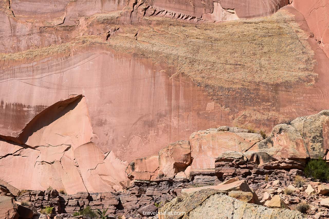
4. Petroglyph Panel
The next section of the highway is one of the most scenic in Capitol Reef. There are a few stops between the Hickman Bridge Trailhead and the Visitor Center.
All of these sights are in Fruita Historic District. This name could remind you of Colorado National Monument near Fruita, Colorado. But there does not seem to be a connection between the two towns.
You should stop at the Petroglyph Panel. It is just a mile (1.6 km) west of the Hickman Bridge Trailhead. You would not even need to hike long to see the rock art.
This panel has one of the most iconic petroglyphs in the United States. You cannot get as close to the panel as in Valley of Fire in Nevada. But even a distant view reveals beautiful patterns.
5. Fruita Schoolhouse
History lovers will like Fruita Historic District. The petroglyphs are not the only historic attraction at Capitol Reef. Fruita Schoolhouse is another worthy stop.
This tiny school welcomed students between 1896 and 1941. You cannot go inside the building now. Still, there is a lot to see through the large windows.
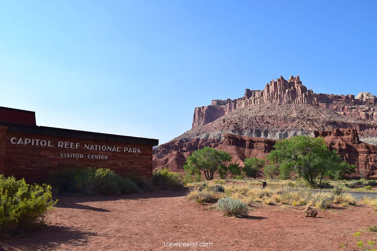
But do not force a schoolhouse exploration if history is not your thing. In this case, continue driving for about 2 minutes. You will reach the Visitor Center. It has a ranger station, park shop, and restrooms.
6. Spring Canyon
The Visitor Center is in also the most scenic part of Capitol Reef. You could get amazing views of Spring Canyon right from the parking lot. No need to hike that 10-mi trail to get a glimpse of the canyon.
In fact, every trail that brings you closer to Spring Canyon involves over 9 miles (14 km). This is true for the 9.9-mi (16-km) Spring Canyon Trail that started miles east on UT-24.
The Rim Overlook/Navajo Knobs Trail is also no exception. It is a 9.4-mi (15-km) out-and-back trail. This strenuous trail starts from the Hickman Bridge Trailhead.
7. Scenic Drive
Day long hikes are not the only way to explore the sights around the Visitor Center. You could also take 8-mi (13-km) Capitol Reef Scenic Drive. It starts right at the Visitor Center.
The Scenic Drive brings you to a park area that requires admission fees. This setup makes Capitol Reef quite unique. There are few if any other national parks that charge admission to just part of the park.
Great Smoky Mountains in Tennessee and North Carolina come to mind. But the most visited national park started charging parking fees recently. You could still visit it for free if you only stop at viewpoints.
Either way, do not forget to get a day pass or display your America the Beautiful annual pass. Your admission or pass fees will help preserve the park for future generations.
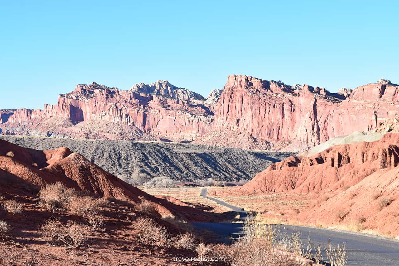
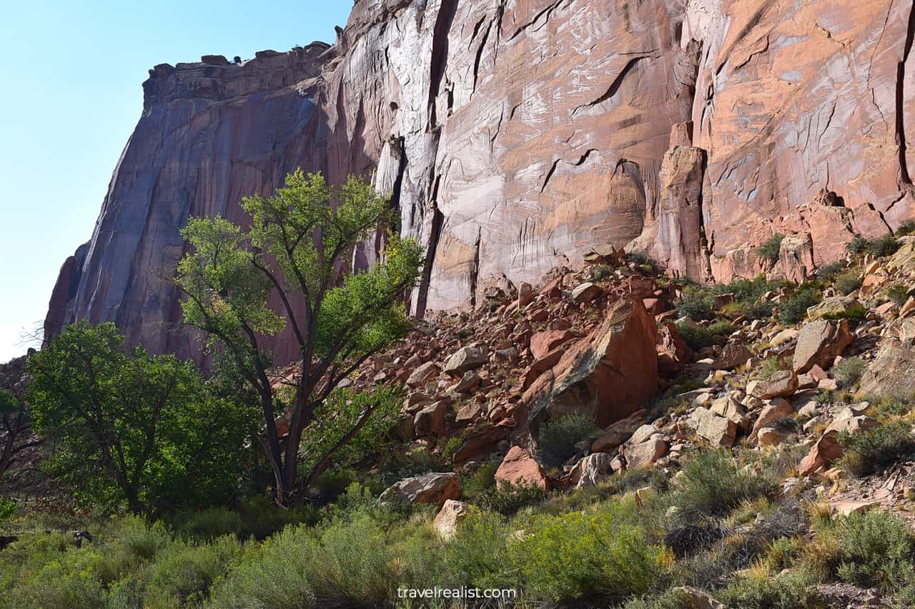
The Scenic Drive is the main attraction of Capitol Reef National Park. The drive is mostly straight and flat. But it narrows at creek and wash crossings.
These crossings are great places to see wildlife. It is best to follow the speed limit and slow down when approaching sharp turns on the drive.
This way, you increase your chances of seeing wildlife in the park. You will also have far less issues with the oncoming traffic. Encounters with both could be quite dangerous on this narrow Scenic Drive.
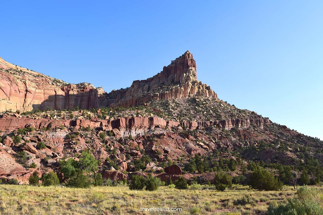
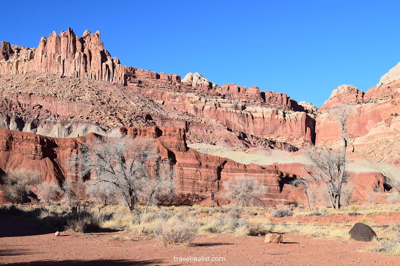
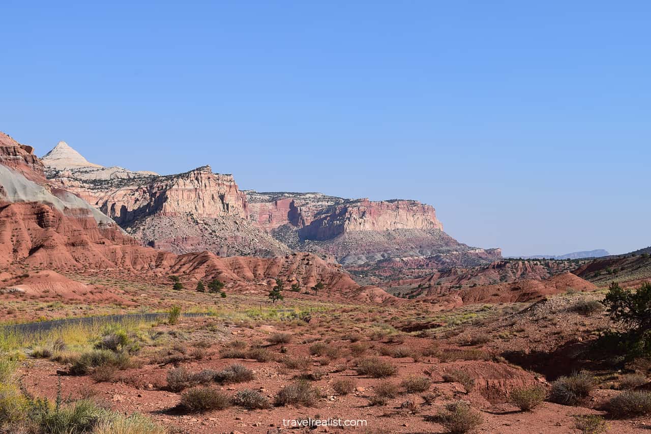
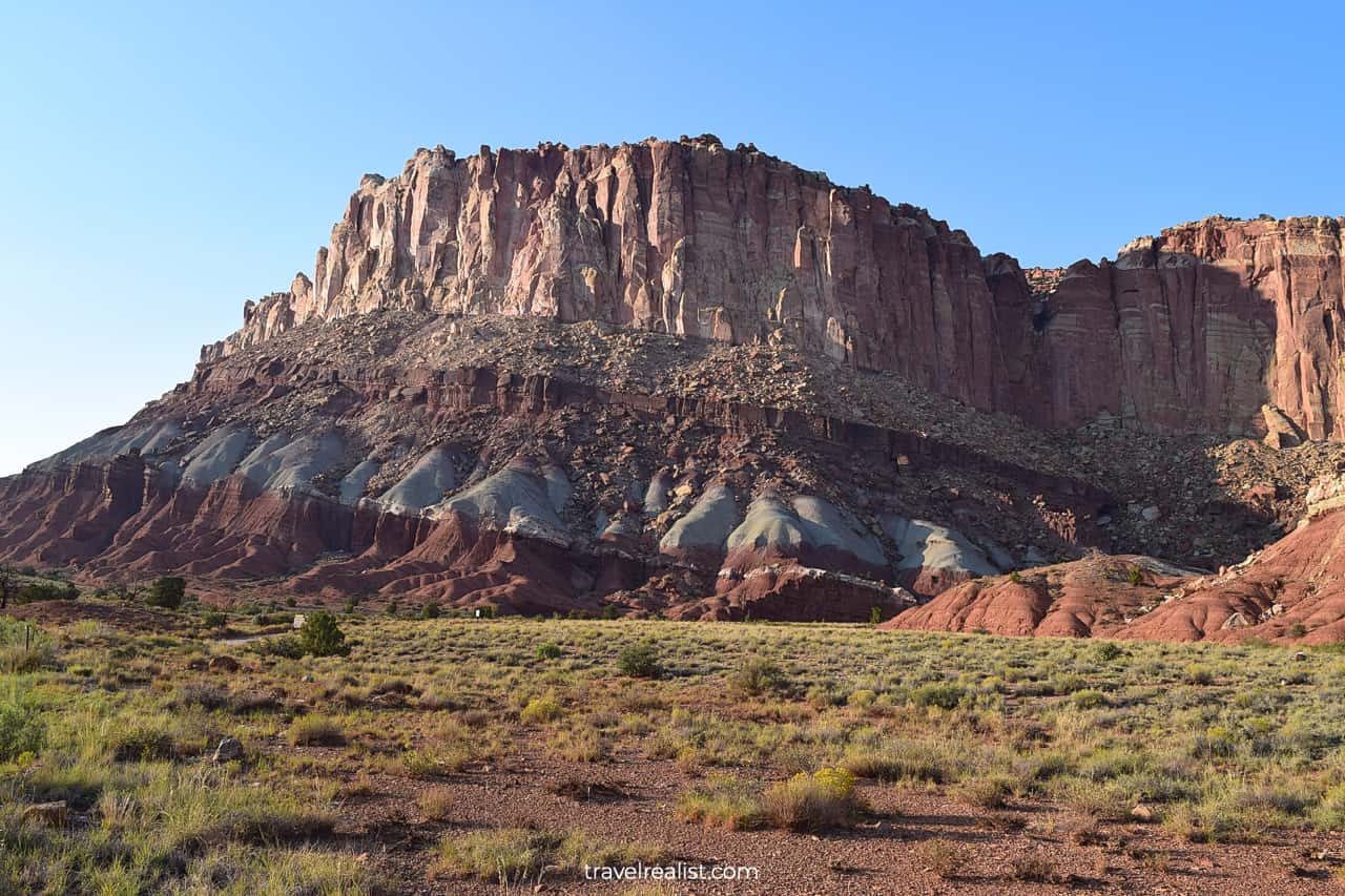
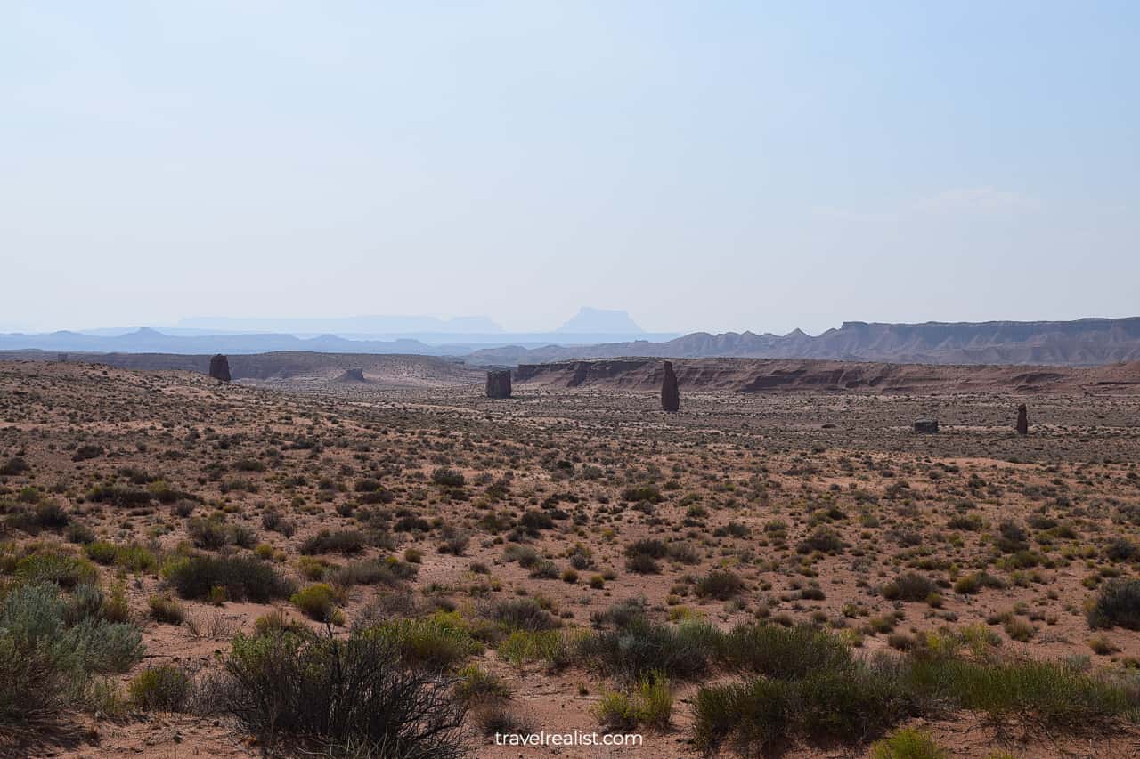
8. Waterpocket Fold
The Capitol Reef Scenic Drive follows the Waterpocket Fold. The fold used to be an underwater reef millions of years ago. It is one of the most important geological formations in the park.
You likely guessed that already since the Waterpocket Fold gave the park its name. This ancient reef is a sight to see in Capitol Reef.
A journey down the Capitol Reef Scenic Drive is the best way to enjoy the Waterpocket Fold. You could only get a distant look at the Waterpocket Fold from the free section of the park.
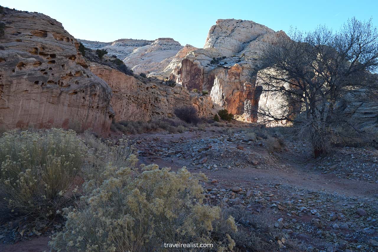
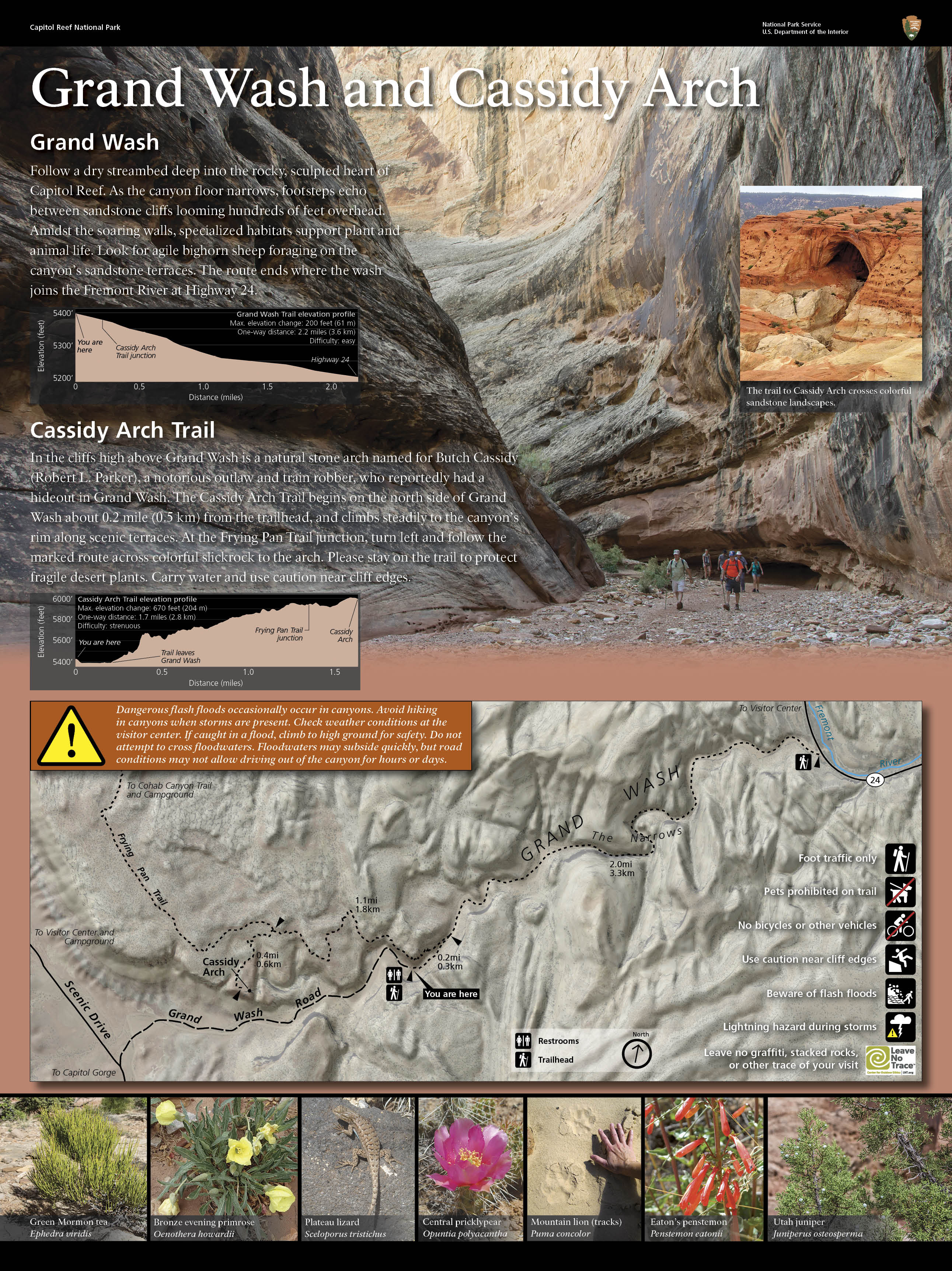
9. Grand Wash
There are very few viewpoints on this Scenic Drive. You could easily drive its entire length without stopping. But you would want to pull over to admire its beauty.
The Grand Wash Road is a good place to enjoy the park for a little while. This 1.3-mi (2-km) gravel road brings you to the Cassidy Arch Trailhead.
This is a much faster path to the Arch than from the Grand Wash Trail on UT-24. You should still get ready for a 3.2-mi out-and-back hike. The elevation gain of 670 ft (204 m) makes this hike strenuous.
Cassidy Arch looks a bit like Mesa Arch in Canyonlands. But you do not need to hike to enjoy the views from the Grand Wash Road.
Just take a look around you. Ferns Nipple and Pectols Pyramid peaks will be on full display. A keen eye would also notice a few layers that make up the Waterpocket Fold.
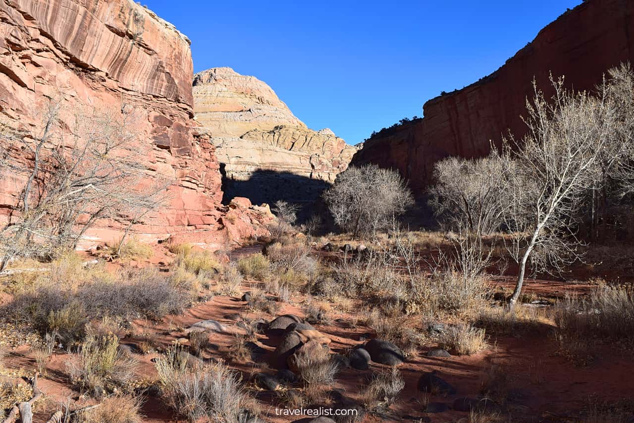
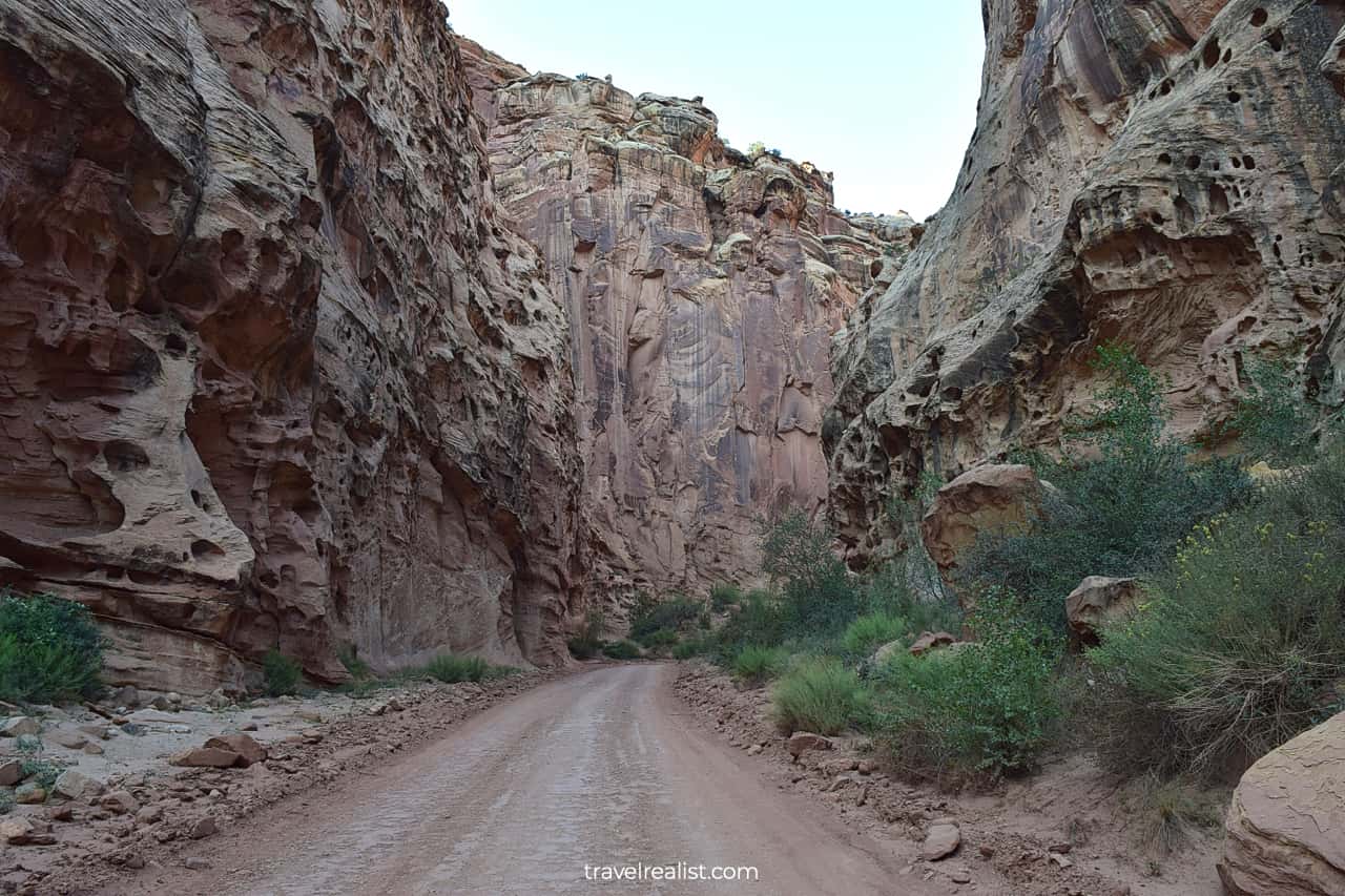
10. Capitol Gorge
The Capitol Reef Scenic Drive finishes near Capitol Gorge Road Picnic Shelter. The drive stops just as abruptly as it starts. You would not get astonishing views at the end of the paved road.
But you should not judge the book by its cover. Capitol Gorge is one of the most picturesque areas of the park. You just need to drive on an unpaved Capitol Gorge Road to see its sights.
A handful of formations in the park look just like ocean reefs. It is easy to think that you are driving at the bottom of an ancient ocean. This feeling will be the strongest when you drive on the Capitol Gorge Road.
The Capitol Gorge Road brings you to the same name trailhead. Most of the trails in this area are strenuous. They involve a sizable elevation gain.
You are welcome to hit the trails if neither the distance nor the elevation gain present a problem for you. In this case, hike to Golden Throne and Pioneer Register.
You can choose from two route options after exploring Capitol Gorge.
- Drive back on the paved Capitol Reef Scenic Drive to Fruita Historic District.
- Continue on the unpaved Pleasant Creek Road and South Draw Road to UT-12.
11. Fruita Historic District
The park describes the South Draw Road as an “extremely rough unmaintained 4WD road”. You might not want to test your car or a rental in these conditions.
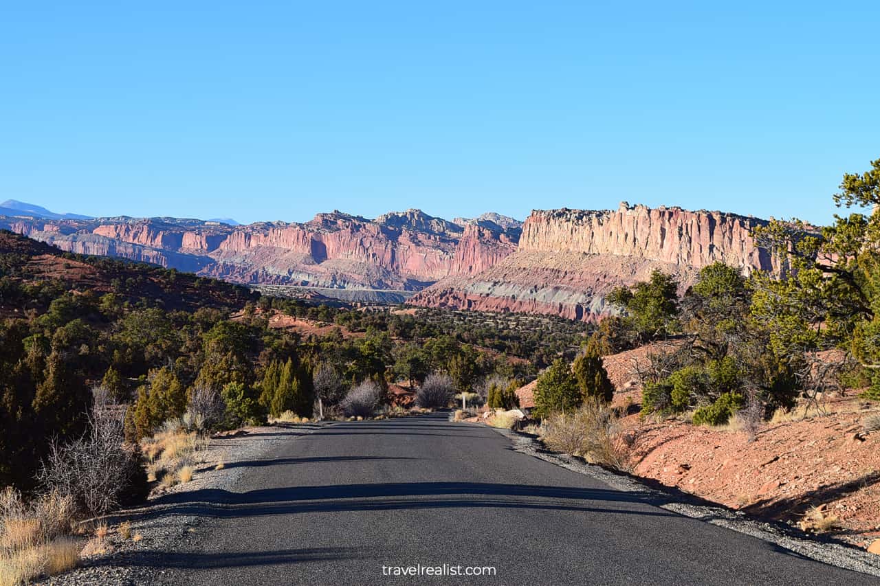
Driving back on the Capitol Reef Scenic Drive will be your only option then. You will pass all of the sights in a reverse order.
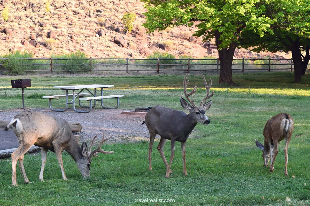
You should make another stop at Fruita Historic District. But this time take a left to the Gifford Homestead, Campground, and Amphitheater.
You could get a little more information about the region at Gifford House and Blacksmith Shop. Or you could enjoy the Fremont River views from the nearby trail.
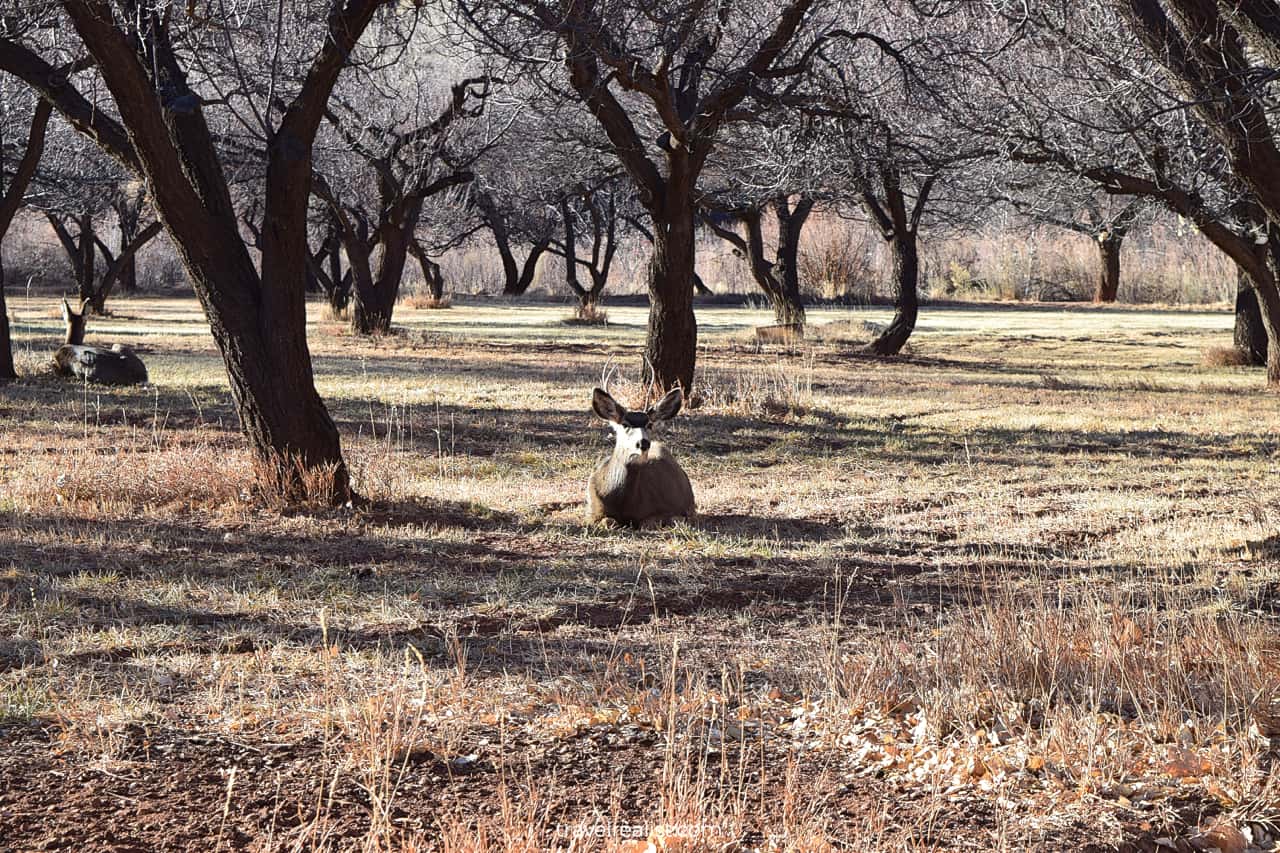
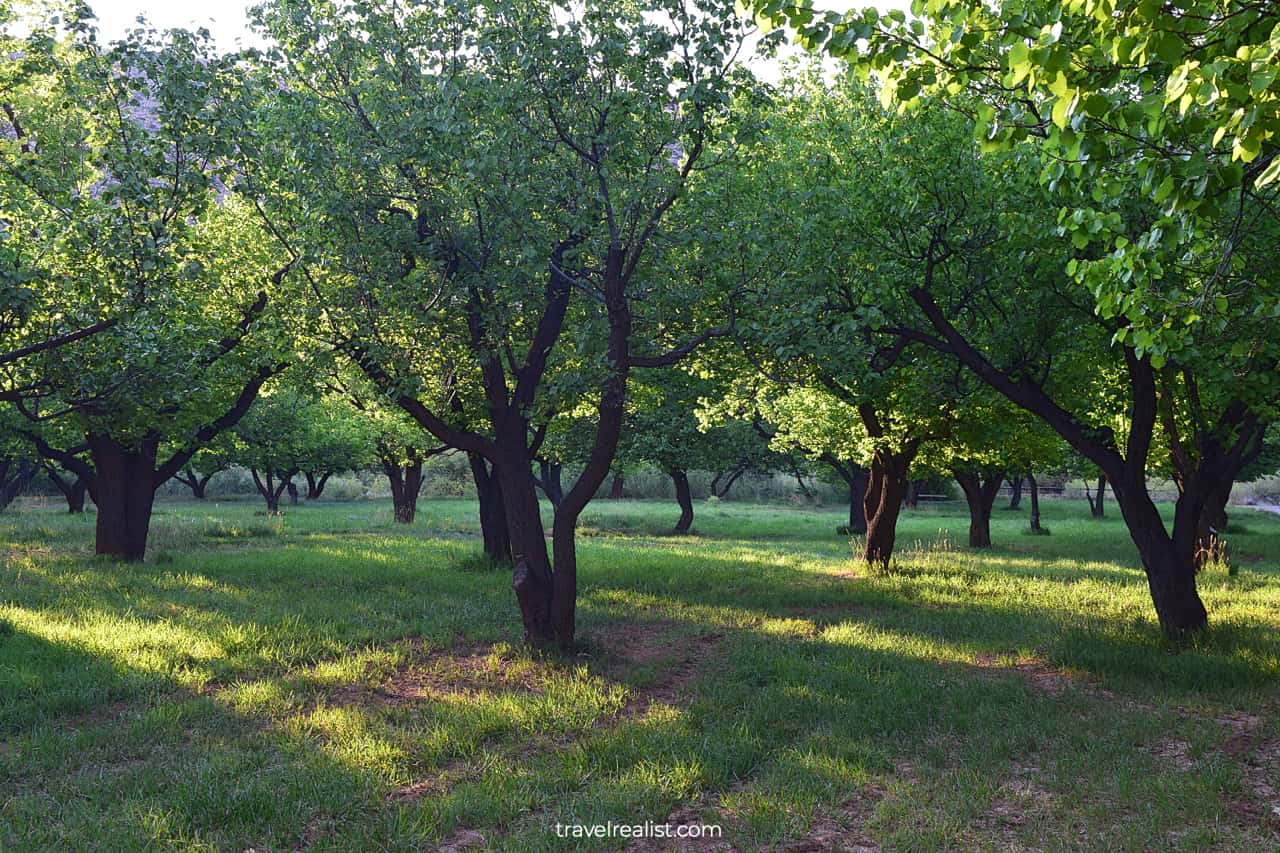
Wildlife watching is another activity in Fruita Historic District. Food scraps from campers and green lawns near the Amphitheater attract deer.
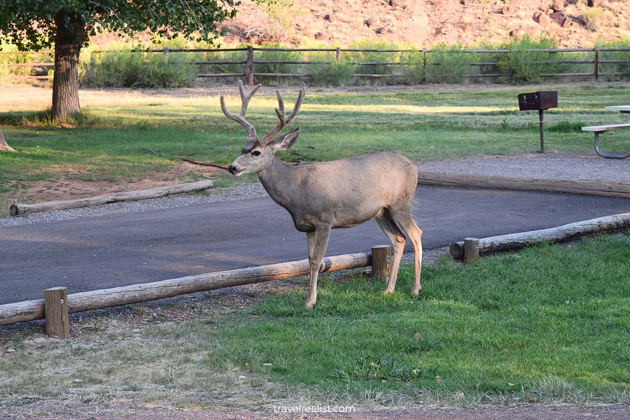
You have a good chance of spotting deer in this part of the park. It does not matter if you visit the park in the summer or in the winter. In fact, the time of the year hardly plays a role.
Deer prefer to rest in the nearby orchid. Without a doubt, the orchard will be a lot more pleasant in the summer. Take a stroll among the fruit trees while wildlife watching.
The part of the park between the Fruita Historic District and the western park boundary has a few viewpoints. You could stop at the Panorama Point, Sunset Point, and Chimney Rock.
The first two points involve short hikes. The Chimney Rock Trail is a 3.6-mi (5.9-km) strenuous loop. You need to cover 590 ft (190 m) in elevation gain.
You will exit the national park shortly after the Chimney Rock Trailhead. But your exploration of Southwestern Utah does not have to stop here.
The next section this Capitol Reef Scenic Drive Guide covers the sights near the national park.
12. Fishlake National Forest
You will have two options once you reach the town of Torrey. It is a tough choice since both of the routes are quite scenic.
- Continue on Utah State Route UT-24: this route will bring you to Interstate Highway I-70. It is the best route to reach Salt Lake City, Park City, and Great Basin National Park.
- Switch to UT-12: this winding road goes through two national forest and a national monument. This is the path to Bryce Canyon, Zion, Snow Canyon, and sights near Las Vegas.
The second path through Fishlake and Dixie National Forests is a more scenic drive. There are plenty of viewpoints. You would want to stop at some of them to capture Capitol Reef from a different angle.
12.1. Larb Hollow
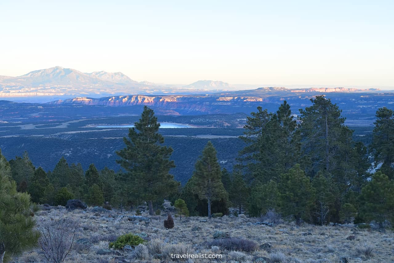
The Larb Hollow Overlook is the first stop on UT-12 in Fishlake National Forest. This is a great place to enjoy panoramic views.
You could see Lower Browns Reservoir down below. The Waterpocket Fold in Capitol Reef is also visible in the distance.
Remember the rough South Draw Road that started at the end of the Capitol Reef Scenic Drive? This road could have brought you to UT-12 just past the Larb Hollow Overlook.
It is 10 miles shorter than a route on the paved Scenic Drive. But you would have needed twice the time to reach this viewpoint from Capitol Gorge.
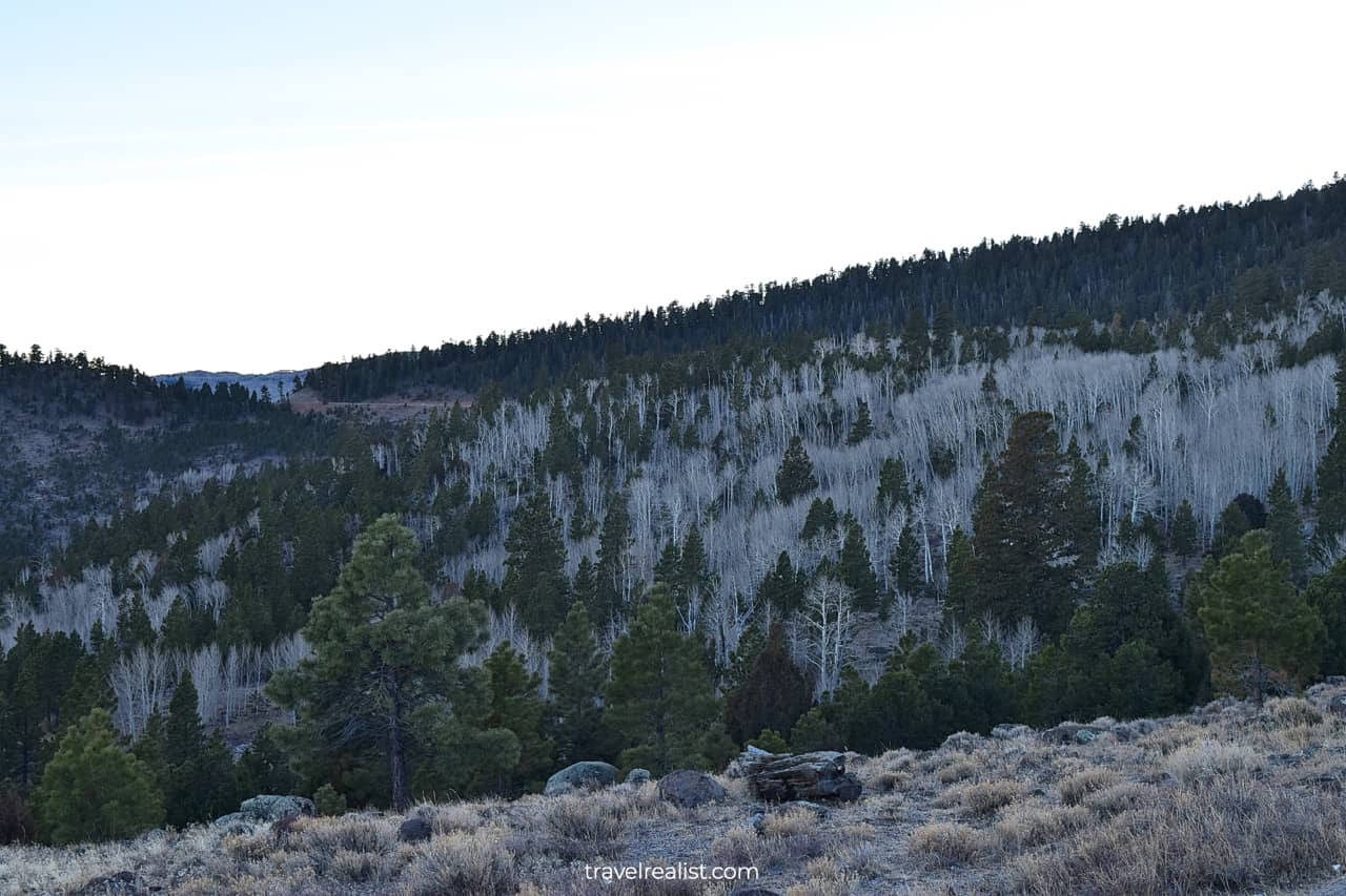
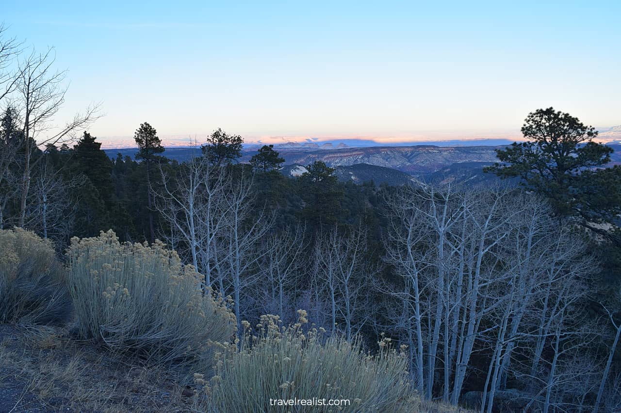
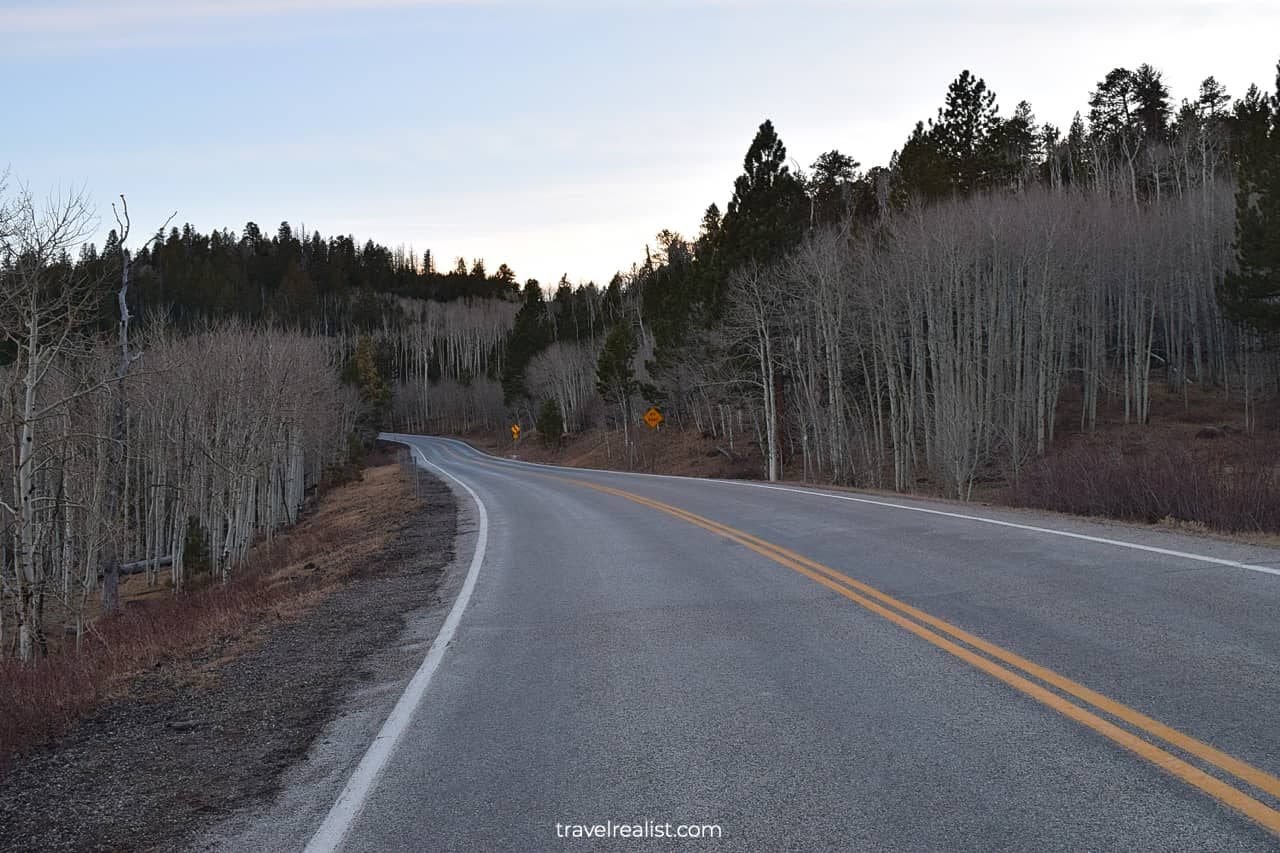
12.2. Steep Creek
The highway will continue to gain elevation after the Larb Hollow Overlook. In fact, you will climb over 3,000 ft (900 m) before you reach the Steep Creek Overlook.
This viewpoint is near the highest point on the UT-12. Its elevation of 9,600 ft (2,926 m) makes it a proper mountain road. You could also get views for miles and miles thanks this high elevation.
The Steep Creek Overlook provides fantastic views of the forest. Fishlake National Forest is breathtaking during every season.
But you should be extra careful if you drive through Fishlake in the winter. High elevation often means ice on the road. Take it slow on the turns to avoid skidding.
12.3. Homestead
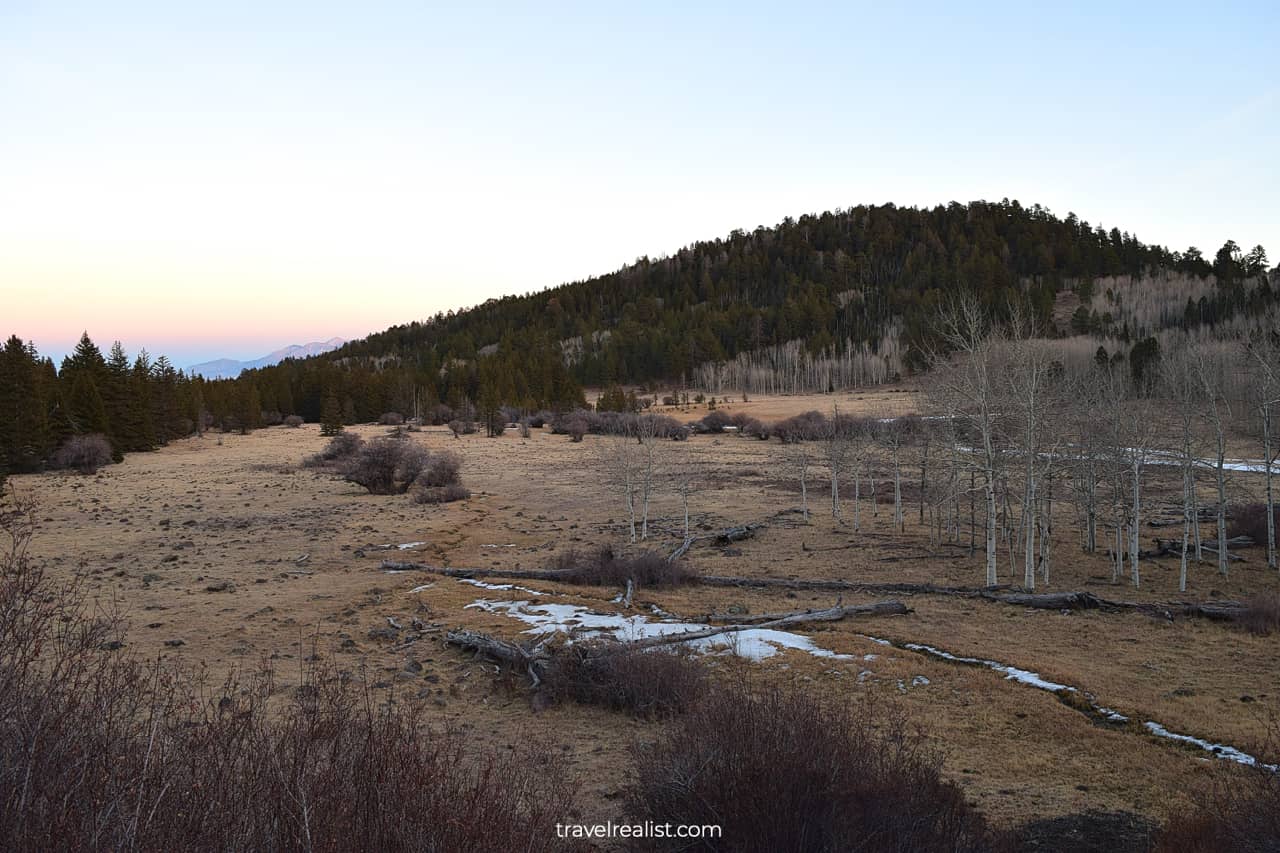
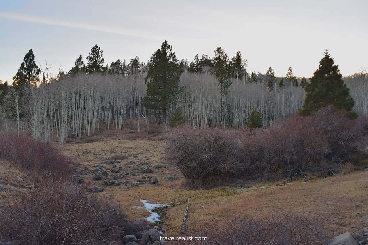
The Steep Creek and Homestead Overlooks are the last viewpoints in Fishlake National Forest. The highway startw going downhill soon after.
You will enter Dixie National Forest. It is a great place to get distant views of Grand Staircase-Escalante National Monument. This very remote park has few paved roads.
The winding turns and elevation drops will continue all the way to Bryce. This town serves as a gateway to Bryce Canyon National Park.
13. Goblin Valley State Park
It is worth spending a few minutes to discuss the places to see east of Capitol Reef. You will see far less sights if your route brings you towards Green River on highway UT-24.
There is only one notable park near your route. Goblin Valley State Park is a short detour from the UT-24. The day pass costs $20 per car. But you could get a distant view of the park at a free viewpoint.
The park has lots of vivid formations. They are a bit similar to Needles in Canyonlands and Garden of Eden in Arches.
Continue with this Capitol Reef Scenic Drive Guide. You will learn more about ways to get to the sights, entrance requirements, and places to stay.
Getting to Capitol Reef
Capitol Reef National Park is in a very remote area of Utah. The park is very far from any major city. You would need at least 4 hours to reach the park from either Salt Lake City or St. George.
The former city is at least a major airline hub. If SLC does not work out with your itinerary, you should look into flying to Las Vegas. Vegas is another nearby hub.
A drive to Capitol Reef from “The Sin City” takes 5 hours. This location makes it very difficult to visit Capitol Reef on a day trip.
Still, there are some positives about the location of this park. Capitol Reef is about halfway between Moab and Bryce. You need to budget 2.5 hours to get to Capitol Reef from either town.
A 5-hour drive leaves just enough time to explore the park on the Capitol Reef Scenic Drive. You could travel between Utah Mighty 5 and explore them all in one trip.
Where to Stay near Capitol Reef
The remote location of Capitol Reef National Park presents a challenge for finding a place to stay. There are very few lodging options near the park.
Richfield is one of the closest towns with multiple places to stay. The town is almost 1.5 hours away from the park. Staying in Richfield makes sense if you visit Great Basin in Nevada or Park City next.
Your only other viable options are staying in Moab and Bryce. Both towns are quite far from Capitol Reef. But you could turn this location to your advantage. Think about this 3-day itinerary:
- Day 1: Explore Arches and Canyonlands on the first day.
- Day 2: Drive from Moab to Bryce and explore Capitol Reef on the way.
- Day 3: Visit Bryce Canyon and Zion on the third day.
Entrance Requirements & Passes
Capitol Reef is open every day of the year. But the Visitor Center works only between 8:00 a.m. to 4:30 p.m. outside of the major holidays.
The park charges entrance fees of $20 per car. The fees only apply for travel on the Capitol Reef Scenic Drive. America the Beautiful annual pass grants free admission to Capitol Reef and its Scenic Drive.
You can explore other areas of the park free of charge. You could thank the park location along the major state highway for the lack of fees.
The Capitol Reef Scenic Drive will be closed in 2024. A rehabilitation project will be underway from April to October. Keep this timeline in mind when planning a trip to Capitol Reef.
Takeaways: Capitol Reef Scenic Drive
Capitol Reef is a nice park. The Waterpocket Fold is an ancient underwater reef that you can now see from land. This formation is a highlight of Capitol Reef National Park.
It is a no-brainer decision to take the Capitol Reef Scenic Drive if you have an Interagency annual pass. But the decision is not as clear if you do not have an annual pass.
The views from the Scenic Drive are not much different from the free viewpoints along UT-24. Driving back on the same route also does not speak in favor of exploring the Scenic Drive.
You would need to go much deeper into the park to see the main sights of the park. Cassidy Arch and Golden Throne involve driving on gravel roads. Hickman Bridge requires a hiking trail to see.
You could even test the limits of your car by taking the rough South Draw Road. If this sounds like an adventure, Capitol Reef is a park for you.
It helps to set the right expectations when visiting this park. Overall, Capitol Reef is the least beautiful among 5 national parks in Utah. But there is a reason to visit it on a trip to Utah Mighty 5.
If you would like to explore them all in one trip, Capitol Reef will fit in nicely with your itinerary. You could visit Capitol Reef on your way from Arches and Canyonlands to Bryce Canyon and Zion.
Do yourself a favor and take a longer route via UT-12 from Torrey to Bryce. Get ready for a rapid elevation gain. And enjoy astonishing views of two national forests and a national monument.
Take a look at this Capitol Reef Scenic Drive Video Guide. And visit the YouTube channel for the latest videos.
Frequently Asked Questions
Capitol Reef is an excellent addition to any Utah itinerary. This park is more remote than other national parks in Utah. But it is a link that connects Arches and Canyonlands with Bryce Canyon and Zion.
Capitol Reef has many sights. Waterpocket Fold has a unique ecosystem and formations. History lovers will enjoy petroglyphs and Fruita Historic District.
Half a day is enough to explore the main sights in Capitol Reef. But you would need a day if you hike longer trails.
You can see the main attractions in Capitol Reef in half a day. Stop at Chimney Rock, drive the Scenic Drive, and enjoy Capitol Gorge. You might even have some time for a short hike or two.
It takes about 1.5 hours to drive the Scenic Drive from the Visitor Center to Capitol Gorge. This time includes a short drive on a dirt road at the end of the Scenic Drive.
Capitol Reef charges admission fees of $20 per vehicle. The fee applies to the Scenic Drive.
You do not need a reservation to visit Capitol Reef. In fact, you can see many of the park’s sights free of charge.
Torrey, Utah is the closest town to Capitol Reef. This town has a few restaurants and places to stay.
Capitol Gorge trail is the easiest hike in Capitol Reef.
Safe realist travels!
