Canyonlands: Scenic Drive on the Island in the Sky

This realistic Canyonlands Scenic Drive Guide helps plan your next adventure in this national park.
Canyonlands is a beautiful national park with sandstone canyons and formations.
This post includes affiliate links that will earn us commission if you make a purchase via these links.
Sights & Places of Interest
Canyonlands is one of the most beautiful national parks in the United States. This park protects the desert landscapes created by the Colorado and Green Rivers over millions of years.
The canyons in the park are not as deep as Grand Canyon or Black Canyon. But the park’s terraces, mazes, and formations continue to attract visitors year after year.
The park has four districts. You can reach the Island in the Sky and the Needles via paved scenic drives. There are only dirt 4×4 roads in the Maze and Horseshoe Canyon districts.
The Orange Cliffs district of Glen Canyon National Recreation Area is visible from Canyonlands. You could reach Orange Cliffs on unpaved roads from Canyonlands.
This Guide will describe the sights to visit along the scenic drives in Canyonlands.
Island in the Sky
Island in the Sky is the most famous district of Canyonlands National Park. It attracts far more visitors than the Needles, the Maze, and Horseshoe Canyon districts.
There is an easy to explain reason for this disparity in visitor numbers. The Island in the Sky is the closest district to Moab and Arches National Park. It also helps that this district has paved roads.
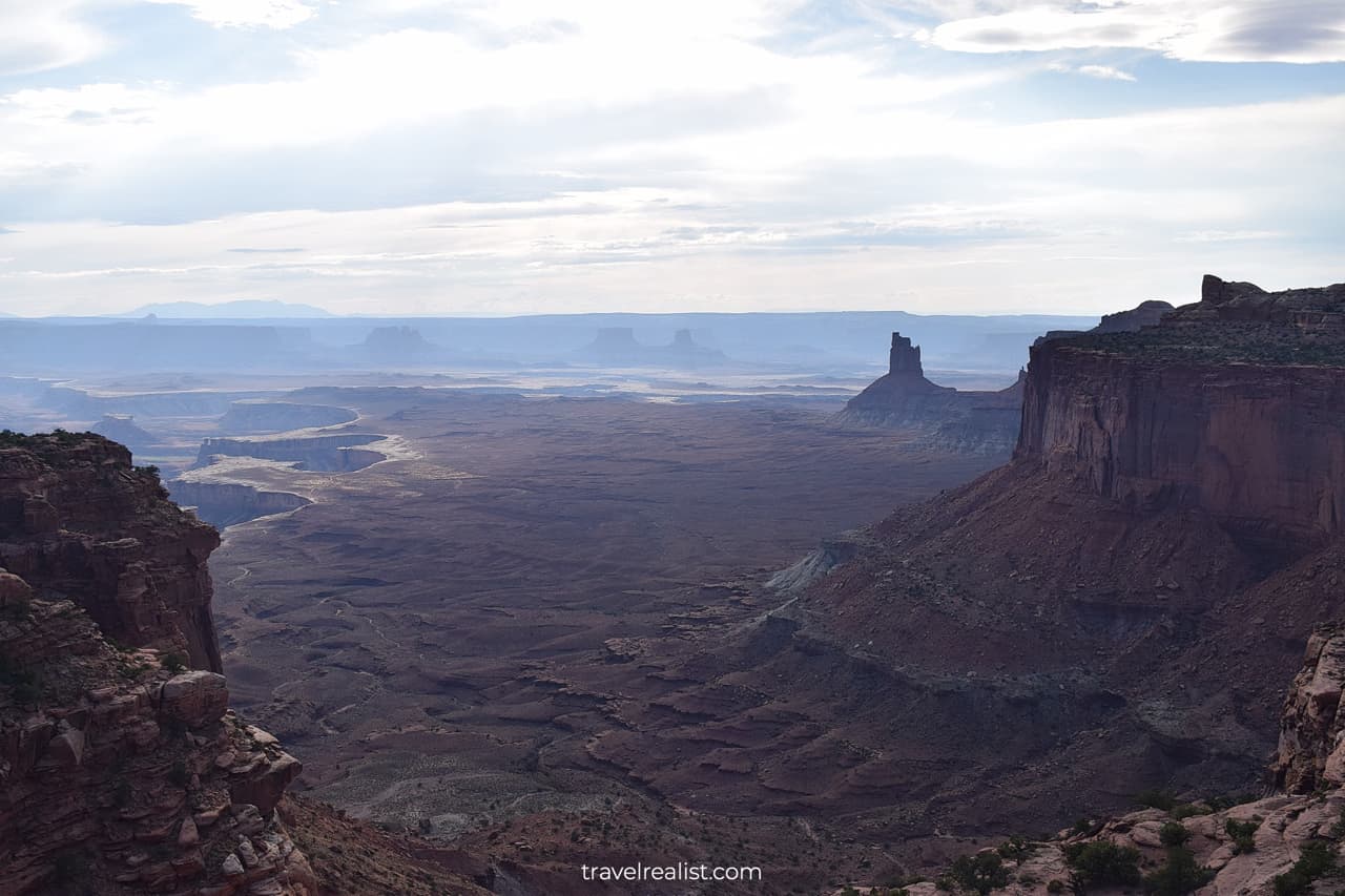
The Island in the Sky is not just a poetic name. It reflects the landscape of this district quite well. You will be driving atop of a plateau on the scenic drive in Canyonlands.
You will get excellent views of the canyons and terraces below as soon as you reach the canyon rim. It could feel as if you are driving on an island in the sky.
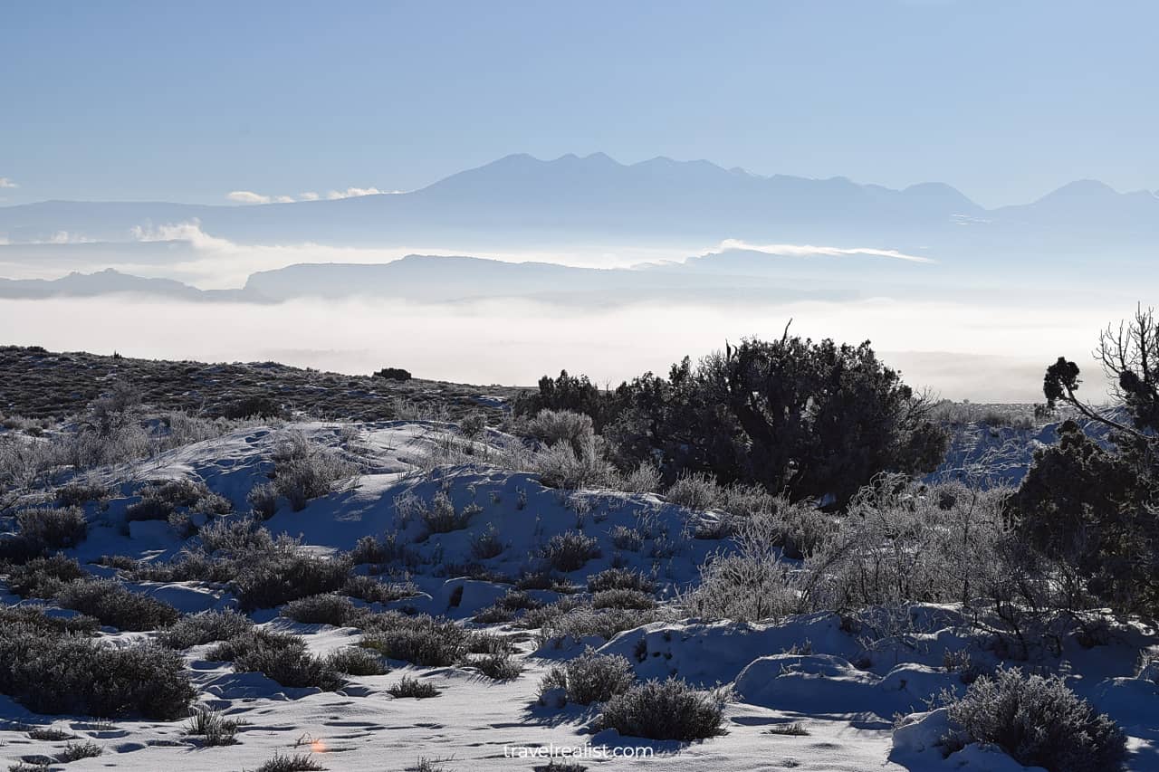
Fog and clouds could be low in Canyonlands during the colder months. This district indeed becomes an island in the sky during fog.
It might be difficult to believe that this park district is home to such beauty. Highway UT-313 that leads to Canyonlands goes over a plateau.
There are few viewpoints outside of the first 9 miles (14 km) of the road next to Highway US-191. But the views change the moment you enter the national park.
The Grand View Point Road is a 38-mi (61-km) scenic drive. It takes you from the Visitor Center to the Grand View Point Overlook, Green River Overlook, and Upheaval Dome.
Each of these big three viewpoints is a dead end. As a result, you would drive on each road twice, on the way into the park and back.
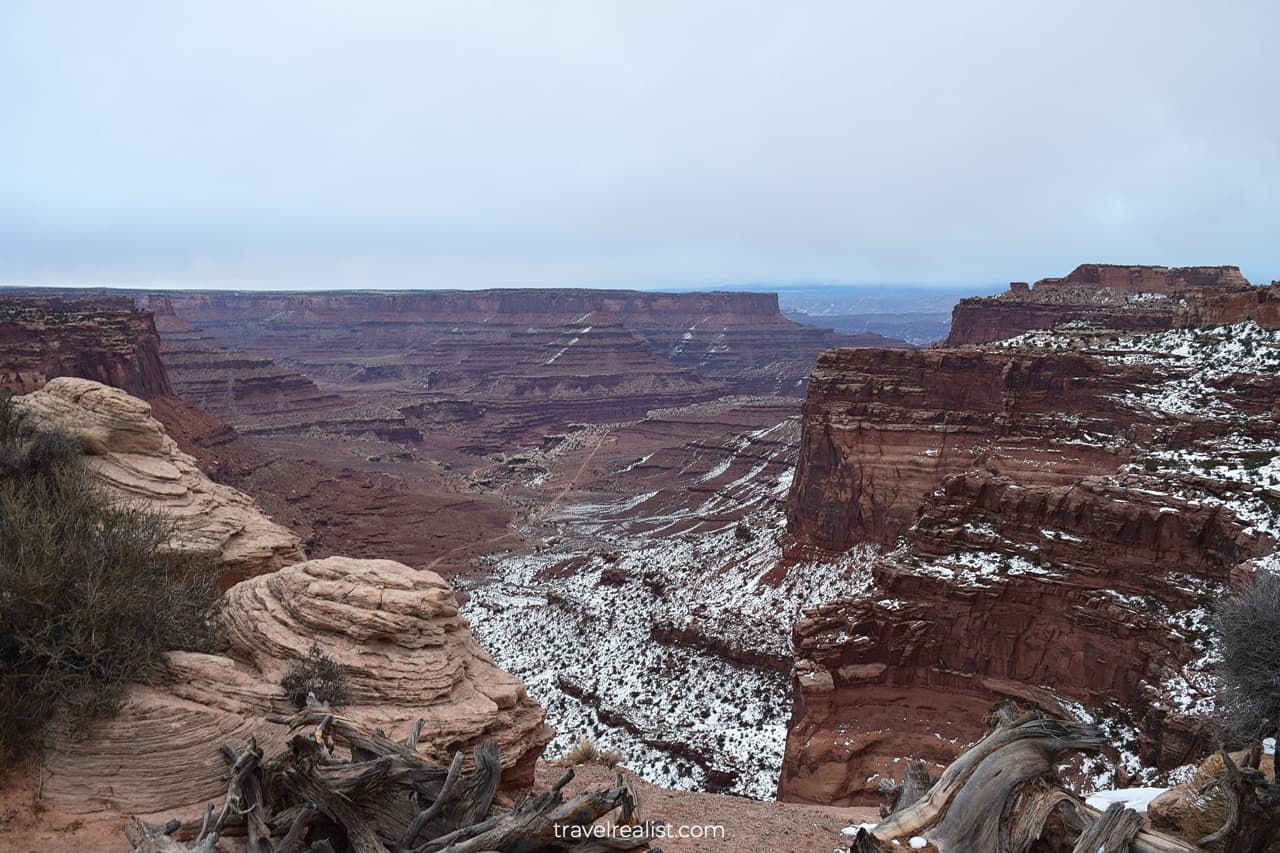
1. Shafer Canyon
You would not have to wait long for the first viewpoint in the Island in the Sky district. The Shafer Canyon Overlook is just around the corner from the Visitor Center.
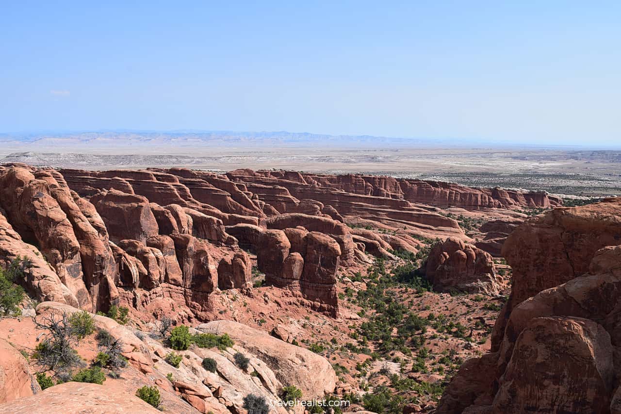
At first, the park will look a lot like Colorado National Monument. You will see steep canyon walls and formations.
But this viewpoint will give you an idea of what you are about to see in Canyonlands. Look for terraces in the distance. They set Canyonlands apart from most parks and monuments.
The Shafer Canyon Overlook also puts the Shafer Basin Road on full display. This dirt road is one of the most scenic roads in the US. It requires a high clearance 4-wheel-drive car.
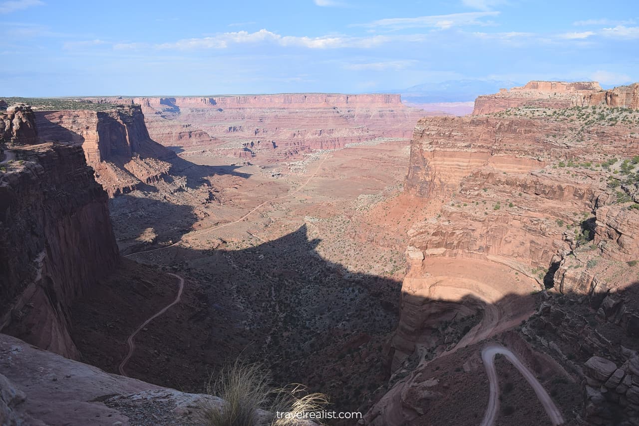
If you have the right car or bike, you could take the Shafer Basin Road to the White Rim Road. The 100-mile White Rim Road takes you all around the Island in the Sky district.
You could still enjoy Shafer Canyon even if you do not have the right vehicle. There is the Neck Spring Trail you could hike. This 5.6-mi (9-km) loop trail is a moderate hike. Its elevation is 418 ft (127 m).
2. Mesa Arch
You might not want to embark on a long hike at the first viewpoint in the park. Continue on the Grand View Point Drive if this is the case. You will be driving for about 10 minutes until the next stop.
You will have an option for another hike. The Mesa Arch Trail is a short and easy hike. This loop trail is just 0.6 miles (1 km) round trip. There is mere 56 ft (17 m) in elevation gain.
Mesa Arch is on the cliff edge. It makes this arch different from the natural bridges in nearby Arches National Park.
There might be a park ranger on duty during the high season. Their job is to prevent tourists from climbing on the arch. A number of accidents took place from reckless visitor behavior over the years.
3. Candlestick Tower
The Canyonlands Scenic Drive will present you with a few options right after the Mesa Arch Trailhead.
- You could continue driving on the Grand View Point Road.
- Or you could turn right on the Upheaval Dome Road.
The latter road has a short side road to the Green River Overlook. It is natural to wonder what route you should take next in the park.
Continue on the Grand View Point Road if this is your first visit to Canyonlands. You will visit more viewpoints sooner this way. You could take the other two Scenic Drives in Canyonlands on the way back.
This Canyonlands Scenic Drive Guide first visits the viewpoints along the Grand View Point Road.
You would not have to wait long for another scenic stop on this drive. The Candlestick Tower Overlook is exactly a mile (1.6 km) from the intersection. This viewpoint could get crowded since it only fits 5 cars.
The Candlestick Tower is a signature formation in Canyonlands National Park. It looks astonishing during every season.
You will get a distant view of the Candlestick Tower from this viewpoint. Look for the glimpses of the White Rim and the Green River to the left from the Tower.
4. Murphy Point
The Murphy Trailhead is the next stop on the Canyonlands Scenic Drive. Two trails start from this trailhead.
- Murphy Point Overlook Trail: 3.4-mi (5.5-km) out-and-back trail with 207 ft (63 m) in elevation gain.
- Murphy Hogback Loop Trail: 10.8-mi (17.4-km) loop trail with 1,448 ft (441 m) in elevation gain.
You would need to hike to get the most from this stop. The Murphy Loop Trail might be too much for a day trip to the park. But the Murphy Point Overlook is a good hike that takes 1.5 hours to complete.
You can enjoy the views of a hogback and the Green River. This is another example of a hogback ridge. You could see them from Shenandoah to Black Hills.
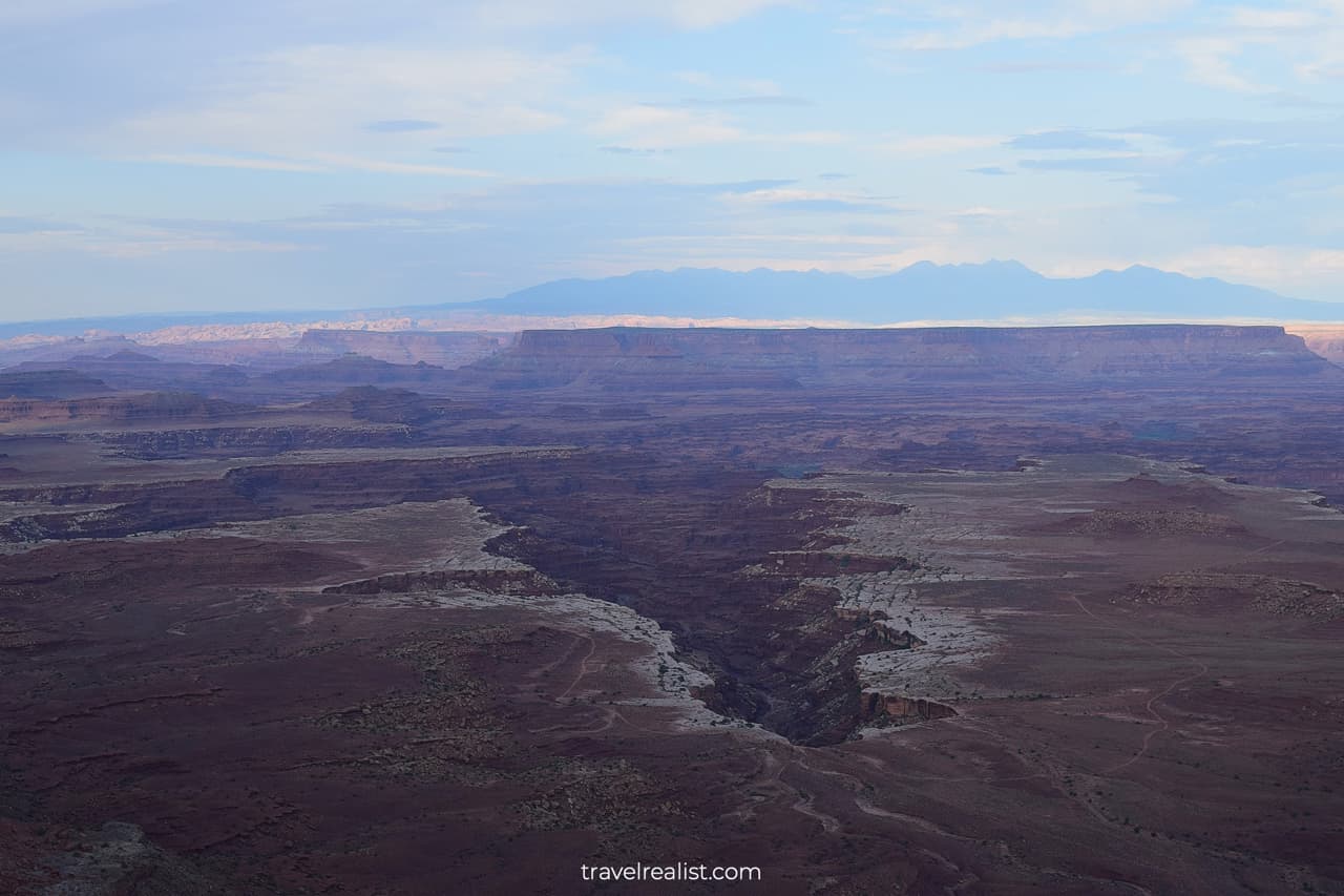
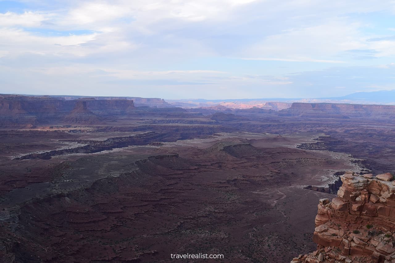
5. Buck Canyon
There is another viewpoint within a mile of the Murphy Trailhead. The Buck Canyon Overlook should be your next stop. It is the first viewpoint facing east since the Shafer Canyon Overlook.
You will not see the Colorado River from this overlook. But Buck Canyon itself is a sight to see. It is one of the most beautiful sandstone canyons in the entire park.
A few different terraces will be on display. Mt Waas, Mt Tukuhnikivatz, Mt Peale, and South Mountain will be on the horizon. You will also notice the unpaved White Rim Road if you look closer.
The best part is that you can get these amazing views right from the viewpoint. There are no hiking trails that start from the Buck Canyon Overlook.
6. White Rim
You can get a better look at the White Rim at the next stop. The White Rim Trailhead is a good viewpoint and rest stop. There are picnic tables and restrooms. Few things are better than a picnic with a view.
You could also use this stop to continue your hiking adventure in Canyonlands. There are two trails for you to choose from.
- White Rim Overlook Trail: 1.8-mi (2.9-km) out-and-back hike with 318 ft (97 m) in elevation gain.
- Gooseberry Trail: 4.6-mi (7.4-km) out-and-back hike with 1,650 ft (503 m) in elevation gain.
The former trail is a great way to see Canyonlands in about 1.5 hours. The latter trail takes you to a primitive campground. You would need about 5 hours to complete this trail.
7. Orange Cliffs
There are two more viewpoints on the Canyonlands Scenic Drive once you pass the White Rim Overlook. They are in a short stretch of the Grand View Point Road. The Road is nearing its main viewpoint.
Still, it is a good idea to stop at the Orange Cliffs Overlook first. This viewpoint faces west. You will get another view at the west part of the Island in the Sky.
It is a great spot for viewing formations in the Upper West Basin Zone of the park. Enjoy the rugged canyons and scenic cliffs.
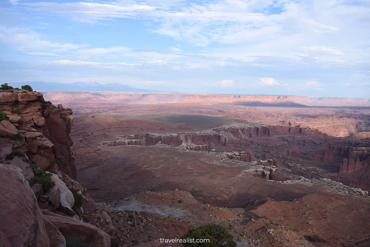
8. Grand View Point
You will reach the Grand View Point Overlook in just a minute from the Orange Cliffs Overlook. It is the southernmost stop on the same named road in the Island in the Sky district.
This viewpoint lives up to its name. It has some of the best views of Canyonlands. You can see Monument Basin, Junction Butte, Upper West Basin, and Lower Basins.
The White Rim Road will be just below you. You could even see the confluence of the Colorado River and Green River in a distance.
It makes sense to spend some time exploring the formations visible from the Grand View Point Overlook.
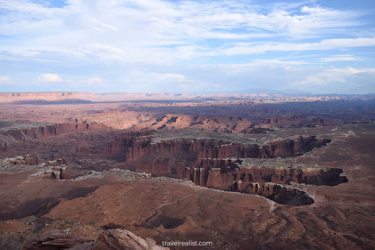
9. Monument Basin
There is no right or wrong way of enjoy the Grand View Point Overlook. You will see the White Rim and Monument Basin if you start your exploration from the east side.
You would have already seen parts of the White Rim at the previous viewpoints in the park. But it will be your first encounter with Monument Basin. This area deserves more of your time.
You can see a collection of lone standing formations just below the rim. They take different forms and shapes. But most of them look like large hoodoos in Bryce Canyon National Park.
There is no trail or road that leads to Monument Basin. You can only enjoy these formations from the distant viewpoints. This ensures that they remain protected from human activity for years to come.
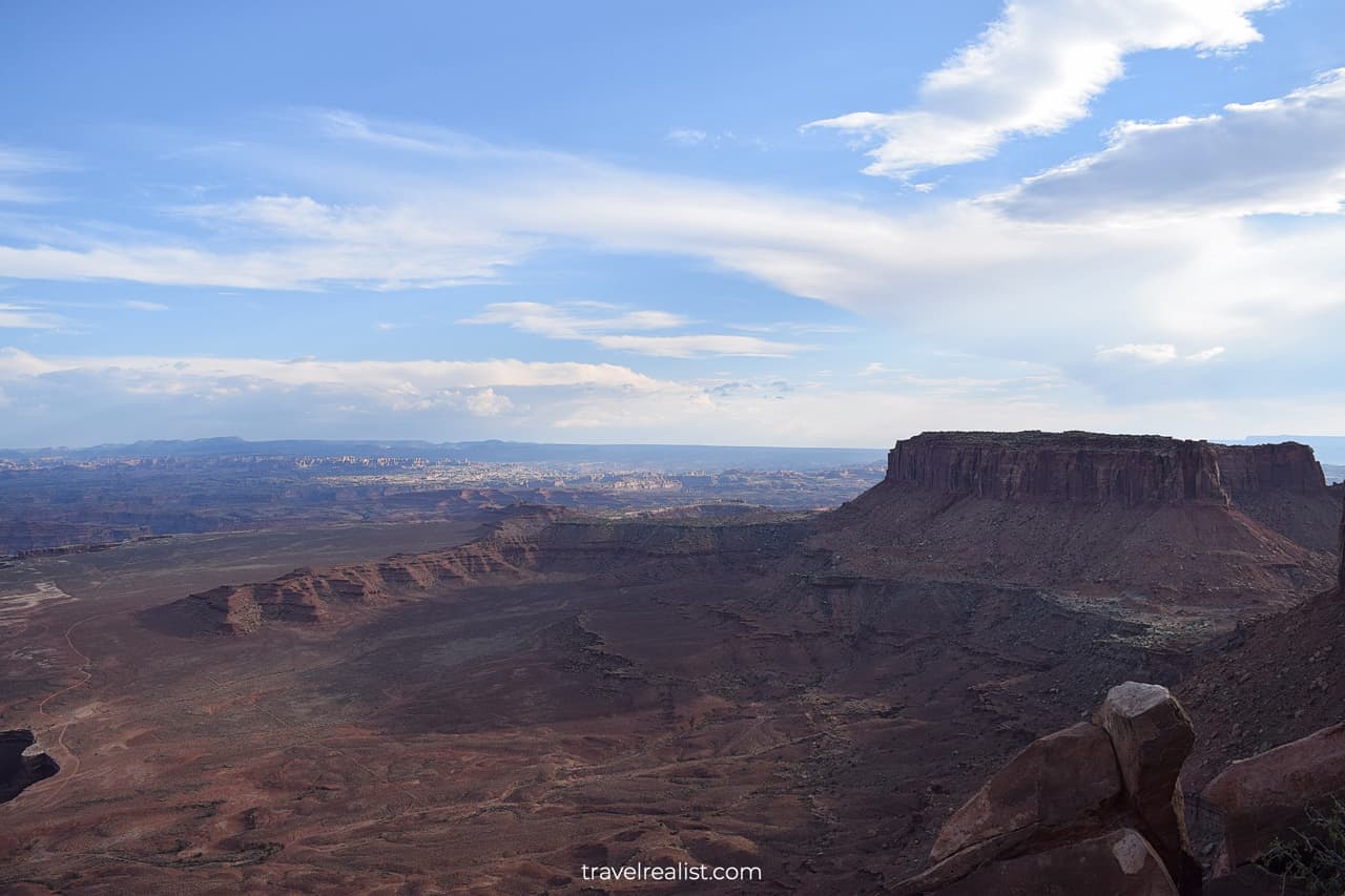
10. Junction Butte
Once you look southwest, you will see Junction Butte right away. This 6,400-ft (1,950-m) summit dominates the landscape. You can get even closer to Junction Butte if you are ready for a hike.
There is a 1.8-mi (2.9-km) round trip trail to Grand View Point. This trail is flat and follows the rim of the canyon. Its elevation is just 73 ft (22 m).
The views at the Grand View Point are a little better than from the Grand View Point Overlook. Canyonlands National Park could have done a better job at naming these two viewpoints.
Still, hiking this trail might not be the best way to spend 1.5 hours in Canyonlands. There are better hikes and viewpoints in the park. As always, the choice is yours.
11. Aztec Butte
The next stop on the Canyonlands Scenic Drive is a quite far from the Grand View Point Overlook.
You would need to drive on the Grand View Point Road back to the intersection with the Upheaval Dome Road. Turn left at the intersection and continue until you pass another intersection. Drive straight.
The Aztec Butte Trailhead will be on your right. This 1.4-mi (2.3-km) loop trail is hardly the most scenic hike in the park. It has an elevation gain of 262 ft (80 m).
You will see the remnants of old houses on this trail. These cliff houses look a bit like structures in Mesa Verde, Wupatki, and El Morro. You might not find this trail worth the effort unless you are into history.
12. Holeman & Alcove Springs
You should pass Holeman Spring and Alcove Spring Trailheads on the way to the next attraction. Both trailheads are not very scenic. You would need to hike to enjoy the views on either trail.
A round trip on each of these trails is over 9 miles (14.5 km). This is a long distance to cover under Utah’s sun. There is no shade on either of these trails.
There used to be one other iconic attraction near Alcove Spring. False Kiva is still in Canyonlands. But the park closed access to this cave due to vandalism. Since you cannot enter the Alcove, it is best to skip this stop.
13. Whale Rock
You are better off driving to Whale Rock. This formation is close to the Alcove Spring Trailhead. You only need to hike 0.8 miles (1.3 km) round trip to see it. The elevation gain is 151 ft (46 m).
The rock itself looks similar to Double O Arch trail in Arches National Park. This is hardly a surprise. These national parks are less than an hour away from one another.
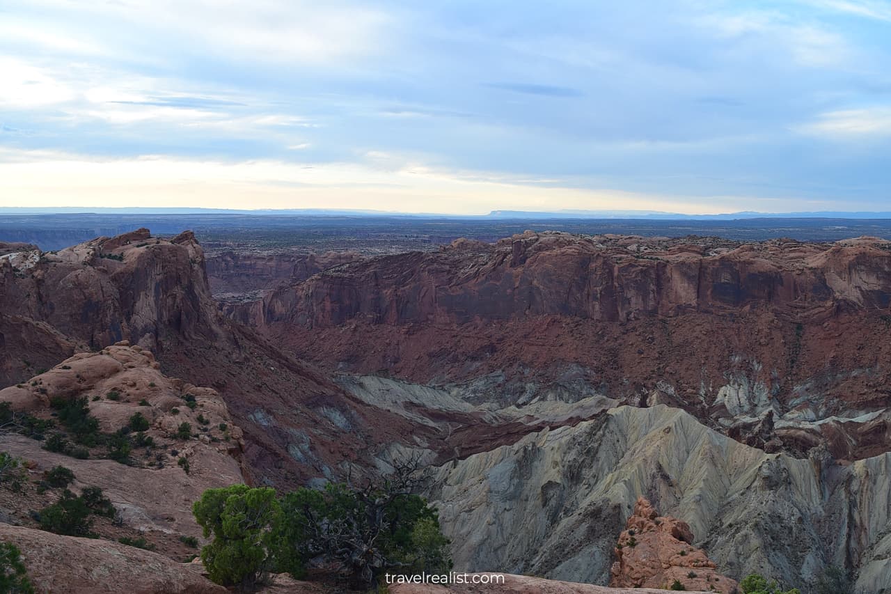
14. Upheaval Dome
You will arrive at the end of the Upheaval Dome Road. In case you have not guessed it, Upheaval Dome is the formation you can reach from this trailhead. You can do so via a few trails.
- First Overlook Trail: 0.6 miles (1 km) round trip. Elevation gain is 140 ft (43 m).
- Second Overlook Trail: 1.2 miles (1.9 km) round trip. Elevation gain is almost 400 ft (123 m).
- Syncline Loop Trail: 8.1 miles (13 km) round trip. Elevation gain is 1,516 ft (462 m).
You can extend the Syncline Loop Trail to see Upheaval Crater or Upheaval Canyon. The former will add another 3 miles (4.8 km) to your journey. The latter destination is another 7 miles (11 km) round trip.
The Overlook Trails are the only viable options if you are visiting Canyonlands National Park on a day trip. They do not take much time. But the views from the top of the crater are fantastic and make the hike well worth the effort.
15. Green River
You would need to start driving back towards the Visitor Center after hiking Upheaval Dome. But there is one more stop to make before exiting the Island in the Sky district.
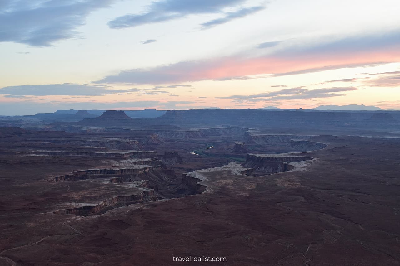
Do not forget to turn right towards the Green River Overlook. The name says it all. This viewpoint has amazing views of the Green River and White Rim.
It is the only viewpoint in the park where you can see either the Colorado or Green River clearly. It is also a great spot to catch a sunset. Stop by this viewpoint and enjoy the setting sun over the formations.
You would need to follow the rest of the Canyonlands Scenic Drive back to the park’s entrance. You will pass the Mesa Arch Trailhead, Shafer Canyon, and Visitor Center on the way back.
The Needles
Canyonlands has another park district with paved roads. Once you have seen the sights in the Island in the Sky district, you could visit the Needles.
The Needles is just across the Colorado River from the Island in the Sky. But you would need to take a 2-hour long journey to reach this district from the Grand View Point Overlook.
Yet, it is easier to visit the Needles if you are traveling on Highway US-191 from Colorado or Arizona. You can add this district to your exploration of Mesa Verde, Monument Valley, or Antelope Canyon.
This Needles will give you a different perspective of Canyonlands. This Canyonlands Scenic Drive Guide will now discuss the places of interest in the Needles district.
The truth is that this park district is not the best destination for a scenic drive in Canyonlands. Just see for yourself.
- The paved scenic drive is 9 miles (14 km) long. You will take same route to drive back.
- There are just a handful of viewpoints in the Needles.
- You could extend your exploration by a few miles (km) by taking two gravel roads.
Whatever the Needles district lacks in viewpoints, it gains in hiking trails. There are over 60 miles (97 km) of trails in this district of Canyonlands.
Hiking is also the only way to see the “Needles” formations that gave this district its name. You can see them from the road. But the views are very distant.
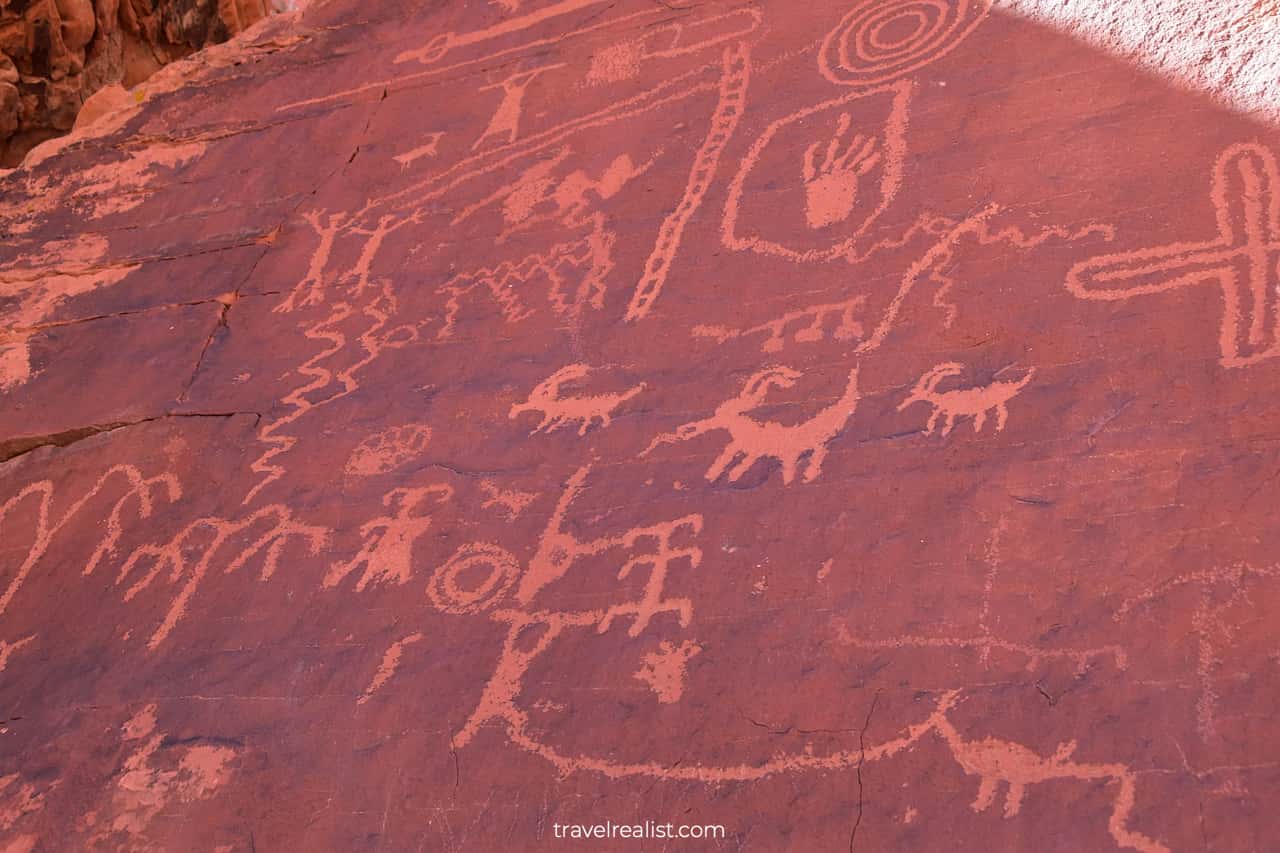
16. Newspaper Rock
You would need to drive for 32 miles (51 km) from Highway US-191 before you enter the national park. At least this route is quite scenic.
You will first pass Newspaper Rock. This is a small state monument that protects petroglyphs. There is a fence that separates the petroglyphs from the parking lot.
Still, the petroglyphs there are quite beautiful. They look most like Atlatl Rock in Valley of Fire State Park in Nevada.
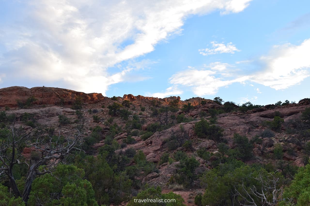
17. Bear Ears
You will reach Bear Ears National Monument soon after Newspaper Rock. This park has been in the center of fierce debates over the last decade. Its boundaries changed a few times.
You will pass the Indian Creek Unit of the Monument on your way to Canyonlands. You will know that you arrived at Indeed Creek as soon as you see green trees and lush vegetation.
It would be easy to forget that you are in the desert. This landscape looks quite a bit like Fremont River Valley in Capitol Reef.
18. Wooden Shoe Arch
Once you enter the Needles district of Canyonlands, you could first stop at the Visitor Center. It is a good place to use amenities and get advice from a park ranger.
The first viewpoint in the Needles is just 2 miles west of the Visitor Center. You will see Wooden Shoe Arch from this viewpoint.
It looks exactly as it sounds. Many names in Canyonlands perfectly describe the attraction. You will get very distant views of this arch. A hike to Wooden Shoe Canyon is 8.7 miles (14 km) long.
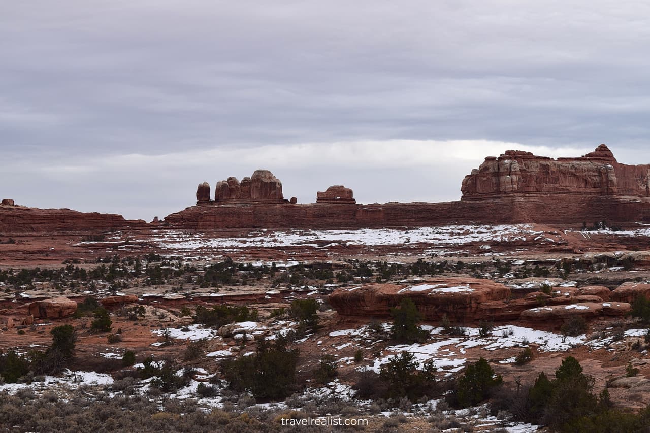
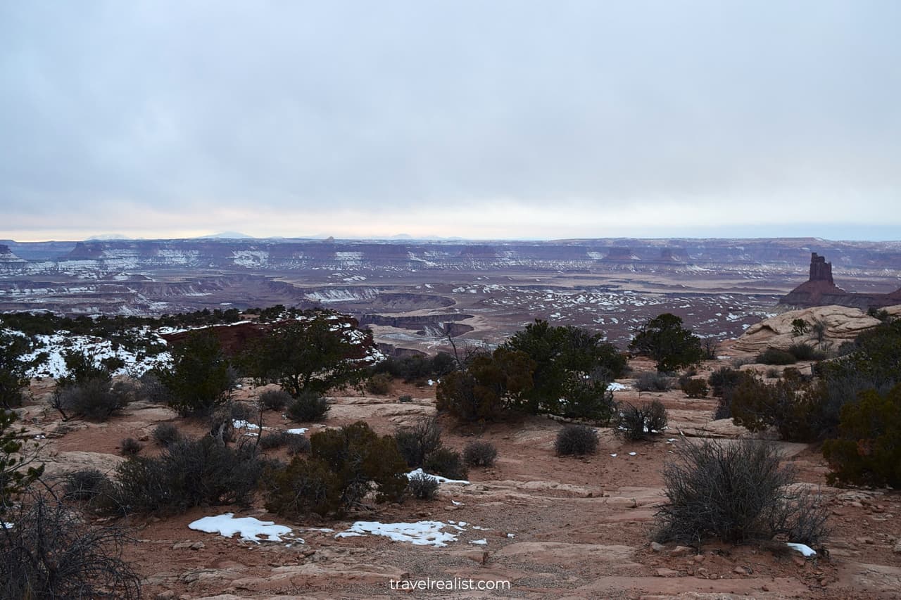
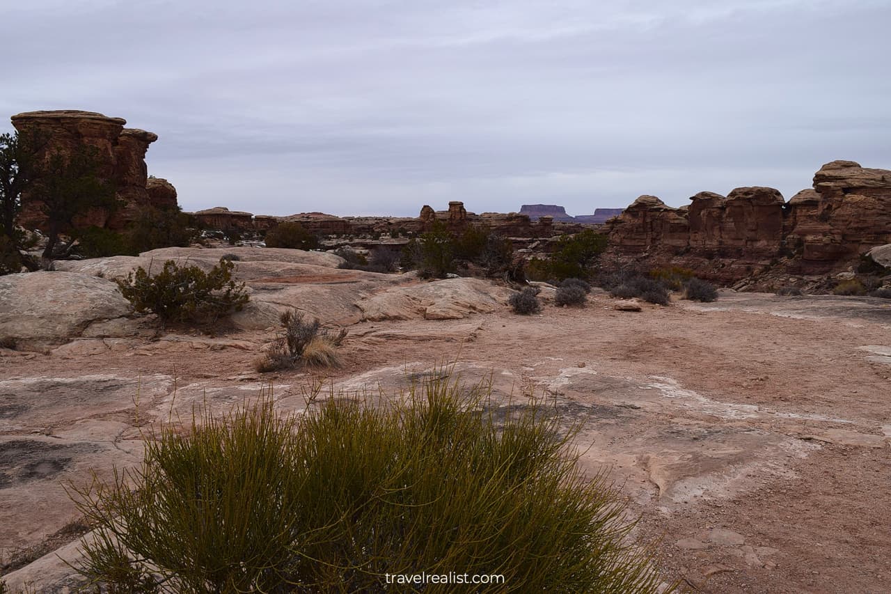
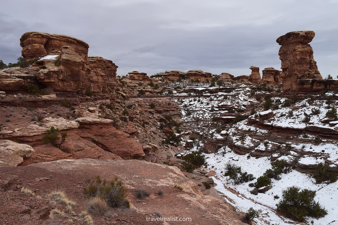
19. Big Spring Canyon
The Canyonlands Scenic Drive in the Needles will then bring you past a campground and a few more trailheads. It will not take you long to reach the end of the road at the Big Spring Canyon Overlook.
You will get nice views of Big Spring Canyon. It might be difficult to see the spring during the cold season. The canyon could be covered in snow if you visit in the winter.
This viewpoint also serves as a trailhead. It is the starting point for a 11-mi (18 km) round trip hike to the Confluence Overlook. You will see the Colorado and Green River confluence at the end of the trail.
The views are breathtaking. But they might not be enough to justify such a long and strenuous hike.
Unless you are ready to hit the trails, there is not much to do in the Needles district of Canyonlands. You would need to drive back on UT-211 all the way to Highway US-191.
The Maze, Horseshoe Canyon, & Orange Cliffs
You can access the Maze, Horseshoe Canyon, and Orange Cliffs districts from Highway UT-24. This is the main road to Capitol Reef National Park.
You would need to drive on a dirt road for 46 miles (76 km) just get to the entrance station. Horseshoe Canyon Unit is in a similar boat. You would have to drive on unpaved roads for 32 miles (51 km).
There is a time and a place for visiting these park districts. But this Canyonlands Scenic Drive Guide leaves both of them outside of this overview.
Continue with this Canyonlands Scenic Drive Guide. You will learn more about ways to get to the sights, entrance requirements, and places to stay.
Getting to Canyonlands
Canyonlands is a national park in Eastern Utah. The park is south of Interstate Highway I-70 and west of Highway US-191. Canyonlands is also near the state line with Colorado.
Moab is the closest town to Canyonlands. But it does not have a major airport. Salt Lake City is the closest city with an airline hub to the park. A drive from SLC will take about 4 hours.
You could also reach Canyonlands from Denver, Colorado. Budget about 5.5 hours to get to the park from the capital of Colorado.
Albuquerque, New Mexico and Las Vegas, Nevada are two other major airports somewhat close to Canyonlands. A trip from either city will take about 6.5 hours.
Canyonlands has four districts or units. There are few roads between these districts. The Island in the Sky and the Needles are the only districts with paved roads. There is 12 miles (20 km) between them.
Still, there is no direct connection between these units inside the park. You would need to take a 107-mi (172-km) detour to reach the Island in the Sky from the Needles.
The Maze, Horseshoe Canyon, and Orange Cliffs do not have any paved roads. You can only reach them by taking dirt roads. These units are not day trip destinations. You would need permits to explore them.
The Island in the Sky district is about 28 miles (45 km) from Arches National Park and Moab. The Needles district is closest to the city of Monticello.
Where to Stay near Canyonlands
Moab is the best choice for places to stay when visiting Canyonlands National Park. You should make this town your base for exploring other sights in the region. Do not forget to visit Arches while staying in Moab.
Places to stay in Moab could get expensive around major holidays. But you could get a good deal if you book lodging as soon as you decide to visit Canyonlands.
There are few nearby towns with as many places to stay as Moab. But you should also look into Green River and Monticello.
Both towns are further away from the park than Moab. Yet, they could provide an alternative if prices in Moab skyrocket.
Entrance Requirements & Passes
Canyonlands National Park is open 24 hours a day, every day of the year. The Island in the Sky and the Needles Visitor Centers have shorter hours. They also observe federal holidays.
The park charges entrance fees of $30 per car. Pack your America the Beautiful annual pass. Or buy it right at Canyonlands. The pass gets you free admission to this national park.
You would need to get day use permits if you plan on driving on the dirt roads in the park. Each permit costs $6 in online fees. You could try your luck and get a free permit at the visitor center.
No permit beyond the entrance fee is needed to drive on the paved scenic drives in Canyonlands.
The remote location of Canyonlands helps with the crowds somewhat. You should still expect a line to enter the park during the peak hours of the summer season.
At least you do not need to get a reservation in advance to visit this park. It sets Canyonlands apart from neighboring Arches.
Takeaways: Canyonlands Scenic Drive
Canyonlands National Park protects unique landscapes. The powerful rivers and creeks created canyons within canyons over many years. This sandstone scenery is absolutely surreal.
You cannot help but admire the beauty of nature in Canyonlands. Just stop at any viewpoint on the scenic Grand View Point Road and explore the park more.
The Island in the Sky district is the right place to visit if you only have one day in Canyonlands. Head down to the Needles district if you have another day in the park.
Beware that the Needles district has very few paved roads. You have to drive on 4×4 dirt roads or hike for long time. You might not enjoy this park district if you are not ready to do either of these things.
Other districts of Canyonlands are best for hardcore travelers. You can get off the grid in the Maze or Horseshoe Canyon. Know your limits when exploring Canyonlands in this fashion.
Take a look at this Canyonlands Scenic Drive Video Guide. And visit the YouTube channel for the latest videos.
Frequently Asked Questions
Canyonlands protects sandstone canyons and formations created by the Colorado and Green Rivers.
Canyonlands National Park is spectacular during any season. Consider visiting the park in the fall or spring. It will increase your chances of seeing the Island in the Sky district in the fog.
The scenic drive in the Island in the Sky district of Canyonlands is 38 miles. It includes the Grand View Point Road, Green River Overlook Road, and Upheaval Dome Road. You would drive all three scenic roads twice.
It will take you about 90 minutes to drive on the Canyonlands Scenic Drive without stopping. Add more time to explore viewpoints and short hikes.
Canyonlands National Park has a 38-mi scenic drive in the Island in the Sky district.
The Island in the Sky district is an ideal destination for the first trip to Canyonlands. It has a good combination of a scenic drive, picturesque viewpoints, and short hikes.
Grand View Point, Mesa Arch, and Upheaval Dome are the best day hikes in Canyonlands. These trails are all in the Island in the Sky district and under 2 miles round trip.
The Needles district of Canyonlands has a few unique formations. But you cannot get to most areas unless you drive on a dirt road or hike. Skip this district if this is your first visit to Canyonlands.
Safe realist travels!