Palmetto State Park: 8 Hikes in A Tropical Forest in Central Texas
This realistic Palmetto State Park Hikes Guide helps you plan your next adventure in this Texas hidden gem.
Palmetto is a state park in Central Texas. It protects dwarf palmetto trees at the swamps of the San Marcos River. These trees gave the park its name.
This post includes affiliate links that will earn us commission if you make a purchase via these links.
Sights & Places of Interest
Palmetto State Park looks and feels very different from other parks in Central Texas. You will not see limestone ledges like in Garner, Lost Maples, or Balcones Canyonlands.
There are no waterfalls like the ones in McKinney Falls and Pedernales Falls. You should not expect flower meadows similar to Muleshoe Bend, Grelle, or Meridian either.
But Palmetto does not need to compete with these parks. Visitors come to Palmetto to experience a swamp ecosystem without driving to Florida, Georgia, or South Carolina.
There are 5 miles (8 km) of easy and moderate hiking trails in the park. This Palmetto State Park Hikes Guide describes all of them in detail.
1. Ottine Swamp Trail
- Distance: 1.0 miles (1.6 km)
- Elevation Gain: 13 ft (4 m)
- Type: loop
- Difficulty: easy
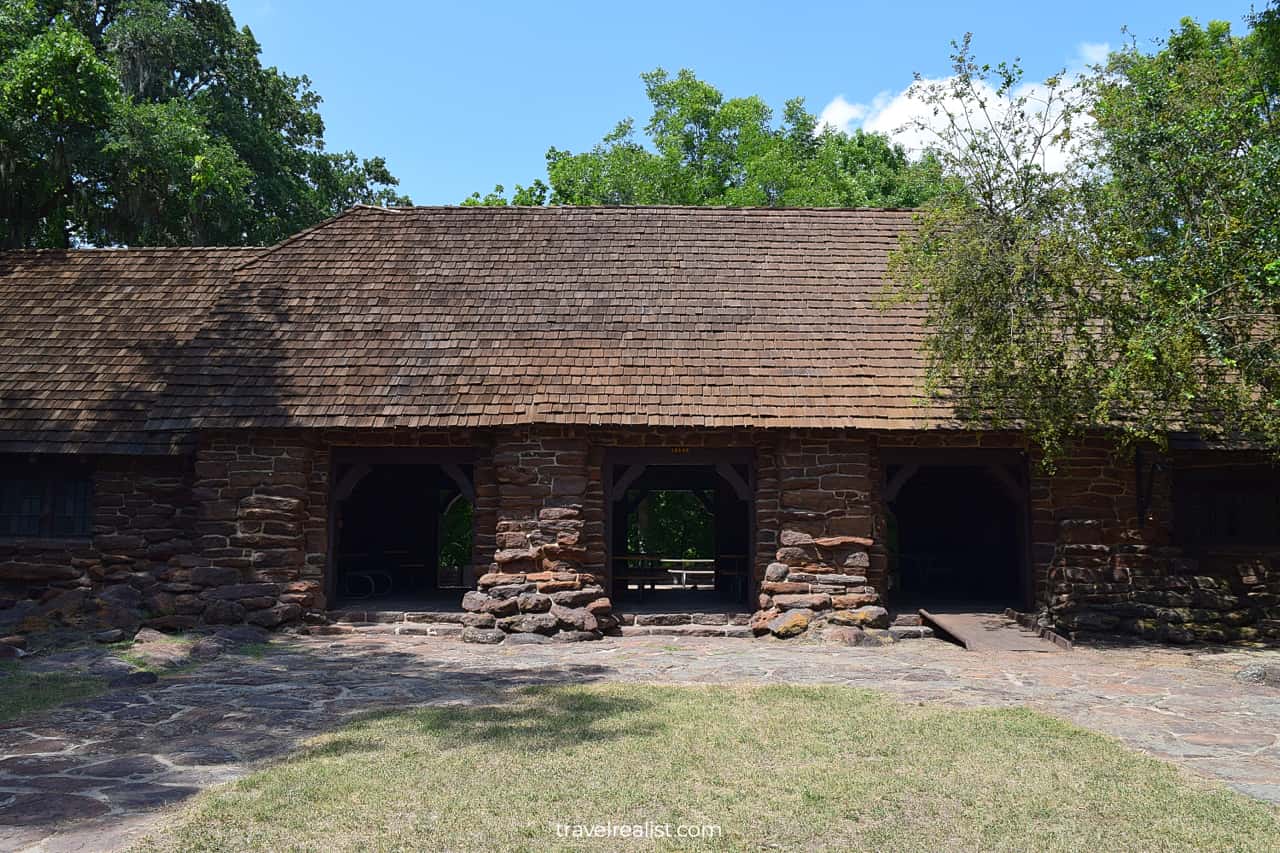
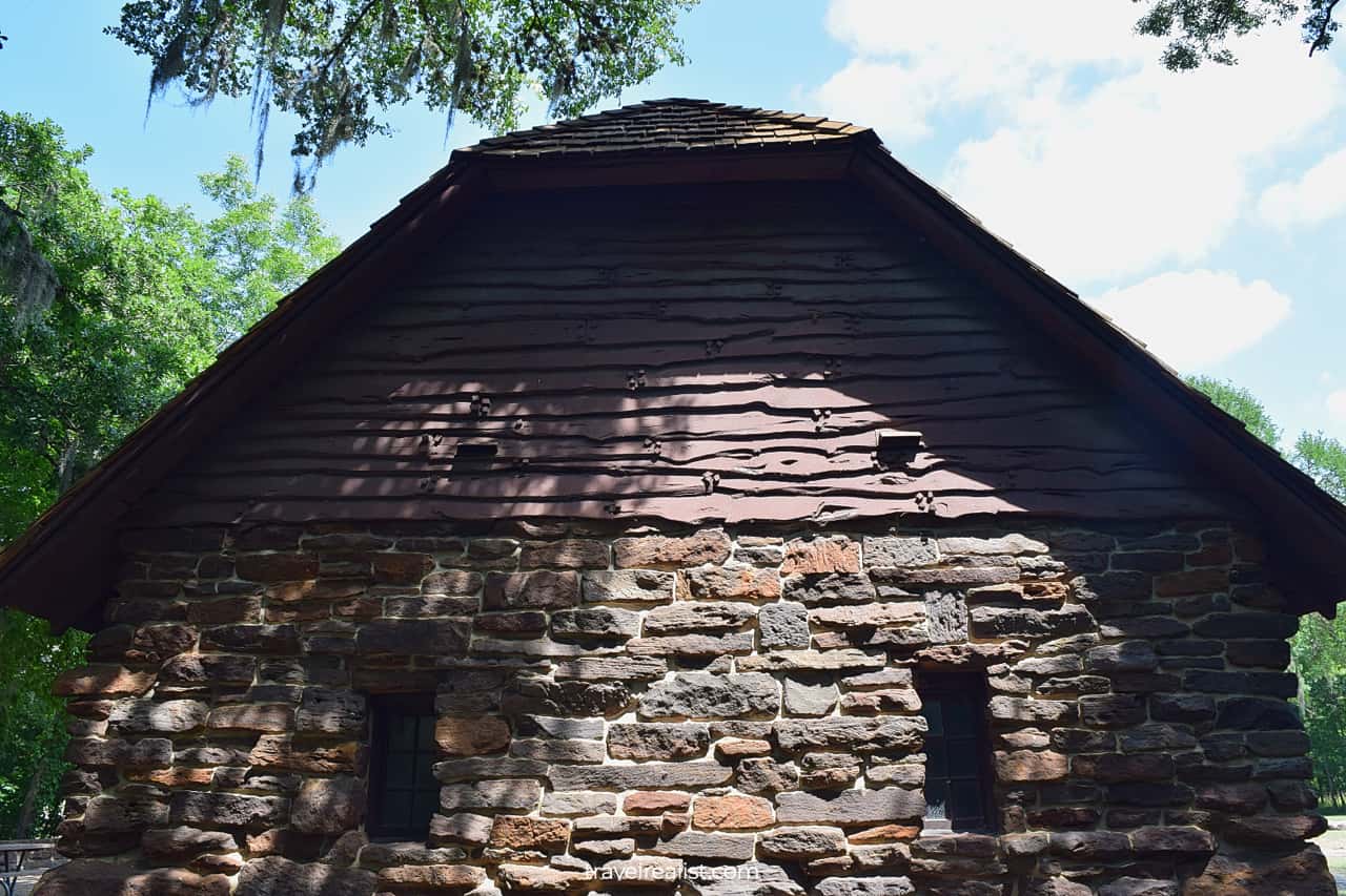
The Ottine Swamp Trail is one of the best day hikes in Palmetto State Park. This easy trail starts from the Civilian Conservation Corps (CCC) Refectory. The 1930s dining hall is next to the trailhead parking lot.
You could find a similar stone buildings in Meridian State Park and Longhorn Cavern up north. But the historic structure is just a preview to the main sights on the Ottine Swamp Trail.
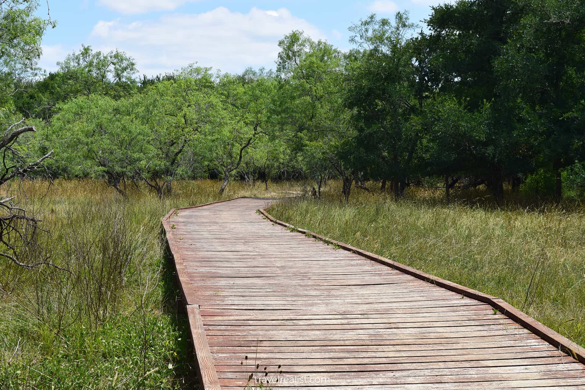
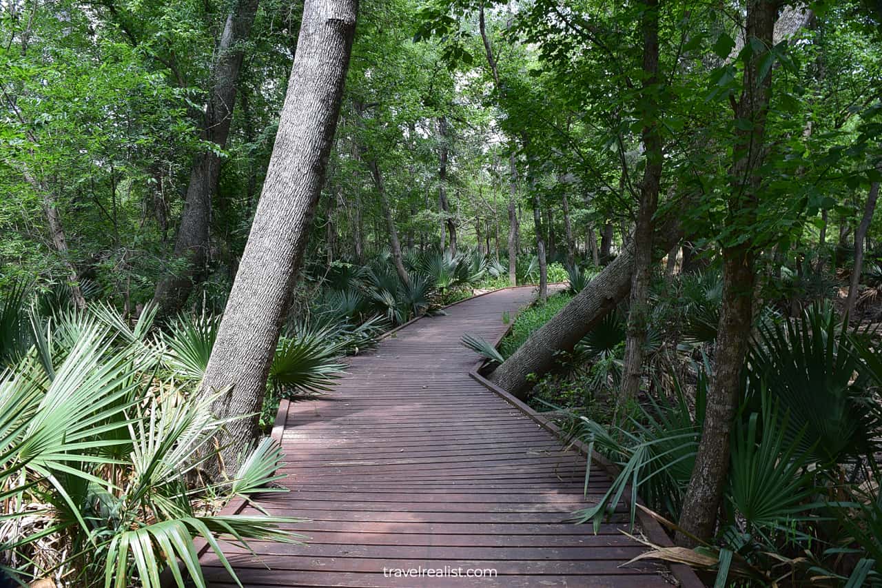
This path starts going over the wooden decks almost as soon as you cross Park Road 11. You will see lots of palmetto trees on both sides of the trail. It is easy to imagine this path in Silver Springs in Florida.
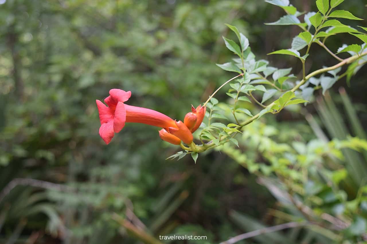
But the experience is surreal for Central Texas. Keep an eye for flowers and wildlife as you go through the Ottine Swamp. Trumpet vine and vultures are a common sight in Palmetto State Park.
2. Palmetto Interpretive Trail
- Distance: 0.3 miles (0.5 km)
- Elevation Gain: 0 ft (0 m)
- Type: loop
- Difficulty: easy
You could take a short detour to the Palmetto Interpretive Trail after completing the hike through the Ottine Swamp. This hiking trail will not wow you with its views, distance, or elevation gain.
You would have also seen a lot of palmettos by the time you reach this nature path. It is natural to wonder whether this extra hike is worth it.
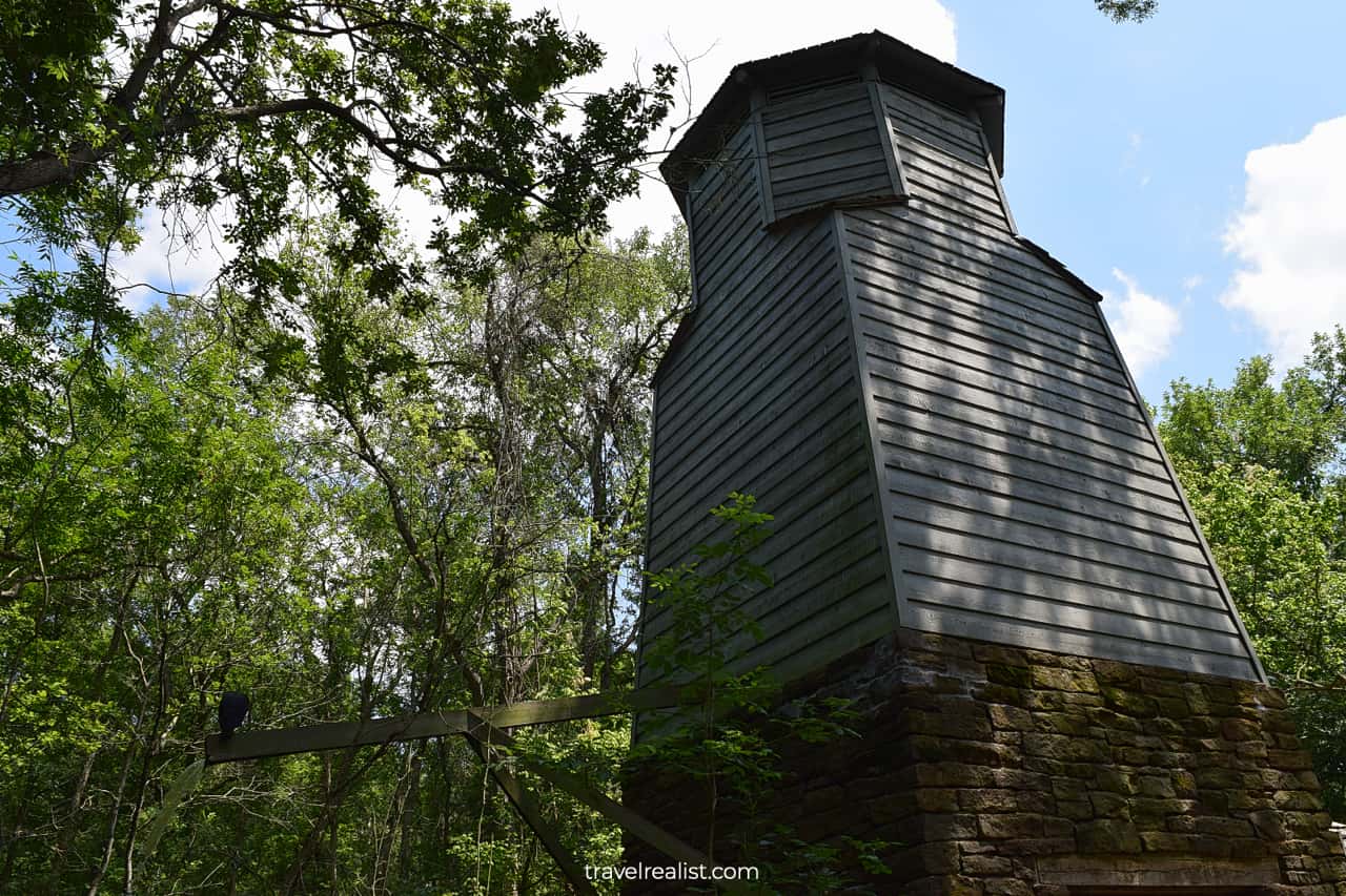
Do not be too quick to jump to conclusions. This short hike has something up its sleeve to surprise you. You will arrive at the CCC Water Tower soon.
This massive tower also dates back to the Great Depression times. This stone and wooden structure provides water to plants and animals at Palmetto. It is one of the best spots to see wildlife in the park.
3. Mesquite Flats Trail
- Distance: 1.1 miles (1.7 km)
- Elevation Gain: 7 ft (2 m)
- Type: out-and-back
- Difficulty: easy
The Ottine Swamp Trail and Palmetto Interpetive Trails both connect you to the Mesquite Flats Trail. This path is one of the most scenic hikes in Palmetto State Park.
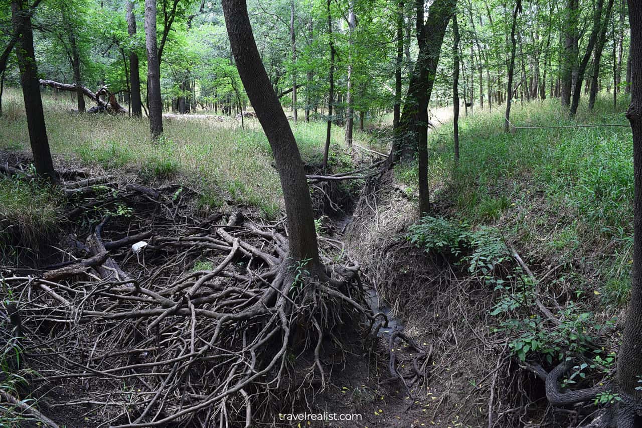
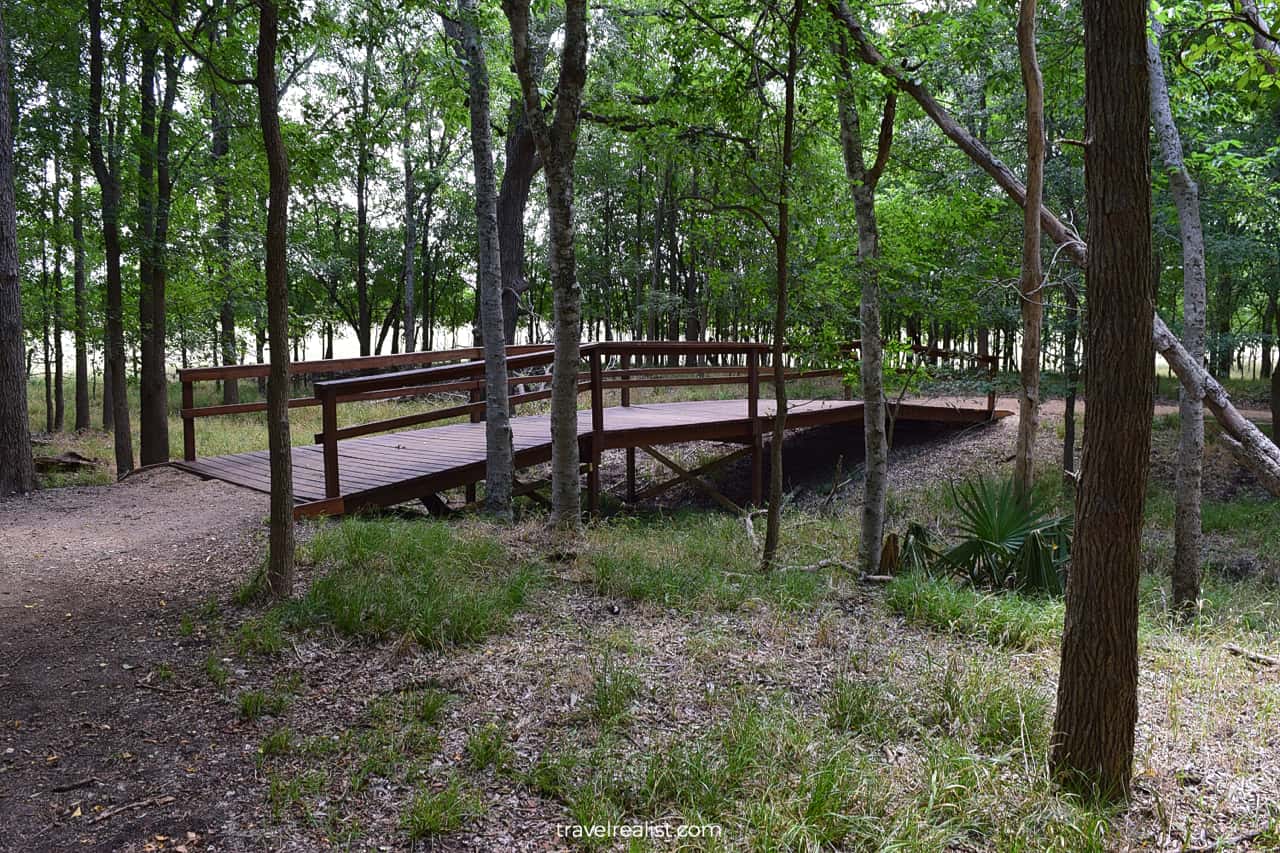
The trail goes through a forest at first. Get ready to cross a creek over a couple of wooden bridges. The creek washes away soil below some of the trees. You could see impressive root systems on full display.
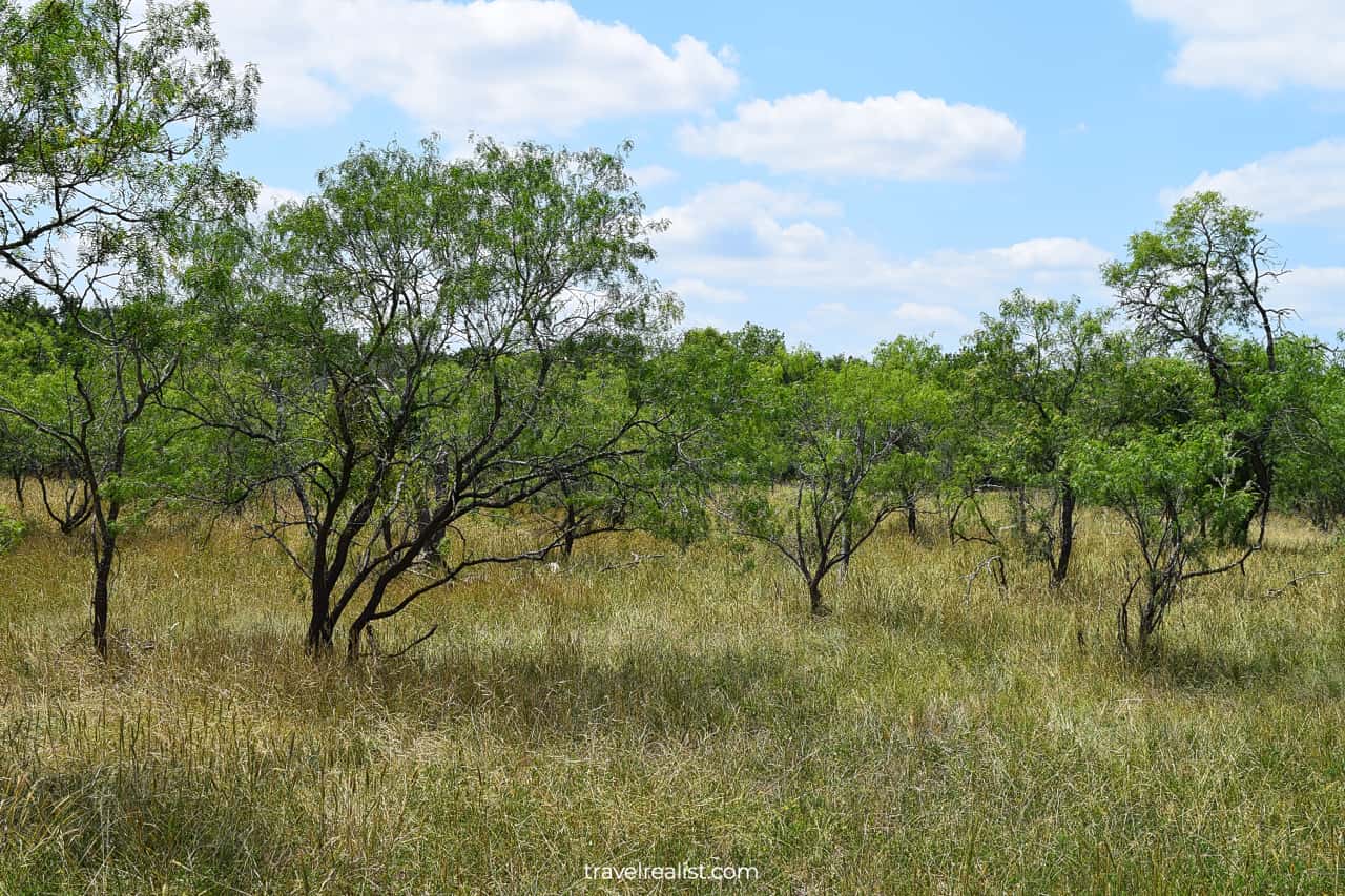
The middle section of the trail brings you to Mesquite Flats. You will see a lot of mesquite trees and grass meadows. The whole section has boardwalks to protect the native plants.
While the flats are scenic, they have zero shade. It could be the most dangerous part of your hiking adventure in Palmetto State Park. Wear a hat and sunscreen no matter when you visit the park.

4. San Marcos River Trail
- Distance: 1.3 miles (2 km)
- Elevation Gain: 42 ft (13 m)
- Type: loop
- Difficulty: easy to moderate
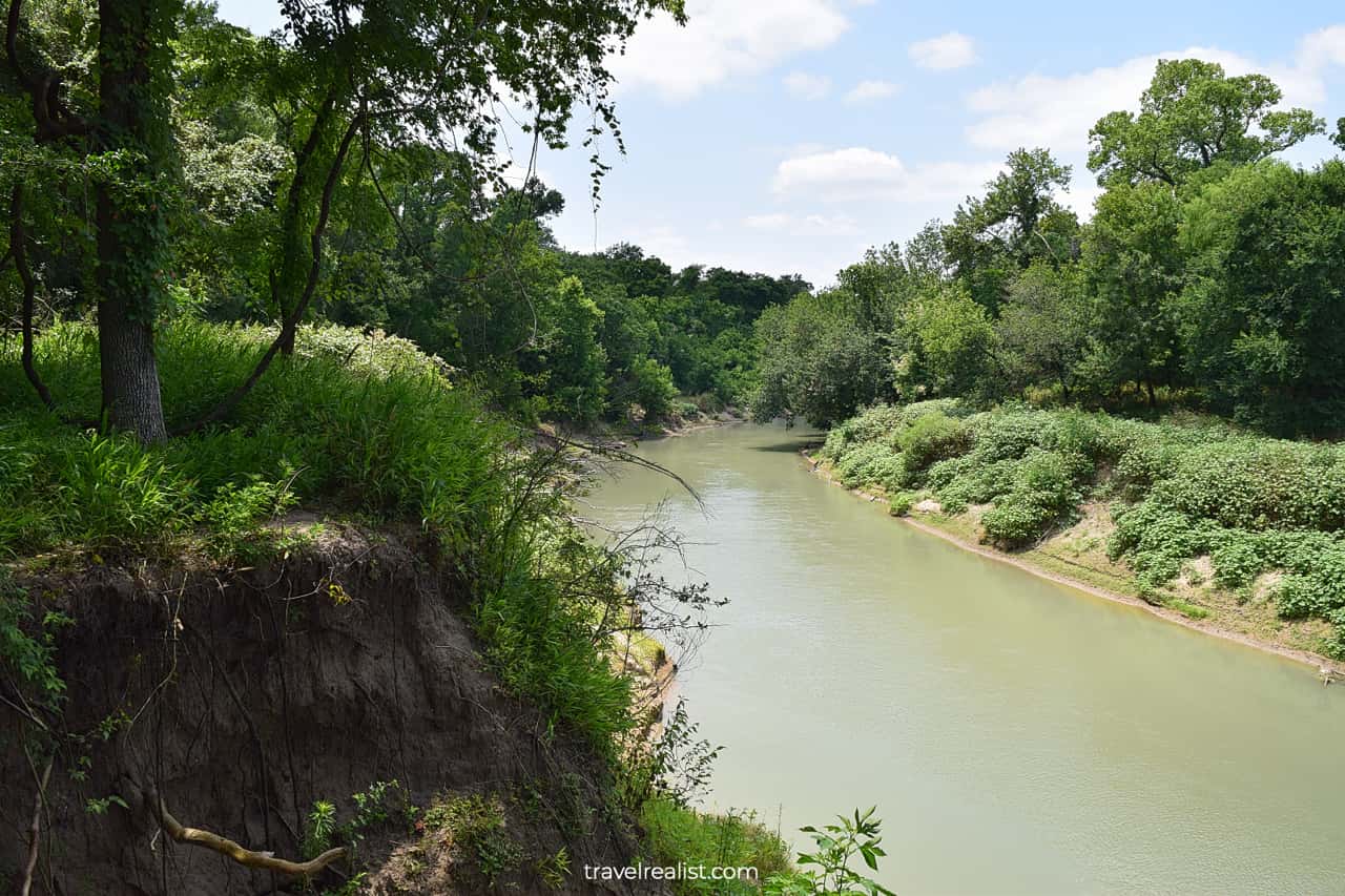
You would have covered about 2.5 miles when you arrive at the San Marcos River Trail. As the name suggests, this hiking trail follows the river as it makes a scenic bend.
The south shore of the San Marcos River has cliffs. These dirt cliffs are a few dozen feet (meters) tall. They are washed away with every flash flood. Be careful as you enjoy the river views from the trail.
There is little to see on the San Marcos River Trail beyond the river. There used to be mud boils like in Yellowstone and Lassen Volcanic. But they went extinct in the 1970s.
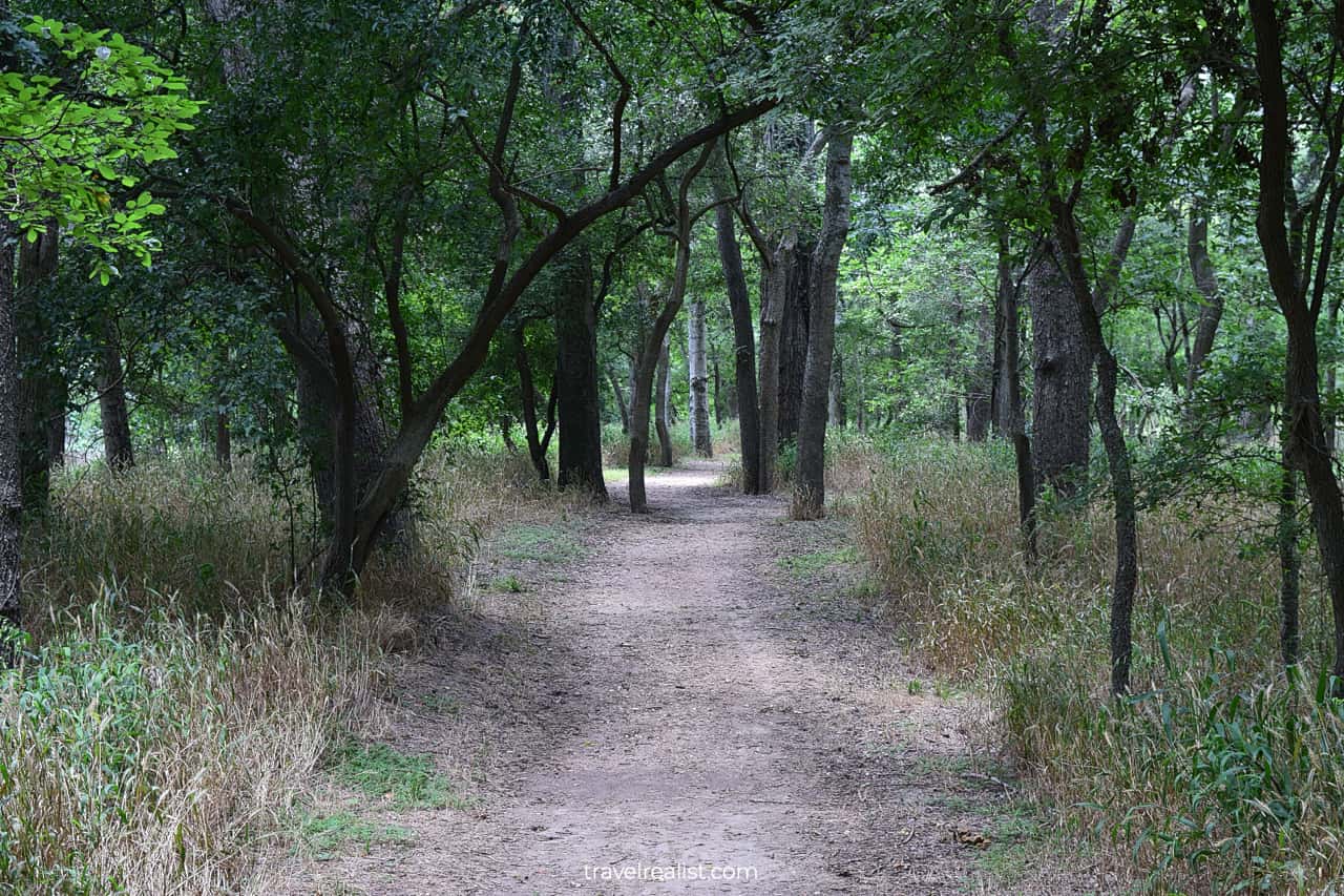
On the bright side, you will be hiking in an oak grove during most of the trail. This setup helps make the hike more bearable even during Texas summer. Water and insect repellent are still good items to pack.
5. Canebrake Spur
- Distance: 0.1 miles (0.2 km)
- Elevation Gain: 0 ft (0 m)
- Type: out-and-back
- Difficulty: easy
You could take the Canebrake Spur if you are looking for a shortcut to the parking lot. It saves you over a mile (1.6 km) in distance compared to the San Marcos River Trail.
This might not be an exciting proposition to the avid hikers. But beginners who chose to complete hikes in Palmetto State Park in the summer might disagree.
This short path goes through an oak grove like most trails in this part of the park. You should be on the lookout for canebrake rattlesnakes. This snakes live in the park and come near the trails sometimes.
6. Mossycup Spur
- Distance: 0.3 miles (0.5 km)
- Elevation Gain: 10 ft (3 m)
- Type: out-and-back
- Difficulty: easy
The Mossycup Spur is one of the last hikes to consider in this part of Palmetto State Park. This path connects the Canebrake Spur, San Marcos River Trail, and a campground.
You will see lots of bur oak trees on this trail. A few exposed roots are also going to be visible due to the water damage and a slight elevation change.
Like the other spur trail in the park, the Mossycup Spur is not the prettiest hike in Palmetto. But you could enjoy a leisurely stroll through a forest if time is not an issue.
7. Oxbow Lake Trail
- Distance: 0.7 miles (1.1 km)
- Elevation Gain: 9 ft (3 m)
- Type: loop
- Difficulty: easy
You will arrive at the parking lot after completing the San Marcos River Trail or the Mossycup Spur. There are two more hikes in Palmetto State Park. But they start from a trailhead about a mile (km) north.
You could certainly reach it by car. Or you could take a low-water crossing behind the Dining Hall. You should be able to even keep your feet dry. A brief walk on Park Road 11 brings you to the trailhead.
The Oxbow Lake Trail starts near another CCC structure. The Artisan Well was built to maintain the water levels in the lake and ponds.
The path makes a full loop around the lake. You will need to cross Park Road 11 twice as you hike the trail. This is not the safest path for kids despite a marked pedestrian crossing.
8. Park Headquarters Trail
- Distance: 0.2 miles (0.3 km)
- Elevation Gain: 9 ft (3 m)
- Type: out-and-back
- Difficulty: easy
There is one last hike in Palmetto State Park. The Park Headquarters Trail connects Oxbow Lake with the Park Office. It is nothing more than a simple connector path.
The hike follows Park Road 11 during the whole time. You will be hiking next to the passing cars. There are no palmetto trees in sight around the trail.
As a result, there are very few reasons to take this path on your visit to Palmetto. Leave this path to the visitors who camp in the park.
Continue with this Palmetto State Park Hikes Guide. You will learn more about ways to get to the sights, entrance requirements, and places to stay.
Getting to Palmetto
Palmetto State Park is in Gonzalez County in Texas. When it comes to the location of this park, you should expect to be surprised.
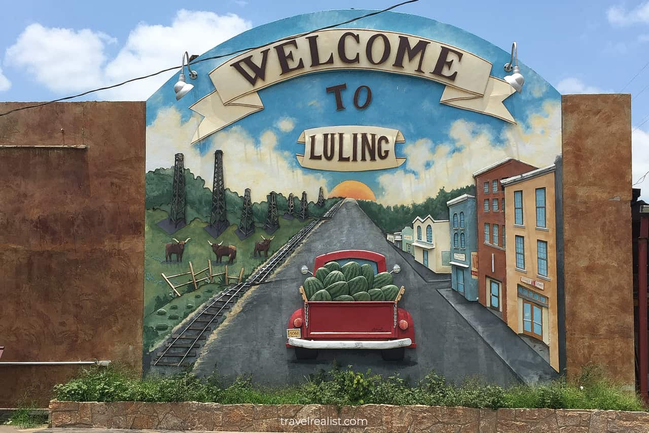
On the one hand, the park is in a rural part of the state. It is about 15 minutes from both Gonzalez and Luling. The latter town is known for its watermelons sold all over the state.
The annual Luling Watermelon Thump takes place on the last full weekend of June. Originally a festival to celebrate watermelon farmers, it has become a major tourist attraction.
On the other hand, Palmetto is less than 10 minutes south of Interstate Highway I-10. The park could be a great stop on your way from San Antonio to Houston. Just use the exit to Buc-ee’s in Ottine.
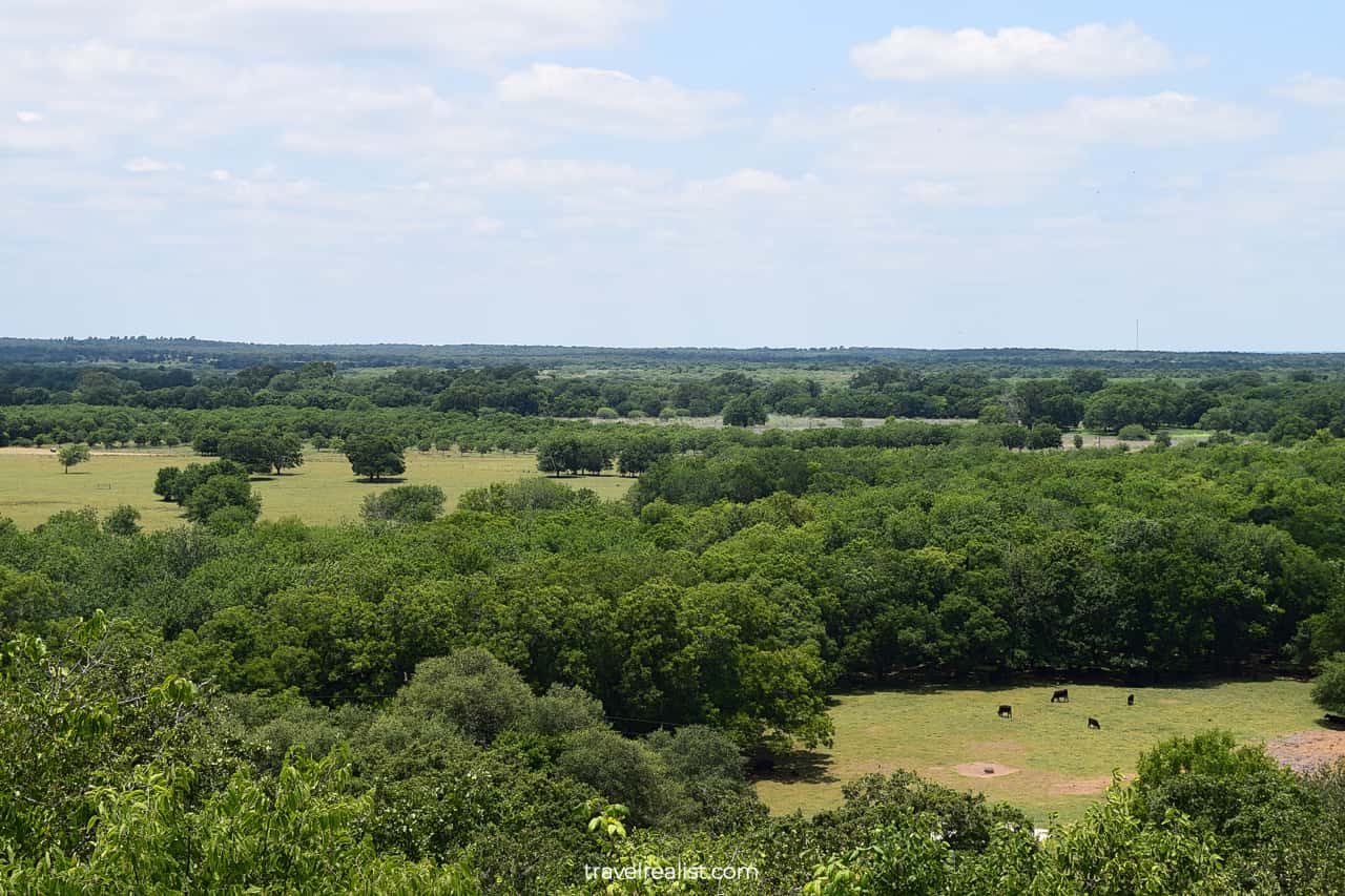
If you visit Palmetto on a day trip from Austin or Victoria, a different highway is a bette route. Take Highway US-183 in this case. It goes from south to north via 5 states.
You could even take this highway to reach the park from Presho, South Dakota. This is just 1.5 hours east of Badlands and close to Wind Cave, Jewel Cave, and Custer in Black Hills.
Make sure to stop at a scenic overlook next to US-183. You will not see any palmetto trees there. But you could enjoy a view of the prairies, forests, and cattle.
A car is necessary to make the most from your visit to Palmetto. Out-of-state visitors should fly to Austin (AUS), San Antonio (SAT), or Houston (HOU, IAH) and rent a car there.
Austin is the closest major city. It is just over an hour north of the park. San Antonio is also close. It is 70 minutes away. A drive from Houston takes slightly over 2 hours with no traffic.
Where to Stay near Palmetto
The part of Texas near Palmetto State Park is not known for having lots of places to stay. But you have a handful of options quite close to the park. Your selection is way better than in Garner or Lost Maples.
Best Western Plus Longhorn Inn & Suites and La Quinta by Wyndham Gonzales TX are the closest hotels to the park. You will spend 15 minutes or less in a car before arriving in the park form either hotel.
A longer drive gives you more options. Seguin, Lockhart, Schulenburg, New Braunfels, and San Marcos are towns with places to stay. The first three have at least one notable place to stay each.
Check out Holiday Inn Express Seguin, an IHG Hotel and Best Western Lockhart Hotel & Suites. Or book Holiday Inn Express and Suites Schulenburg, an IHG Hotel if it works out with your itinerary.
Both New Braunfels and San Marcos have a great variety of places to stay. There are boutique places to stay and chain hotels in both towns.
Check out Courtyard by Marriott New Braunfels River Village and Holiday Inn Express & Suites New Braunfels, an IHG Hotel. These hotels are worth a longer drive.
You could be even pickier in San Marcos. Nearly every major chain has a place to stay in this town. Your budget per night and hotel loyalty membership could play a role in the selection.
Consider Residence Inn by Marriott San Marcos and Homewood Suites By Hilton San Marcos. Take a look at Fairfield Inn & Suites by Marriott Austin San Marcos and Hilton Garden Inn San Marcos, too.
Entrance Requirements & Passes
Palmetto State Park is open from 6 a.m. to 10 p.m. every day of the year. But do not expect to have a ranger on duty at the Park Headquarters during all this time. The Visitor Center has shorter hours.
Like nearly all state parks in Texas, Palmetto charges a per-person entrance fee. But unlike most parks, the fee is very reasonable at $3 per adult. Kids visit this park for free.
This affordable entrance fee might make you doubt a decision to buy a Texas State Parks Pass. You would need to visit Palmetto twice a month to break even on the annual pass.
But the calculation is more favorable if you travel in an adult group. It will take fewer trips for the pass to pay for itself. Plus, it might encourage you to visit nearby parks like Guadalupe River and Honey Creek.
Low fees and proximity to I-10 ensures that plenty of people visit Palmetto. You should consider buying a day pass ahead of time. This reservation ensures no surprises when arriving in the park.
You should start your visit with a stop at the Park Headquarters. A ranger will check you in. You could then take Park Road 11 to the CCC Refectory. This is a trailhead for most hikes in Palmetto State Park.
Takeaways: Palmetto State Park Hikes
Palmetto is a beautiful, accessible, and affordable state park. It has a variety of short and easy hiking trails. This park is a paradise for beginner hikers.
But you should visit Palmetto even if you hiked thousands of miles (km) already. This park has a unique ecosystem. Swamps and palmetto trees are not something most people expect to see in Central Texas.
Plenty of wildlife awaits you in Palmetto State Park. Hares and hogs, deer and vultures, snakes and ants all call Palmetto home. The park is well worth a $3 per adult fee with or without a Texas State Parks Pass.
The park suffered badly during Hurricane Harvey in 2017. But the park staff and volunteers restored the trails and amenities. Palmetto is open and ready to welcome visitors again.
Take a look at this Palmetto State Park Hikes Video Guide. And visit the YouTube channel for the latest videos.
Frequently Asked Questions
Palmetto State Park is in Ottine in Gonzalez County in Central Texas.
– The park is about halfway between the towns of Gonzalez and Luling.
– It is 10 minutes south of Interstate Highway I-10 and 5 minutes from Highway US-183.
– Palmetto is 70 minutes from either Austin or San Antonio.
– Houston is about 2 hours from the park.
A car is a must-have to reach Palmetto State Park in Texas. You could take Highway US-183 all the way from Austin to Palmetto. Or exit Interstate Highway I-10 near Buc-ee’s Ottine to visit the park.
There are plenty of things to do in Palmetto State Park in Texas:
– Study dwarf Palmetto trees that gave the park its name.
– Hike through Ottine Swamp, Mesquite Flats, Bur Oak groves, and around Oxbow Lake.
– Explore the CCC Refectory, Water Tower, and Artisan Well.
– See vultures, hogs, hares, and other wildlife on the hiking trails.
– Go fishing or kayaking on the San Marcos River.
– Admire a panorama from a scenic viewpoint.
– Take part in the Luling Watermelon Thump every June.
There are 8 hikes that span 5 miles in Palmetto State Park. Here is a ranking of all the trails to hike in Palmetto:
1. Ottine Swamp Trail (easy)
2. Palmetto Interpretive Trail (easy)
3. Mesquite Flats Trail (easy)
4. San Marcos River Trail (easy to moderate)
5. Canebrake Spur (easy)
6. Mossycup Spur (easy)
7. Oxbow Lake Trail (easy)
8. Park Headquarters Trail (easy)
Palmetto State Park is a very affordable park to visit. It costs just $3 per adult to see dwarf Palmettos.
Safe realist travels!