Glymur Waterfall: Hiking Guide Via Cave to Falls
This realistic Glymur Waterfall Hiking Guide helps you plan your next hike to the second highest waterfall in Iceland.
Glymur is an impressive waterfall. It managed to get a title in Iceland, a land of waterfalls.
This post includes affiliate links that will earn us commission if you make a purchase via these links.
Sights & Places of Interest
Glymur Waterfall is 650 ft (198 m) tall. This height makes it the second highest waterfall in the country. Morsarfoss in Skaftafell National Park is about 100 ft (30 m) taller.
But Glymur Waterfall has one important advantage over its taller rival. You can reach Glymur much easier.
- You first need to drive to the trailhead (between 1 and 1.5 hours each way).
- You then should budget another 2 hours to complete the trail.
Glymur Waterfall Trail
The trail to the waterfall is a loop. Here are the key facts about Glymur Waterfall Trail:
- Length: 4.1 miles (6.6 km) or 3 miles (4.8 km) to the falls viewpoint
- Elevation gain: 1,309 ft (399 m)
- Type: loop or out-and-back depending on season and your preference
- Difficulty: Moderate
- Trailhead address: Botnsdalur, 301, Iceland
- Notable features: cave and 2 creek crossings.
You can take the loop clockwise or counterclockwise.
The former way only involves a creek crossing at the halfway mark.
- You can take it throughout the year.
- But you can only see the waterfall at the very end of this path.
The latter path involves a cave passage and another creek crossing.
- This path is more scenic. You will get a view of the waterfall sooner. You could also enjoy views of the narrow steep canyon.
- But there is a downside. You might not be able to cross the creek in winter or spring. The powerful creek often washes away the log.
This Glymur Waterfall Hiking Guide will follow the counterclockwise path.
Note that Google Maps only display a part of this path. If you use this service for navigation you will be taking the clockwise route first. Consider offline maps for navigation to Glymur like Maps.me.
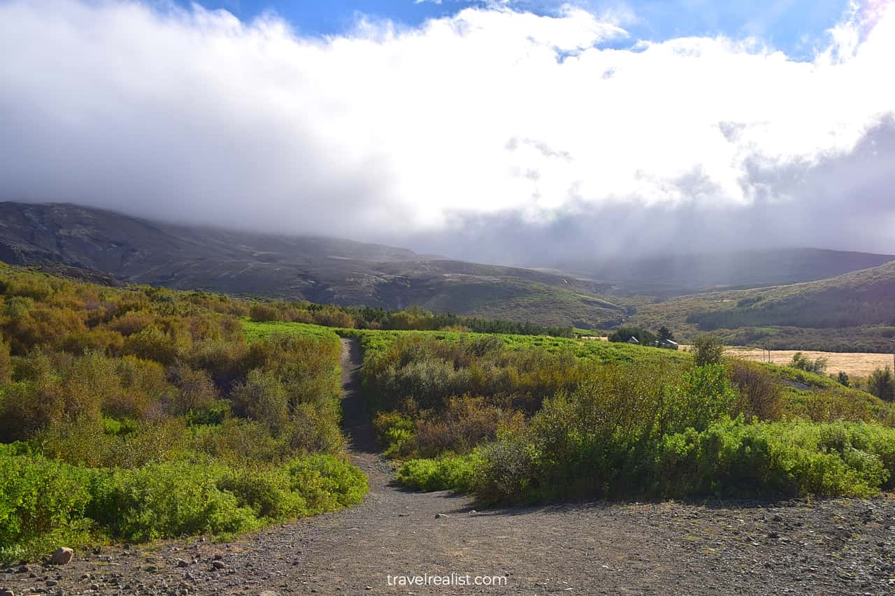
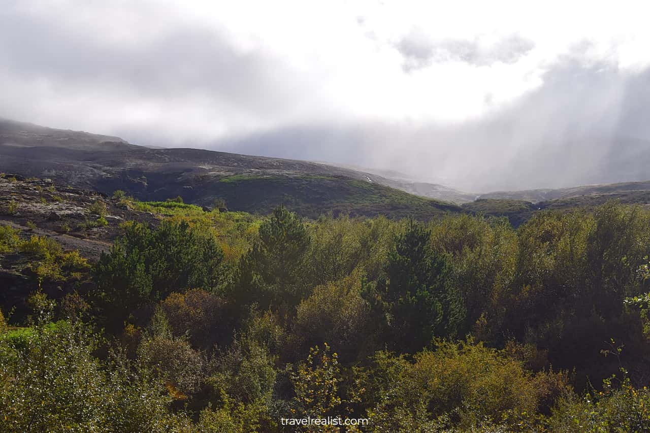
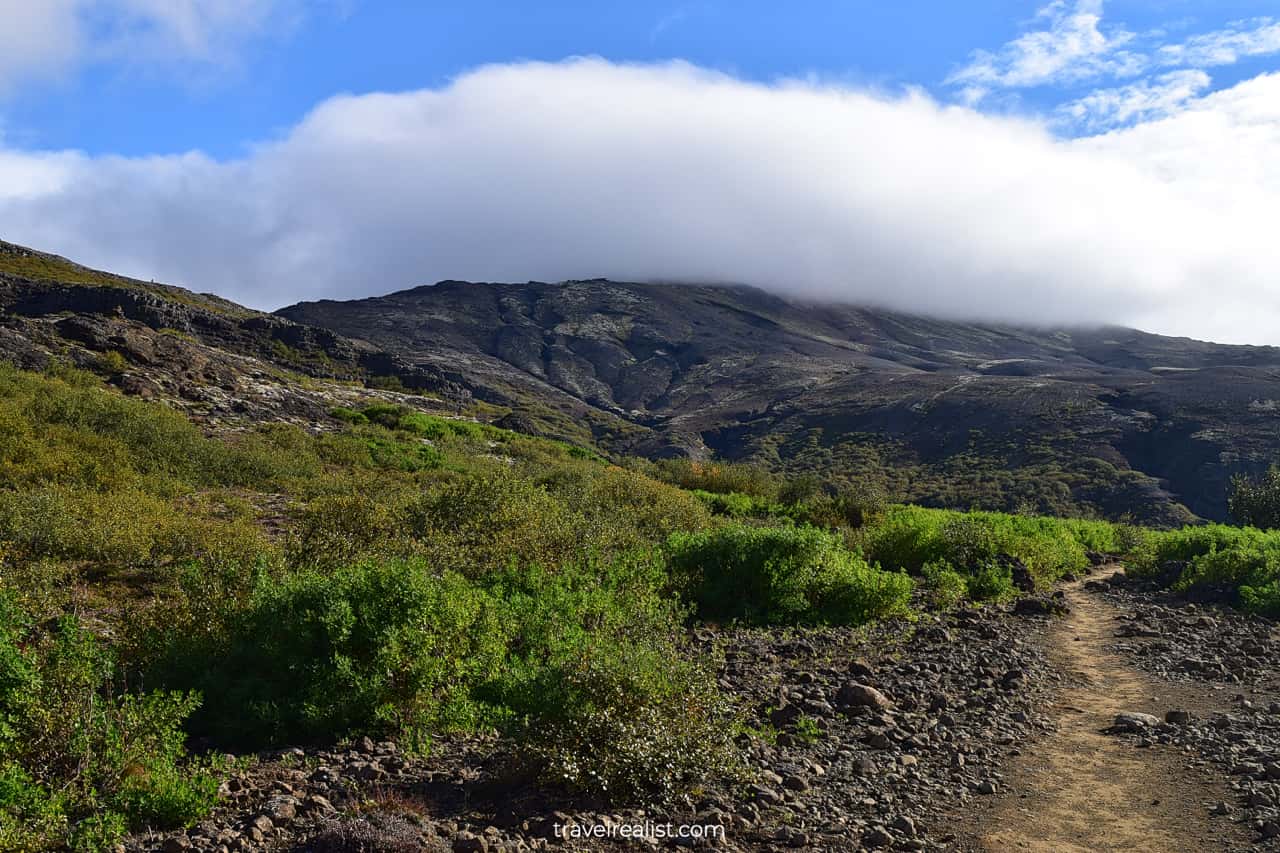
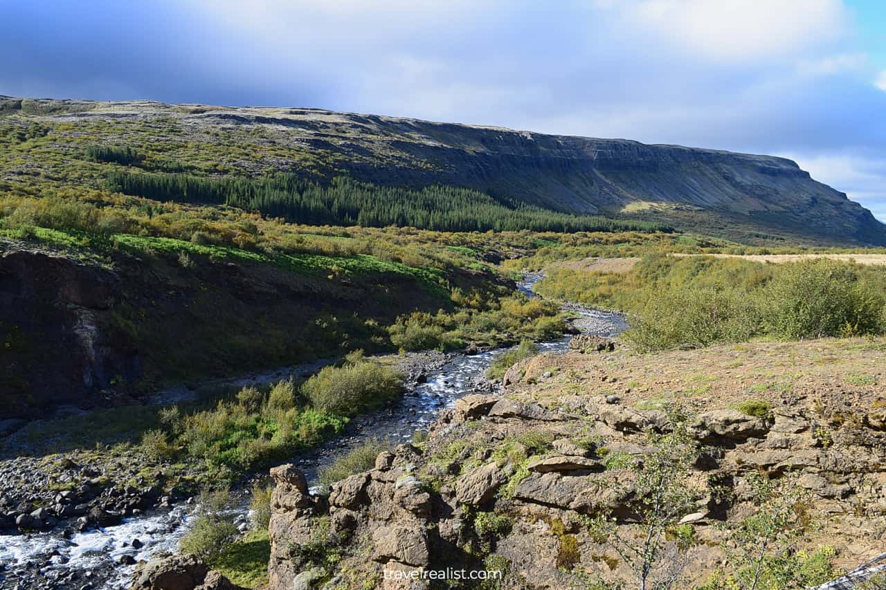
The first mile (1.6 km) of the trail is quite easy. There is only a minor elevation gain. It is a beautiful path along the rocks and bushes.
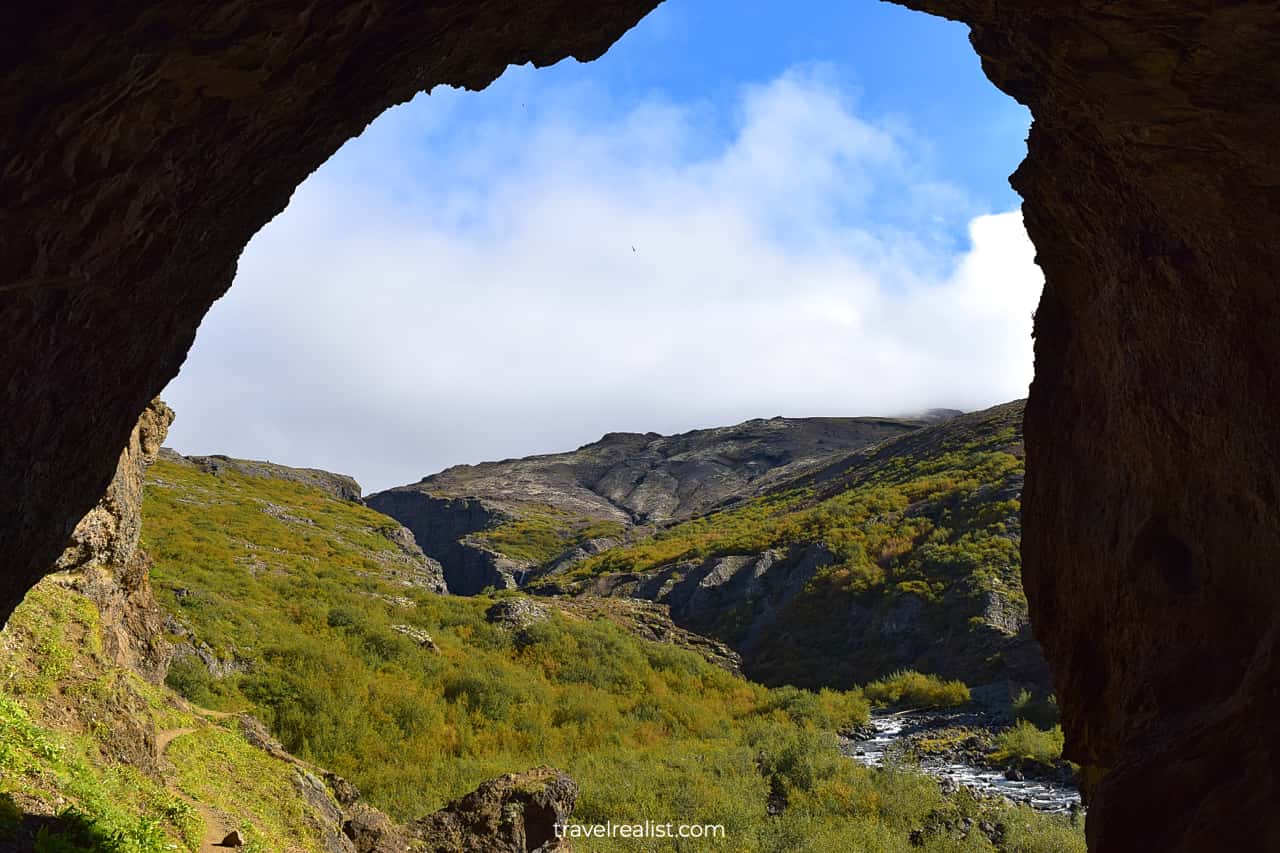
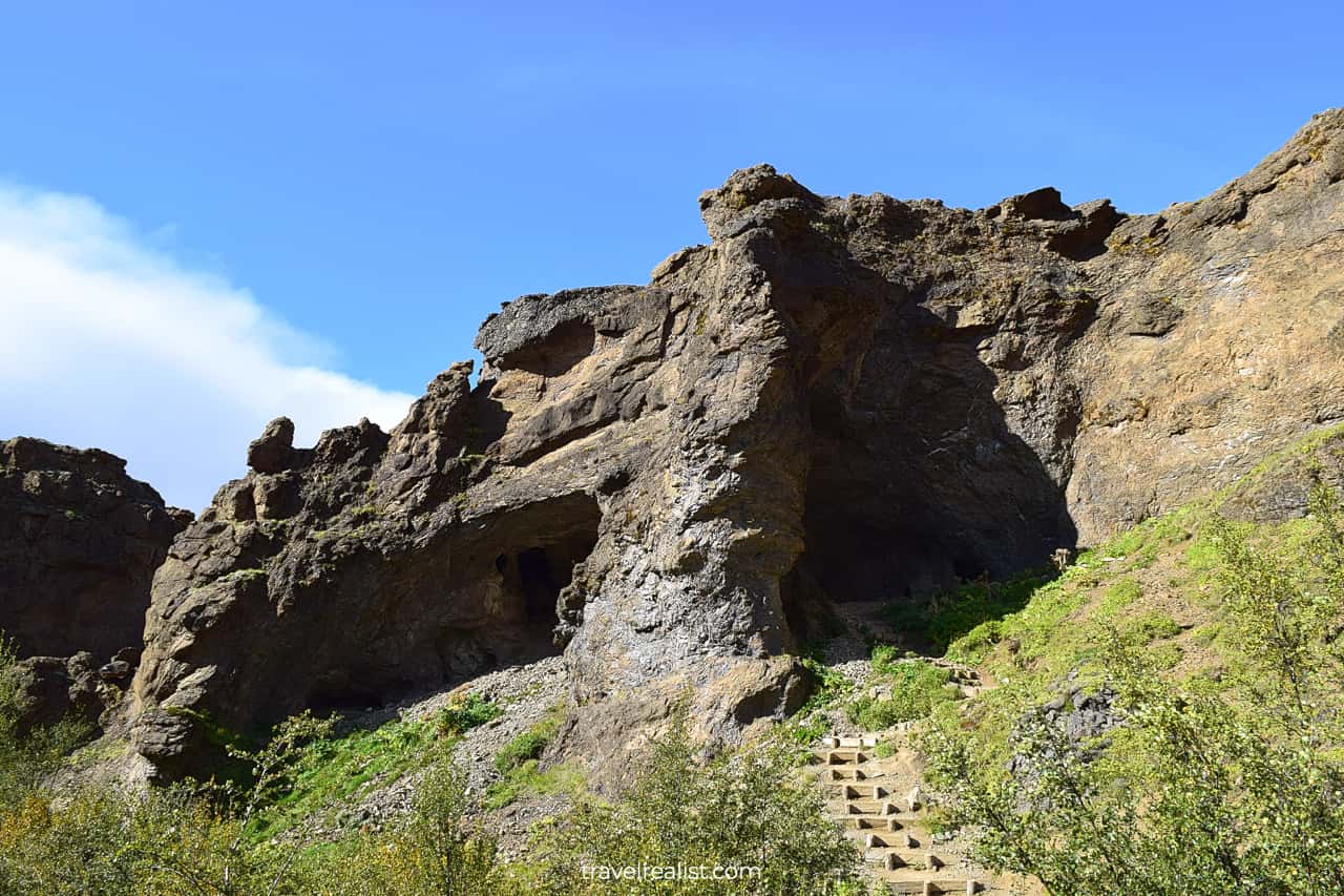
Wash Cave
A small cave will mark the first milestone on your hike. You will enter the cave via a large natural entrance. The trail will proceed downhill. You will soon see two other natural entrances on the other side of the cave.
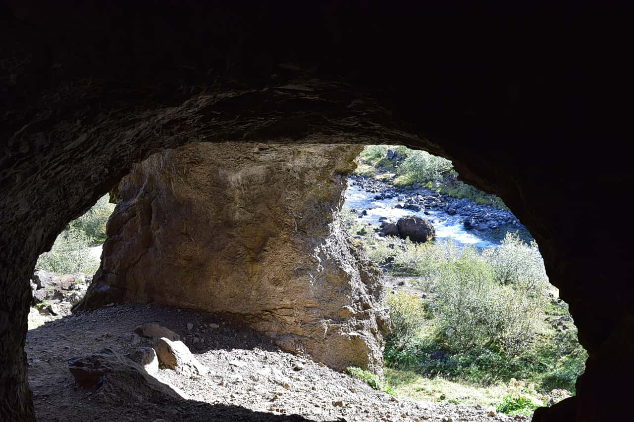
The trail continues via the left entrance. As you exit the cave, you will get a glimpse of what to come. You will be hiking uphill on the edge of the canyon. Glymur Waterfall will be near the top of the mountain.
It is somewhat hard to notice the cave from the other side. Only the wooden steps suggest that the trail goes through the mountain.
Creek Crossing
The trail will continue downhill until it reaches a rocky creek. You will lose almost all the elevation you gained before.
You would need to cross the cree next. Follow a narrow log and a rope. This creek crossing is quite an adventure.
Do not attempt to cross the creek if the log is washed away. The current is powerful. You can easily slip on wet rocks. This hike is not worth risking a serious injury.
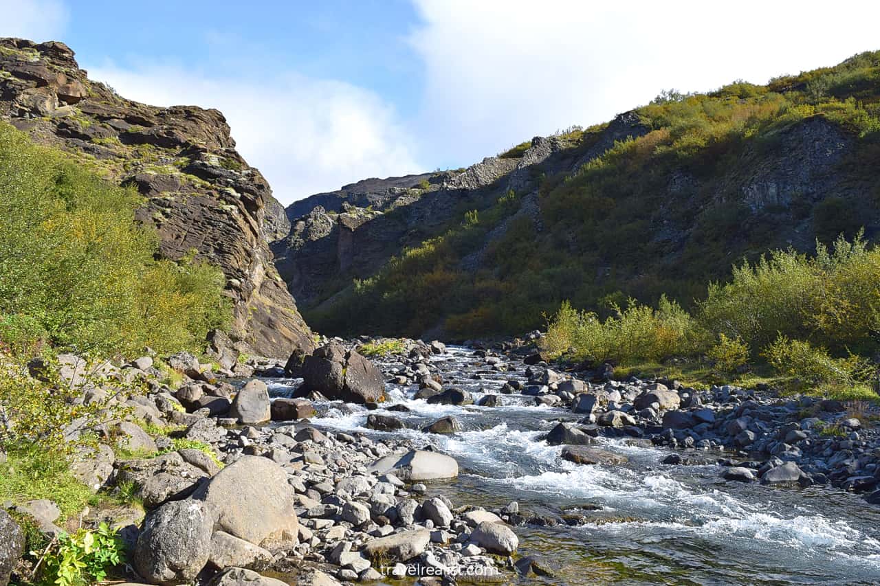
This section of the trail first goes through a forest. It has just a handful of viewpoints. The Icelandic trees are not very tall. You will be hiking above the tree line in no time.
The trail quickly starts to gain elevation as soon as you cross the creek. In fact, it goes almost exclusively uphill. The majority of the trail’s 945 ft (288 m) in elevation gain takes place in this section.
You will be just trying to regain the elevation you lost at first. It will take a few minutes to reach the level you were at before the cave passage.
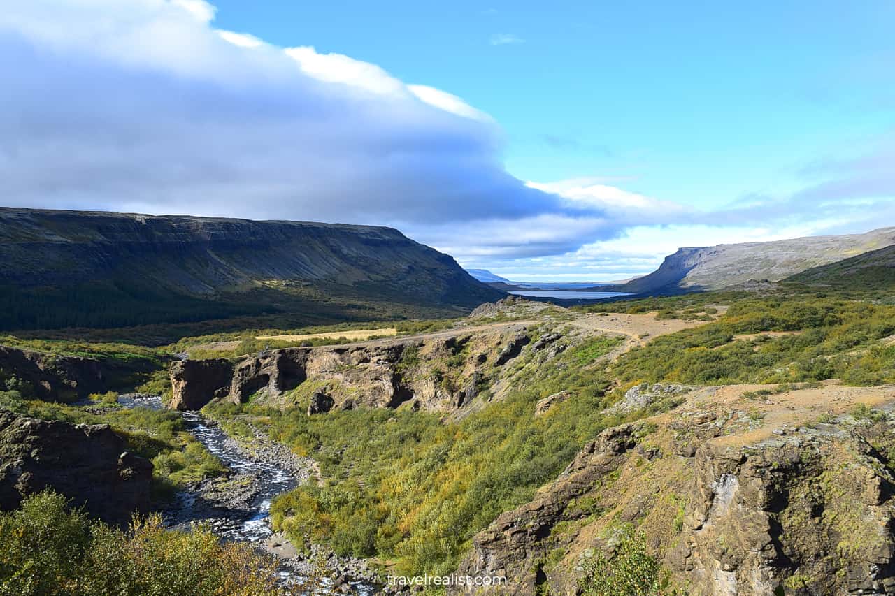
But there is an upside to this steep ascend. You will soon get a distant view of the fjord. The higher you go, the better the views will become.
As a result, these views could give you some more motivation to keep going. You would just need to fight the urge to stop at any no name point to capture the surrounding beauty.
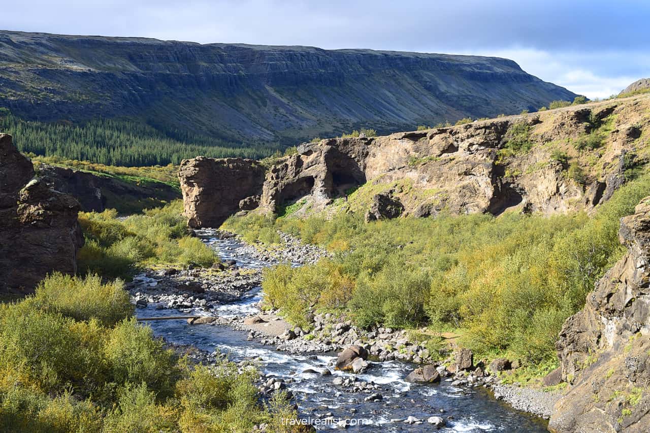
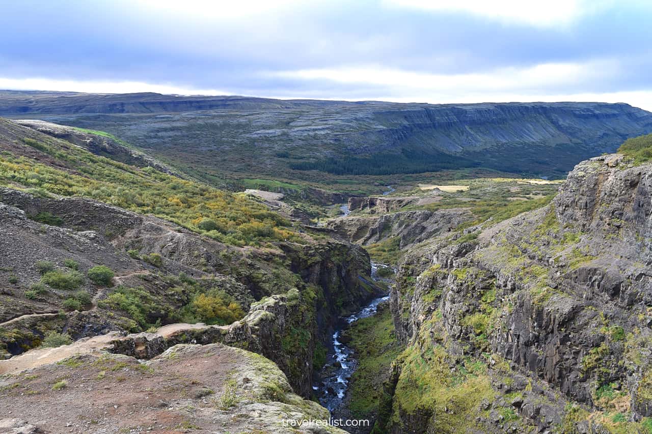
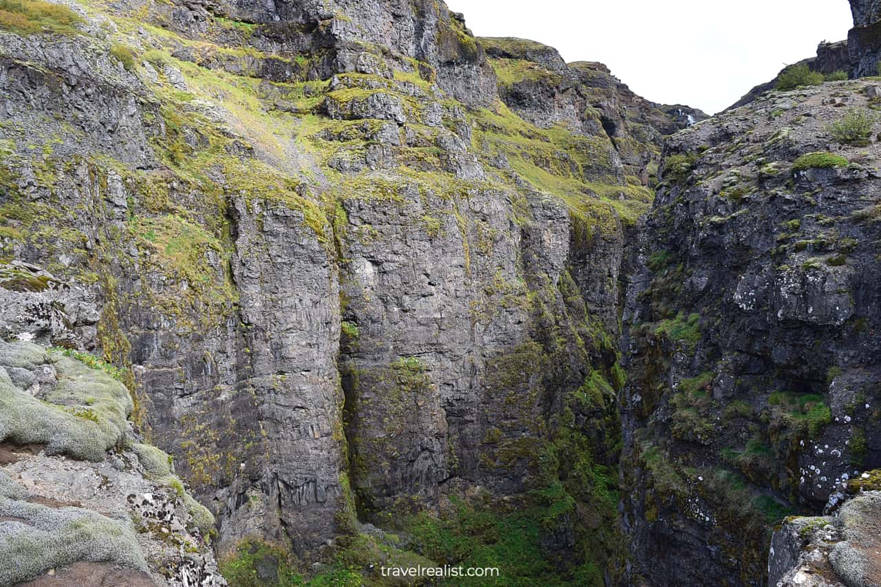
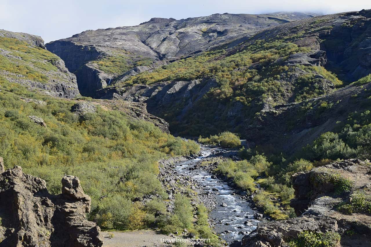
Canyon
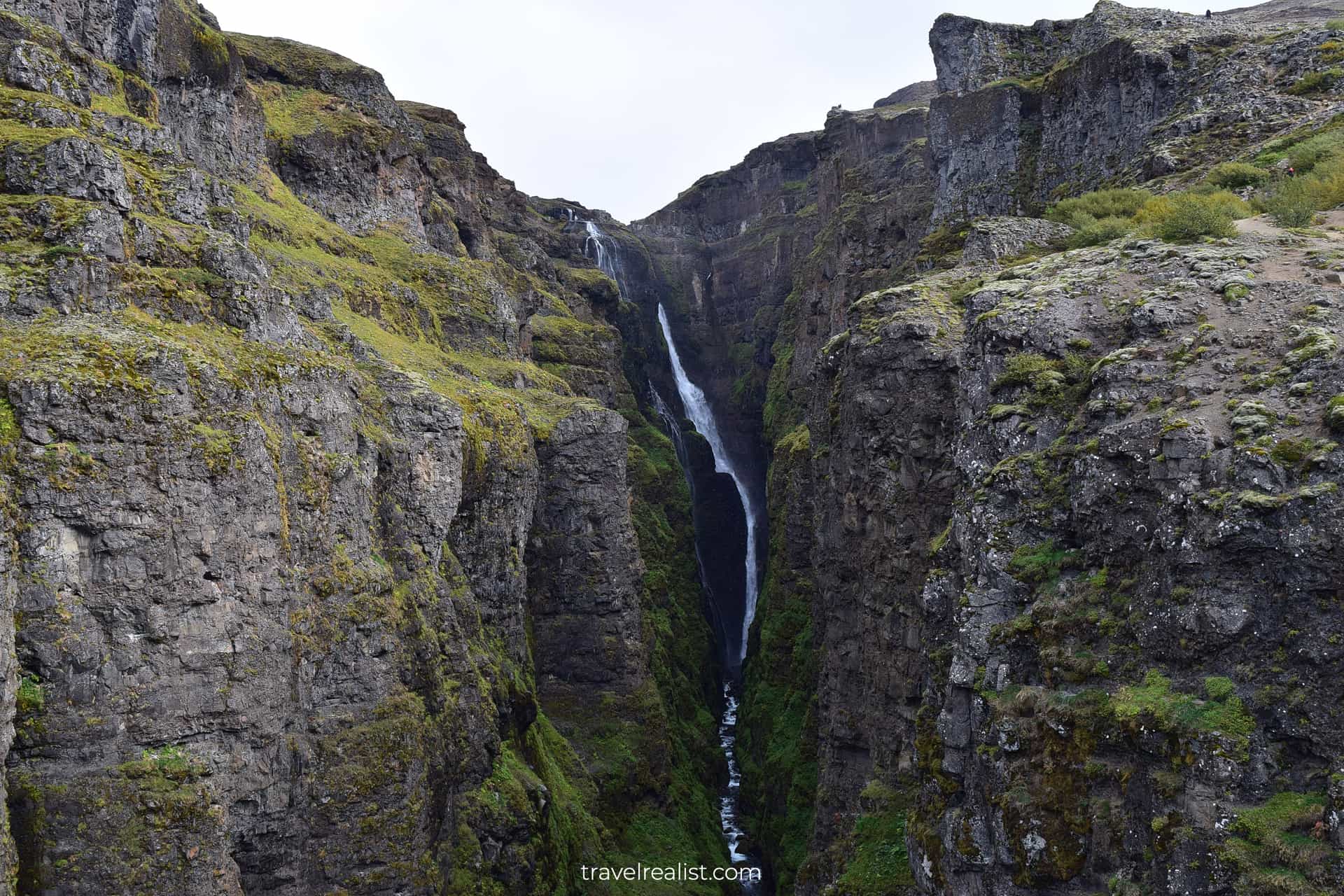
About two thirds into the uphill leg of the trail, you will get a first look at Glymur Waterfall. This viewpoint is a great stop for a photo or water break.
The narrow canyon views look most similar to Black Canyon in Colorado. But the waterfall at the end of the canyon makes this hike unique.
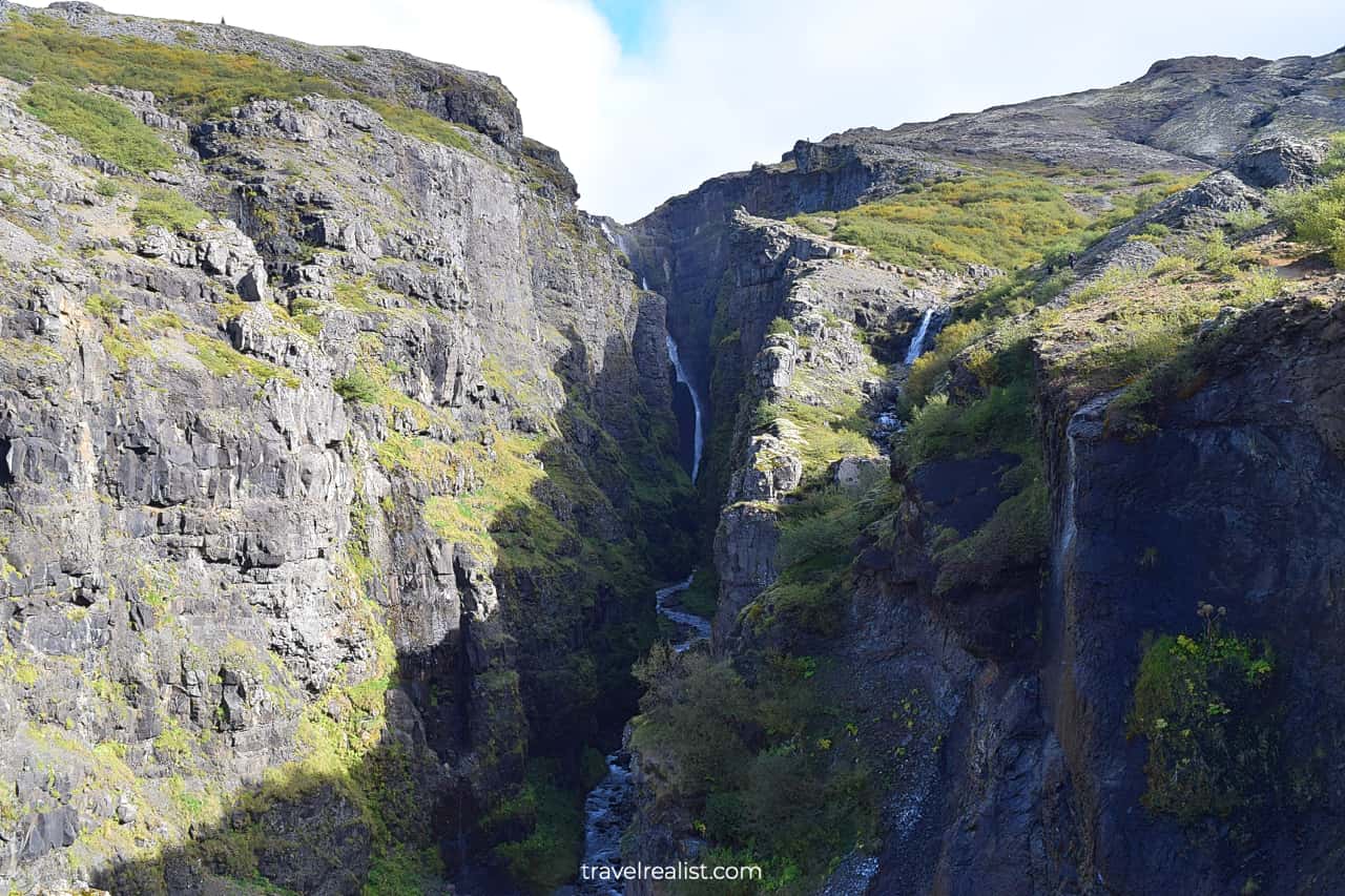
As you climb further, the canyon will start to hide the fjord from sight. You will get a better look at the flat top mountains. But the waterfall views will remain the main driving force for the steep ascend.
Be extra careful in this section of the trail.
- There are no railings.
- The rocks are slippery.
- The ground could be unstable.
- And you would have already climbed quite high.
Any slip could mean serious injury or worse. Take you time as you go through this challenging section.
Waterfall
You will reach the main waterfall viewpoint about 1.5 miles (2.4 km) into the trail. This tall waterfall will be almost on full display. You will not be able to see just its upper section.
This view will serve as a fantastic reward for this moderate uphill hike.

In fact, it is quite difficult to get a full view of this waterfall. As you climb further, the canyon walls will hide the waterfall from sight. When you get near the top, you could only see the upper part of the waterfall.
You have two options for a return leg.
You could continue uphill. In this case, you will cross the river further upstream. You will then return to the parking lot via a different path. This is an excellent choice if you have time to explore the area.
Or you could turn around and return via the same path. It is a bit more boring to return via the same sights. But this path saves you time. It is also an easier way since it has a lower elevation gain.
Continue with this Glymur Waterfall Hiking Guide. You will learn more about ways to get to the sights, entrance requirements, and places to stay.
Getting to Glymur Waterfall
Glymur Waterfall is in Western Region of Iceland. But this waterfall is quite close to the capital city.
- It is about 45 miles (72 km) from Reykjavik and the Golden Circle sights.
- A trip from Keflavik Airport would take about 70 miles (113 km).
- The waterfall involves a 41-mi (67-km) detour from the Ring Road (Route 1).
This location makes Glymur a great day trip destination from the capital city. You could also visit it on your way from Reykjavik to the sights in West Iceland.
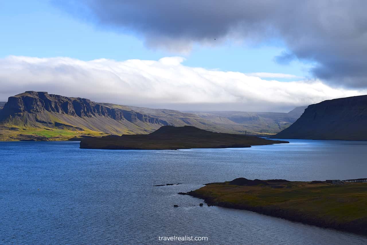
One thing is certain. Any trip to Glymur Waterfall involves a scenic drive along the Hvalfjordur fjord. You will enjoy the fjord’s beauty for at least 23 miles (37 km) each way. Stop at this viewpoint to capture the view.
Where to Stay near Glymur Waterfall
There are very few places to stay near this waterfall. It is hardly a surprise. The waterfall is in a quite rural and remote area.
As a result, you would want to look for lodging in bigger towns. Reykjavik, Borgarnes, and Akranes are your best options. These towns have plenty of hotels and guest houses to choose from.
- Reykjavik gives you the most options. You could stay near restaurants and other sights.
- Borgarnes will have a higher average price per night. But it has a favorable location. This town is on the Ring Road. You could also use it as a gateway to the sights on Snaefellsnes peninsula.
- Akranes is the closest town to Glymur Waterfall. But there are few places to stay. You also need to take a short detour from the Ring Road.
Entrance Requirements & Passes
Glymur Waterfall hike is open 24 hours a day, every day of the year. Summer is the best time to hike to this waterfall.
You will have plenty of daytime and better weather. It will help when you are hiking the steep uphill sections of the trail.
You might not reach the waterfall in winter and spring. The water crossings become dangerous when the level is higher.
It is free to park and hike to this waterfall. A rental car is the easiest way to reach the trailhead. You could also book a tour to hike it.
Takeaways: Glymur Waterfall Hike
The Glymur Waterfall Trail is well worth your time on a trip to Iceland. This waterfall gives you a lot to look forward to.
- You will see the second tallest waterfall on the island.
- You will hike along the narrow steep canyon.
- You will pass through a cave and cross a creek.
But do not get the low mileage (4.1 miles) deceive you. The Glymur Waterfall Hike is moderate and involves some elevation gain. The uphill section could be challenging. And the creek crossing is outright dangerous in spring.
You have to know your limits on this uphill hike. Follow a few tips to make the most from your Glymur Waterfall Hike.
- Wear layers to make the hike comfortable in unpredictable weather.
- Download offline maps since not all services display the full path correctly.
- Start the loop counterclockwise for better views.
- Pace yourself in the uphill sections.
- Drink plenty of water.
- Turn around if the creek crossings lack a log or look too dangerous.
- Stay away from the cliff edge. No selfie or video is worth risking your life.
- Complete the full loop if you have time. Or make it an easier out-and-back hike to the viewpoint.
- Leave no trace.
Take a look at this Glymur Waterfall Hiking Video Guide. And visit the YouTube channel for the latest videos.
Frequently Asked Questions
Glymur Waterfall is the second highest waterfall in Iceland.
Glymur Waterfall is the Iceland’s second highest waterfall. You will pass through a cave and cross a creek on your way to the waterfall.
Glymur Waterfall is 198 m or 650 ft high.
The Glymur Waterfall trail is a moderate hike. It involves a cave passage and 1+ creek crossings. You will gain 1,309 ft (399 m) in elevation. Most of the trail is near the edge of a steep canyon.
The full Glymur Waterfall Loop takes 4.1 miles (6.6 km) round trip. You can shorten the hike by turning around after the falls viewpoint. The trail length will be about 3.0 miles (4.8 km) this way.
Budget at least 2 hours to complete the Glymur Waterfall Hike.
Glymur Waterfall is a beautiful waterfall. It falls into a narrow canyon. The views are worth a hike and a short detour from the Ring Road.
You have to hike to Glymur Waterfall viewpoint to see this waterfall. You cannot see this waterfall until fairly late into the hike since it is in a narrow canyon.
You should take the Glymur Waterfall Loop counterclockwise. This way, you will pass through the cave and see the waterfall sooner.
Google Maps only displays part of Glymur Waterfall Hike. Download free offline maps like AllTrails or Maps.me to get a full trail map.
Safe realist travels!