7 Must-See Stops on Golden Circle Iceland Map
This realistic Golden Circle Iceland Drive Map helps you plan your next adventure on the country’s most famous route.
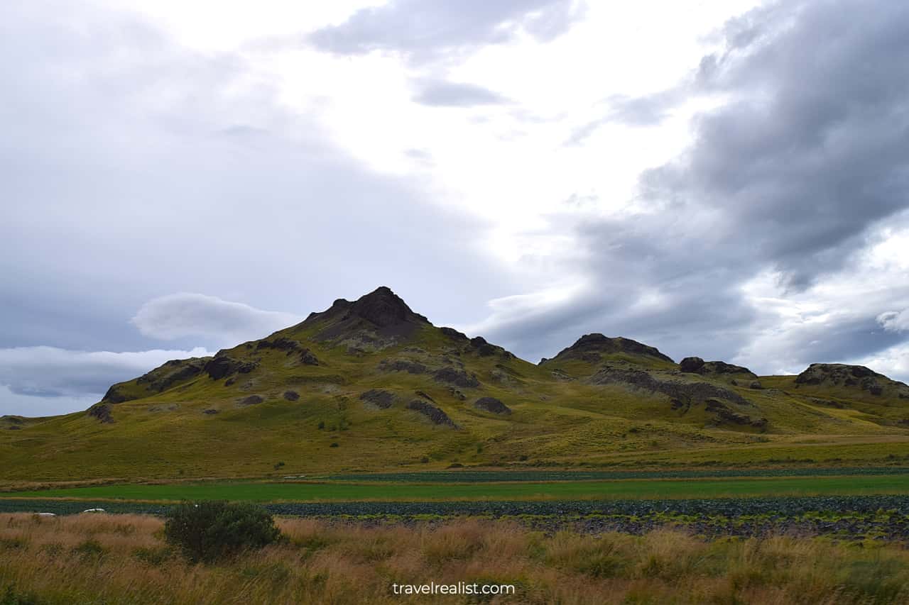
Golden Circle is the most visited drive in Iceland. It has natural and man-made sights near the country’s biggest city.
This post includes affiliate links that will earn us commission if you make a purchase via these links.
Sights & Places of Interest
The Golden Circle sights are close to Reykjavik and the main airport. Depending on the source or the tour, the Golden Circle Iceland Map and the number of its sights differs.
Here are the stops that always make the list:
Stops at Kerid Crater, Faxafoss and Haifoss waterfalls are slightly less common.
Depending on the stops, there are multiple maps for Golden Circle Iceland route.
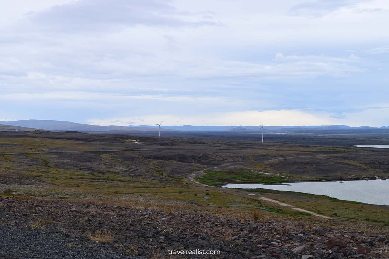
- Main Map: 155 miles (250 km); budget about 5-6 hours to complete the drive and stop at viewpoints.
- Map with Haifoss: 250 miles (400 km); budget 7-8 hours.
- Map from Keflavik Airport: 280 miles (450 km); budget 8-9 hours.
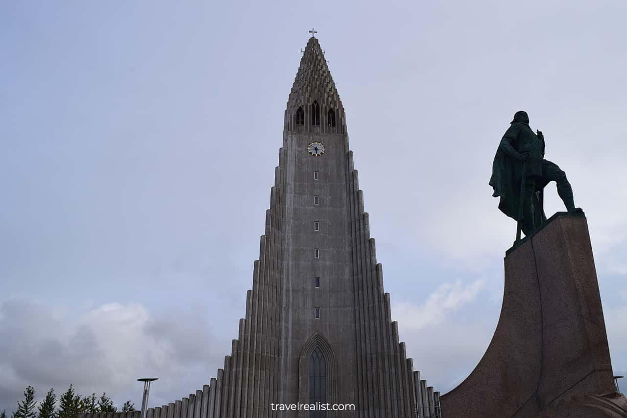
1. Reykjavik
Reykjavik is a good start or end point for the Golden Circle Iceland trip. The city’s center is quite small. You can easily reach all sights on foot.
Hallgrimskirkja is the most recognizable building of the country. The walls of this church look like organ pipes. There is an observation deck at the top of the church’s tower. You can climb it for a fee.
Reykjavik is far from the most picturesque cities in the world. But it has a northern charm. And it is a place to find food that does not cost a fortune.
Take a closer look at Saegreifinn (Seabaron) restaurant. It offers reasonably priced food from Icelandic standards. Keeping food costs under control is a must when visiting Iceland on a budget.
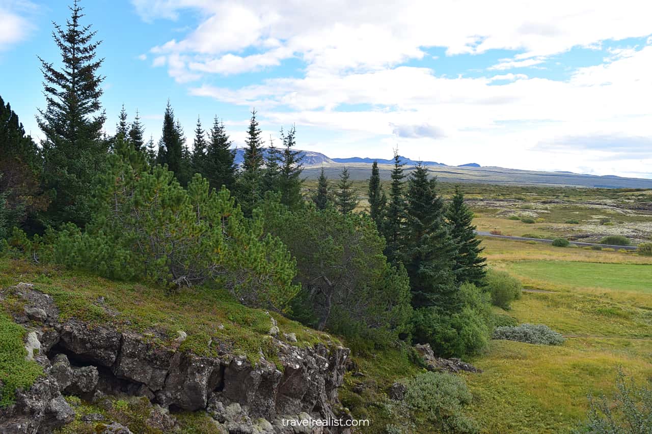
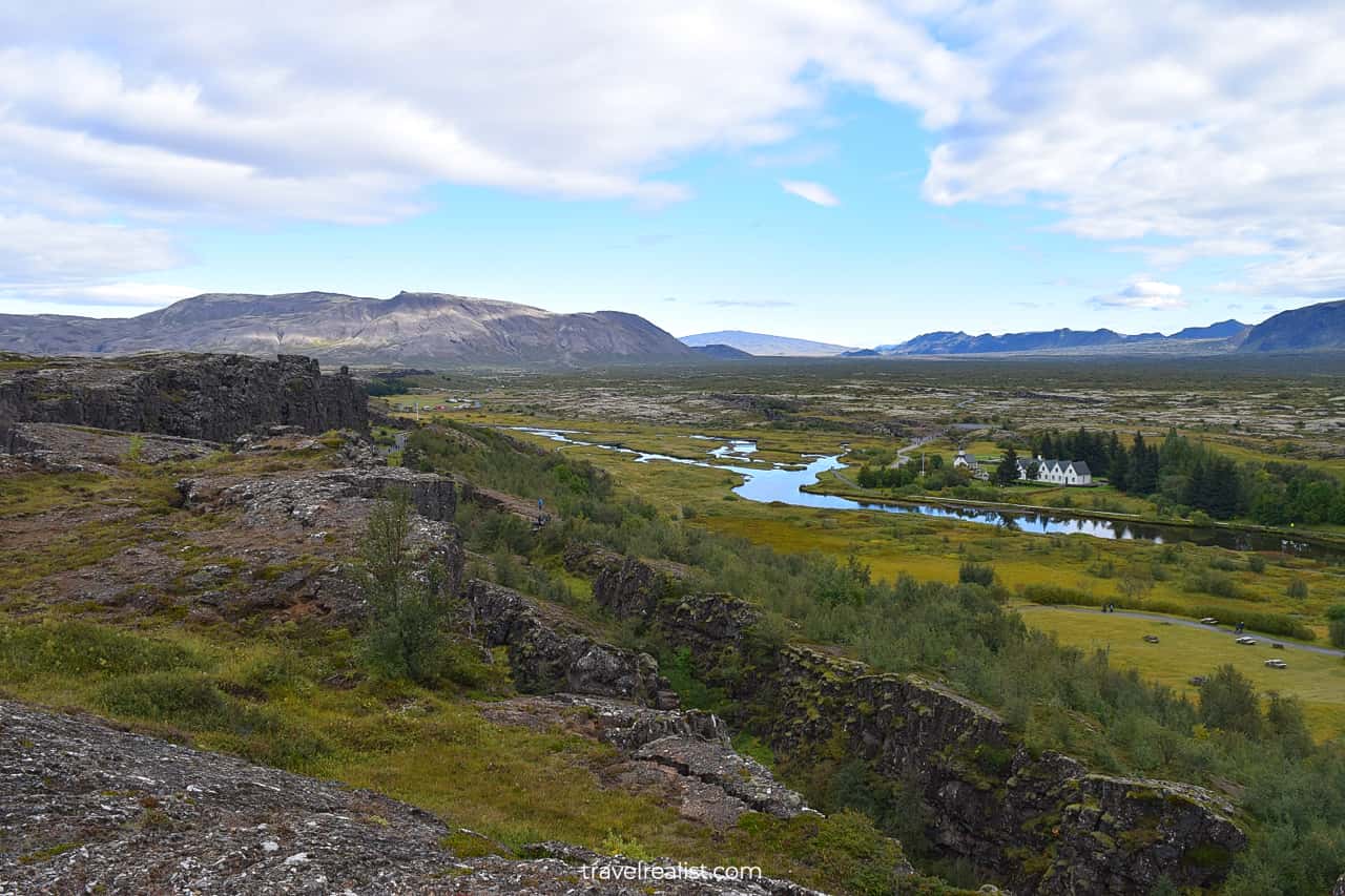
2. Thingvellir
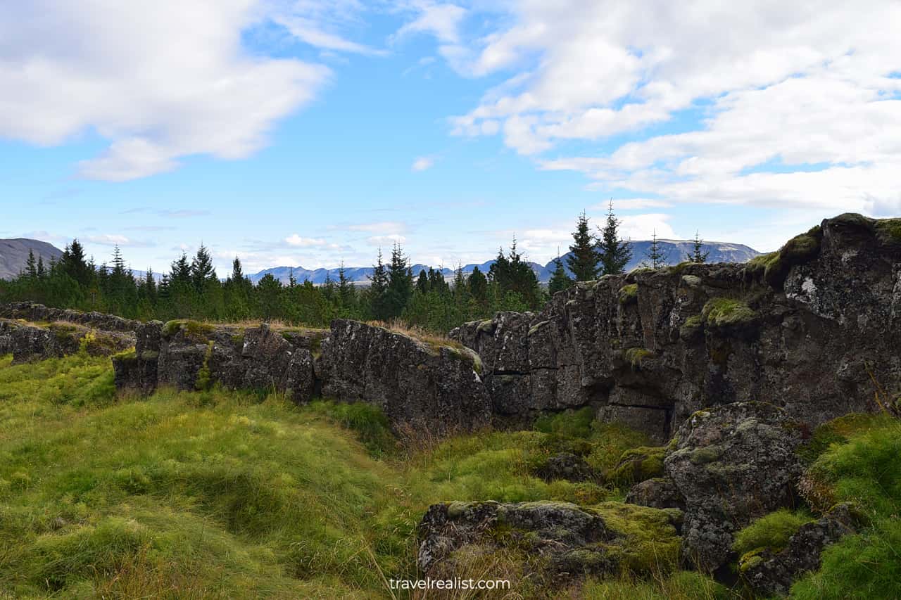
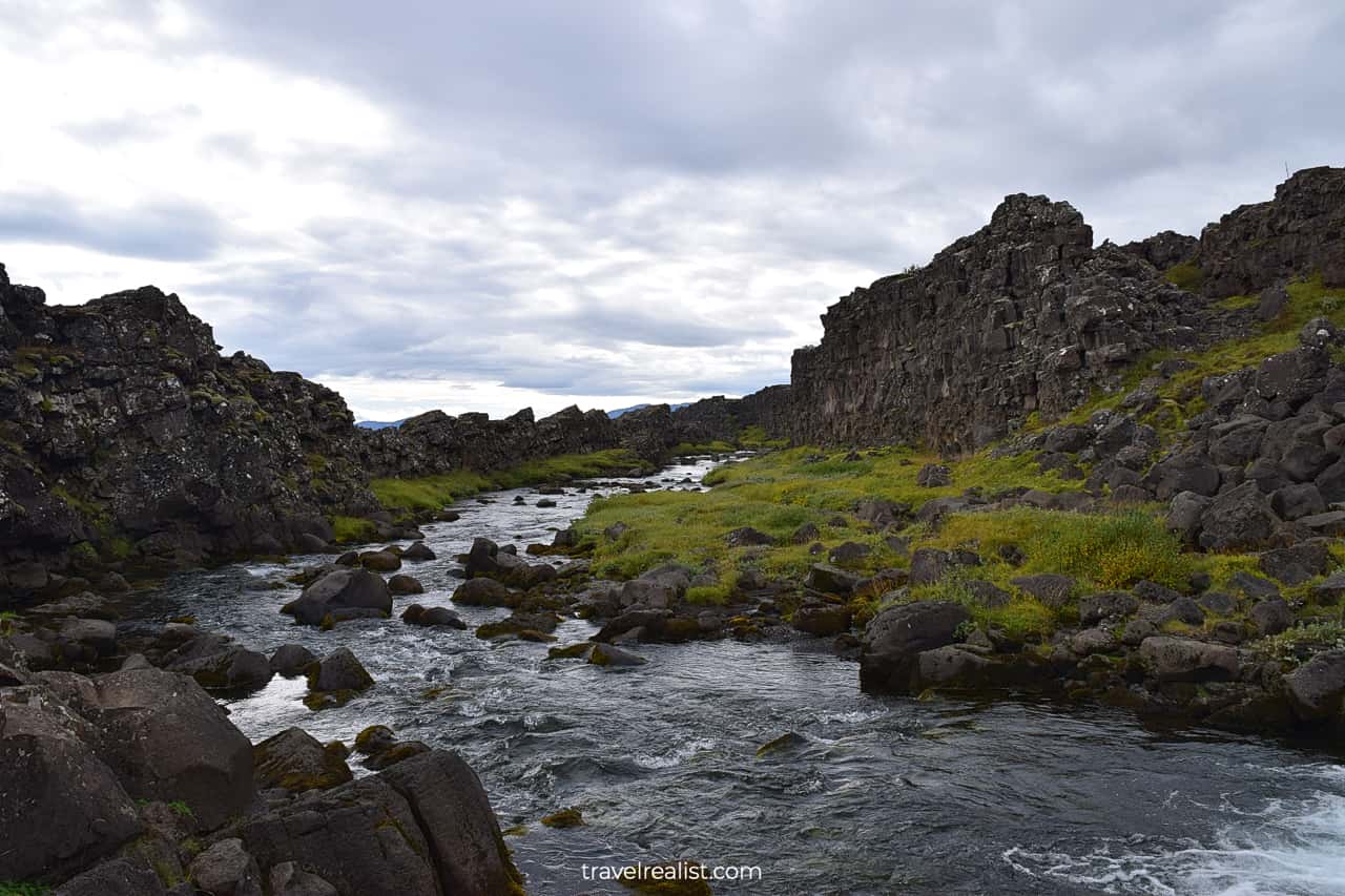
Thingvellir is the first natural attraction on the Golden Circle Drive Map. It is the oldest of the three national parks in the country.
There are a handful of sights for you to see in Thingvellir. You can explore its geological formations, waterfalls, and monuments.
There are several parking lots in the park. You can start your journey from the Visitor Center or Oxararfoss Waterfall.
The former is best if you need to use a restroom. Keep in mind that there is a charge to use it. But you get excellent views of the park. The latter parking is nearest to the waterfall and volcanic formations.
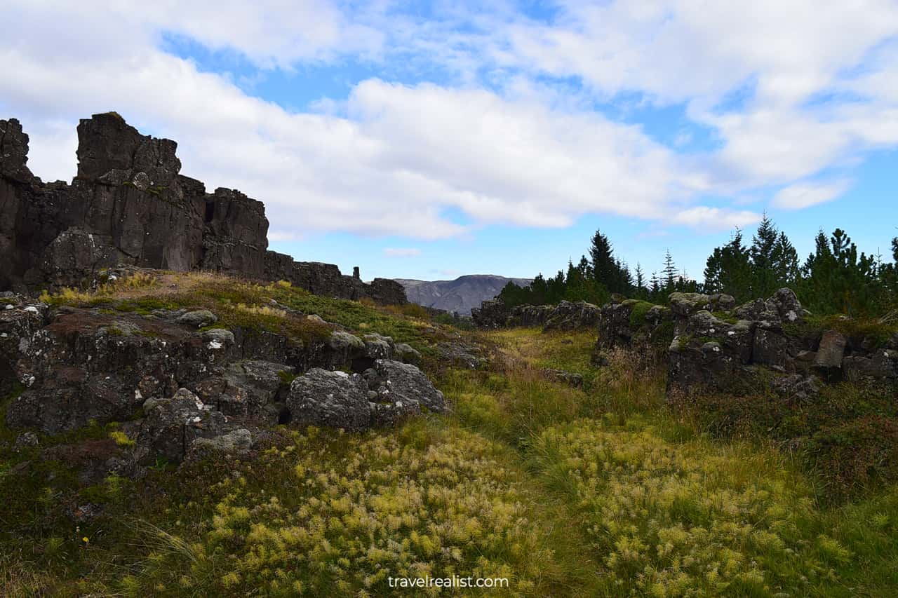
The park is part of the Mid-Atlantic Ridge. It serves as a natural boundary between two tectonic plates that house Eurasia and North America.
This park is one of the few places where you can see this boundary first hand. A trip to Northern Iceland would be your other option to get a similar view.
2.1. Logberg
The park’s volcanic landscape also played an important role in the history of Iceland. It was the place of the country’s first parliament. And Logberg, or Law Rock, was a stand for delivering speeches.
You need to budget about an hour to walk the park’s main trails. The wooden and paved paths bring you from either parking lot to the main sights.
Hiking in Thingvellir National Park is much easier than reaching Glymur in West Iceland or Svartifoss in East Iceland. Nearly all of the paths in this park are flat and accessible.
The trail from the Visitor Center is 2.1 miles (3.4 km) round trip. You will enjoy the views of the northern landscape throughout your walk. They will look most like the Alaska Range on the Richardson Highway.
2.2. Oxararfoss
The waterfall is the next attraction in this park. It is smaller than most other waterfalls in Iceland. But it is very easy to reach. You just need to follow another flat accessible path.
This waterfall looks a bit like a smaller version of Svartifoss thanks to the volcanic rocks nearby. It could be an alternative if you cannot travel to the more remote attraction.
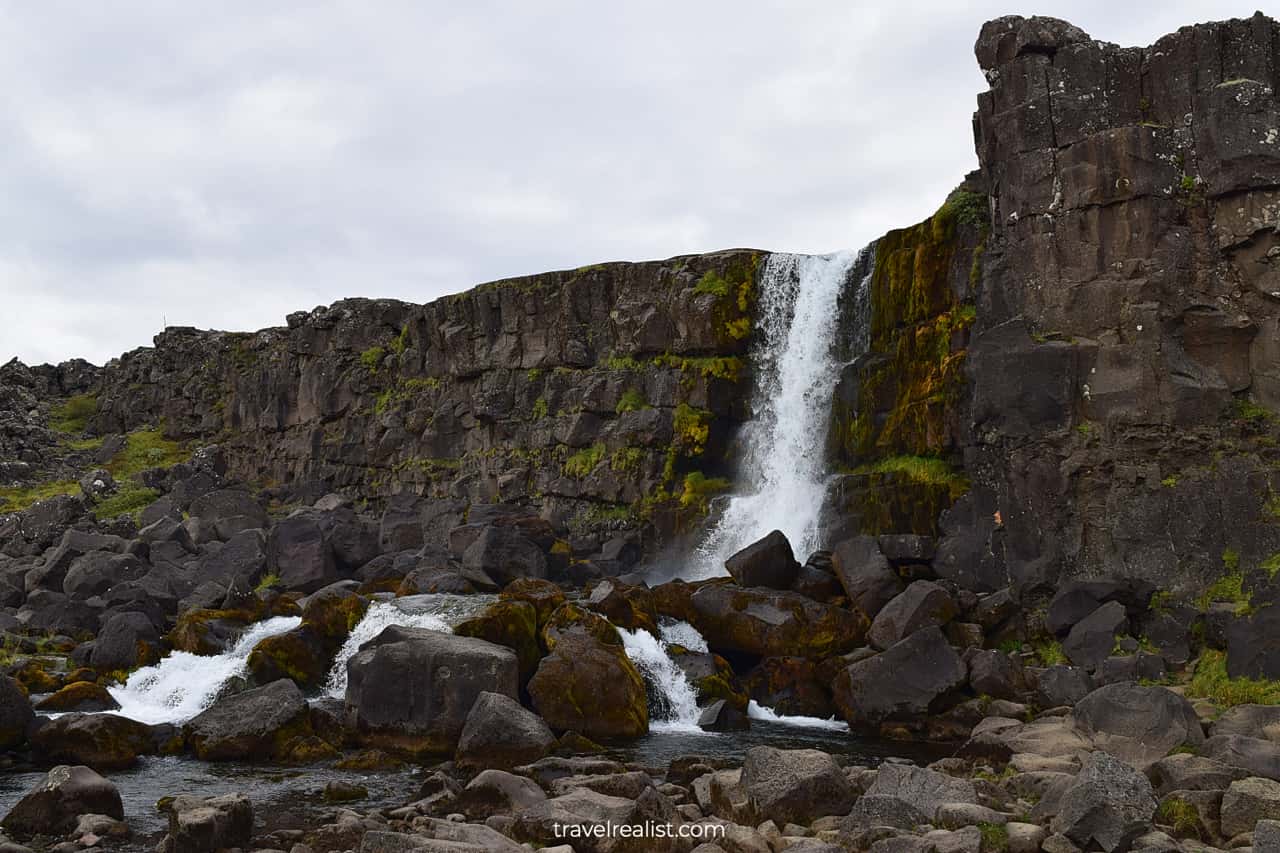
You can also enjoy the views of the Oxara river. The river is quite narrow even after the waterfall. It connects two lakes in the park.
You can easily spend a few hours in the park if you hike the inland trails. They will bring you further from the volcanic sights to the rivers and swamps. This landscape is very similar to Chugach in Alaska.
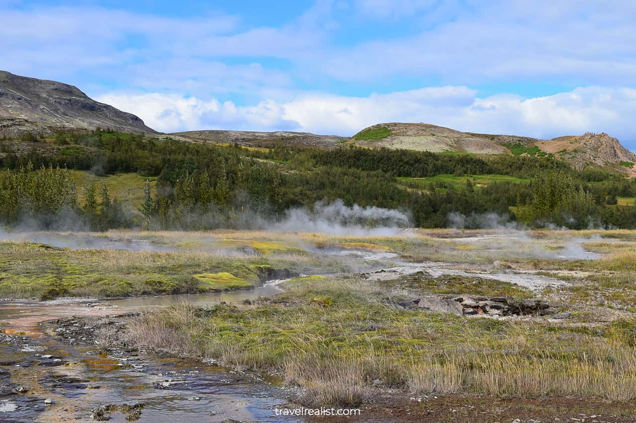
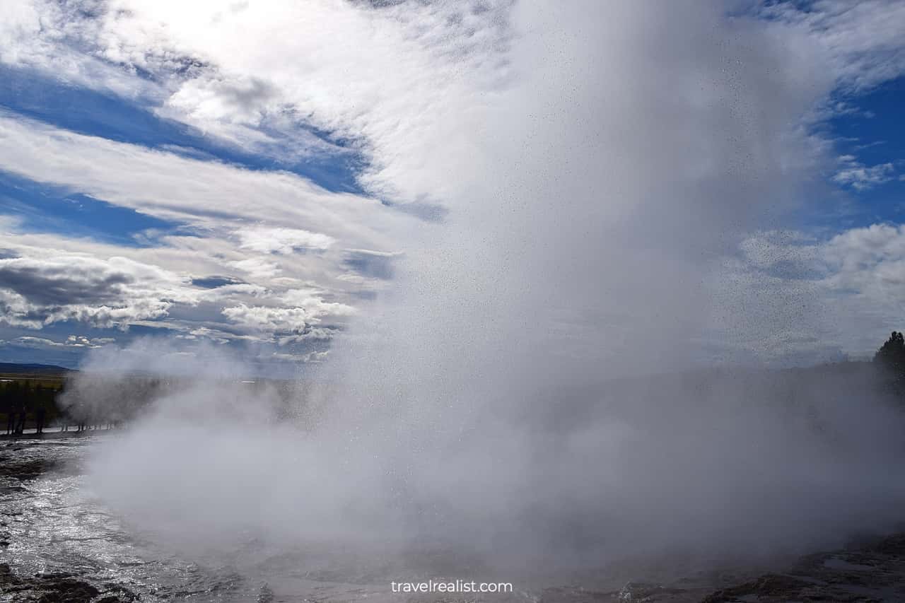
3. Geysir
The next stop on the Golden Circle Iceland Drive Map requires getting back on the road. About 37 miles (60 km) separate Thingvellir and Geysir.
You will transition from the Alaskan landscapes to the land of Yellowstone. This is hardly a surprise. Geysir is an area with lots of geothermal springs.
All erupting hot springs worldwide now carry the name of Great Geysir. You can find geysers all over the world, from Iceland and Yellowstone to Chile and New Zealand.
This term is another Icelandic gift to the world. Every time you see a geyser you could think of this hot spring in Iceland.
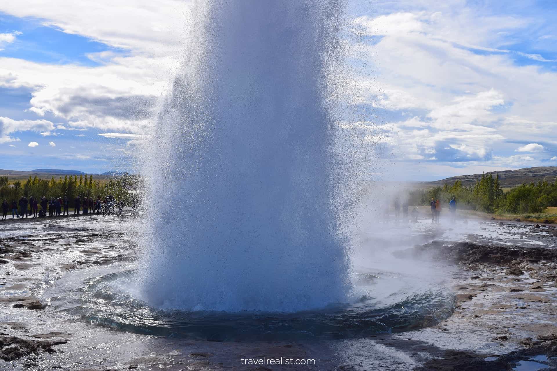
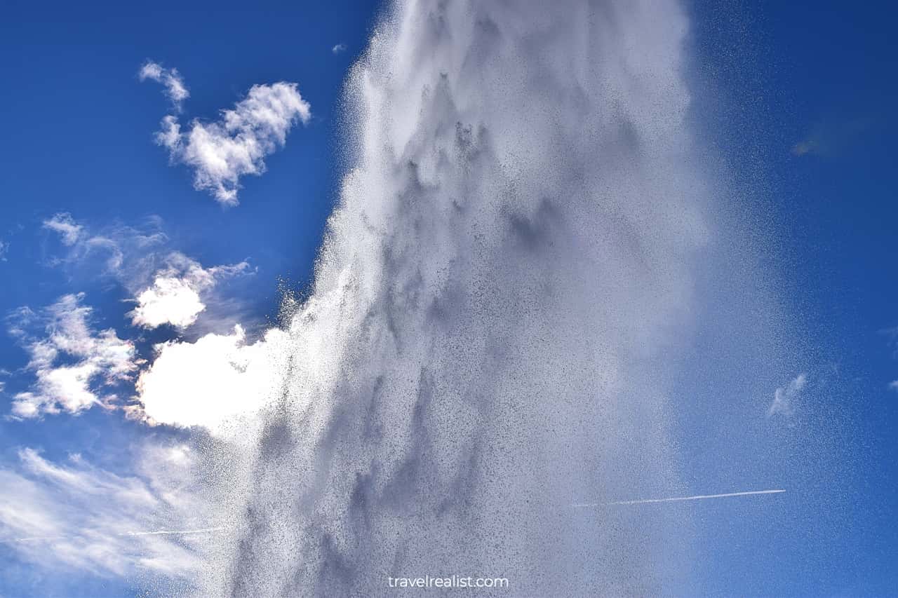
3.1. Strokkur
The Geysir does not erupt as frequently as it used to. But you do not need to worry. This area is home to another, more predictable, geyser.
Strokkur erupts about every 10 minutes or so. You would not need to wait long for an eruption no matter when you arrive.
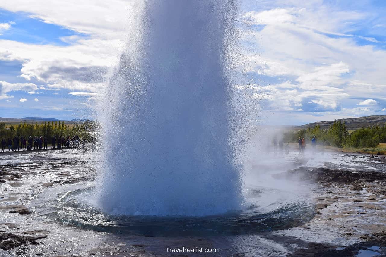
Strokkur reaches the height of 65 ft (20 m). It is quite a bit lower than the Old Faithful in Yellowstone. But lower height has some advantages. You can come a lot closer to Strokkur than most other geysers.
You also do not need to worry as much about the hot water and mist. That makes Strokkur a great place to visit on the Golden Circle Iceland Drive Map.
The eruptions are timely. Yet they still surprise most visitors. The good thing is that you can always catch the next one. All you need to do is wait for a few minutes.
After you enjoyed a couple of Strokkur’s eruptions, you can continue driving along the Golden Circle Iceland Map.
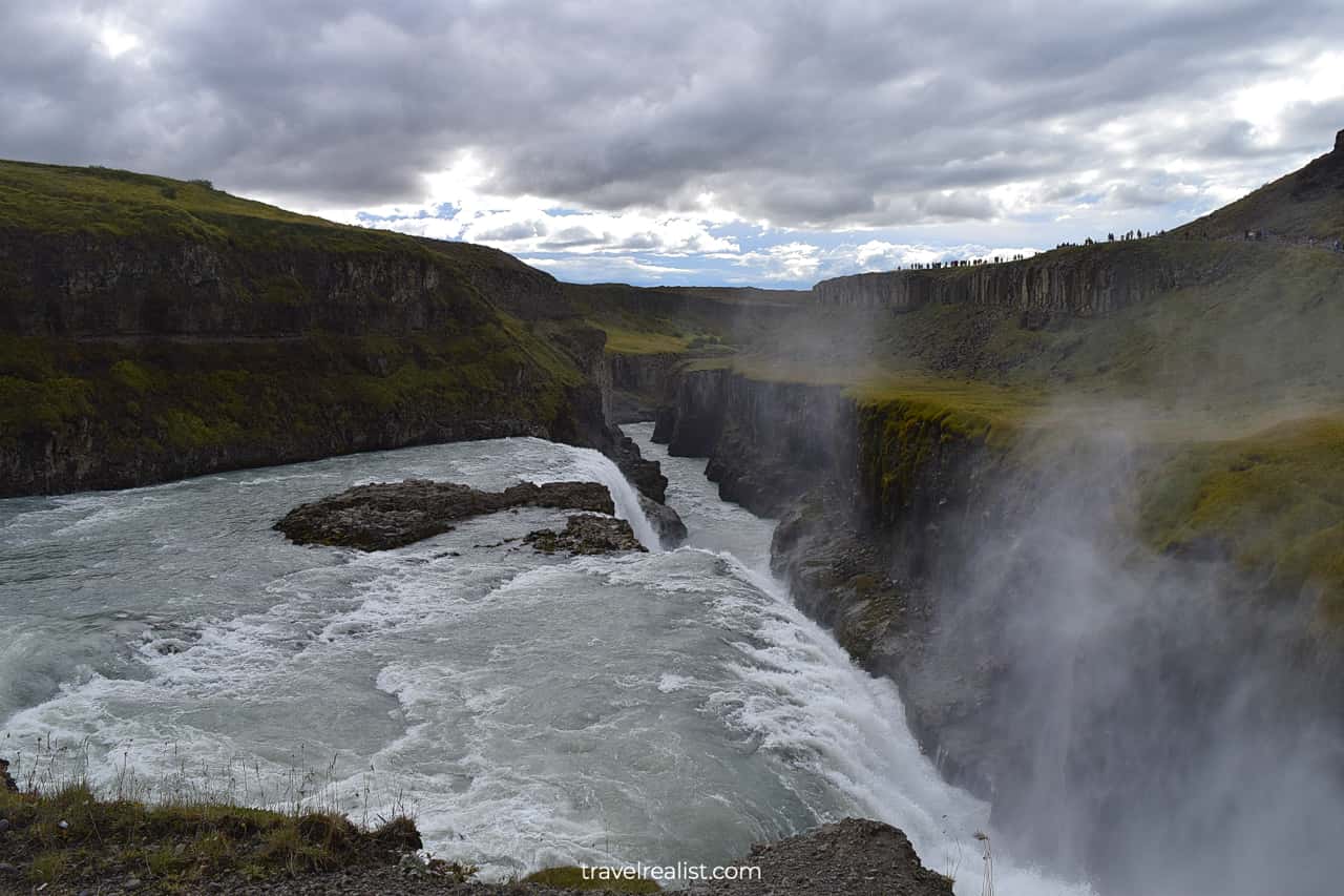
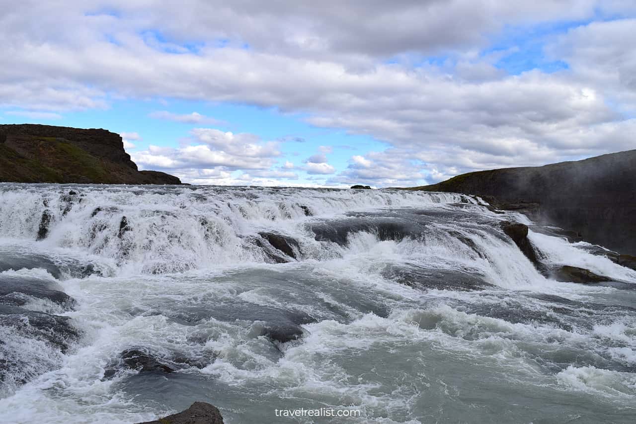
4. Gullfoss
This time your drive will not be long. Gullfoss waterfall is just 6 miles (10 km) from Geysir. This waterfall is well worth a stop on your route.
Just see for yourself. The waterfall has two terraces. First, It drops 36 ft (11 m) to a triangular terrace. Then, It has a 69-ft (21-m) drop into a narrow canyon.
The canyon is just 65-ft (20-m) wide. The total height of Gullfoss is just 105 ft or 32 m. But this waterfall has a right combination of height, power, and beauty.
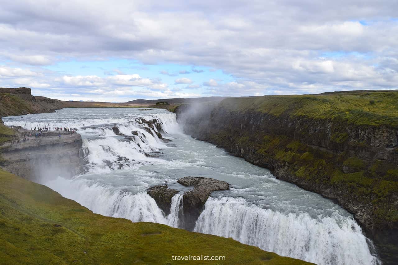
There is a short paved and gravel trail to the viewpoint. It takes about 0.3 miles (0.5 km) round trip. The trail brings you very close to the powerful stream.
Get ready for mist. But do not let it stop you from getting closer to the waterfall. The best views of the canyon require this short walk. A waterproof jacket or a raincoat is a good idea when visiting Gullfoss.
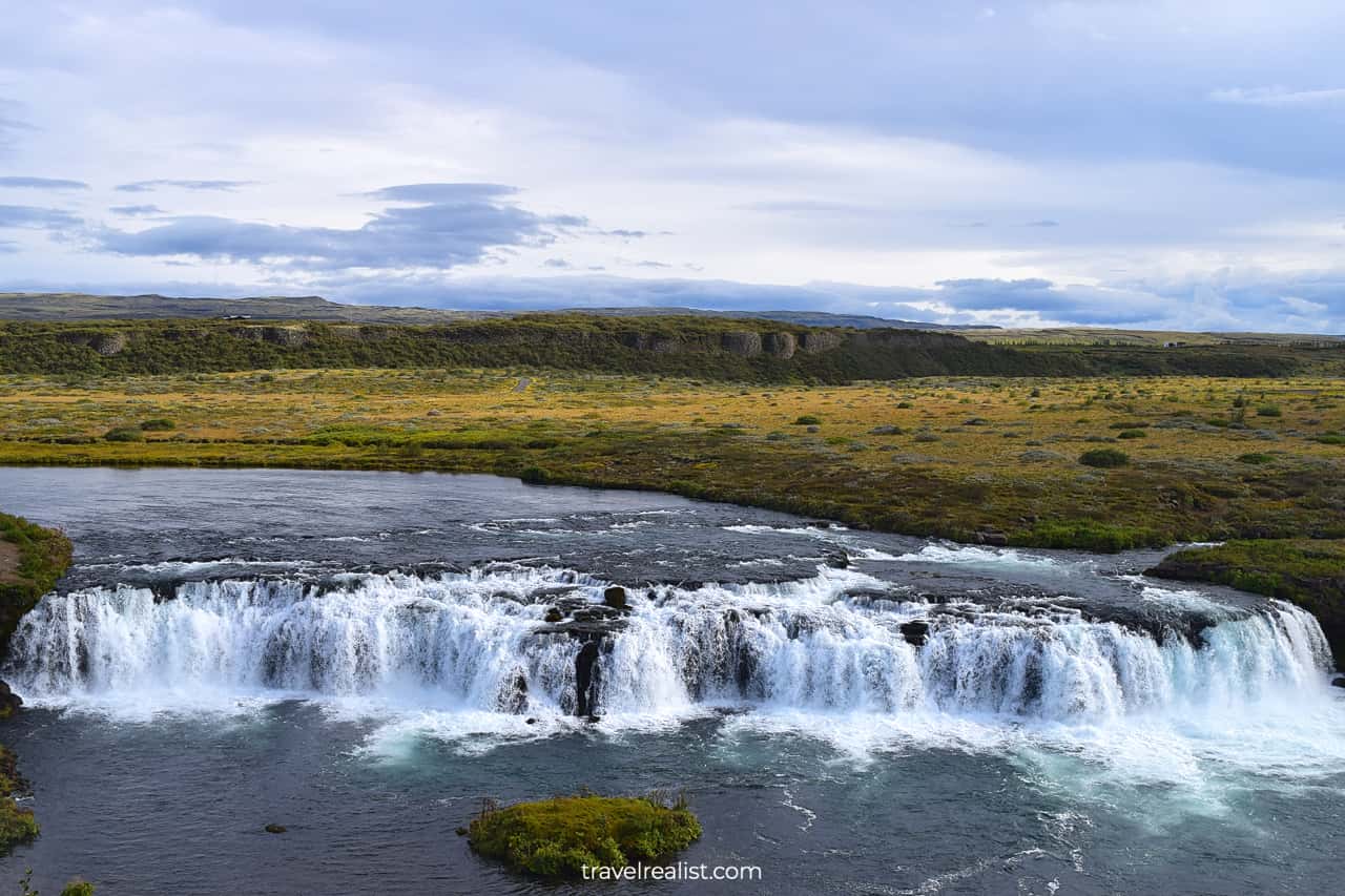
5. Faxafoss
Gullfoss is the furthest point on the Golden Circle Iceland Map for many visitors. Most people start driving back to Reykjavik from this waterfall. But there are still sights to see on the way.
Faxafoss is one of them. This waterfall is just 13 miles (21 km) from Gullfoss. It is near the Route 35. This quick stop will reveal another beautiful waterfall.
It is not as high or powerful as Gullfoss. Instead, this waterfall is very wide. It looks more like a cascade rather than a fall.
6. Kerid Crater
Kerid Crater is a final stop on the Golden Circle Iceland Drive Map for most tours. It is another stop just off Route 35. You can reach it by driving 22 miles (35 km) from Faxafoss.
As the name suggests, Kerid is a volcanic crater. There are a lot of craters in Iceland and all over the world. The water that filled it makes Kerid unique.
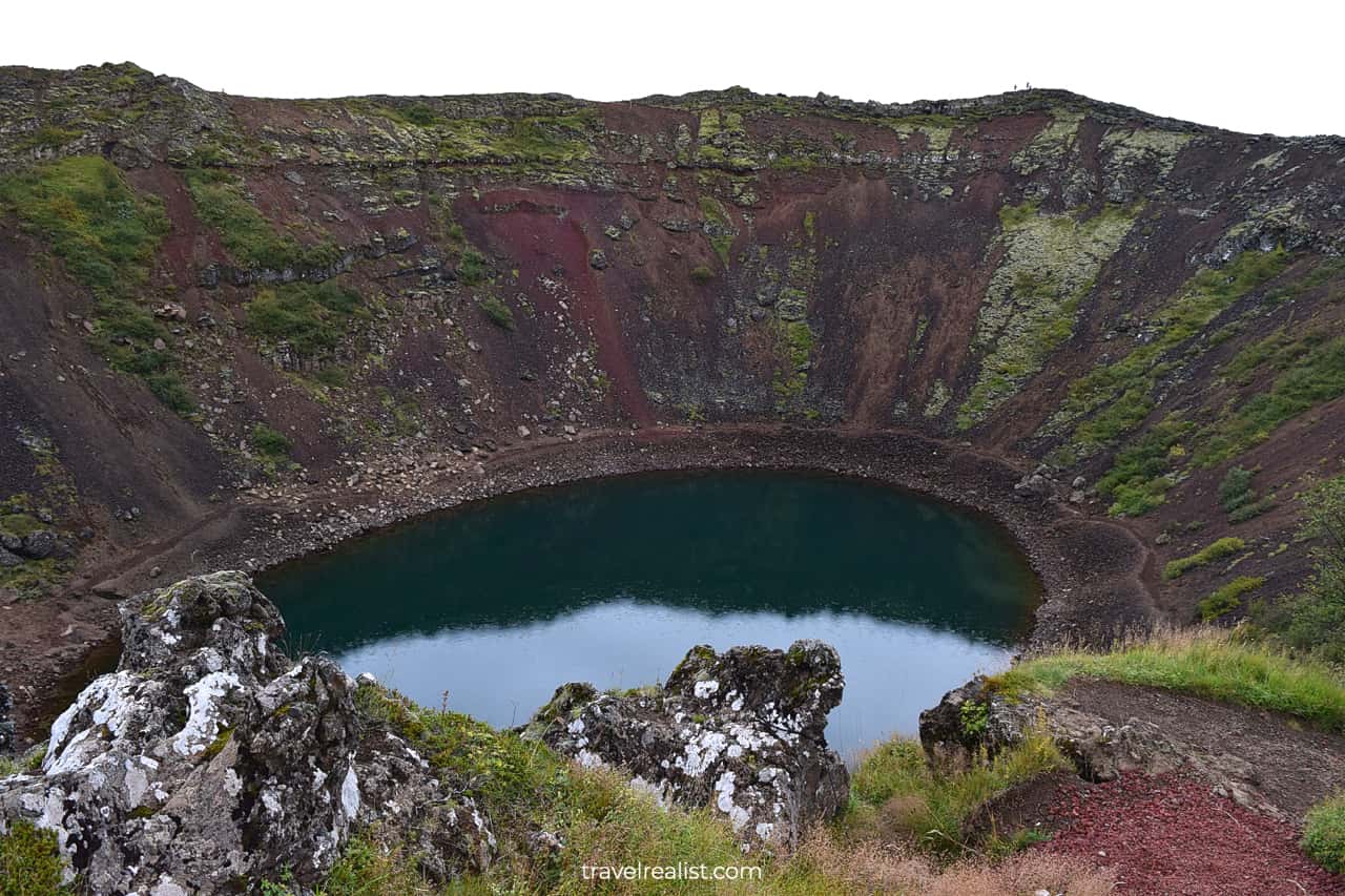
This park has a short hiking loop on top of the crater. You could also hike down to the bottom of the crater. This path will bring you close to the crater lake.
But there is a small downside to visiting this crater. It is one of the few sights on the Golden Circle Iceland Map that requires a fee. It could be a bit underwhelming if you compare it to other stops on the route.
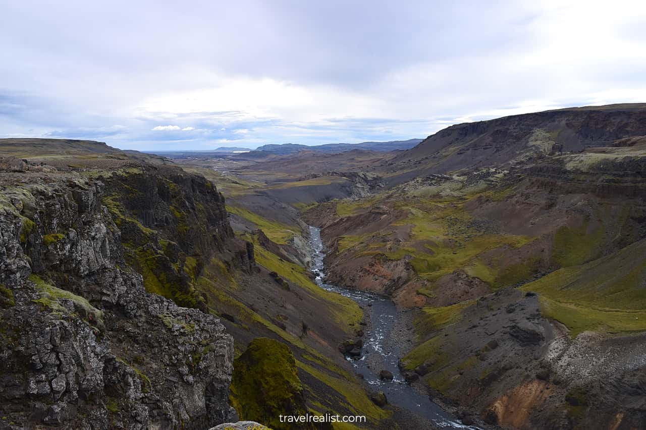
7. Haifoss
There is an extension to your route if you do not want your Golden Circle exploration to end. Haifoss is further away from other Golden Circle Iceland stops. In fact, it is deep in the South Iceland region.
Remote location and a gravel road result in many tours dropping Haifoss. But its beauty is well worth a challenge.
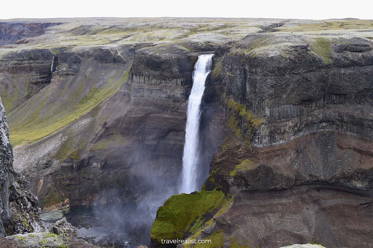
This waterfall requires a more elaborate journey. Even getting to this waterfall is an adventure in itself.
- There are about 48 miles (77 km) between Faxafoss and Haifoss.
- The last 4.6 miles (7.5 km) are very challenging. You need to drive on a rocky gravel road.
- You might want to rent a high clearance or a 4×4 vehicle.
- You could get to the waterfall in a sedan or a hatchback. But their low road clearance could result in damage. Decide if you want to take your chance with car rental and insurance companies.
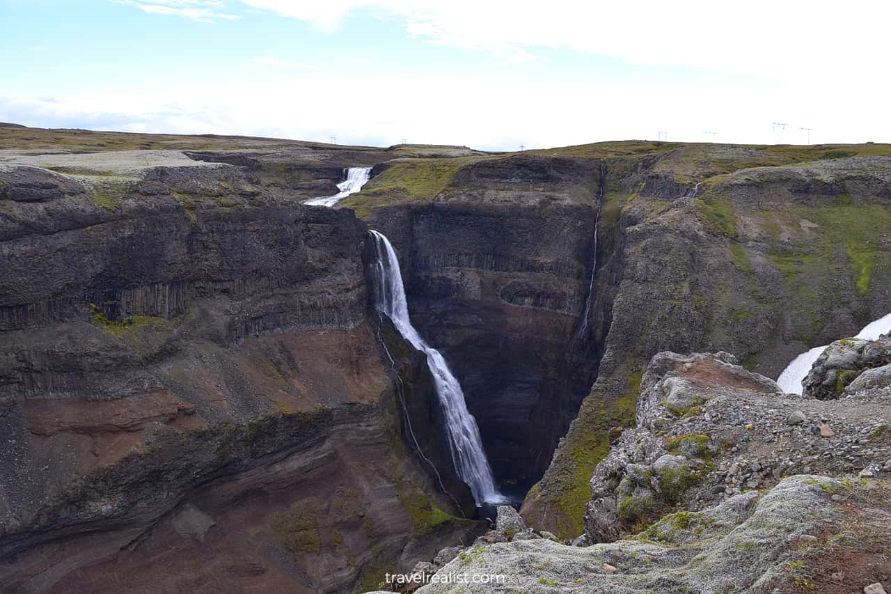
This waterfall is 400 ft (122 m) high. It is the fourth highest waterfall on the island. Haifoss waterfall is likely the highest waterfall in Iceland you could see from your car.
7.1. Granni
Haifoss is more than just a waterfall. You will see two powerful falls and several smaller streams. Granni, the fifth highest waterfall in Iceland, is right next door.
This fact makes a long and challenging journey to Haifoss a lot more rewarding. Beautiful views of the valley below are another amazing sight at Haifoss. You would want to spend some time to enjoy this area.
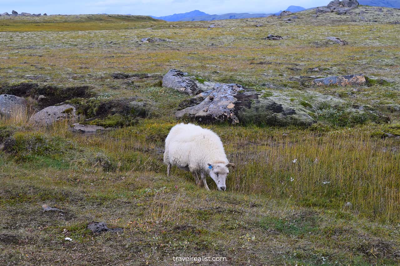
But remember that Icelandic weather could be quite unpredictable. It often gets windy at this waterfall. It is best to wear layers to make your exploration more comfortable.
You could also see sheep at this Golden Circle Iceland stop. Iceland has more sheep than people. But it lags behind Ireland and New Zealand.
Continue with this Golden Circle Iceland Drive Map. You will learn more about ways to get to the sights, entrance requirements, and places to stay.
Getting to Golden Circle Iceland
Iceland is an island just south of the Arctic Circle. That means that you need to fly to explore the country’s sights. The same is true for the stops on the Golden Circle route in Iceland.
Keflavik Airport is the main hub for air travel in Iceland. It serves as the primary gateway for the international visitors to Iceland. Most airlines market this airport as Reykjavik Keflavik Airport.
It is quite misleading. The airport is a good 30 miles (50 km) from the capital city’s center. You can see Reykjavik on the horizon from the town of Keflavik, just 2 minutes from the airport.
On the other hand, the airport is just a 25-minute drive from the famous Blue Lagoon Spa Resort. Some itineraries place this hot spring on the Golden Circle Iceland Map.
The resort has a blue colored hot spring. It is expensive to visit. You should expect to pay $60+ per person. Yet the place is so popular that you will run into crowds no matter when you visit it.
But Blue Lagoon is not the only geothermal spring in Iceland. You could look into Mývatn Nature Baths near Akureyri and lesser known spots. They are cheaper and less crowded.
Airfare will likely be the cheapest item on your trip’s budget. Everything else is expensive in Iceland. You can easily pay $150 for a taxi ride from the airport to the city center.
This makes a car rental a good idea in Iceland. The gas in the country is not cheap. But at least you will have the freedom to explore the Golden Circle Iceland sights at your own pace.
Otherwise, you could always take a tour from one of the many operators on this route. Do your research and compare drive maps, itineraries, and prices.
Where to Stay near Golden Circle
Finding budget friendly places to stay is another challenge when visiting the Golden Circle sights. But it is not due to the lack of hotels or guest houses.
There are a lot of options in Keflavik, Reykjavik, Selfoss, and Hveragerdi. You could also find a few options right next to the Golden Circle sights.
But you would have to search quite hard to find a place to stay within your budget. Also keep in mind that many guest houses have shared toilets and showers.
Entrance Requirements & Passes
You can visit most sights on the Golden Circle Iceland Map free of charge. There are a few exceptions:
- Thingvellir charges a ISK 750 ($5) parking fee. There is also a separate fee to use a restroom at the Visitor Center.
- Kerid Crater charges ISK 450 ($3) per person.
- Hallgrimskirkja has a fee of ISK 1,300 ($9) per person to visit its tower.
All sights are open from sunrise to sunset in the summer. Winter hours could differ.
Takeaways: Golden Circle Iceland
Golden Circle in Iceland is a great route with beautiful natural and man-made sights.
- You could explore geological formations at Thingvellir, Geysir, and Kerid Crater.
- If waterfalls are your thing, you will enjoy Gullfoss, Haifoss, and Faxafoss.
- The buildings in Reykjavik round up the list for architecture lovers.
Golden Circle is a route you would not want to miss. But Iceland is a lot more than the Golden Circle. You should plan to visit the country’s other sights. Many of them are a just a short drive from the capital city.
Take a look at this Golden Circle Iceland Video Map. And visit the YouTube channel for the latest videos.
Frequently Asked Questions
Golden Circle Iceland is the most popular driving route in Iceland. It has both natural and man-made sights. You can visit waterfalls, geysers, and volcanic formations.
You can easily complete the Golden Circle Iceland drive in about 6 hours. Add another 2 hours if you visit Haifoss waterfall.
Thingvellir, Geysir, and Gullfoss waterfall are on every Golden Circle Iceland map. Some itineraries also include Haifoss and Faxafoss Waterfalls, Kerid Crater, and Reykjavik.
You can visit Golden Circle in Iceland without a tour. You just need to rent a car since most Golden Circle sights are quite far from one another.
Most sights on the Golden Circle route in Iceland are free to visit.
– You only need to pay entrance fees to Kerid Crater and the observation tower at Hallgrimskirkja.
– Parking and restrooms at Thingvellir National Park also require fees.
Summer is the best season to drive on the Golden Circle Iceland route. You will experience the long daytime. The weather will be at its best. Crowds at main sights are a trade-off.
The Golden Circle Iceland route takes between 250 km and 450 km. It depends on the sights, your start and end points.
The Golden Circle Iceland is a paved drive. The last 7.5 km to Haifoss waterfall are the only challenging section of the drive. This rocky gravel road requires a high clearance vehicle.
Safe realist travels!