Iceland Ring Road Itinerary: 5 to 7 Days

This realistic Iceland Ring Road Itinerary helps you explore the country on a 5 to 7 day long road trip.
This post includes affiliate links that will earn us commission if you make a purchase via these links.
What is the Ring Road in Iceland?
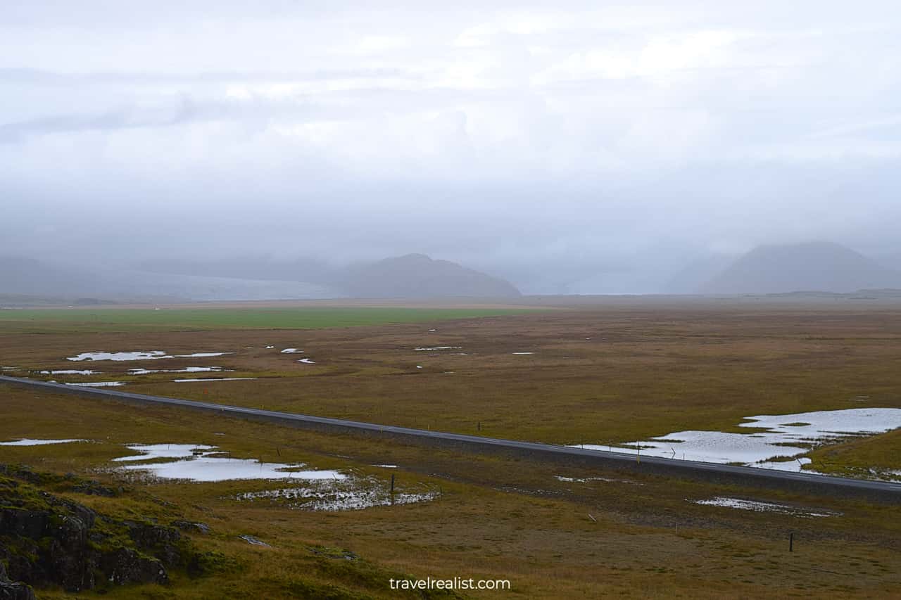
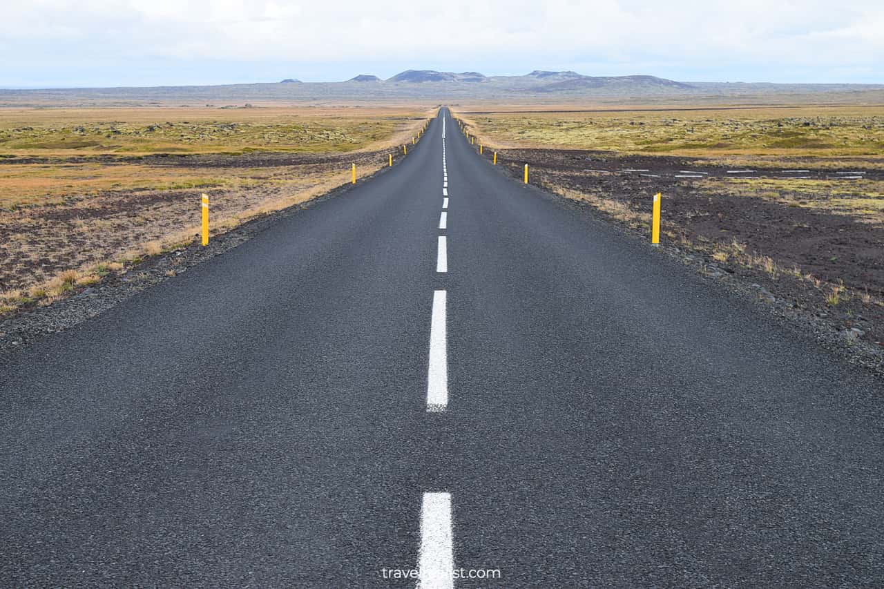
The Ring Road is a 820-mi (1,322-km) loop road that goes around the entire island. You could also see it under the name of Highway (Route) 1. The Ring Road starts and ends just east of Reykjavik.
Many iconic sights in Iceland are on or near the Ring Road. You can explore them on a road trip that takes between 5 and 7 days.
The shortest Iceland Ring Road Itinerary takes 5 days. You would need to skip West Iceland and a few sights further away from the route. You could see even more of Iceland if you add two more days.
Day 1: Reykjavik to Vik
- Distance: 152 miles (245 km).
- Driving time: 3.5+ hours.
- Main sights: capital city, waterfalls, and black sand beaches.
The first day on the Iceland Ring Road Itinerary explores Reykjavik and South Iceland. You can ease into your trip with a shorter route on Day 1.
There are no strenuous hikes on the plan for this day. You will start your exploration with a brief stop in the capital city. You could then get on the Ring Road and visit iconic waterfalls and black sand beaches.
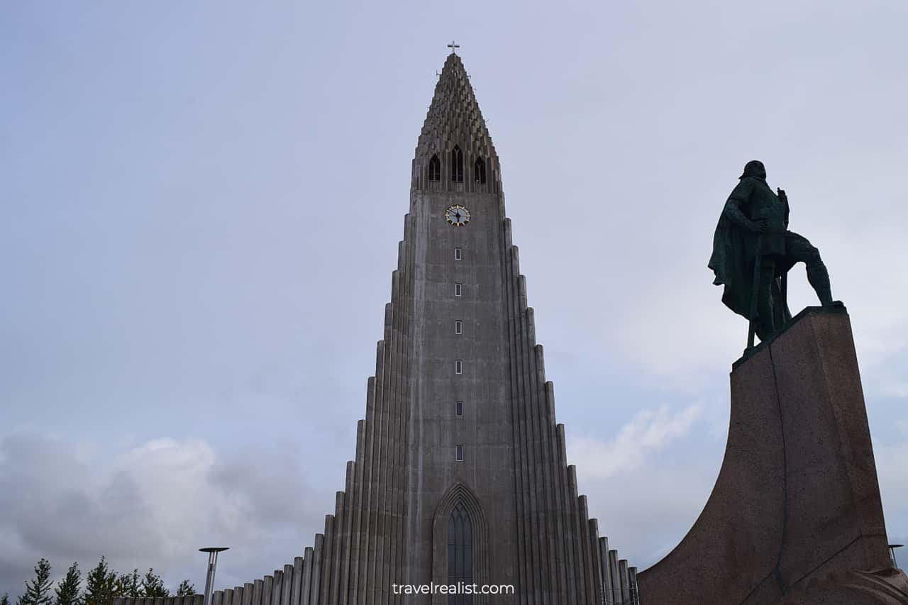
1.1. Reykjavik
- Distance from Ring Road: 12 miles (19 km) round trip.
- Type: city walk.
- Entrance fees: depends on the attraction.
Almost every Iceland Ring Road Itinerary starts in Reykjavik. The capital city has the largest airport in the country. The airport is about 45 minutes from the city.
So if you rent a car near the airport, you might not feel like stopping in Reykjavik. Yet, it is wise to make a quick stop in the city.
You will find lots of supermarkets and restaurants in Reykjavik. It is a great place to stock up on snacks for your Ring Road journey. While the city center is small, there are also a few things to see.
You could head to Hallgrimskirkja. This 240-ft (73-m) church is one of the tallest building in Reykjavik. You can get great views of the city from its observation deck. The visit costs about $10 per person.
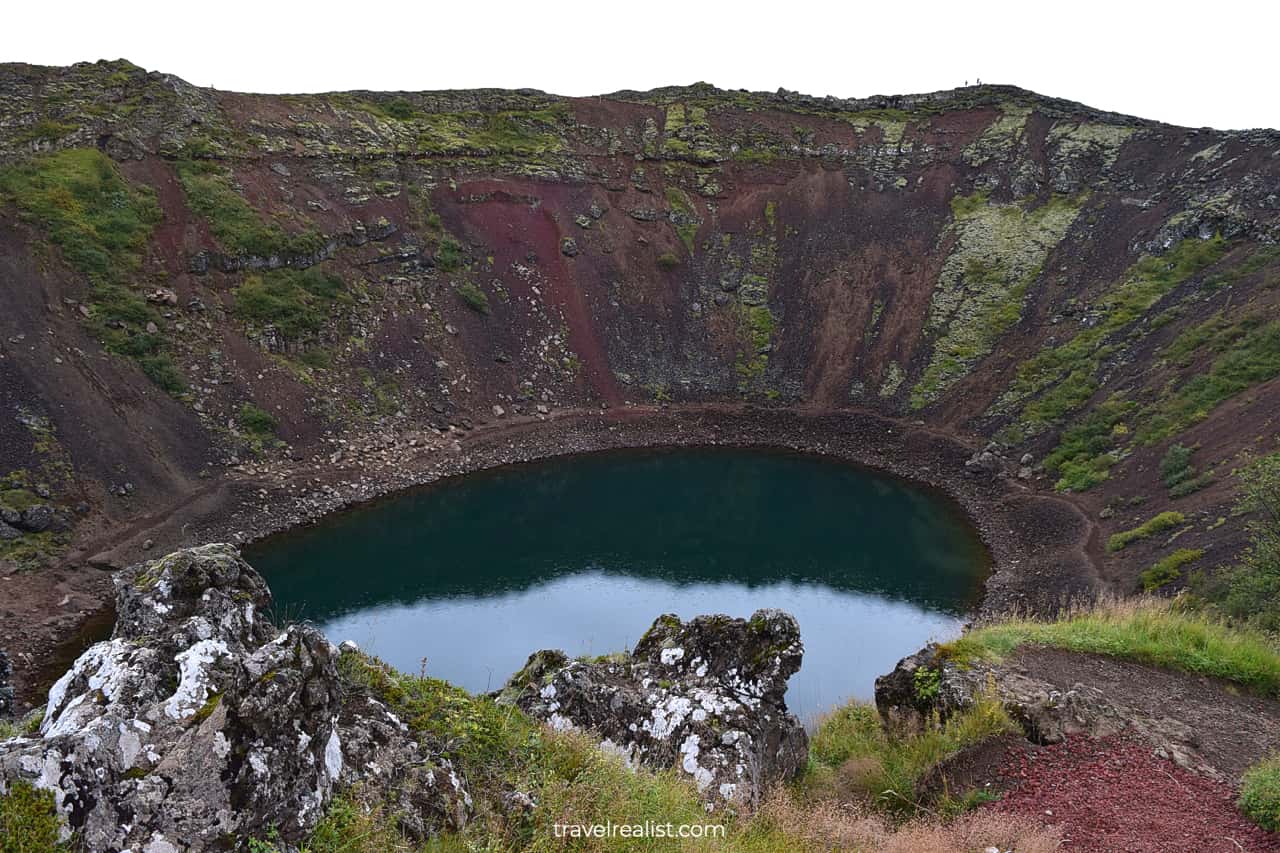
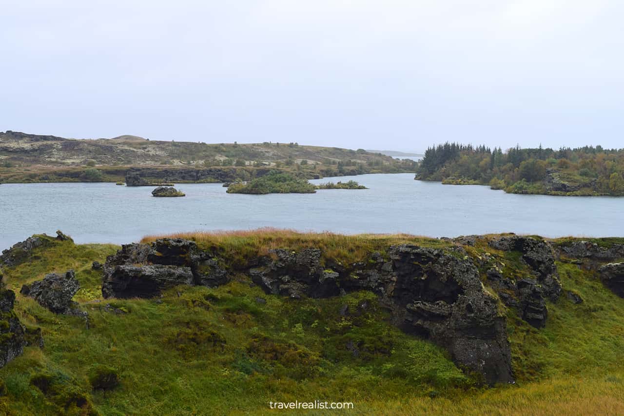
1.2. Kerid Crater
- Distance from the Ring Road: 16 miles (25 km) round trip.
- Type: a viewpoint with a path.
- Entrance fees: ISK 450 ($3) per person.
Kerid Crater could be your first stop on the Ring Road itinerary outside of Reykjavik. The crater with a lake is on the Golden Circle tourist route. It is the closest attraction on this iconic route to the Ring Road.
You would still need to budget about 30 to 45 minutes to reach the crater, explore it, and get back. Kerid Crater is one of the few sights in the country that charges admission fees.
You might be on the fence about visiting the crater due to the detour and entrance fees. You could get somewhat similar views in West Iceland if your itinerary covers this region.
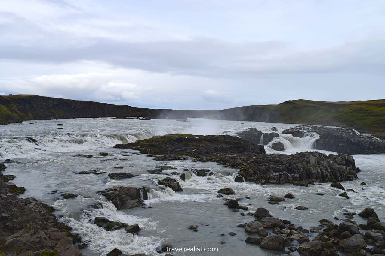
1.3. Urridafoss Waterfall
- Distance from the Ring Road: 1.5 miles (2.5 km) round trip.
- Type: a viewpoint.
- Entrance fees: free.
Urridafoss Waterfall should be your next stop on the Ring Road. This waterfall in South Iceland is among the easiest to reach from the capital city. You will be at the falls viewpoint in about 75 minutes.
Urridafoss is a powerful but not a very scenic waterfall. It is just the right waterfall to start your exploration of the waterfalls in Iceland. Stop by the viewpoint and enjoy the falls on the Thjorsa River.
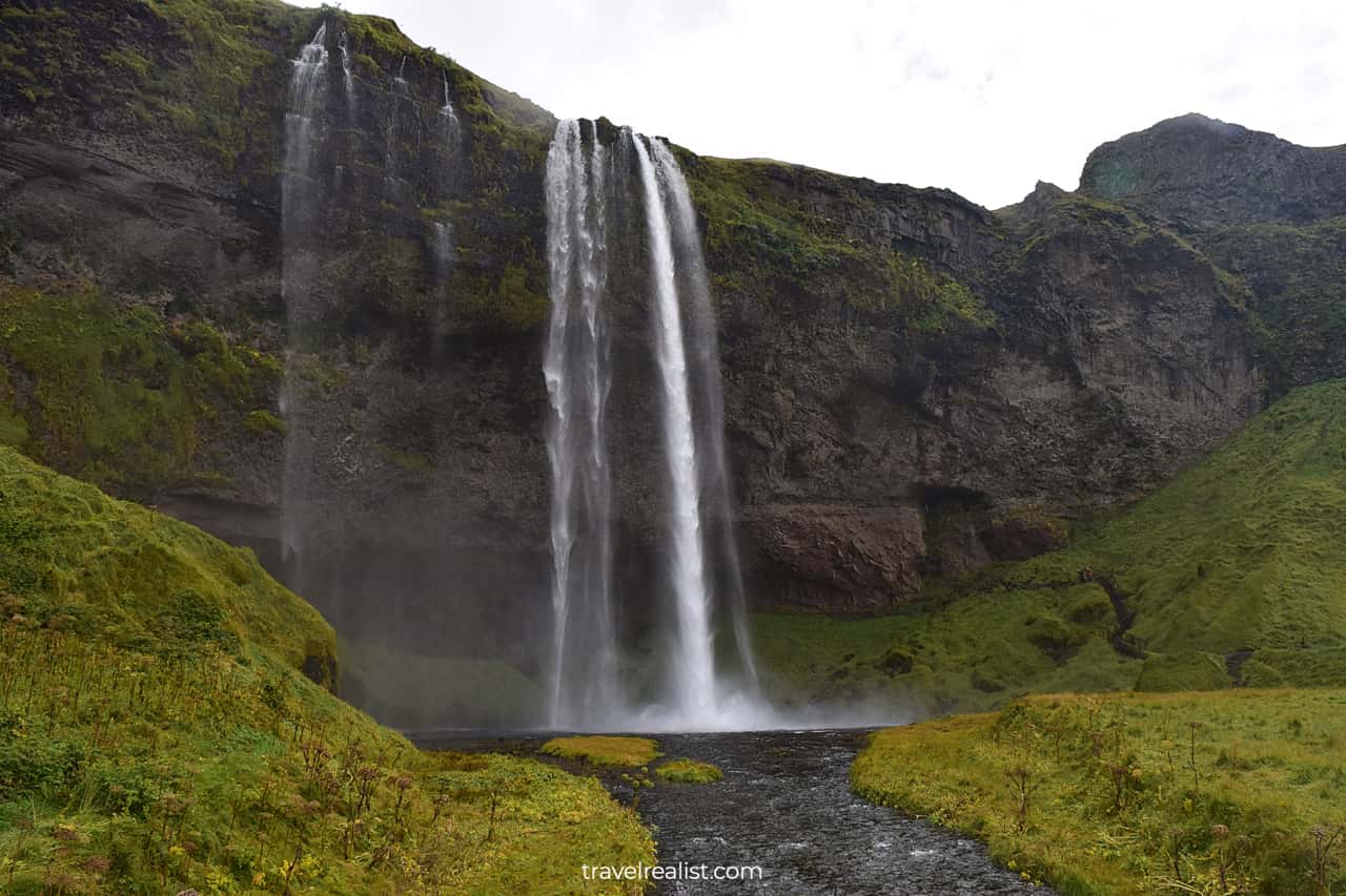
1.4. Seljalandsfoss Waterfall
- Distance from the Ring Road: 0.9 miles (1.5 km) round trip.
- Type: viewpoint with a path.
- Entrance fees: ISK 900 ($6.5) per car.
Your exploration of the Ring Road will continue with a more scenic waterfall in South Iceland. Seljalandsfoss Waterfall is within the top 20 highest waterfalls in the country. It drops 213 ft (65 m).
But tourists come to this waterfall to see more than its height. This waterfall has a grotto. There is a path that takes you behind Seljalandsfoss Waterfall.
Wear waterproof boots and jacket. This way, you will not have to worry about the mist. If you are up for it, take a 1.2-mi (2-km) out-and-back hike to Gljufrabui Waterfall.
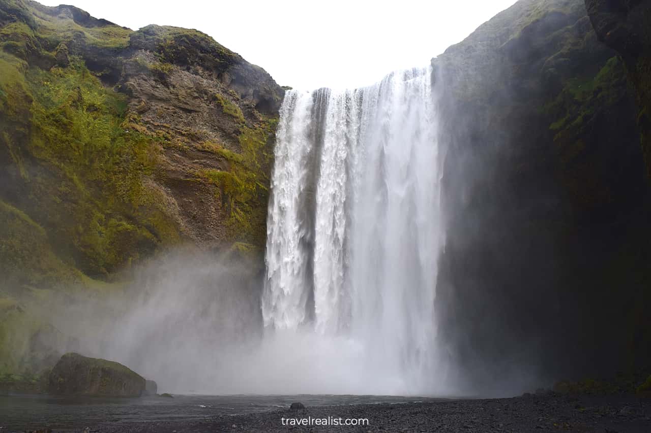
1.5. Skogafoss Waterfall
- Distance from the Ring Road: 1.7 miles (2.8 km) round trip.
- Type: a viewpoint with a path.
- Entrance fees: free.
The next stop on the Iceland Ring Road Itinerary will bring you to Skogafoss Waterfall. This waterfall is one of the symbols of South Iceland. It is one of the most famous falls in the entire country.
It is easy to see why. Skogafoss is one of the highest, most powerful, and scenic falls in Iceland. Free parking sweetens the deal. You will see the waterfall right from the Ring Road and the parking lot.
There are two hiking paths that bring you even closer to the waterfall. The first one continues at the river level. The second path is an uphill hike to the upper observation deck.
1.6. Dyrholaey Peninsula
- Distance from the Ring Road: 7 miles (11 km) round trip.
- Type: a viewpoint with a path.
- Entrance fees: free to visit; restroom is ISK 200 ($1.5) per use.
You will have an option to take a break from the waterfalls at the next stop on the Ring Road. Head to Dyrholaey Peninsula. It is easy to spend an hour exploring these beautiful shores.
There are plenty of things to do. The viewpoint has great panoramic views of the Lighthouse and Natural Arch. You could take a cliff walk to explore the rugged ocean shore.
Stop by Kirkjufjara Beach to walk on volcanic black sand. And do not forget to see the Arnardrangur. This lone standing cliff is just across a narrow water passage from the beach.
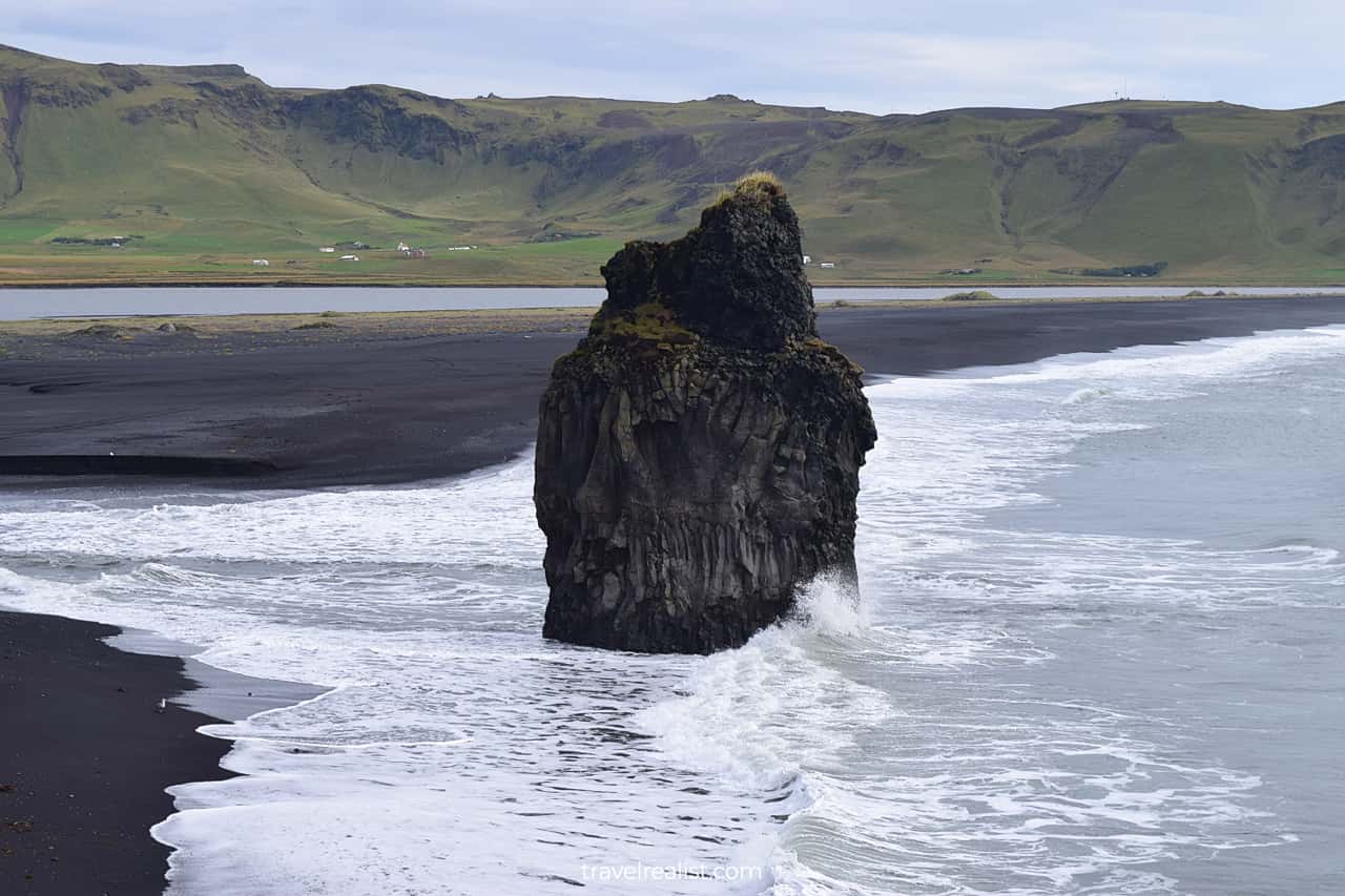
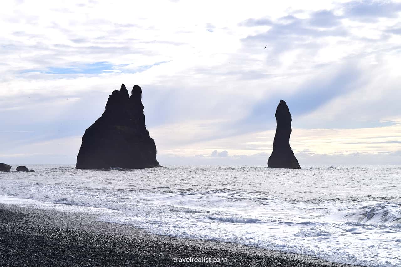
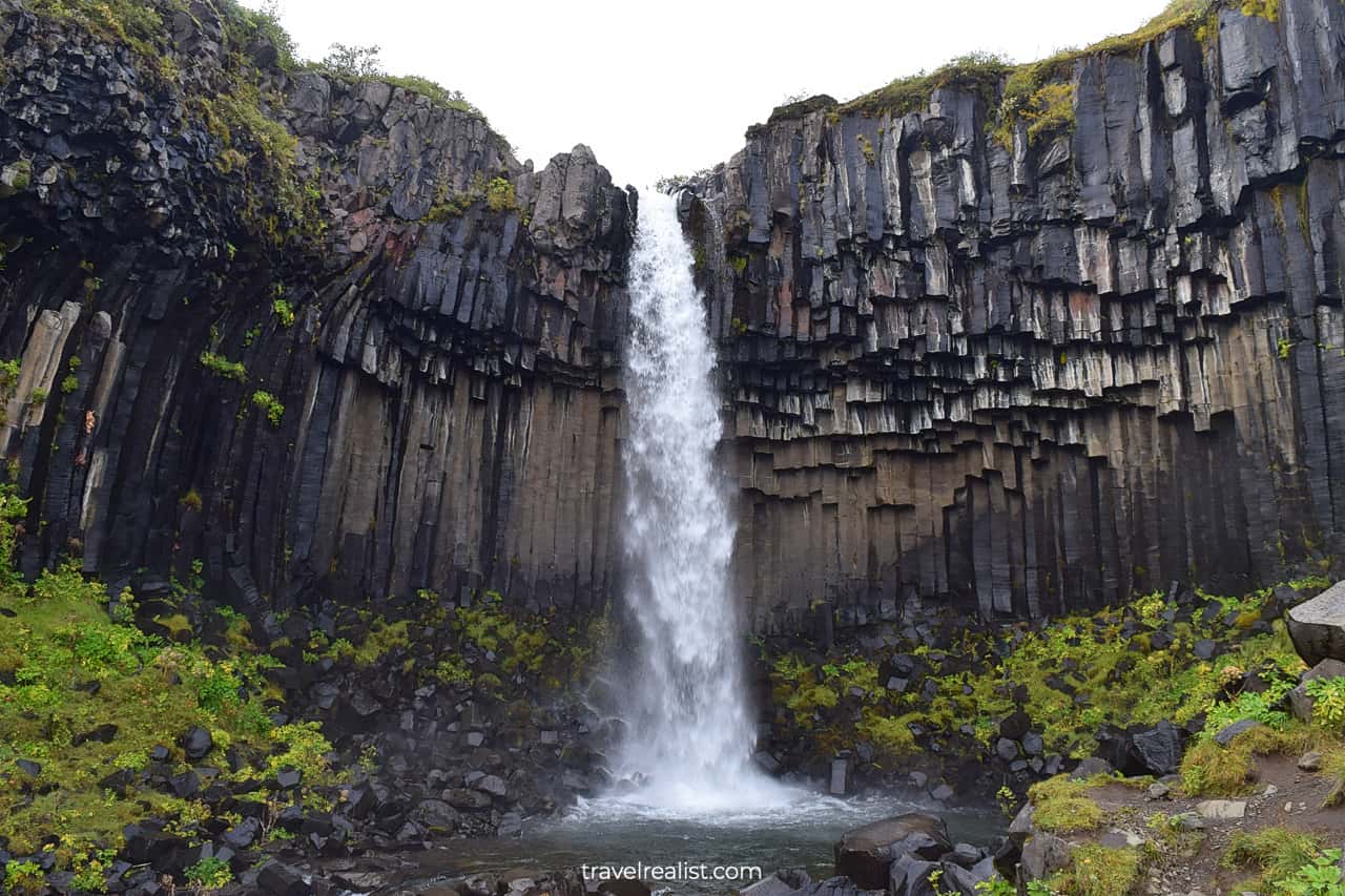
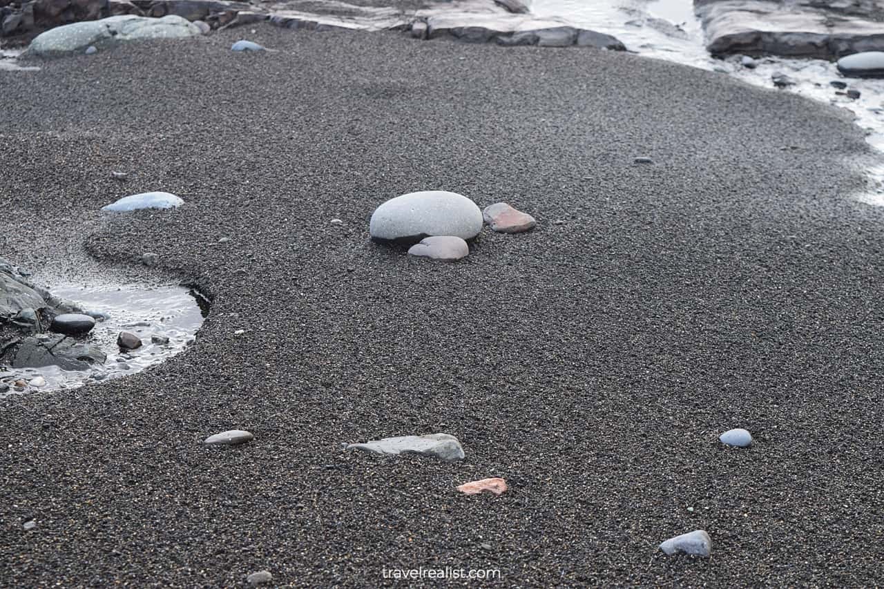
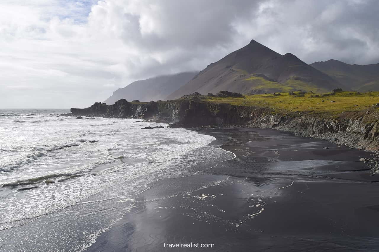
1.7. Reynisfjara Beach
- Distance from the Ring Road: 7 miles (12 km) round trip.
- Type: a viewpoint.
- Entrance fees: free to visit; restroom is ISK 200 ($1.5) per use.
There is one more natural wonder to visit on the first day of your Iceland Ring Road Itinerary. Reynisfjara Beach is the most well known black sand beach in the country.
You will see black sand, pebbles, basalt columns, and sea cliffs at this beach. Admire the breaking waves of the North Atlantic Ocean from a safe distance.
If all of this is not enough, Reynisfjara is also a great spot to see the sunset. It will be the perfect end to the action packed first day on the Ring Road in Iceland.
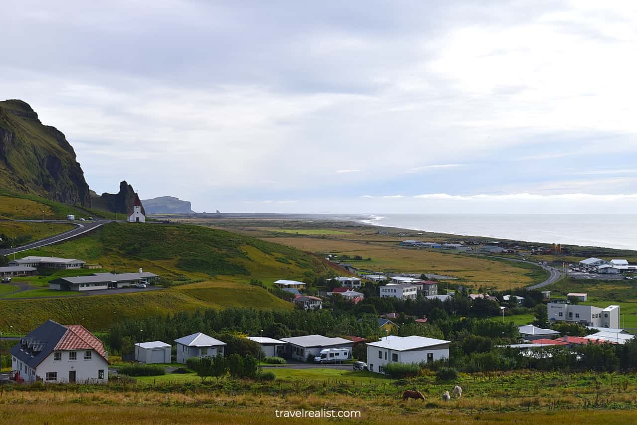
1.8. Vik
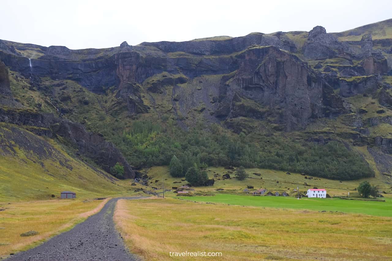
You will have just a short drive from Reynisfjara Beach to your hotel and restaurant. Vik on the Ring Road is just on the other side of the mountain.
It is a small fishing village in South Iceland. The village gained popularity thanks to its location right next to the famous black sand beaches. There are now a handful of restaurants and places to stay in Vik.
More supply means greater competition. Your chances of finding a better deal on lodging are higher in Vik than in other villages in this region.
It makes sense to make Vik your last destination on the first day of the Iceland Ring Road Itinerary. Get a nice dinner and enjoy the evening before exploring even more sights on the second day.
Day 2: Vik to Hofn
- Distance: 180 miles (289 km).
- Driving time: 4+ hours.
- Main sights: hikes, waterfalls, and glaciers.
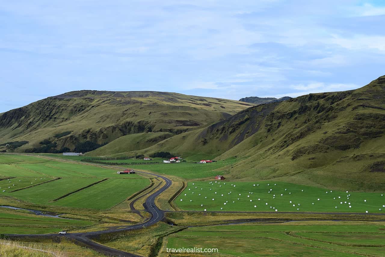
The second day on your Iceland Ring Road Itinerary will be one of the most eventful days in the country. You will finish the drive through South Iceland and pass through a part of East Iceland.
You would need to get ready for a few hikes. Depending on your fitness level, you could hike about 7 miles (11 km) to the glaciers, waterfalls, and canyons.
This day could also become quite expensive if you decide to take a glacier lagoon boat tour. The cheapest tour is about $50 per person.
It is key to prioritize your stops, viewpoints, and hikes on Day 2. There will be lots of smaller places you could visit on the way. You will be better off skipping some of them to have enough time in the major parks.
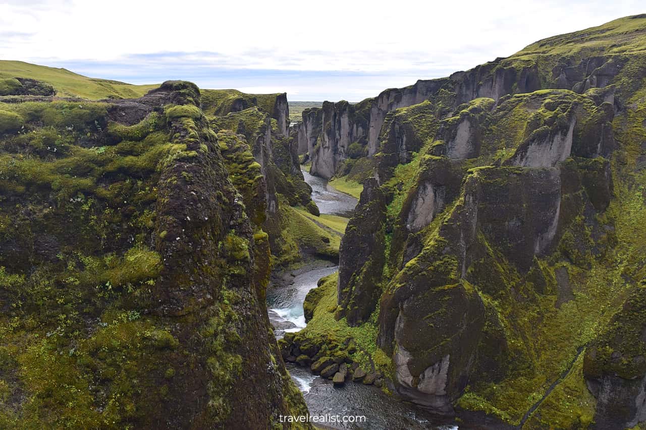
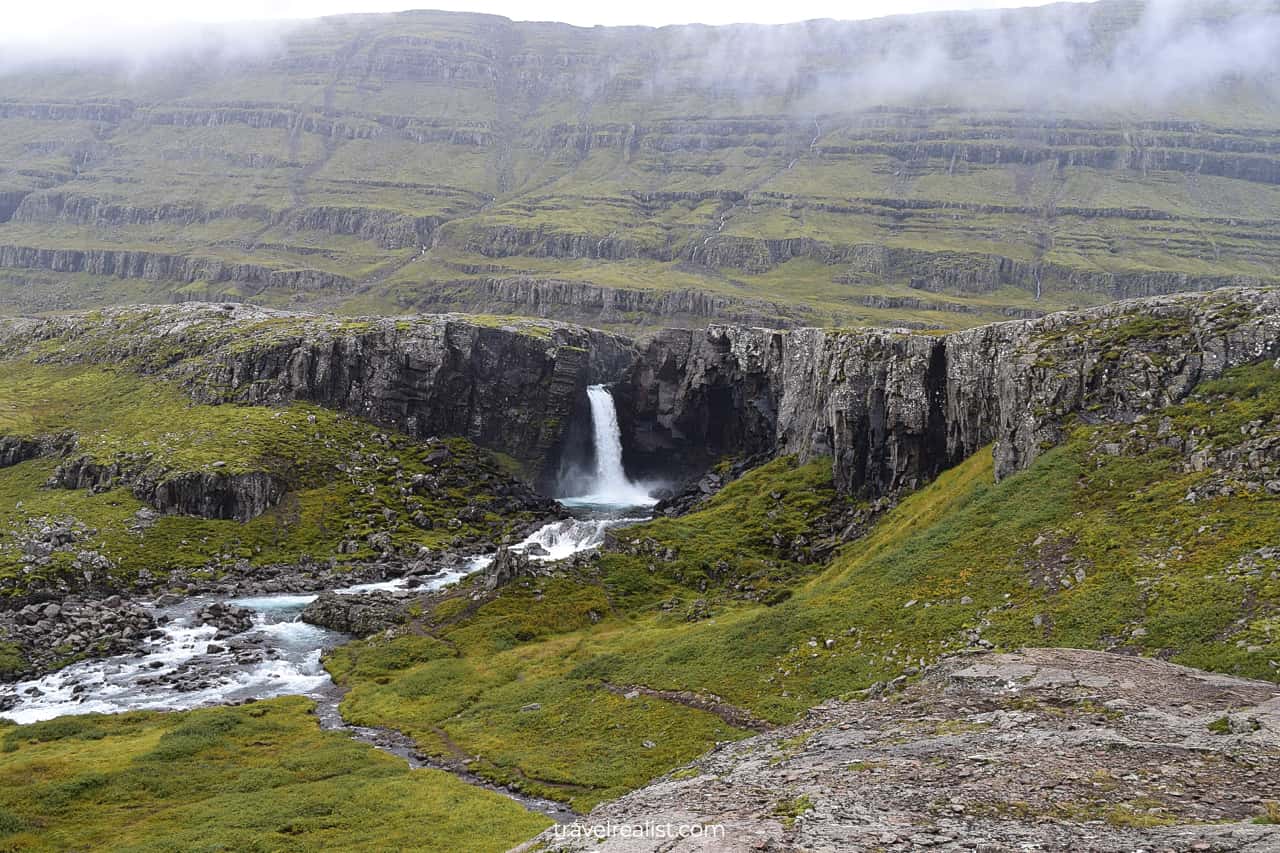
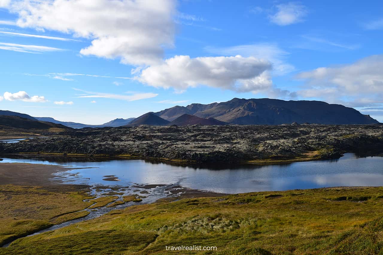
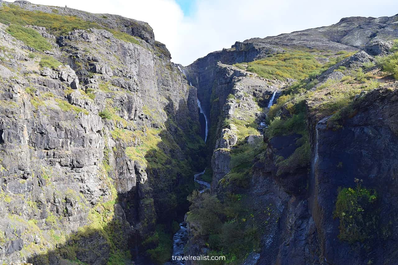
2.1. Fjadrargljufur Canyon
- Distance from the Ring Road: 4 miles (6.4 km) round trip.
- Type: hike.
- Entrance fees: free.
Fjadrargljufur Canyon is a majestic destination in South Iceland. A hike atop of the rim of this canyon will be a great start to your second day in Iceland.
It is a good idea to get to the trailhead early in the morning. This way, you will beat the crowds of fellow hikers. It will also be a lot easier to get a parking spot right at the trailhead.
This 2-mi (3.2-km) hike involves 253 ft (77 m) in elevation gain. You will be hiking uphill on the way to Mogafoss Waterfall. But in this case it is more about the journey than the destination.
2.2. Systrafoss Waterfall
- Distance from the Ring Road: 1.7 miles (2.8 km) round trip.
- Type: viewpoint.
- Entrance fees: free.
Systrafoss in South Iceland will be the next attraction on your Ring Road journey. This waterfall is one of the highest in the country.
You will get distant views of this 226-ft (69-m) waterfall right from the Ring Road. To get a better view, you would need to take a detour through the village of Kirkjubaejarklaustur.
There is no public parking nearby. But if you figure out the parking, there is a trail that brings you even closer to the falls.
2.3. Stjornarfoss Waterfall
- Distance from the Ring Road: 1.4 miles (2.2 km) round trip.
- Type: viewpoint with a path.
- Entrance fees: free.
If you already took a detour from the Ring Road to see Systrafoss, you should stop at Stjornarfoss. This waterfall is near the same village in South Iceland.
There is a spacious parking lot on the right side of the side road. You can great views of the waterfall right from the bridge. Take a short path along the river if you would like to see the falls even closer.

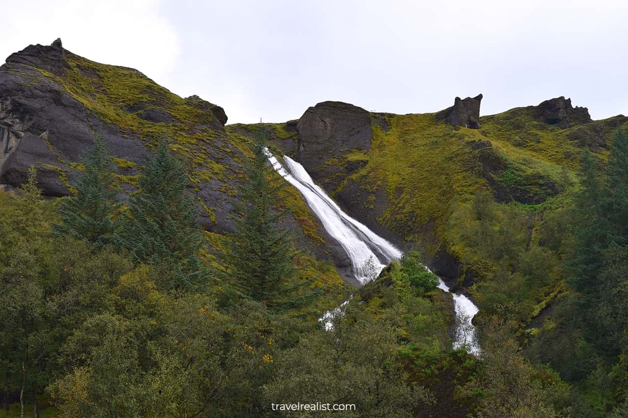
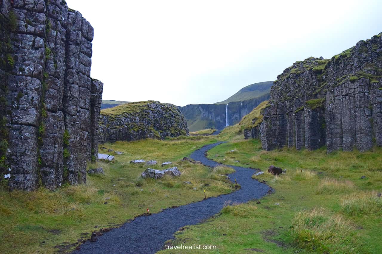
2.4. Foss a Sidu Waterfall
- Distance from the Ring Road: 0 miles (0 km).
- Type: viewpoint with a path.
- Entrance fees: free.
Foss a Sidu waterfall will be the first true viewpoint of the day. You would not need to take any detours to get amazing views. You can just park on the side of the Ring Road at Dverghamrar in South Iceland.
The 8th highest waterfall in the country will be on full display at this viewpoint. Go a bit further into Dverghamrar site.
This is the way to capture an iconic view of the waterfall with the columns on both sides.
2.5. Skaftafell National park
- Distance from the Ring Road: 1.9 miles (3 km) round trip.
- Type: a hike.
- Entrance fees: ISK 1,000 (~$7) per car.
There are a few smaller viewpoints in South Iceland, like Fossalar Waterfall or Lomagnupur Mountain. But you should keep driving to the next major attraction.
Skaftafell National Park in East Iceland is worth a 45-minute nonstop drive from Foss a Sidu Waterfall. It is part of the largest national park in the country.
Skaftafell protects the fragile landscapes around the same name glacier. You would need to hike to get the most out of this park. You can easily spend 3 hours in Skaftafell.
A 2.7-mi (4.3-km) hike brings you to the iconic Svartifoss Waterfall. A hike to the glacier will add another 2.5 miles (4 km) to your journey.
This is when you would need all the time saved by skipping the smaller viewpoints.
2.6. Fjallsarlon Glacier Lagoon
- Distance from Ring Road: 0.6 miles (1 km) round trip.
- Type: a viewpoint and a boat tour.
- Entrance fees: free; ISK 9,300 ($68) per person for the boat tour.
You will likely be at least a bit tired after hiking in Fjadrargljufur Canyon and Skaftafell National Park. But you are in luck. The next few stops in East Iceland do not have any hikes.
The viewpoint at Fjallsarlon Glacier Lagoon is a beautiful stop right next to the Ring Road. You will see Fjallsjokull glacier and icebergs in the lagoon.
There is also an option to take a boat tour to explore the icebergs even closer. You would need to pay about $70 per person for a 75-minute boat ride.
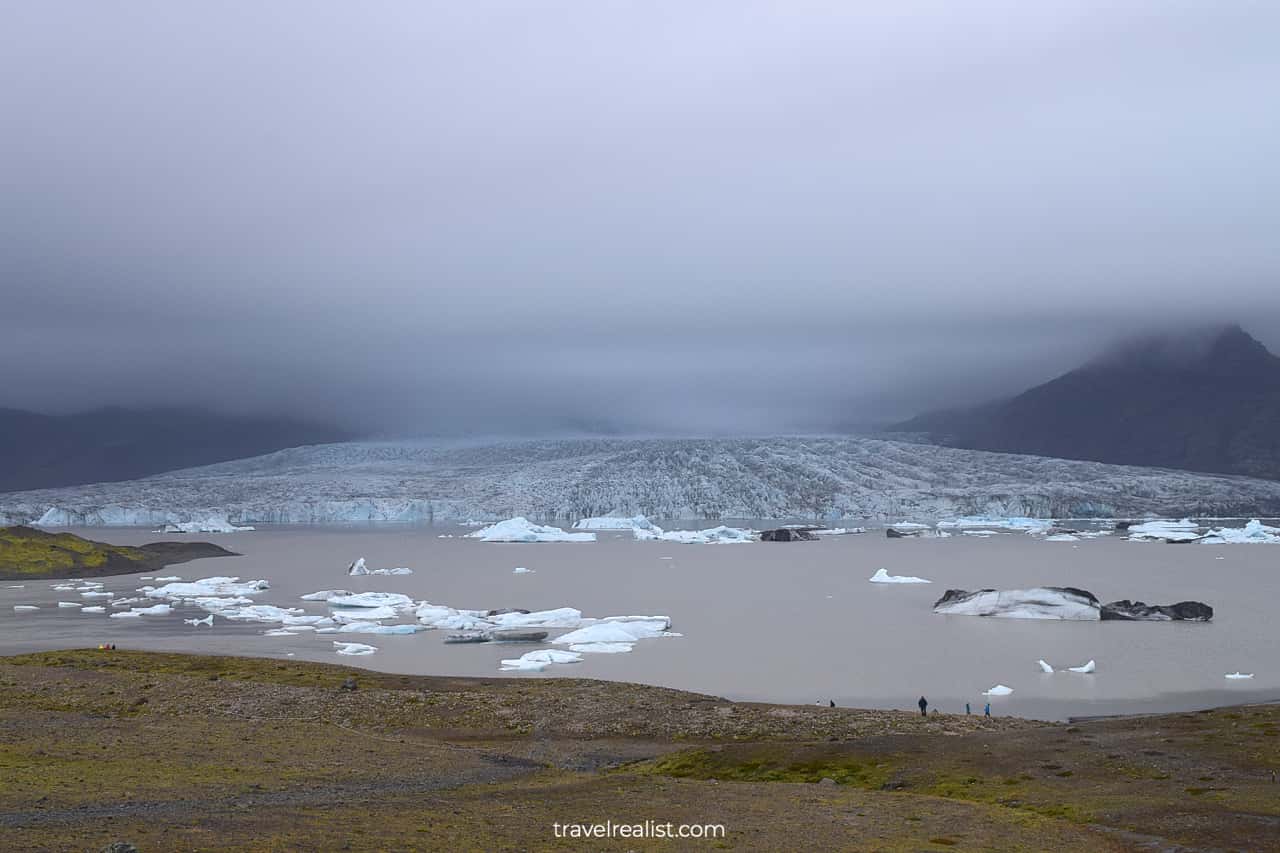
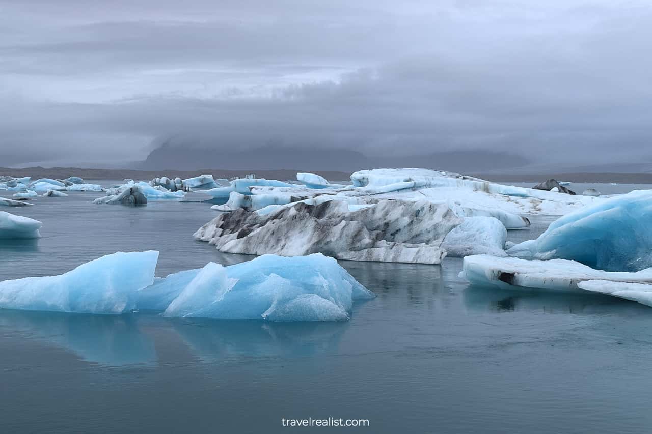
2.7. Jokulsarlon Glacier Lagoon
- Distance from the Ring Road: 0.5 miles (0.8 km) round trip.
- Type: a viewpoint and a boat tour.
- Entrance fees: free; ISK 6,300 ($46) per person for the boat tour.
Another glacier lake should be your next stop on the Iceland Ring Road Itinerary. Jokulsarlon Glacier Lagoon is a much larger lake. You might not see the glacier as close as at Fjallsarlon viewpoint.
But Jokulsarlon is worth a stop. You can see more icebergs in this lake. They will also be much closer to the viewpoint.
You could still take a boat tour if you desire. A larger boat will bring you around the icebergs to the glacier and back for about $50 per adult.
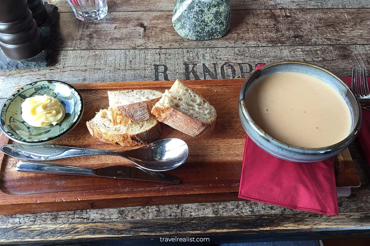
2.8. Hofn
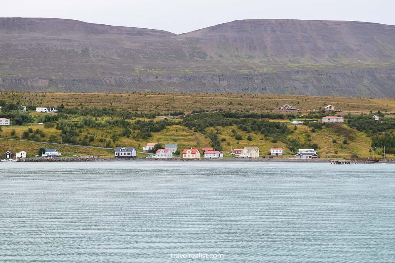
You will reach Hofn about an hour after leaving Jokulsarlon Glacier Lagoon. This town will mark a long-awaited end of your second day on the Ring Road in Iceland.
Hofn is a major stop on most Ring Road Itineraries. It is on a peninsula about 5 miles (8 km) south of the Route 1. The town has lots of restaurants and places to stay.
Get dinner at one of the local restaurants. There is nothing better than a chowder after a long day of hiking and exploring the glaciers.
Have a good night’s sleep at one of the hotels in Hofn. You can sleep in since the third day on the road should be far less demanding.
Day 3: Hofn to Egilsstadir
- Distance: 163 miles (262 km).
- Driving time: 3.5+ hours.
- Main sights: viewpoints, waterfalls, and black sand beaches.
The third day on the Iceland Ring Road Itinerary should be a bit less eventful than the second one. You would still need to drive for over 3.5 hours between Hofn and Egilsstadir.
But you will spend the entire day in East Iceland. There will be no hikes to speak of on the third day.
All of the sights will be visible right from the Ring Road. Short detours from main route will bring you even closer to some of the sights on the way.
If you breeze through the route, consider visiting Gilsarfoss and Klifbrekku Waterfalls. You would need to take gravel side roads to reach these waterfalls.
But this effort is worth a chance to see another grotto falls and terrace falls.
3.1. Fauskasandur Beach
- Distance from the Ring Road: 0.6 miles (1 km) round trip.
- Type: viewpoint.
- Entrance fees: free.
The first stop on the third day’s journey will take almost an hour from Hofn. You would have covered over 37 miles (60 km) by the time you reach Fauskasandur Beach.
This black sand beach rivals more famous Reynisfjara and Kirkjufjara Beaches near Vik. You will see the finest black sand at Fauskasandur Beach.
Thanks to a much more remote location, there will be few tourists when you visit this beach. This is a great place to take pictures without crowds getting in the way.
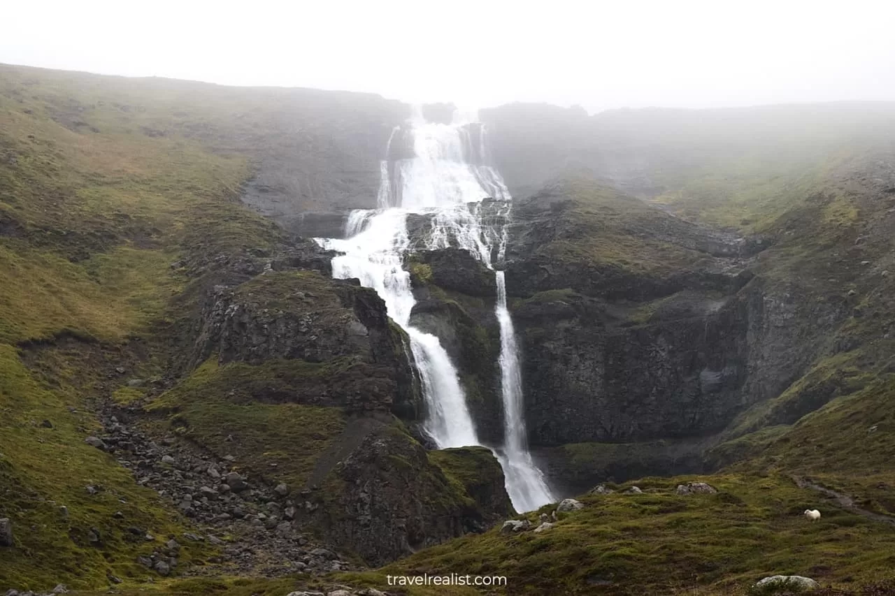
3.2. Barkinafoss Waterfall
- Distance from the Ring Road: 0 miles (0 km).
- Type: a viewpoint with a path.
- Entrance fees: free.
The next viewpoint does not require you to do anything but stop your car at a pullout. You can admire Barkinafoss Waterfall right from your car. It is a lesser known waterfall in the region.
You could also take a short path to get even closer to this waterfall. Barkinafoss is among the easiest waterfalls you will see on your Ring Road drive.
3.3. Nykurhylsfoss Waterfall
- Distance from the Ring Road: 0.6 miles (0.9 km) round trip.
- Type: a viewpoint with a path.
- Entrance fees: free.
Your next stop on the Iceland Ring Road Itinerary would be at another waterfall. This time you would need to take a side gravel road to reach the viewpoint.
But Nykurhylsfoss Waterfall is worth the extra effort. It is a very powerful waterfall. You can admire its blue waters as they flow into the river and the fjord.
3.4. Folaldafoss Waterfall
- Distance from the Ring Road: 5.7 miles (9.1 km) round trip.
- Type: a viewpoint.
- Entrance fees: free.
Folaldafoss Waterfall is the next notable attraction near the Ring Road in East Iceland. It requires a much longer detour on the gravel road.
If you fear issues with your car rental and insurance companies, you might decide to skip this waterfall. It is a reasonable decision.
But the gravel road to Folaldafoss is in a fairly good condition. In fact, this road through the Öxi Pass is the main route to Egilsstadir. It saves you about 40 minutes compared to the drive on the Ring Road.
3.5. Meleyri Beach
- Distance from the Ring Road: 0 miles (0 km).
- Type: a viewpoint.
- Entrance fees: free.
There are a few sights if you decide to return to the paved Ring Road after visiting Folaldafoss Waterfall. Most of them involve driving around the scenic East Fjords.
You can stop at the viewpoints every few miles to enjoy the scenic ocean shore. Meleyri Beach is a nice beach stop. It is a yellow sand beach in a land of black sand beaches.
You could stop there to take a break from the waterfalls. Rest up before the last 70 minutes to Egilsstadir.
3.6. Egilsstadir
The Ring Road will bring you to Egilsstadir through a 3.6-mi (5.8-km) tunnel. There are few sights near the route unless you take the gravel side roads.
Egilsstadir is the most populous town in East Iceland. It is a no-brainer stop when doing the full Iceland Ring Road Itinerary.
You can choose from a dozen of places to stay in Egilsstadir. This is an unheard variety in East Iceland. The town also has a handful of restaurants and cafes.
You should use your time in this town to stock up on snacks. There will not be any other supermarkets all the way to Akureyri in Northern Iceland.
The next leg of the Ring Road journey will bring you to very remote and desolate parts of the country.
Day 4: Egilsstadir to Akureyri
- Distance: 198 miles (318 km).
- Driving time: 4+ hours.
- Main sights: viewpoints, waterfalls, and volcanoes.
You will be ready to continue your Iceland journey after a delicious dinner, a supermarket run, and a restful sleep.
Day 4 on your Iceland Ring Road Itinerary will bring you from East Iceland to Northern Iceland. You will see a few more waterfalls during the day’s journey.
But you will also get a front row seat to the volcanic formations. You will see dormant volcanoes and steaming fumaroles. Lakes and hot springs will round up your day.

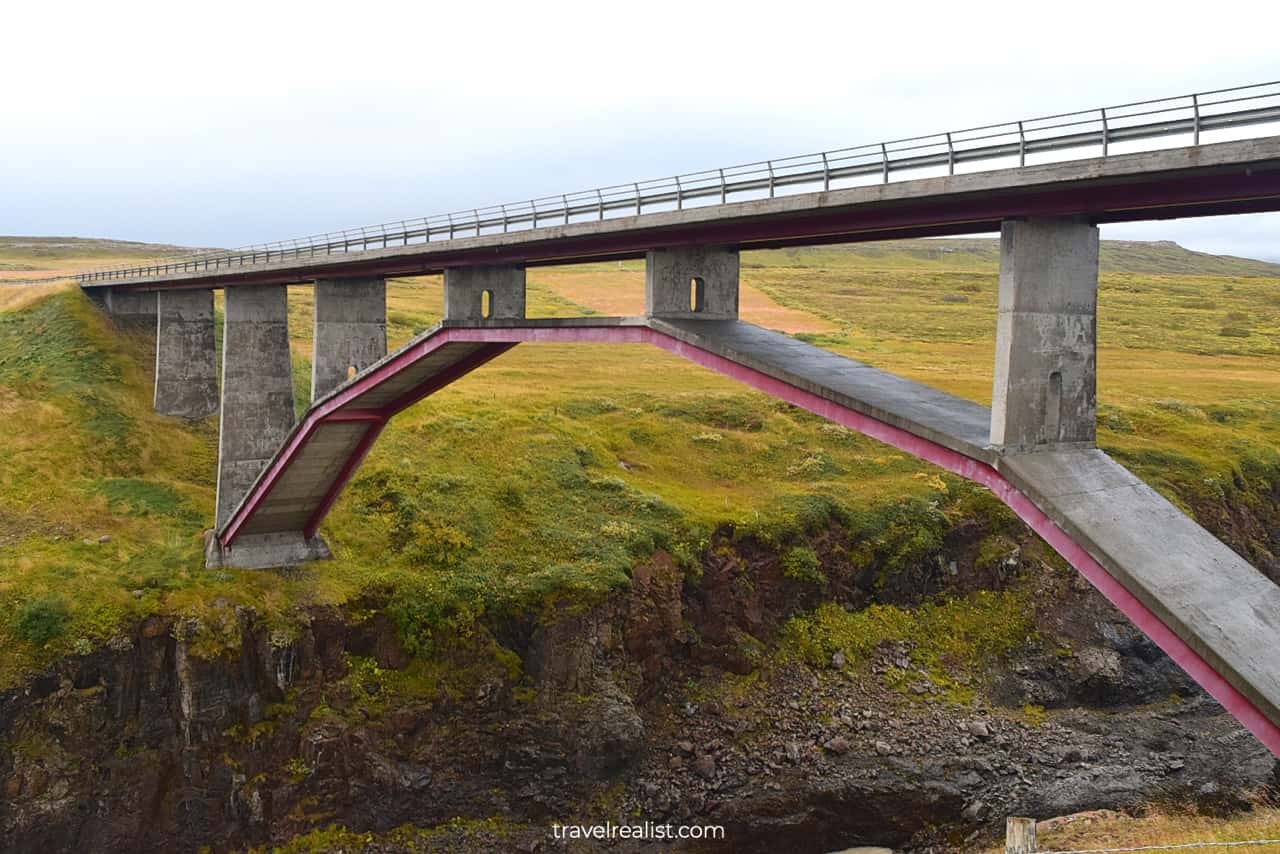
4.1. Pjodvegur Arch Bridge
- Distance from the Ring Road: 0 miles (0 km).
- Type: viewpoint.
- Entrance fees: free.
The first attraction on the fourth day of your Iceland Ring Road Itinerary is barely 20 minutes after leaving Egilsstadir. It is an arch bridge over the Jokulsa a Bru river.
This human made structure is thoughtfully incorporated into the surrounding landscape. If you enjoy bridges and architecture you will find this stop quite rewarding.
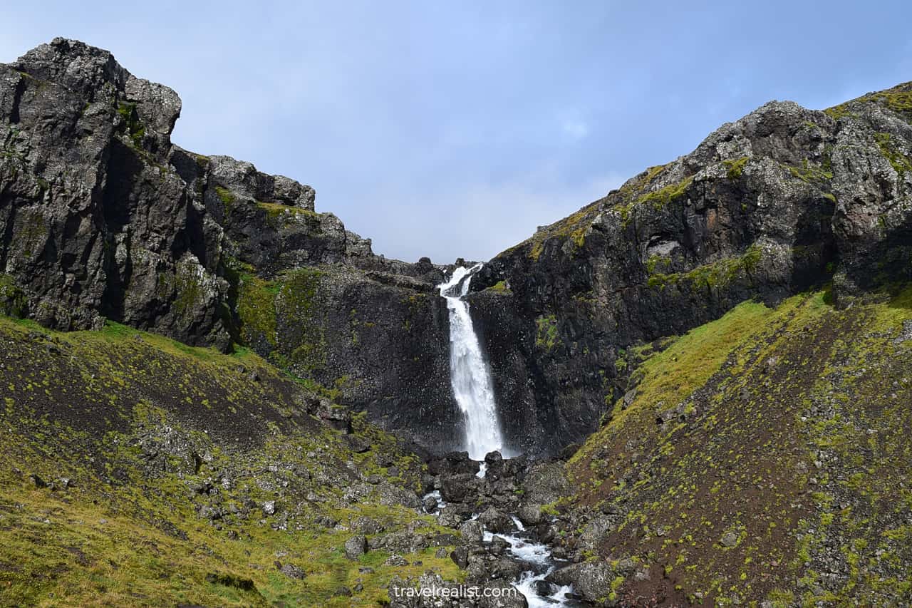
4.2. Rjukandi Waterfall
- Distance from the Ring Road: 0 miles (0 km).
- Type: a viewpoint with a path.
- Entrance fees: free.
Rjukandi Waterfall will be the next stop on the Ring Road. You can admire the 7th highest waterfall in Iceland right from a viewpoint.
Like many other waterfalls on the Ring Road, you could take a short uphill path from the viewpoint. It will bring you even closer to the waterfall.
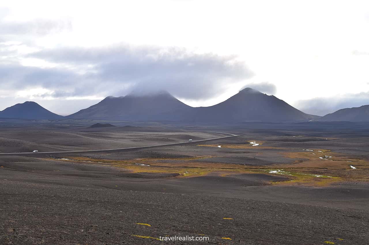
4.3. Volcanoes
- Distance from the Ring Road: 0 miles (0 km).
- Type: a viewpoint.
- Entrance fees: free.
You will enter the volcano land soon after stopping at Rjukandi Waterfall. Stop at the white chair viewpoint. The chair is long gone. But you should still take the time to admire this volcanic ridge.
The Ring Road will bring you to the ridge in under 10 minutes. You will cross the ridge via a mountain gap. Do not forget to enjoy the breathtaking views of the volcanoes up-close.
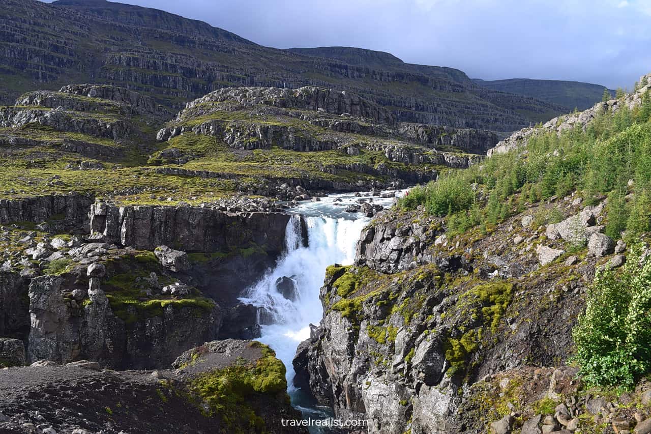
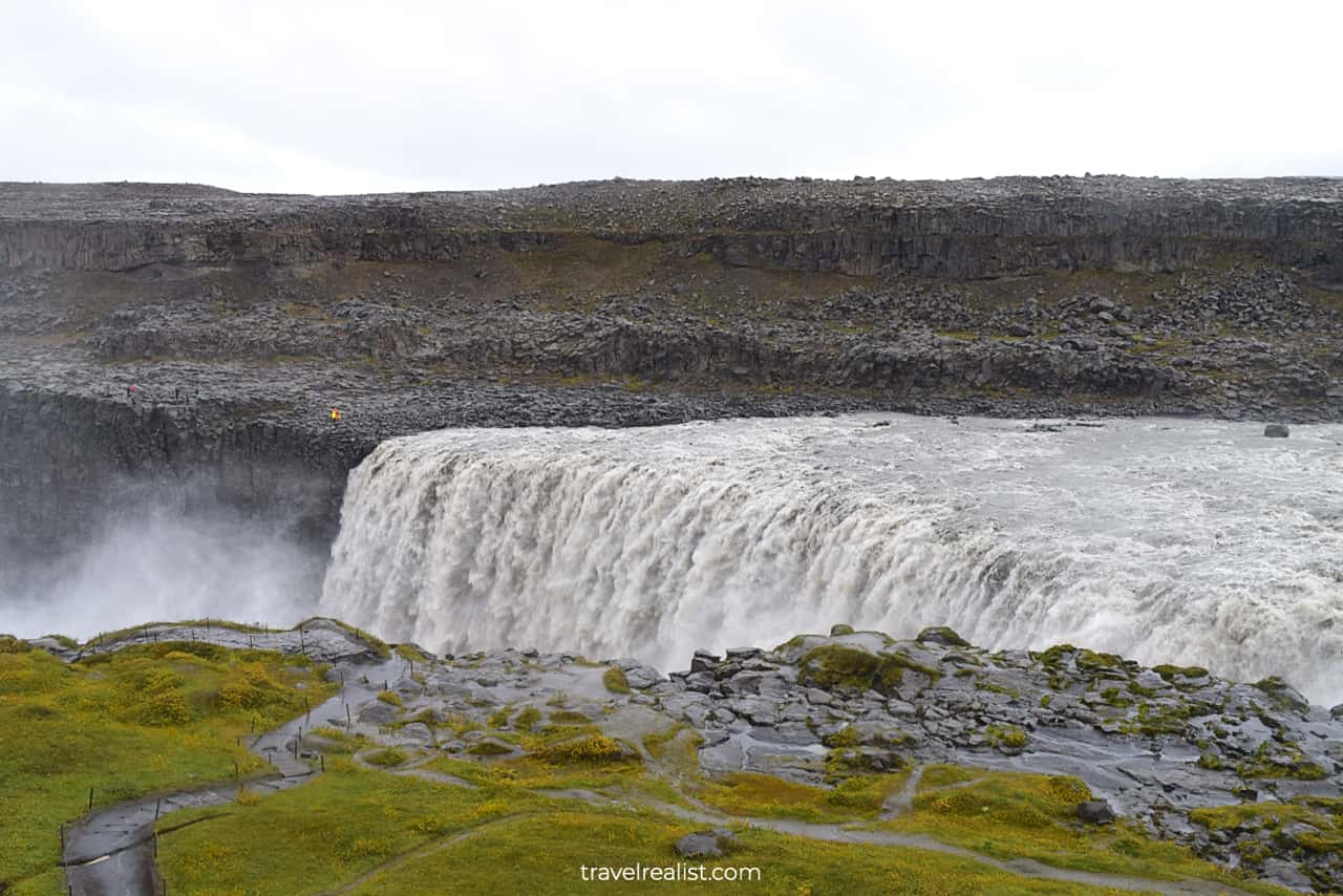
4.4. Dettifoss Waterfall
- Distance from the Ring Road: 30 miles (48 km) round trip.
- Type: a hike to a viewpoint.
- Entrance fees: free.
The next stop on the fourth day of the Iceland Ring Road Itinerary involves a lengthy detour and a hike. You might also not feel like visiting yet another waterfall. But Dettifoss is worth it.
This waterfall is the most powerful waterfall in the country. You will not understand the power of this waterfall until you see it. There will be mist everywhere. Bring your waterproof jacket.
You would need to hike for about 2.2 miles (3.5 km) to see Dettifoss from the West Viewpoint. You can reach it on a paved road. The East Viewpoint is only accessible via a gravel drive.
This waterfall also marks the region line between East Iceland and Northern Iceland.
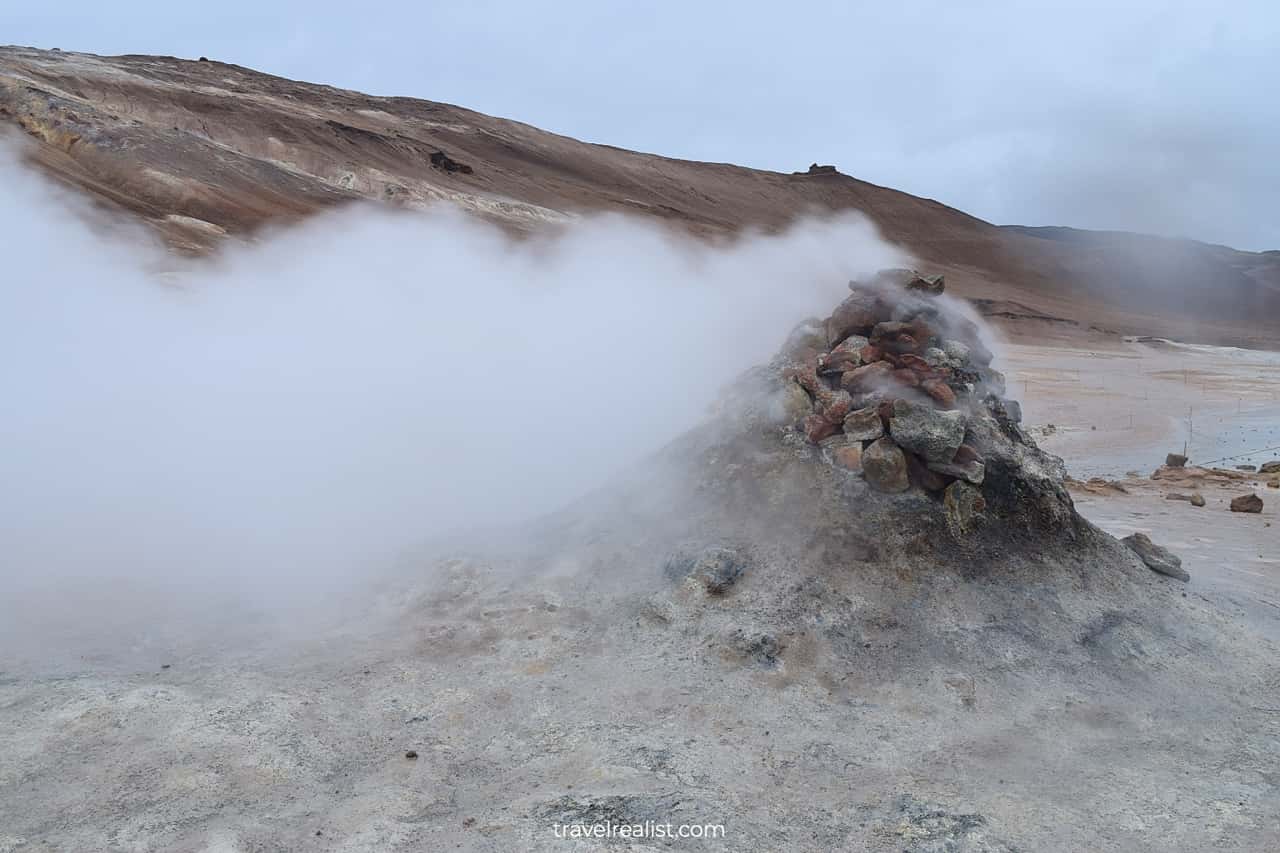
4.5. Hverir Fumaroles
- Distance from the Ring Road: 0.4 miles (0.6 km) round trip.
- Type: a short hike.
- Entrance fees: ISK 1,200 ($9) per car.
You will return to the land of volcanoes shortly after visiting Dettifoss Waterfall. Hverir is a good next stop on the Ring Road.
The parking fee is quite high for a place with no restrooms and paved trails. But you should still stop at Hverir to see the fumaroles and mud pools. These steaming hills are a sight to see.
Just remember that their sulfuric gas is toxic. Limit your exposure to avoid eye irritation.
4.6. Myvatn Lake
- Distance from the Ring Road: 0 miles (0 km).
- Type: viewpoint and hot springs.
- Entrance fees: free; ISK 6,490 ($47) to visit Myvatn Nature Baths.
You will see Myvatn Lake as soon as you drive through a mountain pass near Hverir. There are a few lake viewpoints along the Ring Road. You can stop and enjoy the views.
Myvatn is also home to a geothermal area. You could see the blue pools for free from a road pullout. But there is a way to explore these pools closer.
You can stop at Myvatn Nature Baths. This spa resort rivals Blue Lagoon near Reykjavik. But it is a bit cheaper. Enjoy a swim in the blue pools if this is your cup of tea.
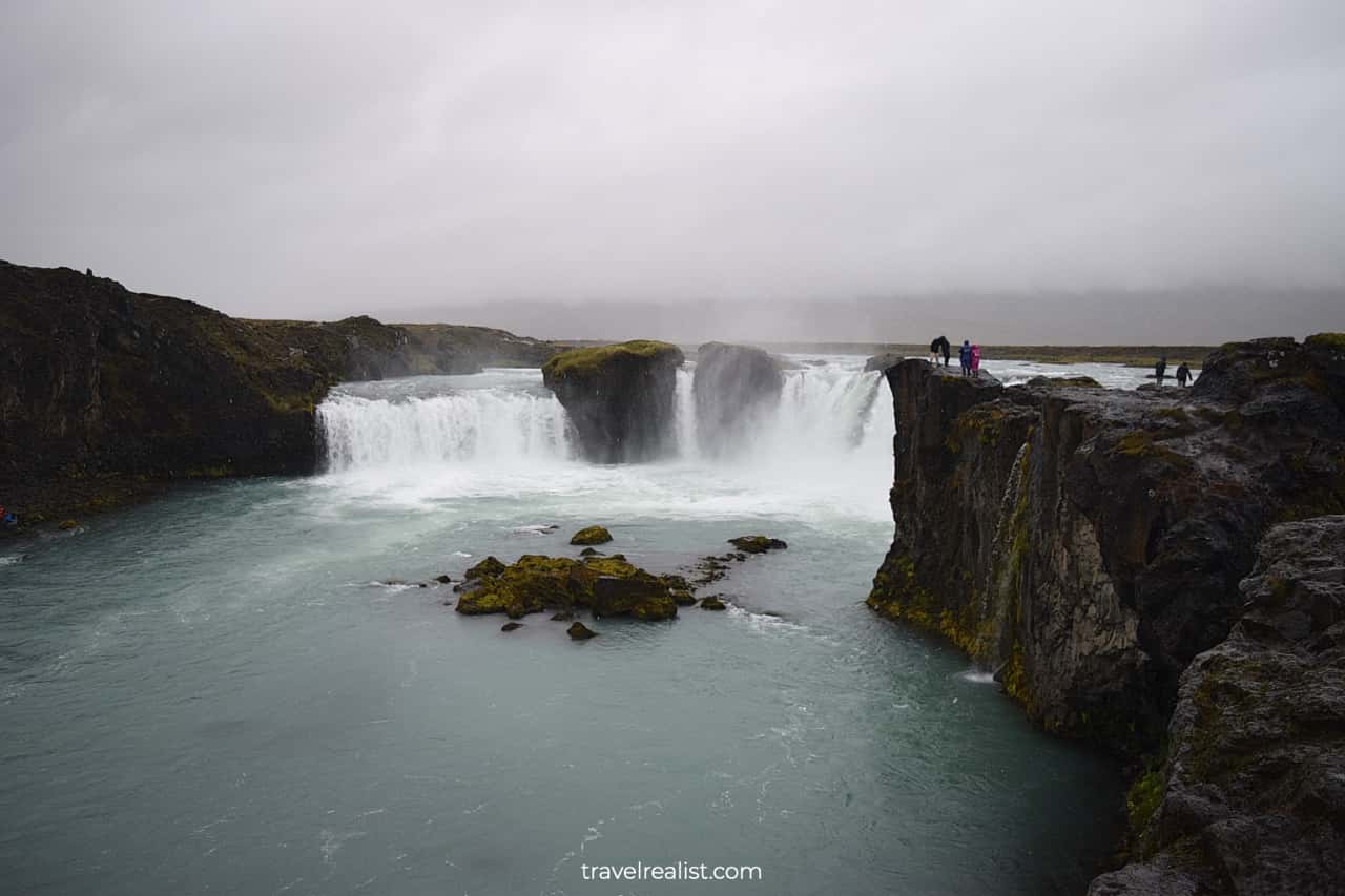
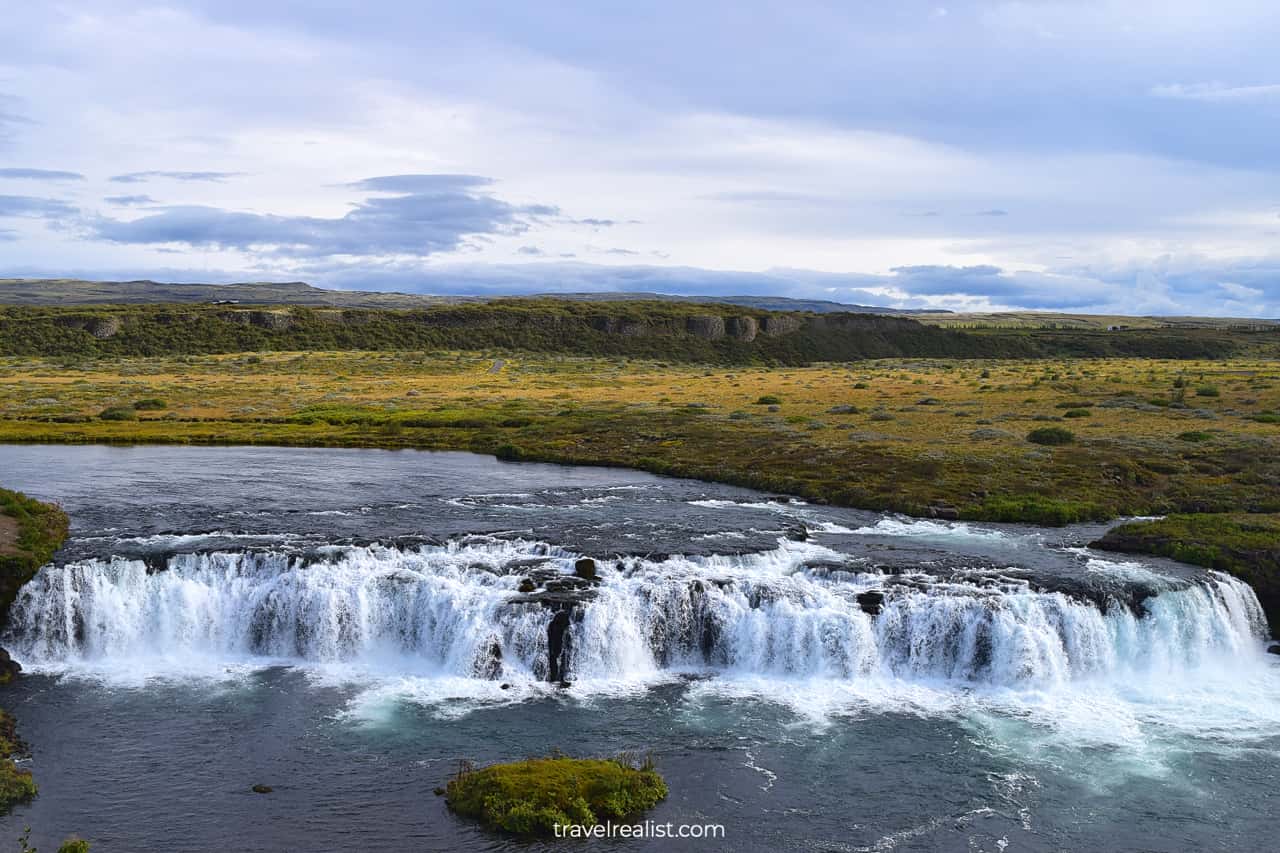
4.7. Godafoss Waterfall
- Distance from the Ring Road: 0 miles (0 km).
- Type: a viewpoint.
- Entrance fees: free.
There is one more stop on the Ring Road drive through Northern Iceland before you reach Akureyri. Godafoss Waterfall is an easy stop right next to the Ring Road.
It does not have the height of Glymur, the power of Dettifoss, or grace of Svartifoss. But it is an iconic waterfall in the region.
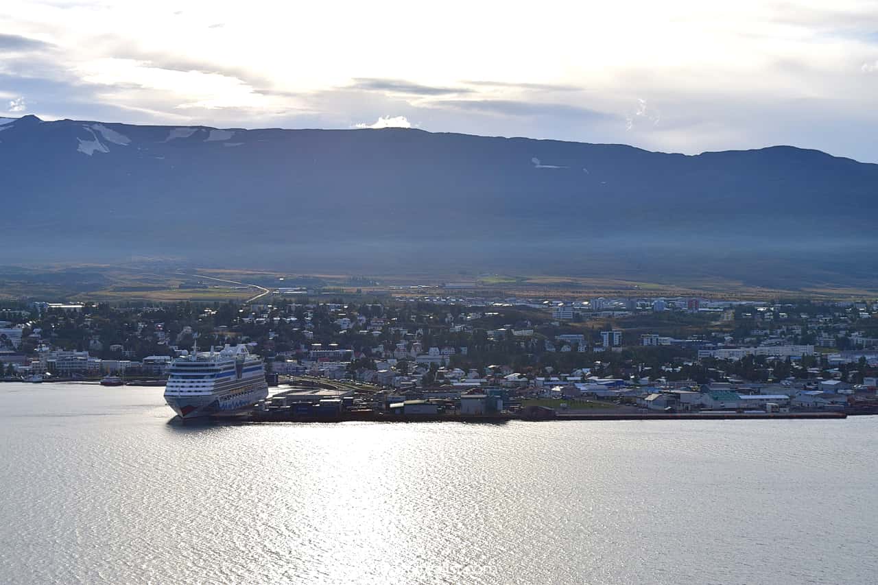
4.8. Akureyri
There are little to none alternatives to Akureyri when visiting Northern Iceland. It is the largest town of the region. You should look for places to stay in or near Akureyri. This is a way to get the best deal.
Keep in mind that the Ring Road has a toll tunnel just east of the town. You can take the tunnel and pay even more to your car rental company in convenience fees.
The free detour is just 15 minutes longer. This route will also bring you around Eyjafjordur Fjord. It is quite a scenic drive.
Day 5: Akureyri to Reykjavik or Borgarnes
- Distance: 249 miles (400 km) to Reykjavik; 203 miles (326 km) to Borgarnes.
- Driving time: 5+ hours (to Reykjavik); 4+ hours (to Borgarnes).
- Main sights: road, whales, and waterfalls.
Day 5 could be the last day of your Iceland Ring Road Itinerary. This will be the case if you are trying to visit the country in the least number of days.
It will be a driving heavy day regardless of your final destination. But you will spend over 5 hours in the car if you travel to the capital city.
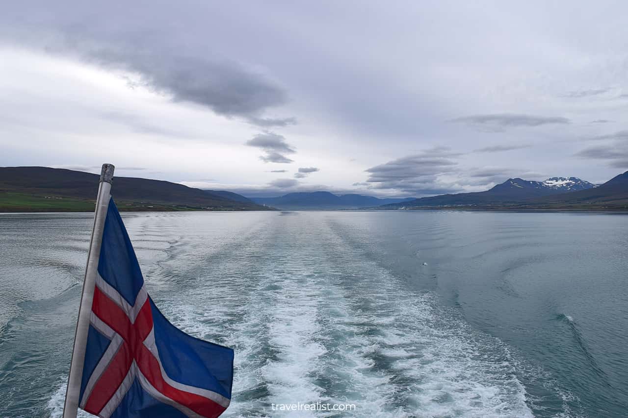
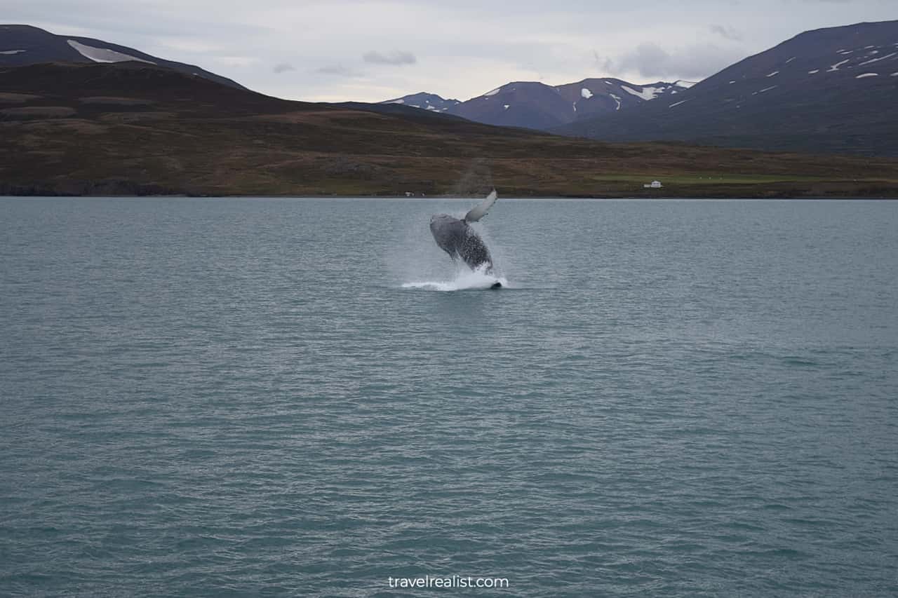
Akureyri is a fantastic whale watching spot. You could start the day by taking a whale watching tour right from the town’s harbor. The rest of the day is a long drive with a couple of waterfall viewpoints.
5.1. Whale Watching from Akureyri
- Distance from the Ring Road: 0 miles (0 km).
- Type: a tour.
- Entrance fees: ISK 12,990 ($93).
You should consider taking a whale watching tour in Akureyri. It is a long journey to get to this northern town. You might as well get some more memories out of your trip.
Akureyri is the right place go on a wildlife safari. You can see whales year round. And you would not even need to take a detour from the Ring Road.
There are a handful of companies that offer whale watching tours from Akureyri. Their prices and schedules differ quite a bit. The cheapest 3-hour tour is about $95 per adult.
Whale watching is not a budget friendly activity. Yet, it is cheaper than similar trips in Alaska. And a chance to see a whale jump out of water could be priceless.
5.2. Kolugljufur Canyon
- Distance from the Ring Road: 7.1 miles (11.5 km) round trip.
- Type: a viewpoint with a path.
- Entrance fees: free.
You will pass through some incredible landscapes on your way from Akureyri. You will be leaving behind flat top mountains, passes, and lakes.
But Kolugljufur Canyon should be the next stop on your journey. It takes almost 2.5 hours to reach it from Akureyri. The beauty of this waterfall and narrow river canyon are worth the wait and a gravel detour.
5.3. Glanni Waterfall
- Distance from the Ring Road: 0.4 miles (0.7 km) round trip.
- Type: a viewpoint with a path.
- Entrance fees: free.
You would need to drive for over an hour until the next stop. The landscapes surrounding the Ring Road in Northern and West Iceland will continue to be beautiful.
But there are very few viewpoints on this part of the drive. Glanni Waterfall is the first scenic stop in a while. You will get to the parking lot via a short gravel side road.
Get ready to hike for 5 minutes to see the falls. Glanni Waterfall is not the most beautiful waterfall you would have seen in the country. But it is a good stop to stretch your legs after a long drive.
5.4. Reykjavik or Borgarnes
You will have an option to finish your Iceland Ring Road Itinerary in 5 days. In this case, you should continue the drive to Reykjavik. You will reach the capital city in an hour.
But you should extend your journey by a day or two if you have more time in the country. There are lots of sights to see in West Iceland and on the Golden Circle route.
You should finish your Day 5 drive in Borgarnes if you decide to visit either region. This town has plenty of places to stay, restaurants, and supermarkets.
If time permits, you can take a longer detour to Barnafossar and Hraunfossar Waterfalls. These falls are outside of the main routes. But they can be a highlight of your trip to Iceland.
Day 6: Borgarnes to Snaefellsnes Peninsula or Reykjavik
- Distance: 228 miles (367 km) to Reykjavik; 182 miles (294 km) to Borgarnes.
- Driving time: 5+ hours (to Reykjavik); 4+ hours (to Borgarnes).
- Main sights: viewpoints, volcanoes, and waterfalls.
The sixth day of your Iceland Ring Road Itinerary will take you away from the Ring Road. You will spend the vast majority of the day in West Iceland.
This region is home to a national park, a world famous mountain, and a few scenic waterfalls. Most of these sights are must-visit destinations on a trip to Iceland.
6.1. Bjarnarfoss Waterfall
- Distance from the Ring Road: 62 miles (101 km) one way.
- Type: a viewpoint with a path.
- Entrance fees: free.
Bjarnarfoss Waterfall is a great first stop on Snaefellsnes Peninsula in West Iceland. It will take you over an hour to get there from Borgarnes.
This is one of the highest waterfalls in Iceland. You can see its impressive 262-ft (80-m) drop right from the viewpoint on paved Highway 54.
There is an accessible path that brings you to the waterfall. You would gain 265 ft (81 m) on this 0.8-mi (1.3-km) out-and-back trail.
6.2. Snaefellsjokull National Park
- Distance from the Ring Road: 88 miles (142 km) one way.
- Type: a series of viewpoints and trails.
- Entrance fees: free.
The viewpoints become plentiful as soon as you pass Bjarnarfoss Waterfall. You will enter Snaefellsjokull National Park. It is one of only three national parks in the country.
This park is a great place to see the land of ice and fire. It protects a glacier and a volcanic landscape. There are lots of things to do in Snaefellsjokull.
- Start with Gatklettur to see volcanic cliffs.
- Then head to Londrangar. You can explore the frozen lava fields at the ocean shore.
- See the inside of Saxholl Crater.
- Stop at Gufuskalar to explore the old fishing sheds.
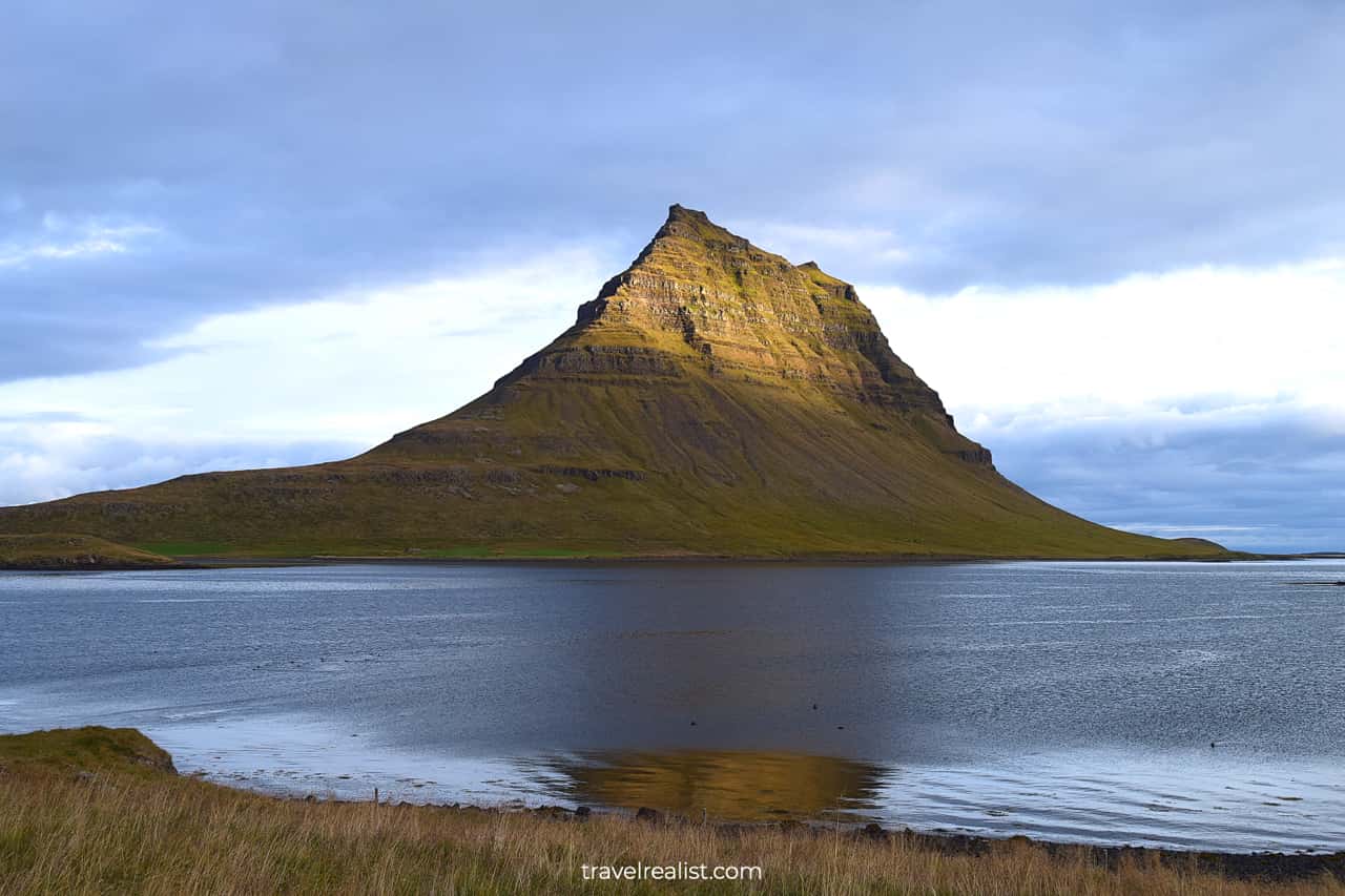
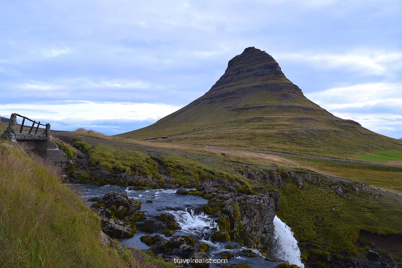
6.3. Kirkjufell Mountain
- Distance from the Ring Road: 66 miles (106 km) one way.
- Type: a viewpoint with a path.
- Entrance fees: free; ISK 1,000 ($7) for the waterfall viewpoint.
You would pass the tip of Snaefellsnes Peninsula in Snaefellsjokull National Park. The route will now be bringing you closer and closer to the Ring Road.
Your next stop should be at Kirkjufell Mountain. This arrowhead looking mountain was part of Game of Thrones series. You will see lots of tourists near the mountain all the time.
You can see the mountain for free from Highway 54 or nearby village of Grundarfjordur. But you would need to pay a parking fee to see Kirkjufellsfoss waterfall with the mountain.
6.4. Selvallavatn Lake
- Distance from the Ring Road: 49 miles (79 km) one way.
- Type: viewpoint.
- Entrance fees: free.
The road from Kirkjufell back to Borgarnes has a few viewpoints. A viewpoint at Selvallavatn Lake and Selvallafoss Waterfall is the most scenic of them.
You will see a lake, lava beds, and volcanoes in the background. Go below the main viewpoint to see the somewhat hidden waterfall.
6.5. Borgarnes or Reykjavik
Just like on Day 5, you will have two options on Day 6. You could either drive to Reykjavik and finish your trip there. Or you could spend another night in Borgarnes.
The latter option will give you a chance to explore more sights in the Capital Region. You could even stay in the same hotel if you liked it.
Day 7: Borgarnes to Reykjavik
- Distance: 188 miles (302 km).
- Driving time: 4+ hours.
- Main sights: hikes, waterfalls, and geysers.
The last day on your Iceland Ring Road Itinerary will bring you back to the main road for some time. You will visit the second tallest waterfall on the island.
You can spend the rest of the day visiting the attractions along the Golden Circle route. There are a few waterfalls and geysers to see on the way.
7.1. Glymur Waterfall
- Distance from the Ring Road: 18 miles (29 km) one way.
- Type: a hike.
- Entrance fees: free.
Glymur Waterfall should be the first stop of your seventh day on the journey through Iceland. This waterfall drops 650 ft (198 m). It is the highest waterfall in the country you can see after a 2-hour hike.
The 3-mi (4.8-km) hike to the waterfall viewpoint gains 1,309 ft (399 m) in elevation. It is a moderate out-and-back trail. But it can also get strenuous or impassable due to two water crossings.
Get ready to hike through a cave, cross a creek via a log, and see a fjord on this trail.
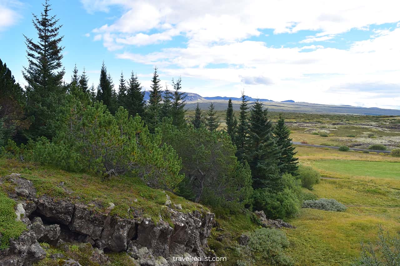
7.2. Thingvellir National Park
- Distance from the Ring Road: 21 miles (34 km) one way.
- Type: a hike.
- Entrance fees: ISK 750 ($5) per car.
You should visit Thingvellir National Park next. It will take you about an hour to reach this park from the Glymur Waterfall trailhead. This is more than enough time to catch your breath after a moderate hike.
The oldest national park in the country has many things for you to explore. You can hike to Oxararfoss Waterfall. Logberg, the place of the first parliament in Iceland, is also a good stop.
You could also explore the Continental Divide between the North American and European plates.
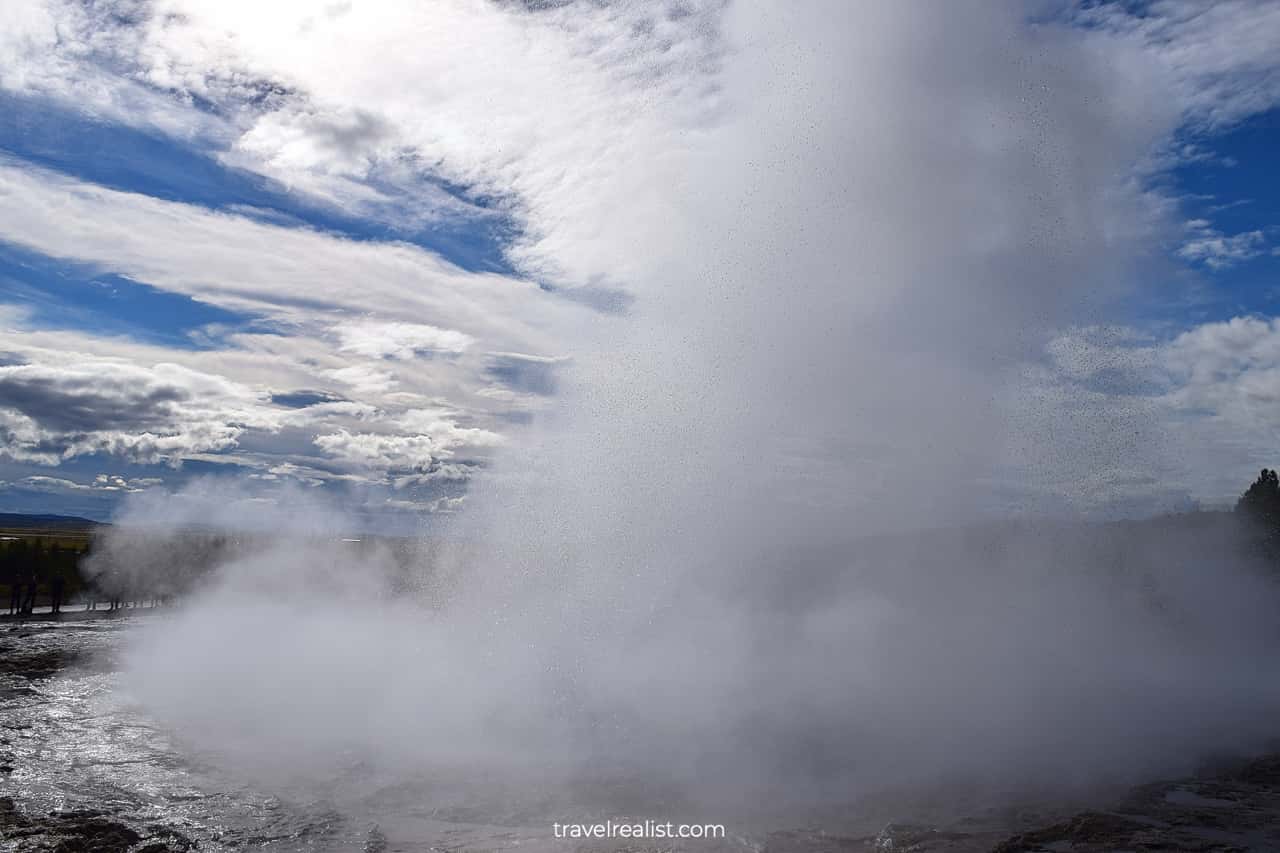
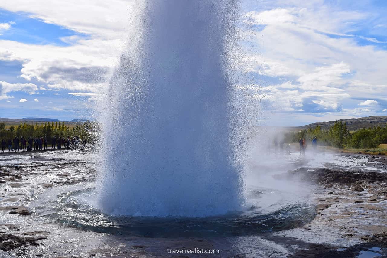
7.3. Geysir
- Distance from the Ring Road: (59 km) one way.
- Type: a short hike.
- Entrance fees: free.
You would need to get back on the road after exploring Thingvellir. The Golden Circle is about to reveal one of its main sights.
Geysir will be your next stop. This Geysir gave the name to all erupting hot springs in the world. While it stopped erupting a while ago, you could see an eruption from Strokkur geyser every 15 to 20 minutes.
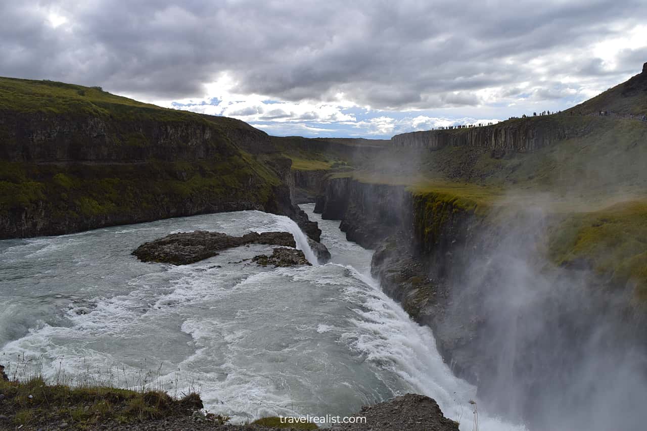
7.4. Gullfoss Waterfall
- Distance from the Ring Road: 39 miles (62 km) one way.
- Type: a viewpoint with a path.
- Entrance fees: free.
You would not need to drive long to get to the next attraction on the Golden Circle. Gullfoss Waterfall is the easiest large waterfall to reach from Reykjavik.
This waterfall flows over two terraces into a narrow canyon. You would have truly saved the best for last if you visit Gullfoss Waterfall on your last day in Iceland.
7.5. Faxafoss Waterfall
- Distance from the Ring Road: 30 miles (48 km) one way.
- Type: a viewpoint with a path.
- Entrance fees: free.
Faxafoss Waterfall is the last stop on the Iceland Ring Road Itinerary before returning to Reykjavik. This waterfall pales in comparison to other famous falls in the country.
But it is on the way and free to visit. You can enjoy the views of this low and wide waterfall. You will be missing this northern country soon.
7.6. Reykjavik
This time Reykjavik will be the end of your Iceland Ring Road 7-Day Itinerary. You could stop by one of the restaurants in the city. Or head down to Blue Lagoon for a spa treatment.
This spa resort is more expensive than Myvatn Nature Baths in Northern Iceland. But there is a reason why so many people visit Blue Lagoon. It is less than 30 minutes from Keflavik Airport.
Takeaways: Iceland Ring Road Itinerary
A drive on the Ring Road in Iceland is the best way to see the country. You can enjoy over 50 different sights. They range from waterfall viewpoints and glacier hikes to black sand beaches and hot springs.
You can also see volcanoes and whales, human landmarks and cliffs from the Ring Road. Not all 820 miles of the Ring Road will be equally beautiful. But together they make for a great drive.
You can finish a drive on the Ring Road in 5 days. This itinerary would mean a lot of driving and some sacrifices. You would have to skip most of West Iceland.
Extend your trip to 6 or 7 days. This way, you will see more of Iceland while pacing your driving and exploration.
Iceland has strict laws and high fines for speeding. It will take you at least the time stated by the navigation system to drive between the sights. Add more time to enjoy the viewpoints and hikes.
Use long daylight to your advantage if you visit Iceland in the summer. You will not run out of the daylight during this season. June is the longest month of the year. A trip between May and September should also work out great.
Take a look at this Iceland Ring Road Itinerary Video Playlist. And visit the YouTube channel for the latest videos.
Frequently Asked Questions
The Ring Road (Route 1) in Iceland is 820 miles (1,322 km) long.
You can drive the Iceland Ring Road and see the major sights along the way in 5 days. This will be an action and driving packed adventure.
An ideal 5-day itinerary connects the largest towns and villages in each region. This way, you can see the sights without breaking the bank on lodging.
Here is a breakdown of a 5-day Iceland Ring Road itinerary:
1. Day 1: Reykjavik to Vik: see waterfalls and black sand beaches.
2. Day 2: Vik to Hofn: hike canyons and glaciers or take a glacier lake tour.
3. Day 3: Hofn to Egilsstadir: have a lazy day at black sand beaches and waterfalls.
4. Day 4: Egilsstadir to Akureyri: enjoy volcanoes and hot springs.
5. Day 5: Akureyri to Reykjavik: take a whale watching tour and stop at waterfall viewpoints.
You should spend 5 days exploring the sights on Iceland Ring Road. This is a great way to see waterfalls, glaciers, volcanoes, and black sand beaches in the major regions.
You should add another day to visit Snaefellsnes Peninsula in West Iceland.
The 7th day is for Glymur Waterfall and the Golden Circle sights. You could also use it to space out your exploration.
Safe realist travels!