Yosemite National Park Scenic Drive: Beat Crowd to Sights
This realistic Yosemite National Park Scenic Drive Guide helps you plan your next adventure in this world famous park.
Yosemite is one of the most popular parks in the nation. Some 3.6 million people visit this park every year. They come to enjoy the stunning views of the Sierra Nevada Mountains, valleys, and waterfalls.
This post includes affiliate links that will earn us commission if you make a purchase via these links.
Sights & Places of Interest
Yosemite National Park has an impressive variety of natural sights. There are also 6 scenic drives in Yosemite.
- Tioga Road: a 59-mi (95-km) road through Tioga Mountain Pass. The road is usually open between Memorial Day and Halloween.
- Yosemite Valley: a 15-mi (24-km) loop road that consists of Southside Drive, Northside Drive, and Happy Isles Loop Road. Open year round.
- Big Oak Flat Road: a 17-mi (27-km) road from Big Oak Flat Entrance to Yosemite Valley. Open year round.
- El Portal Road: a 6-mi (10-km) road from Arch Rock Entrance to Yosemite Valley. Open year round.
- Wawona Road: a 26-mi (42-km) road from South Entrance with Yosemite Valley. Open year round.
- Glacier Point Road: a 32-mi (51-km) out-and-back road from Wawona Road to Glacier Point. The road is closed in winter; you can usually drive on this road between May and November.
This Yosemite National Park Scenic Drive Guide describes three roads. It starts with the Big Oak Flat Road. The Guide continues with the roads in Yosemite Valley. It finishes with the Wawona Road.
1. Yosemite Valley Vista Point
You could take one of two routes when traveling to Yosemite from the San Francisco Bay Area. The Big Oak Flat Road and the El Portal Road bring you to Yosemite Valley in about the same time.
The Big Oak Flat Road is a more scenic route. It goes at higher elevations than the El Portal Road. As a result, you could get better views of the surrounding mountains.
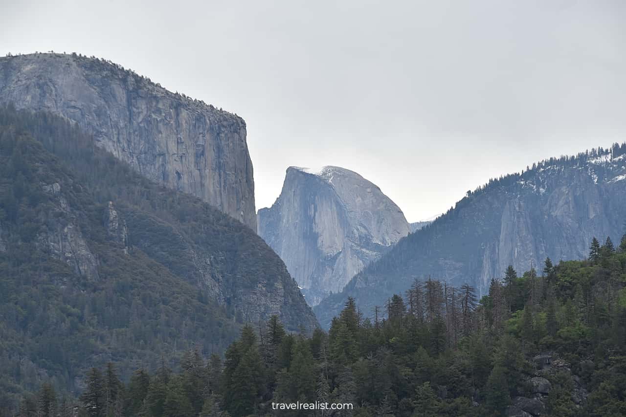
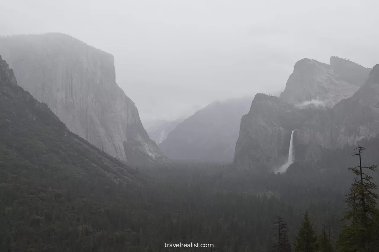
The Yosemite Valley Vista Point is an example of such a stop. It provides you with a panoramic view of Yosemite Valley. You could see El Capitan and Half Dome summits from a distance.
The Merced River is flowing hundreds of feet (meters) below. The El Portal Road follows the river. It makes this viewpoint look a bit like Black Canyon in Colorado.
2. Cascades
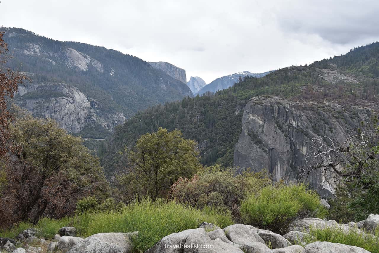
The Big Oak Flat Road has a few more notable viewpoints on the way to Yosemite Valley. The Cascades are the next one.
As the name suggests, the Cascades refer to a group of waterfalls at the confluence of Cascade and Tamarack Creeks. Both creeks flow into the Merced River.
The rocky terrain and large elevation drop guarantee a powerful stream. You will see the Cascades at their best in the spring during snowmelt. The waterfall is also breathtaking after recent rain.
The Cascades have a tiny parking lot right next to the Big Oak Flat Road. You will not be able to see the full Cascades, just their top section. The best view is from a bridge over Cascade Creek.
You need to cross the road to see the falls. There is no official pedestrian crossing. So, you need to be careful with the oncoming traffic.
There is also a Cascade viewpoint on the El Portal Road. It is a few hundred feet (meters) below the Big Oak Flat Road. The other viewpoint is more spacious. It also provides a better view of the falls.
It is the only case when the El Portal Road is a better choice than the Big Oak Flat Road. If you really want to enjoy a full view of the Cascades, take a 3.6-mi (5.8-km) detour. Turn right after passing two tunnels.

3. Yosemite Valley
You will need to switch to the El Portal Road anyway. It is the only road to Yosemite Valley on the right bank of the Merced River.
But your drive on this road will be short-lived. You would take a right turn to the Southside Drive just a mile after entering the El Portal Road.
Driving in the valley is a large one way loop. You need to find parking at the trailheads and viewpoints on your first try. Returning to the missed spots could add hours to your journey.
Yosemite Valley is a crown jewel of this national park. This narrow and long valley continues for about 7 miles (11 km). Steep slopes on both sides of the valley make you feel as if you are driving in a canyon.
There are a handful of waterfalls and summits in Yosemite Valley. Yosemite Fall, Vernal Fall, Half Dome, and El Capitan are iconic sights. All of them are in the valley.
You could see some of the waterfalls from your car or a nearby viewpoint. Bridalveil Fall and Yosemite Falls are in this category. But you would need to hike to enjoy Vernal Falls.
The same is true of the summits. You could see Half Dome and El Capitan right from the Southside and Northside Drives. But Sentinel Dome and Taft Point are hardly visible due to high trees.
This Yosemite National Park Scenic Drive Guide will now walk you through the attractions in Yosemite Valley.
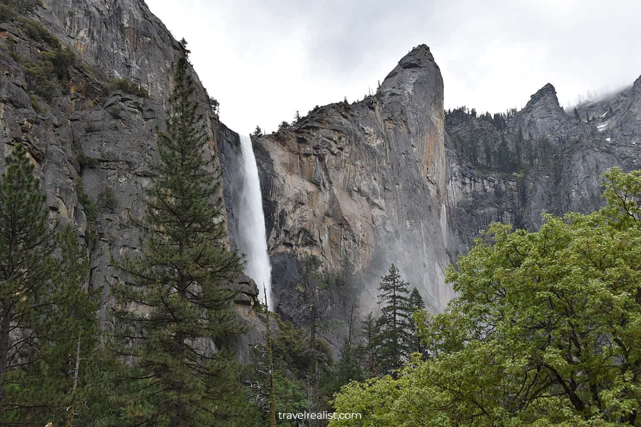
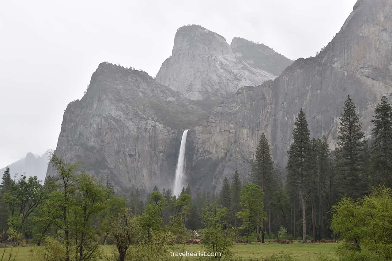
4. Bridalveil Fall
Bridalveil Fall is the first attraction in Yosemite Valley. You will arrive at the fall viewpoint just minutes after crossing the Merced River. The parking lot is right after the intersection with the Wawona Road.
Get ready to practice your parallel parking skills. This is the only way to stop and enjoy this waterfall. You might need to wait for a few minutes for a spot to open up. But do not stop completely while you wait.
Instead, keep driving slowly. The parking zone is quite large. You will likely find an open spot just a few hundred feet (meters) later. This way, you might not need to repark when stopping at the next attraction.
Once you park, you can take a short hiking trail to the bottom of the waterfall. You will see a picturesque waterfall. Bridalveil Fall drops nearly vertically from a high cliff.
You could see Leaning Tower on the right and Cathedral Rocks on the left. Bridalveil Fall looks nothing like the same name waterfall in Keystone Canyon in Alaska.
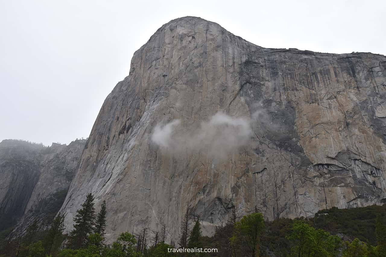
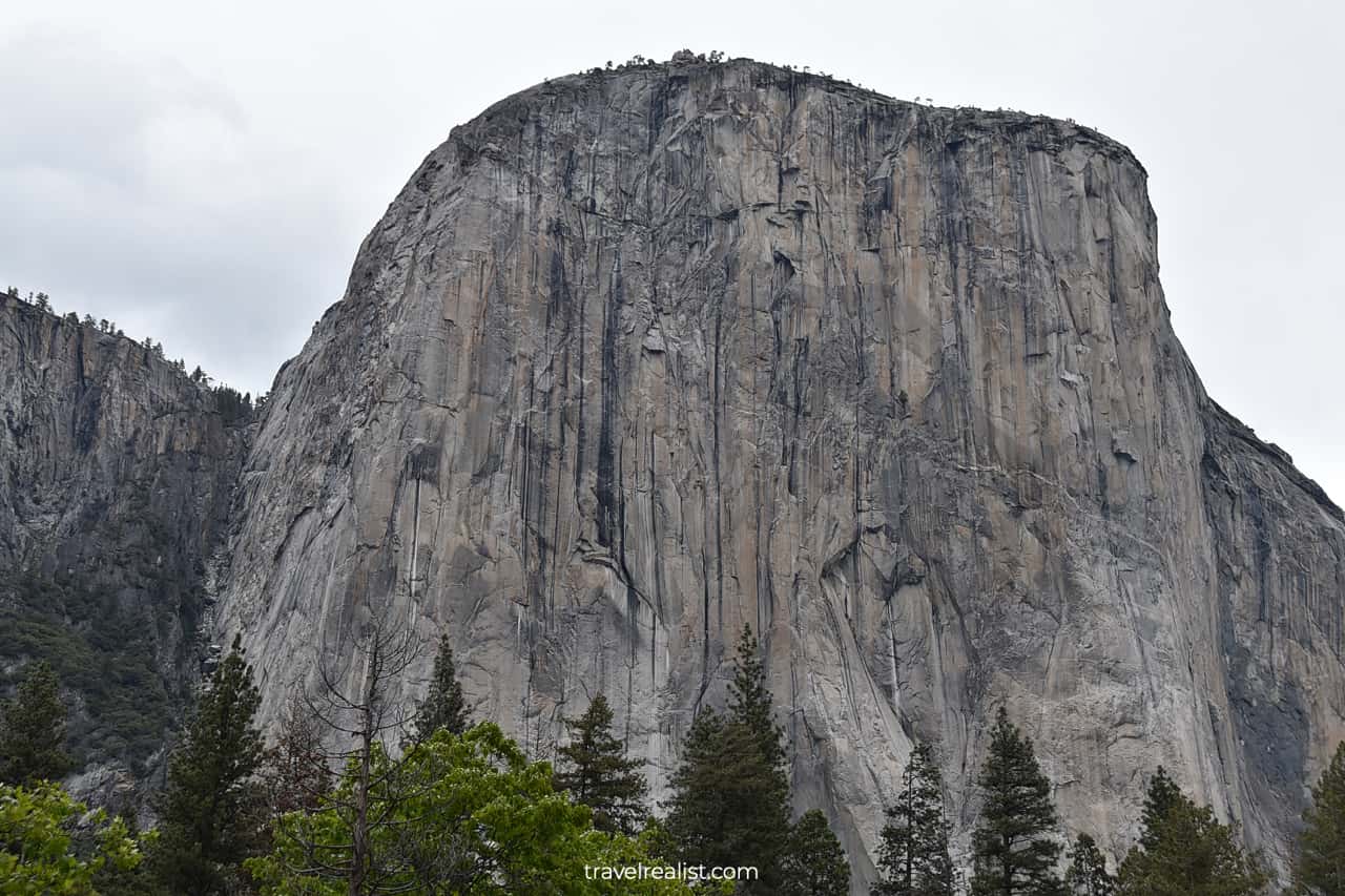
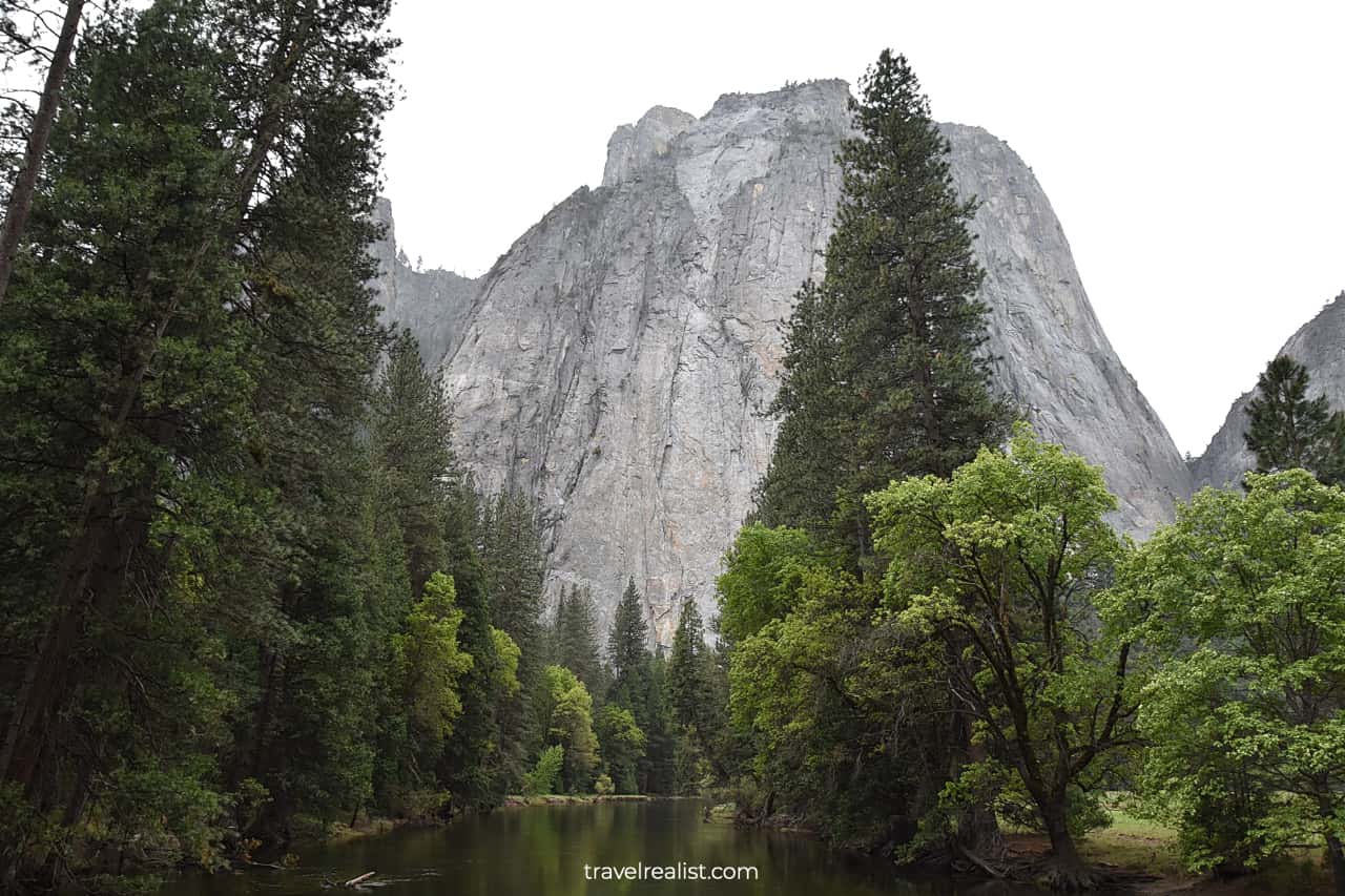
5. El Capitan
You might not need to repark your car to see the next attraction in Yosemite Valley. This time, look towards the north side of the canyon.
You can enjoy the iconic El Capitan summit. El Capitan is an impressive rock formation. Its elevation is 7,573 ft (2,308 m).
Many MacBook users would recognize this view. The summit was a screensaver on Mac OS X El Capitan. So, it is possible that you saw El Capitan without knowing that it was in Yosemite.
You could hike to the top of El Capitan summit. But this is a strenuous 13.6-mi (21.9-km) out-and-back route. The elevation gain is 4,799 ft (1,463 m). You might need over 6 hours to finish this hike.
6. Yosemite Point
There will be few noteworthy stops on the Southside Drive for a while. You would not miss much if you just admire the formations from your car.
But it will change once you pass Sentinel Beach and Swinging Bridge Picnic Areas. Stop at the next no name viewpoint and take the boardwalk.
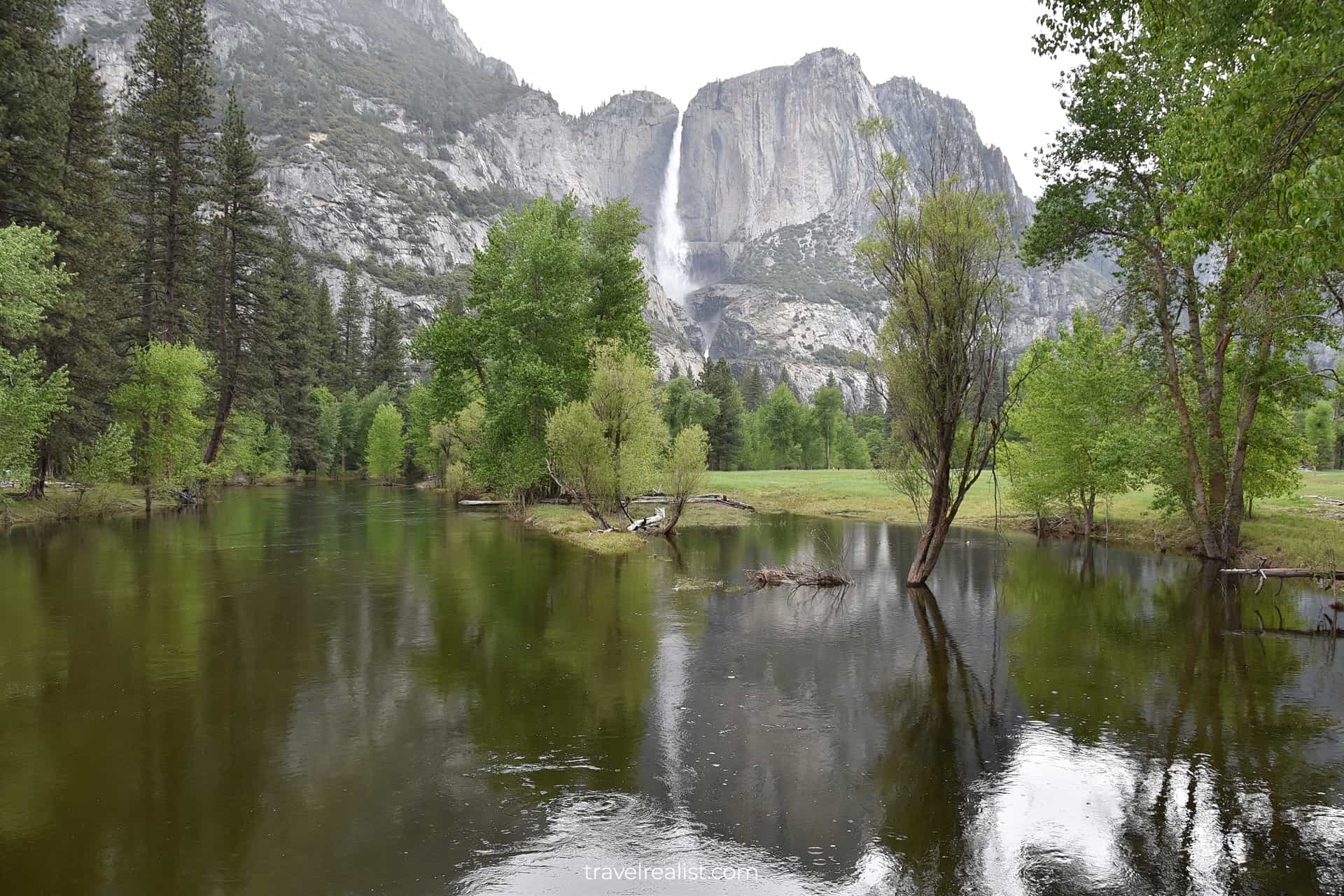
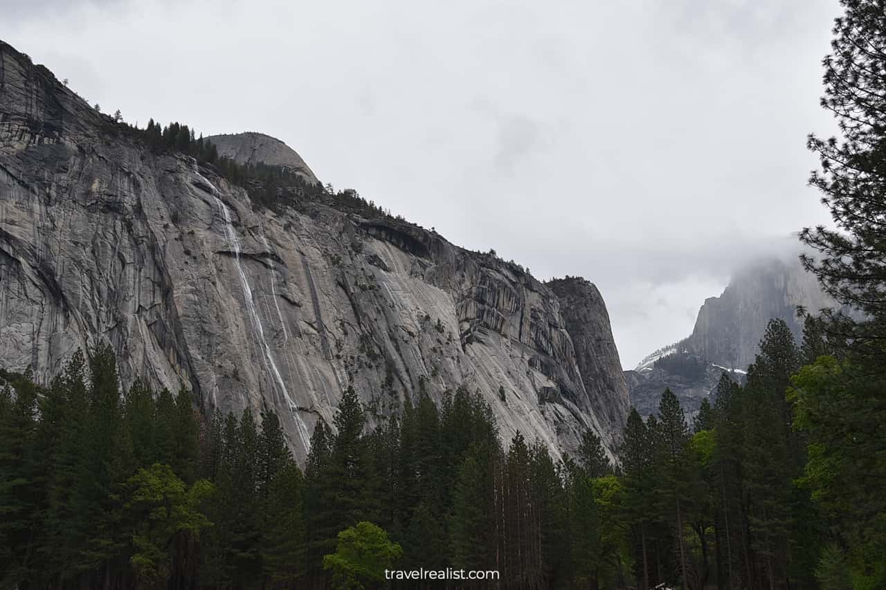
You will arrive at the left bank of the Merced River. Enjoy a fantastic view of Yosemite Point and Yosemite Fall. You might even be able to capture their reflection in the Merced River.

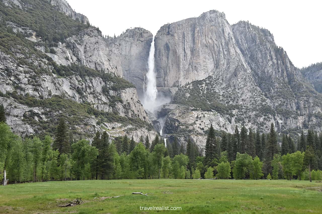
7. Upper Yosemite Fall
You should continue on the paved foot path along the river. Cross the Superintendent’s Bridge. You will soon find yourself on the Cook’s Meadow Loop.
This area is the best spot to get a clear view of Upper Yosemite Fall. This waterfall drops 1,430 ft (435 m). You could feel its mist quite far from the waterfall. But you are safe on the Cook’s Meadow Loop.
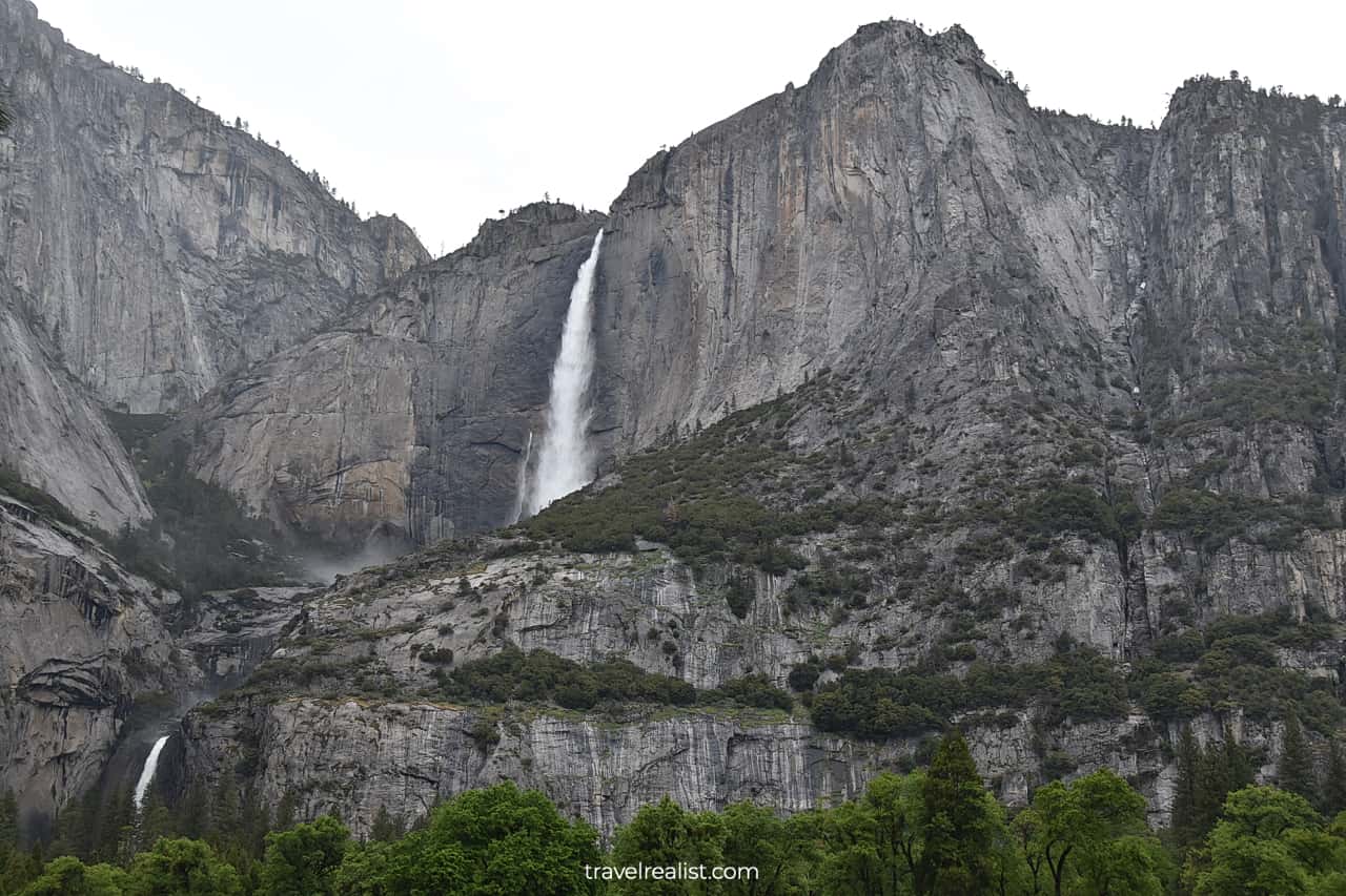
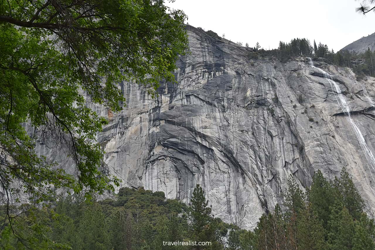
8. Lower Yosemite Fall
Yosemite Fall consists of there different waterfalls. Upper Yosemite Fall is the highest of all three. But there is also Middle Cascades and Lower Yosemite Fall.
Together they make one of the tallest waterfalls in the world. It is far more difficult to see Middle Cascades and Lower Yosemite Fall without hiking.
Both of them have lower drops and flow through a narrow canyon. You would want to drive further into the valley to catch a glimpse of these waterfalls.
You could stop at Yosemite Fall Vantage Point. There is a slightly better view of Yosemite Lower Fall from this viewpoint.
The other option is to try your luck as you drive on the Northside Drive. The traffic will get worse as you approach the Visitor Center. And you could admire some of the sights without needing to park your car.
9. Yosemite Conservation Heritage Center
Before you turn to the Northside Drive, remember that it is a one-way road. You would need to drive all the way to the El Capitan Bridge if you need to return.
Instead, you should drive further into Yosemite Valley to hike the trails in the park. The trailheads for most hiking routes but the Yosemite Fall Trail (and El Capitan) are further in the park.
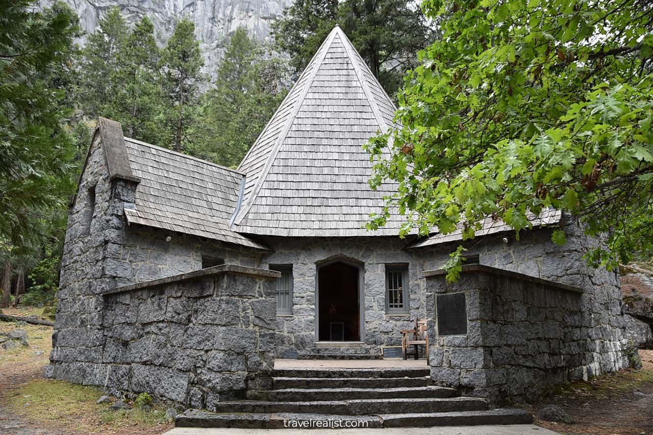
There are also a few other things to see along the Southside Drive. You would not want to miss Yosemite Conservation Heritage Center.
Also known as LeConte Memorial Lodge, this building dates back to 1904. It looks just like Hagrid’s Hut from Harry Potter movie series.
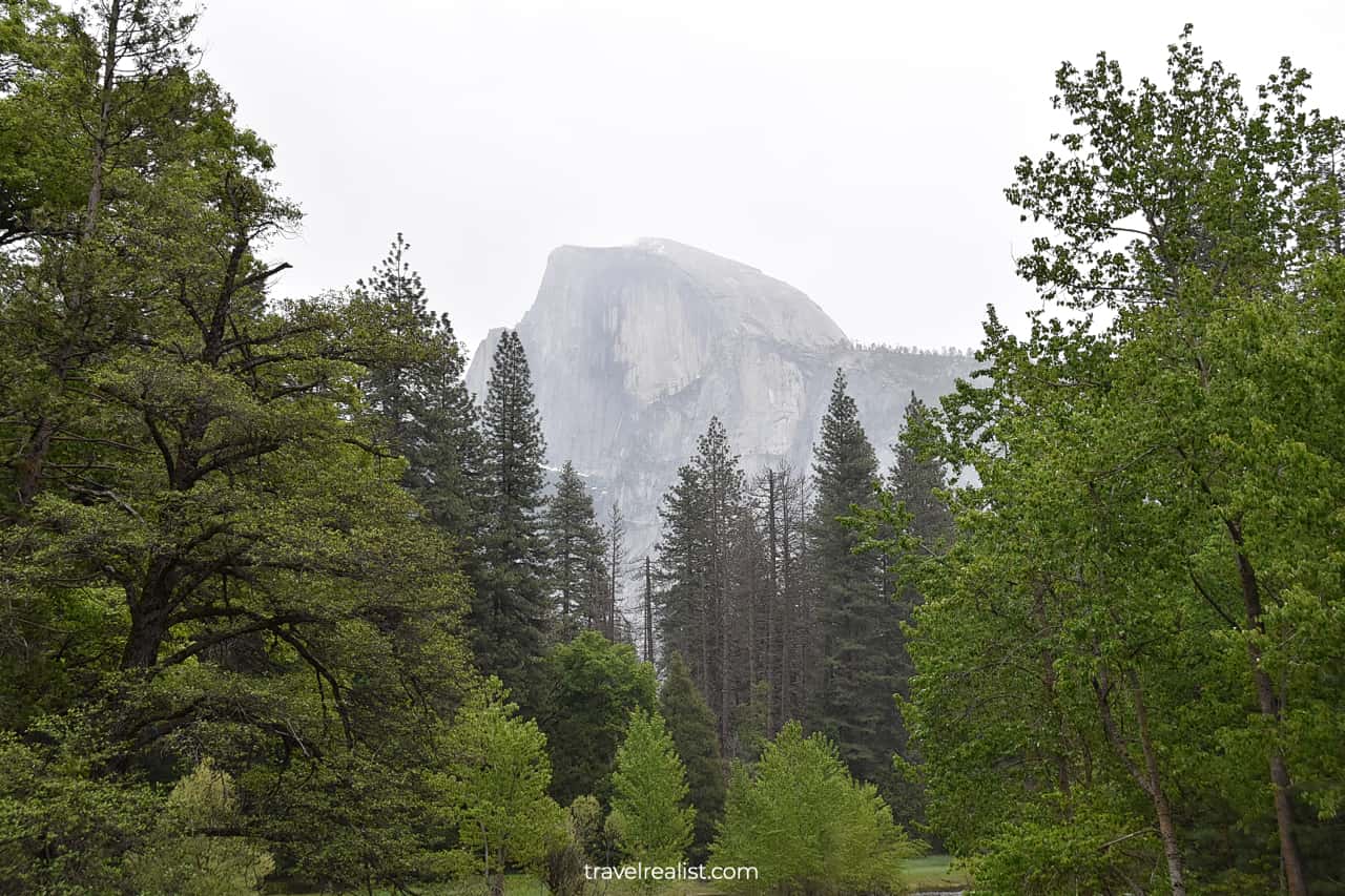
10. Half Dome Summit
You need to drive even further into Yosemite Valley if you plan on hiking the trails. Take the Happy Isles Loop Road at the intersection of the Southside and the Northside Drives.
This road will bring you to a small trailhead parking lot. It is as close to the trails as you could drive in the valley. If you are lucky to find a spot, you can begin your hike.
This trailhead is best for the strenuous trails along the Merced River.
- Vernal Fall: a 2.4-mi (3.9-km) round trip hike with 1,131 ft (344 m) in elevation gain.
- Nevada Fall: a 5.4-mi (8.7-km) round trip hike with 2,000 ft (610 m) in elevation gain.
- Half Dome: a 14-mi (22.5-km) round trip hike with almost 5,000 ft (1,524 m) in elevation gain.
Finding a parking spot is only part of the challenge when hiking the Half Dome Trail. The last section of that trail involves cables. They allow hikers to reach the summit without rock climbing equipment.
As a result, the entire Half Dome Trail requires a permit. Only 300 people can hike Half Dome Summit every day. If you do not have a permit you will not be allowed to hike on this trail.
You should not worry if hiking on the cables is too much for you. You can get a distant view of Half Dome from the Sentinel Bridge. No permit is necessary to capture a view of the summit and the Merced River.
11. Tenaya Creek
You should use a different parking lot if your hiking journey centers around Tenaya Creek and Canyon. It provides faster access to Mirror Lake.
This lake is another very popular hike in Yosemite. As the name suggests, it is a 2-mi (3.2-km) round trip hike to the lake. This moderate trail has an elevation gain of 301 ft (92 m).
You can capture reflections in the lake and return to the parking lot in about an hour. Hiking around the lake and to Snow Creek Falls will double the hiking distance.
12. Royal Arches
After hiking to Mirror Lake, you could start driving back out of the valley. The Happy Isles Loop Road will first bring you to the Northside Drive.
This section of the drive is best for viewing Washington Column, Royal Arches, and Royal Arch Cascades. All of them are on the north side of the valley.
Despite what you might think, Royal Arches look nothing like the formations in Arches National Park in Utah. But they are just like the formations in El Morro National Monument in New Mexico.
You can hike below these formations. But it would add another 2.5 miles (4 km) to your route. It might be a better idea to just admire these Arches while driving on the Northside Drive.
You will enter the busiest area of the park just after Royal Arch Cascade. The road continues past the Yosemite Valley Visitor Center, Yosemite Valley Lodge, and Yosemite Fall Trailhead.
Drive slowly to account for crowds of hikers, cyclists, and tourists. This is the only way out of Yosemite Valley if you made it that far.
13. El Capitan Bridge
Once you pass the busiest park area, you could be driving for a while. Most of the pullouts are overflow parking lots for hikers. You can also drive past the campground and the picnic area.
Tall trees will be in your way of getting nice views of Yosemite Valley for a while. Your next stop should be near the intersection of the Northside Drive and the El Capitan Drive.
This is the first spot where you could get a clear view of the mountains. There are plenty of parallel parking spots. Head to the El Capitan Bridge. This bridge has sidewalks on both of its sides.
The north side gives you a nice view of El Capitan at a different angle. The Dawn Wall will be on full display. This is a challenging rock climbing route.
The south side is a great spot to see Cathedral Rocks and Cathedral Spires. These peaks are on the other side of the valley.
There are no hiking routes that bring you to these mountain peaks. You can only enjoy them from a distance. The El Capitan Bridge is an easy-to-reach place to see these beautiful peaks.
You should also use this stop to get a better look at the Merced River. You can study the underwater logs. Watching the strong river current for a few minutes is also a calming activity.
14. Valley View
The Valley View is the last viewpoint on the Northside Drive. Most people pass it as they look to exit the park after a long adventure in the park. It means that there will likely be open spots at the Valley View.
You can get quite close to the Merced River at this viewpoint. Try capturing the iconic view while standing on the rocks. The view includes El Capitan on the left side and Bridalveil Fall on the right.
You might have to think on your feet if the weather turns for the worse. Enjoy the views before the valley disappears in fog or heavy rain.
You will be at the crossroads as soon as you leave the Valley View. There are three options you could explore depending on your destination and available time.
- Continue on the El Portal Road. This is the fastest way out of the park and to Merced, California.
- Turn to the Big Oak Flat Road. You can use it to drive to Modesto, California. This road will also bring you to the Tioga Road, the other side of the Sierra Mountains, and Nevada.
- Return to the Southside Drive briefly before taking the Wawona Road. This is the route to the Glacier Point, Oakhurst, and Fresno, California.
15. Tunnel View
If you visit the park in the summer or fall, you should drive on the Tioga Road. This is the best scenic drive in Yosemite National Park.
But this road is closed during most of the year. If you visit the park during such a time, driving on the Wawona Road is your best shot. At the very least you should visit the Tunnel View.
This viewpoint has a breathtaking view of Yosemite Valley. You could capture Half Dome in addition to El Capitan and Bridalveil Fall thanks to a higher elevation.
In a way, the Tunnel View is a more picturesque version of the Valley View you saw earlier. There is something surreal about the Tunnel View even if you visit it during pouring rain.
As soon as you pass the Wawona Tunnel, you will not see Yosemite Valley again. This is true unless you turn to the Glacier Point Road about 8 miles (13 km) later.
The Glacier Point Road has the same issue as the Tioga Road. It closes for the winter around November. The road remains inaccessible until May or June.
Continue with this Yosemite National Park Scenic Drive Guide. You will learn more about ways to get to the sights, entrance requirements, and places to stay.
Getting to Yosemite National Park
Yosemite National Park is high in the Sierra Nevada Mountains of Central California. Still, the park is fairly close to major cities and airports. Fresno is the closest airport to the park. It is just 2 hours away.
But there are also plenty of airline hubs for you to choose from. You can reach Yosemite Valley in under 4 hours from Oakland, Sacramento, San Jose, and San Francisco.
You can see the Golden Gate Bridge, hike at Land’s End, or tour the Winchester House and then reach Yosemite. In theory, you could do all of these activities on the same day.
In practice, you might want to take a few days to explore the Bay Area before driving to Yosemite. It would help to plan your Yosemite trip in advance to find the best route.
You could also look into Reno, Nevada. It is a viable starting point for your Yosemite trip in the summer. It takes about 4.5 hours to reach Yosemite Valley from Reno.
But you will drive on the entire Tioga Road, one of the most scenic drives in the park. This mountainous road has a short driving window, just like the Beartooth Highway in Yellowstone.
Where to Stay near Yosemite National Park
Yosemite is close and yet far from the major cities. You can reach the park on a day trip from the San Francisco Bay Area. But you will likely run out of daylight and have to cut your exploration short.
It is better to find a place to stay in or near the park. You could stay right in Yosemite Valley at Yosemite Valley Lodge, The Ahwahnee, or Curry Village.
You will pay a location premium when staying at these properties. But given the parking scarcity in the valley, you might be fine with the the extra price.
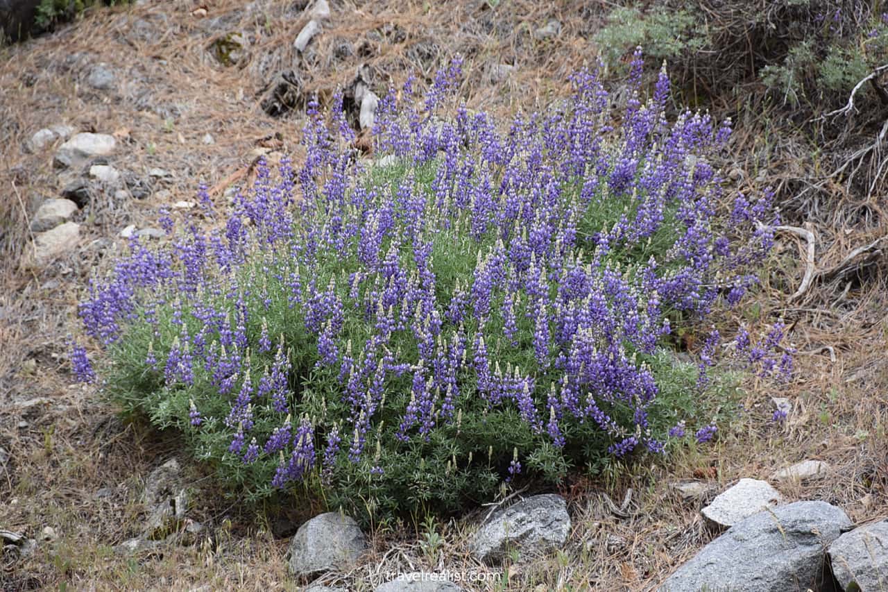
There are a handful of hotels along the El Portal Road and Wawona Road. Their availability differs by season. Sometimes it could be as short-lived as the wildflower bloom in the mountains.
Mariposa and Oakhurst have a lot places to stay. They are still close to the park. Yet, you will pay a fraction of the price.
Your other option is to drive even further away from the park. Look for places to stay in Merced, Turlock, Modesto, Madera, and Fresno.
The first three cities are best if the road takes you next to the Bay Area, Sacramento, or Northern California. Madera and Fresno work better for visiting Sequoia and Los Angeles.
Entrance Requirements & Passes
Yosemite National Park is open 24/7. But it is only partially true. You could reach Yosemite Valley throughout the year.
But Glacier Point and Tioga Road close for the winter around late October. These routes remain closed until late May or early June. It makes the season to explore their sights quite short.
Yosemite charges admission fees of $35 per car. America the Beautiful annual pass costs $80 but gives you free admission to this and other parks for a year. It is a no-brainer to use the pass in Yosemite.
The park introduced advanced reservations during the pandemic. The system is not in use anymore. You can visit the park without a reservation until at least the end of 2023.
The reservation requirement was there for a reason. Yosemite enjoys a lot of visitors. Most amenities, like parking lots, trails, and restrooms are overcrowded.
You might have to spend hours to just get into the park. Finding a trailhead parking spot is not much easier. Park where you find a spot.
Then take Yosemite Valley free shuttle. This shuttle runs every 15 minutes from 7 am. to 10 p.m. It is a good way to get to the trailhead if you arrive late.
Have a Plan B in case your original itinerary falls through. Be ready to skip certain hikes or sights if you run out of time. There is plenty to see in Yosemite outside of the valley.
You need to get a permit if you plan on hiking Half Dome. Just like Angel’s Landing in Zion, you have two chances to score a permit. Apply before the season begins or two days before the hike.
The permit costs a $10 nonrefundable fee at application. Another $10 refundable fee is due when and if you receive the permit.
Takeaways: Yosemite National Park Scenic Drive
Yosemite National Park has to be on the must-visit list for every traveler. Its stunning natural beauty is certain to impress any outdoor enthusiast.
El Capitan and Half Dome, Bridalveil Fall and Yosemite Fall, Tioga Road and Glacier Point. These names and sights are synonymous to the Sierra Nevada Mountains for a lot of people.
It is quite difficult to recommend a visit to Yosemite due to crowds. You will be fighting for a parking spot wherever you go. Expect long lines at the Entrance Stations and restrooms. Even the trails are packed.
All of this is true even during the off-season, if such a thing even exists at Yosemite. As a result, you need to set the right expectations before visiting Yosemite.
- Start your Yosemite visit as early as you are comfortable.
- Budget more time than you expect in the park due to crowds.
- Have a couple of alternative routes, trails, and sights if your original plan does not work out.
- Book a place to stay as close to the park as your budget permits.
- Apply for a permit well in advance if you plan on hiking Half Dome.
- Try to forget about the crowds as you admire the beauty of the park.
- Relax, take it easy, and have some fun exploring Yosemite.
Take a look at this Yosemite National Park Scenic Drive Video Guide. And visit the YouTube channel for the latest videos.
Frequently Asked Questions
There are 6 scenic drives in Yosemite for you to choose from:
– Tioga Road is the most scenic drive in Yosemite National Park.
– Yosemite Valley and Glacier Point Road are other notable scenic highways in the park.
– Big Oak Flat Road, El Portal Road, and Wawona Road round up the list of scenic drives in Yosemite.
You could reach Yosemite Valley in 2 hours from Fresno, California.
It takes about 4 hours to reach Yosemite National Park from San Francisco.
The drive through Yosemite Valley is a 15-mi loop road. It consists of two one way drives and a handful of shorter two way connecting roads.
You could drive between 100 and 200 miles if you take scenic drives in Yosemite. Tioga Road is the longest drive in the park. It would add 59 miles if you drive on it in one direction. Yosemite Valley is a 15-mi loop. Connecting drives could add another 30-60 miles to your park visit.
The Tioga Road is the main drive through Yosemite. It takes you to the other side of the Sierra Nevada Mountain Range in 59 miles.
There are plenty of things to do in Yosemite.
– Take a scenic drive through Yosemite Valley.
– Hike to Vernal Fall or Mirror Lake.
– See El Capitan and Half Dome.
– Visit Yosemite Conservation Heritage Center.
– Drive on Tioga Road through Tioga Pass.
– Enjoy breathtaking views from Glacier Point.
Safe realist travels!